Thursday PM update: Chance of snow on Friday

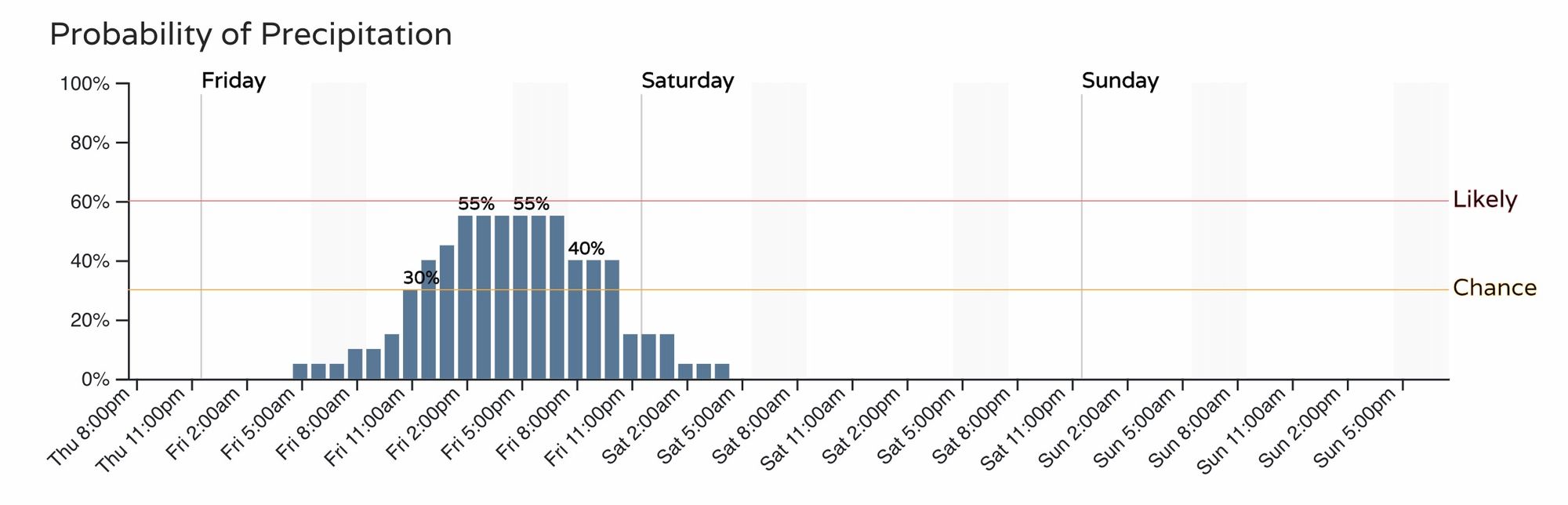
Things remain on track for tomorrow's snow chance, as another quick-moving system will bring some snow to the state Friday and Friday evening.
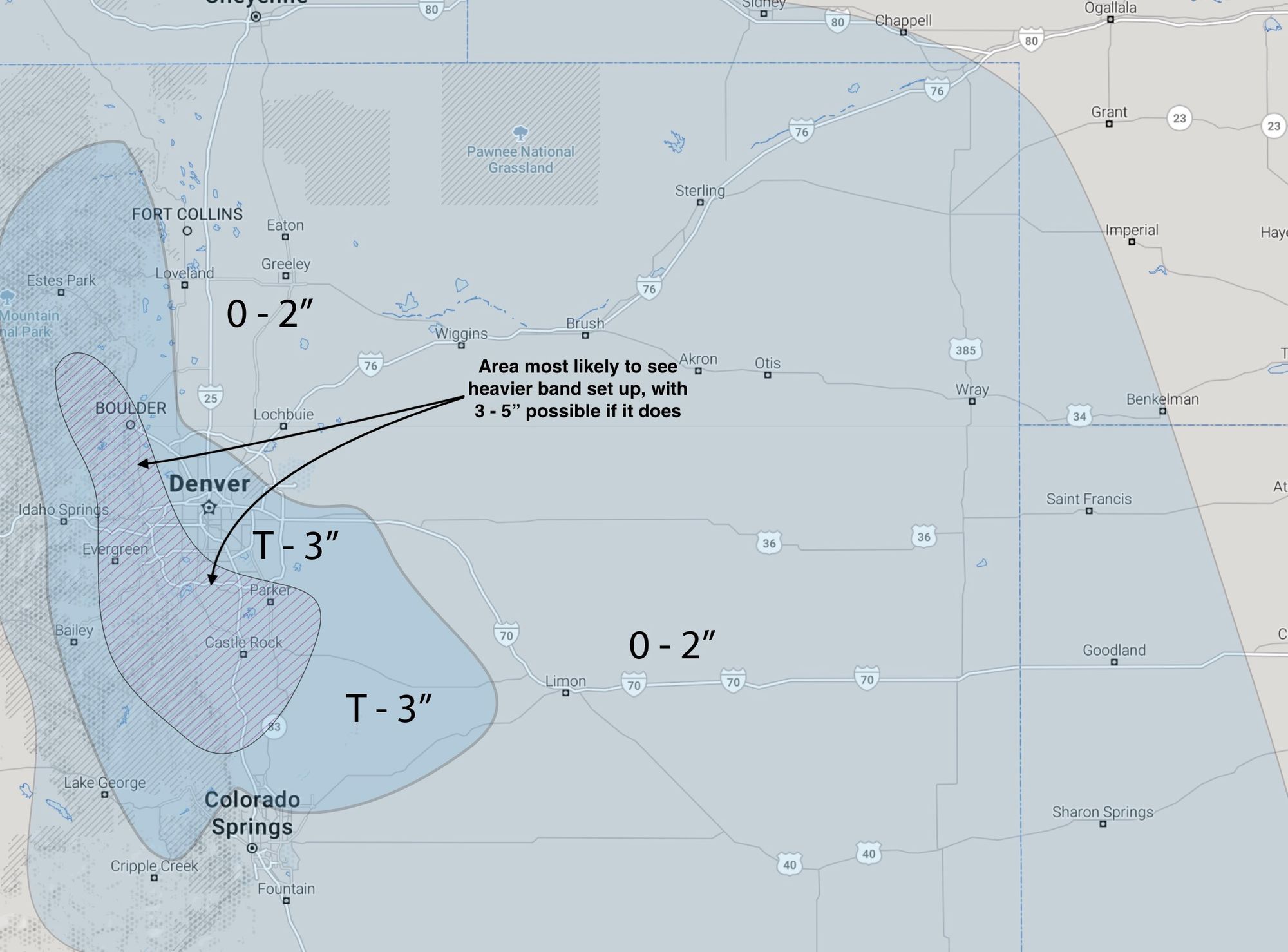
For most cities up and down the Front Range the snow chance will be in the 50% range with this system, with higher probabilities for the foothills west of Denver and Boulder.
The timeline for the Denver metro area shows snow chances increasing by late morning Friday, and continuing through the evening before tapering off before midnight. The commute most likely to be impacted by tomorrow's snow is the evening one, and it may well be a slick drive out of town for those heading to the high country for the weekend.
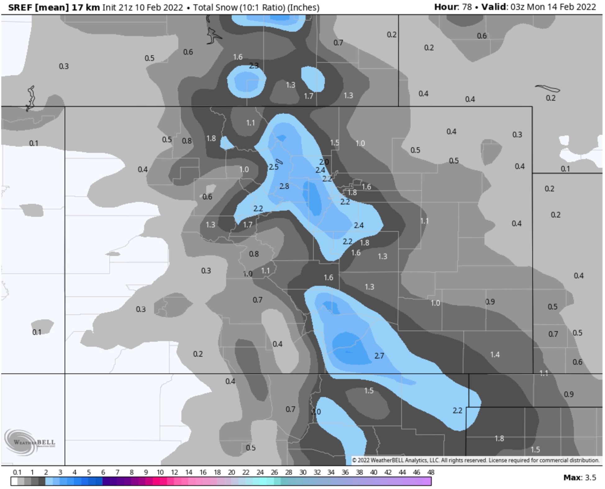
Snowfall totals will be a bit tricky. Most areas are most likely to see low-end totals, from a Trace to 2" of snow. Still, a heavier snow band or two may set up, and if this happens we could see a swath of 3 - 5" totals under the band.
Ensemble guidance shows this, with most of northeast Colorado in that Trace to 2" range, and the heavier snow showing up along a line from Boulder and Jefferson counties southeast across the Western Palmer Divide.
For our forecast, we'll stick pretty close to the above. Most areas see 0 - 2", across the Denver/Boulder area T - 3", with the area which has the best chance to see the heavier band of snow set up (and 3 - 5" totals under that band) highlighted. In many respects this feels like the Friday system from a few weeks back, and we know what that did to 285 and I-70 heading up the hill out of Denver.

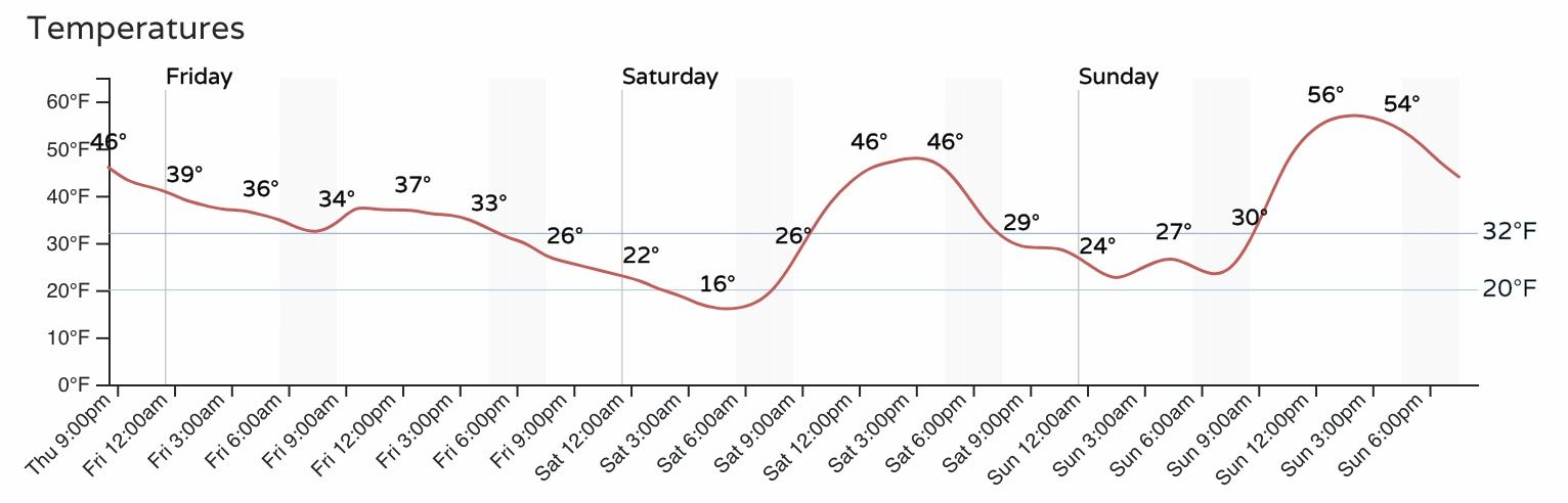
Temperatures will moderate quickly following tomorrow's system, with highs near 50 degrees again on Saturday, and pushing 60 degrees on Sunday.
Keep an eye on the sky tomorrow, and as always, if you see snow let us know when and how much!