Winter Storm Warning issued for the northern Front Range, latest snowfall forecast

Here we go again... Snow is set to return to the Front Range today and tonight, and bring several inches of snow to many of us across the region before departing Thursday. The snow will be heavy at times, with travel impacts likely Wednesday PM through Thursday AM.
The National Weather Service in Boulder has issued a Winter Storm Warning for cities from Castle Rock, to Denver, up through Boulder and Fort Collins. The Warning goes into effect at 2 pm this afternoon, and extends through 5am Thursday. The Warning, in pink below, is focus in and along the northern Front Range, with Winter Weather Advisories west and south.
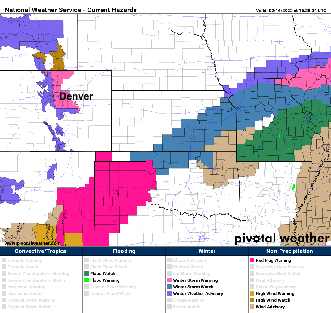
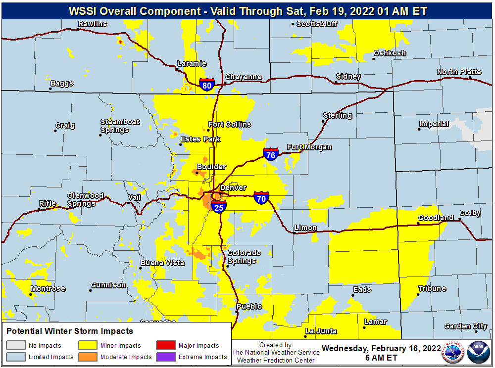
Most of the I-25 corridor through Colorado will see impacts from this system, the worst of it expected along the Palmer Divide and north. The map below shows where minor to moderate road impacts are expected with the incoming snow:
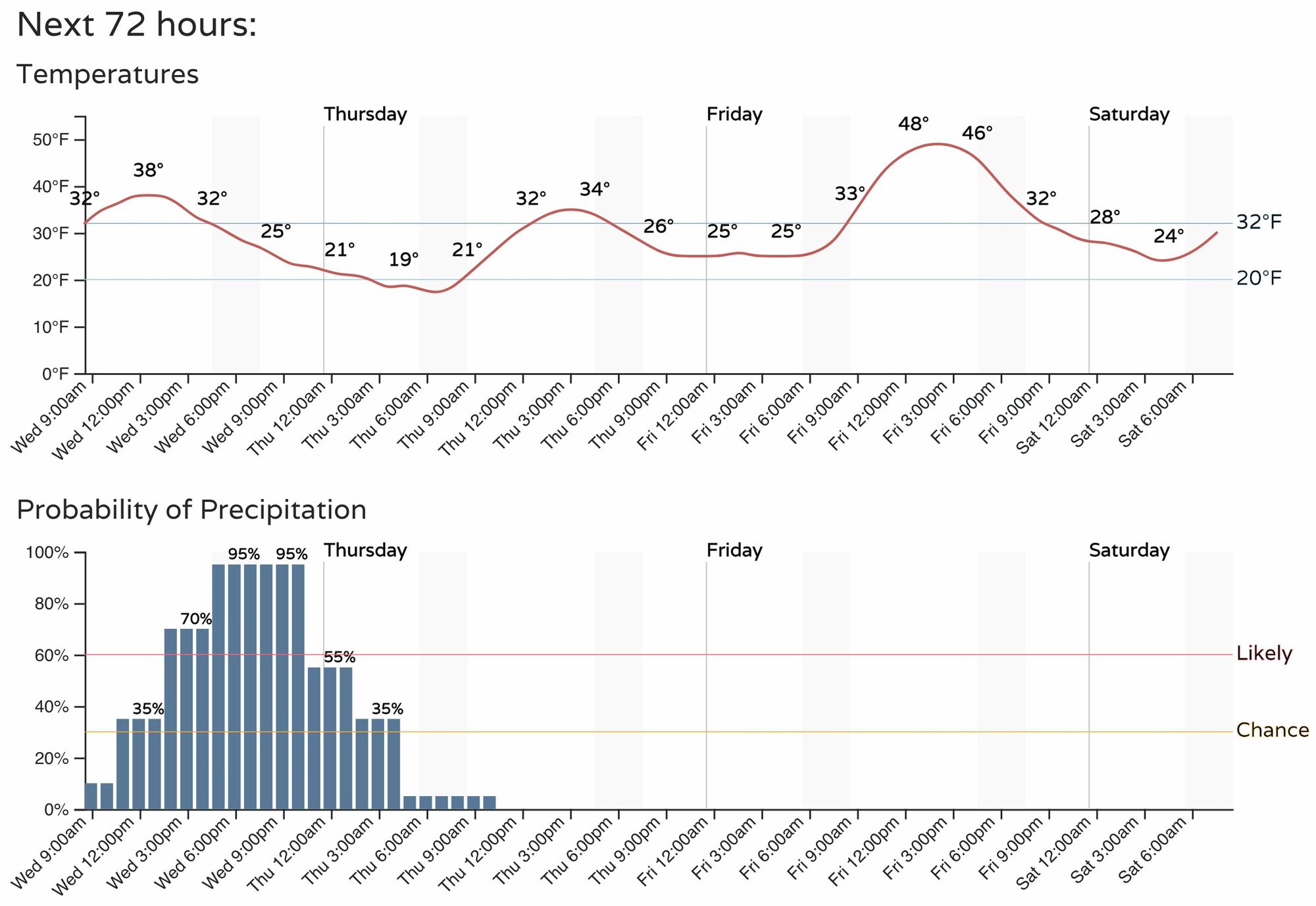
For timing... we expect the bulk of the snow to fall between noon and midnight, with, unfortunately, some of the heaviest snow possibly aligning with the evening commute. Below is a look at the timeline for Denver, with temperatures dropping into the 20s during the evening commute, and a good chance of snow on the way.
While the snow will likely be over for most areas by the morning commute (flurries aside), roads will likely be snowpacked and icy where the heaviest snow falls this evening.
For snowfall totals, guidance has trended up for most cities since our update yesterday, aside from Colorado Springs which may end up with an unfavorable snow-producing wind. Latest SREF plumes have the following:
- Fort Collins: 4.5"
- Broomfield: 6.0"
- DIA: 4.5"
- Denver south: 6.5"
- Elizabeth: 6.0"
- Colorado Springs: 4.0" (high end of model guidance)
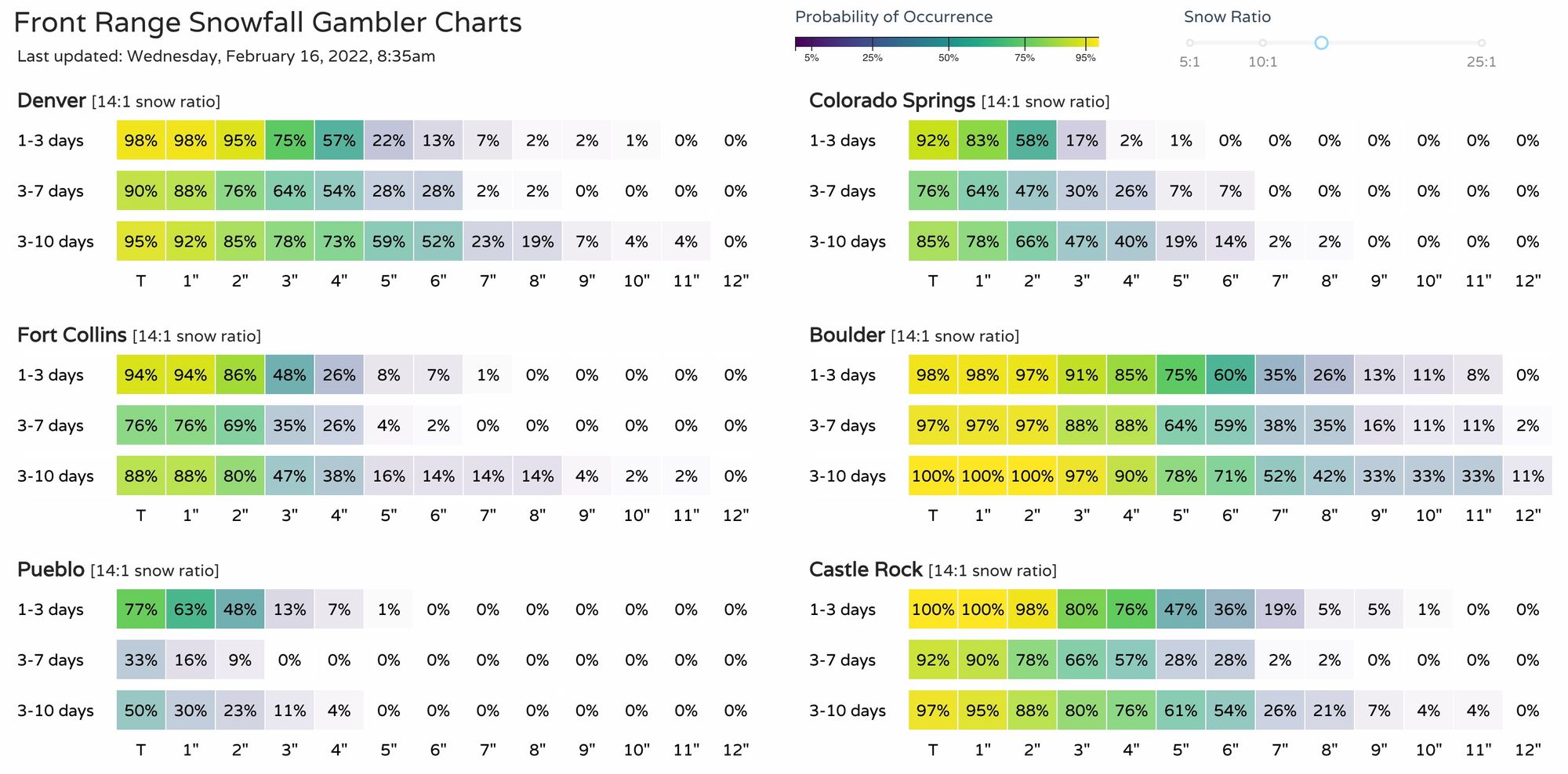
Our gamblers are up a touch as well in some cases, with a better than 50% chance for Denver to see 4" of snow or more, and 60% chance for Boulder to see 6" of snow or more! High end totals for Fort Collins and Colorado Springs are not out of the question, but probabilistically lower odds.
With that, we've made a few adjustments to the snowfall forecast, but nothing major. Looks like 3 - 7" will be doable for most of the northern urban corridor along and west of I-25, with upwards of 5" likely for the higher terrain to our west.

Looking forward to your reports!