
Wednesday AM update: Tracking a chilly change on the way to Colorado this weekend

Spring is in full swing this week, but as spring tends to swing in Colorado, the warmth won't last but a couple more days.
As discussed in this week's SOTA, the warm and dry weather we are enjoying this week will be replaced by a cooler and potentially wetter pattern by the weekend, with rain and snow back in the forecast for much of the state by Friday night.
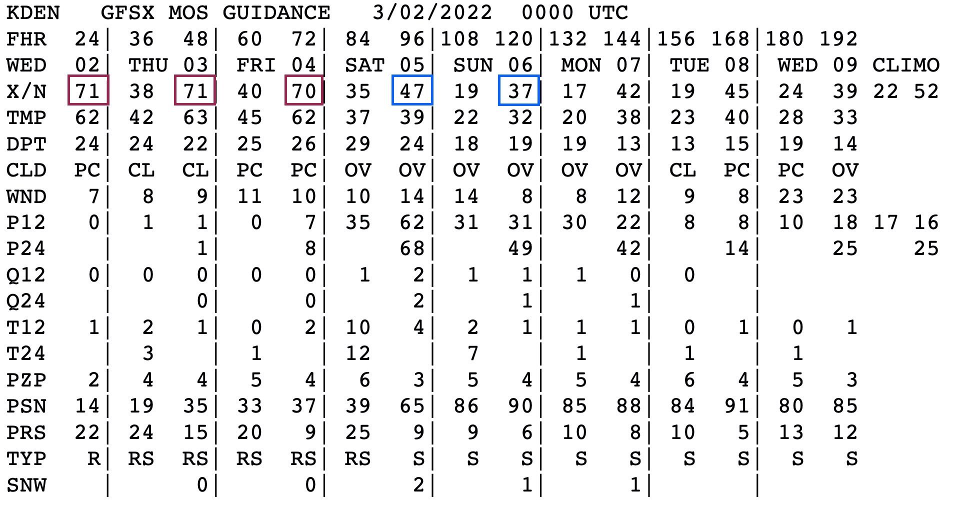
MOS guidance has highs in the low 70s today and Thursday for Denver, the near 70°F Friday before dropping into the 30s and 40s this weekend. Some models have highs closer to 75°F on Thursday which would put us close to tying the record for the date of 76°F, set back in 1921, but it's mostly like to end up just out of reach of us tomorrow.
By Friday afternoon and night we begin feeling the impacts of a rather messy upper level pattern shift that will no doubt bring cooler and wetter weather to Colorado this weekend and likely next week as well, but details on those impacts will remain fuzzy for some time.
In the animation below you can see the ridging overhead replaced this weekend by a series of troughs digging into the Southwest, then making their way across Colorado and ejecting east.
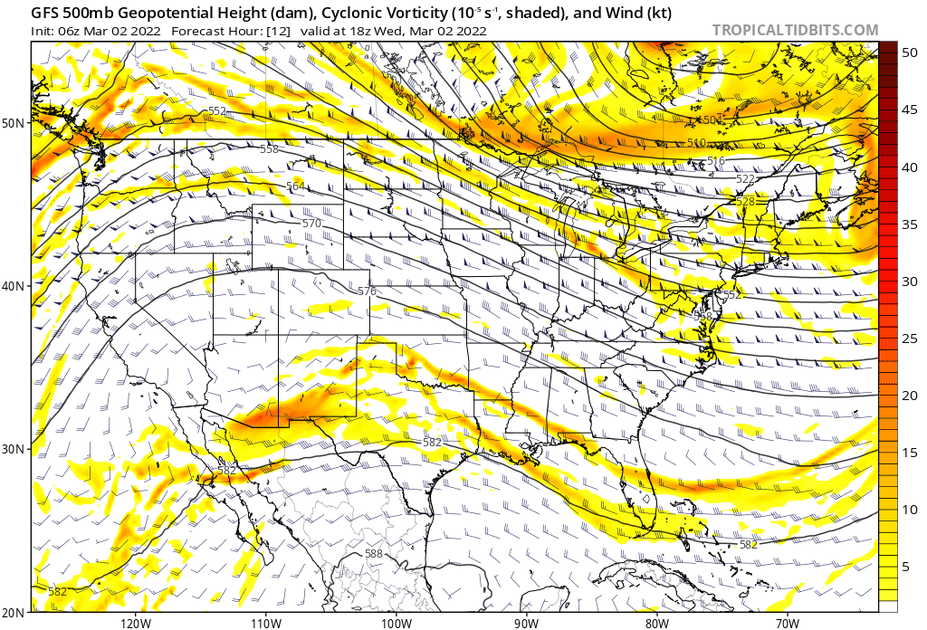
We see the first bit of energy come through Friday night and Saturday morning, and the secondary one Saturday PM through Sunday PM.
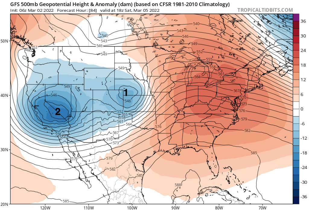
As things look this morning, it's the second one that could deliver more snow to Eastern Colorado than the first, but again... details. The track of the first looks less favorable as it's pretty far north, and much of what precipitation we do see could come in the form of rain/mixed showers vs accumulating snow. By Saturday afternoon and night we have more cold air in place and the trough is a bit further south, which could mean more snow, but it's not entirely clear how organized the trough will be.
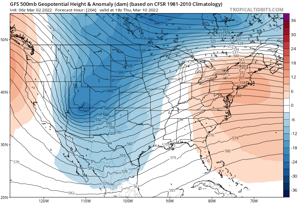
The GFS then dries things out for a couple of days early next week before pulling another elongated trough across the state by the Wednesday/Thursday timeframe, and with it the potential for more snow across the state as well.
As for timing and impacts of our weather changes on the way this weekend... again, we see warm and dry weather rule the pattern through Thursday, then changes begin to move in during the day Friday.
Our hourly planner for Denver shows precipitation chances increasing Friday afternoon and night, with temperatures cooling, but not particularly cold. With that, it's likely we'll see some rain at least initially Friday PM, before mixed precipitation and possible turnover to snow Friday night.
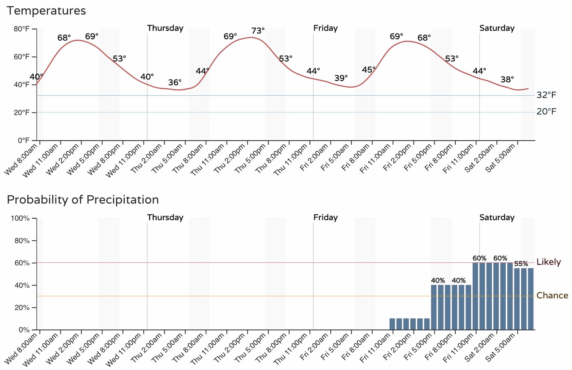
Rain and snow chances decrease a bit Saturday morning, but will increase Saturday afternoon and night as the secondary system begins impacting the state.
Due to a rather messy pattern overall for the weekend, and little agreement in the modeling, how much snow we are likely to see (or not see) remains very much in question.
The blend of models model really stresses the fact the first wave may end up pretty far north and bring limited snow chances to the Denver area, particularly those south of I-70 across Eastern Colorado. Below is its latest snowfall forecast through Saturday afternoon:
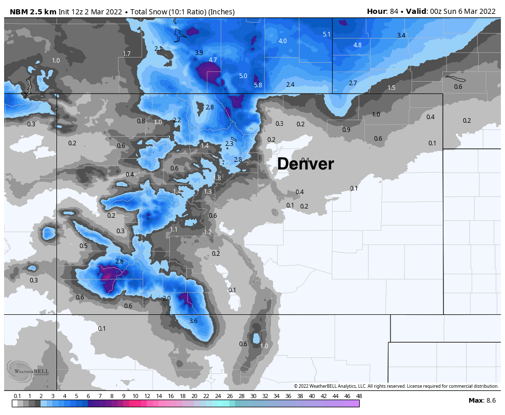
And corresponding precipitation forecast (note it has precipitation forecast for Denver, but no accumulating snow):
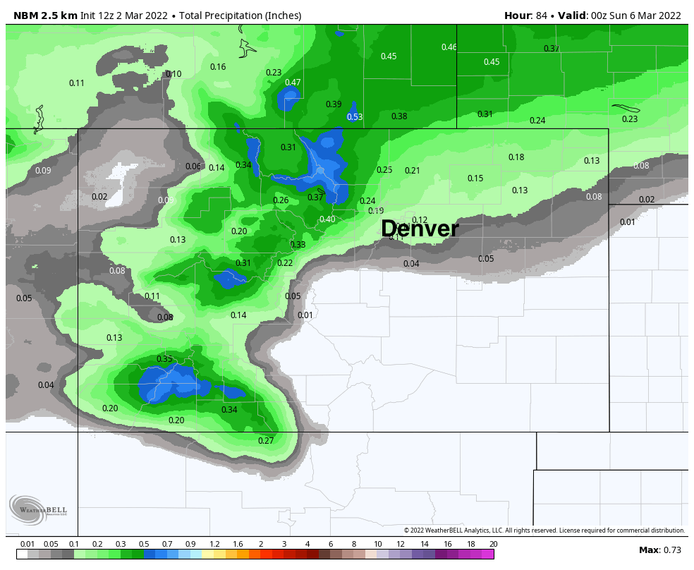
Through the end of the weekend we see a better look for precipitation across the urban corridor, with lots of 1.0"+ precipitation totals for the mountains well!
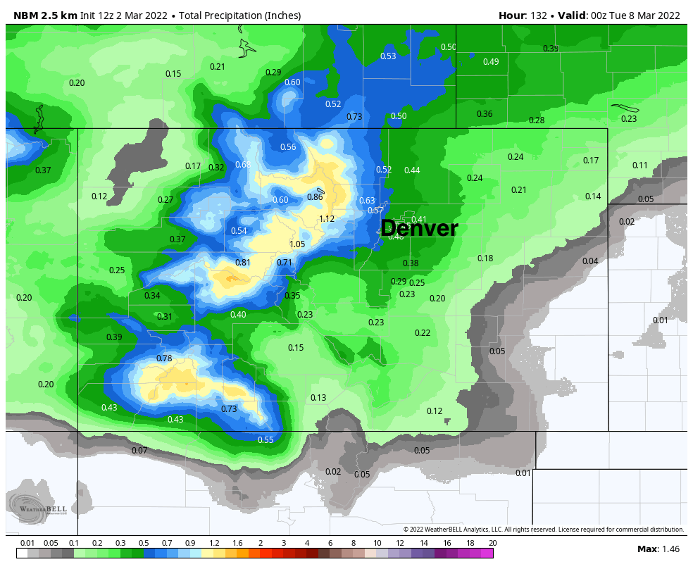
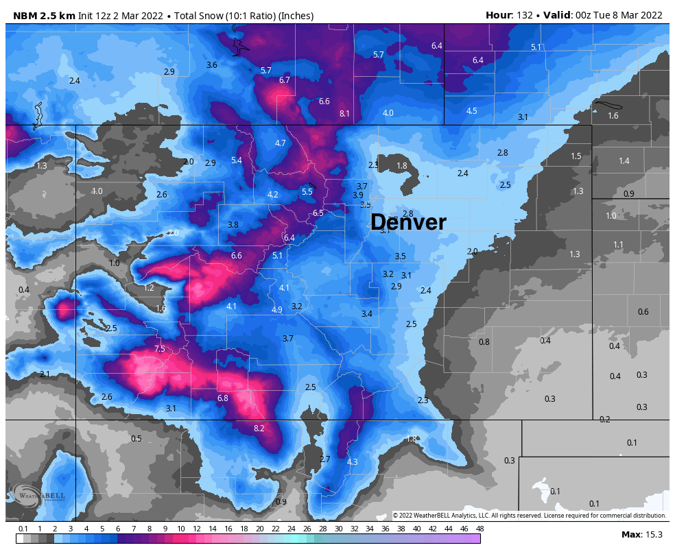
As for snow, the blend of models suggests a few inches will be possible up and down the I-25 corridor Saturday PM through Sunday, with about 2 - 4" for the Denver area at this time. Lots of uncertainly here.
We'll keep tracking things for the weekend, but get out and enjoy the warmth for now!