Denver Weather: Big cooldown headed to the Front Range by the weekend

While we set daily records for the heat, there is relief on the way and it looks relatively significant. High temperatures by the weekend may struggle to reach the 60s!
Before we get there, though, we still have more heat on the way, and more records to set.
From Tuesday:
Record breaking highs for Tuesday. Thanks to our cooperative observers for the great info they provide for us! #cowx pic.twitter.com/PQvmk4F4PZ
— NWS Boulder (@NWSBoulder) September 7, 2022
Denver's 90°F count is now up to 62 this year. That pushes us into 3rd place of most 90 degree readings ever recorded (since 1872) in one season. We've reached 95°F 34 times, and 100°F 5 times this summer.
— NWS Boulder (@NWSBoulder) September 7, 2022
More info and heat stats at https://t.co/Io3WLXjUrJ #COwx pic.twitter.com/vo9FAk0kX5
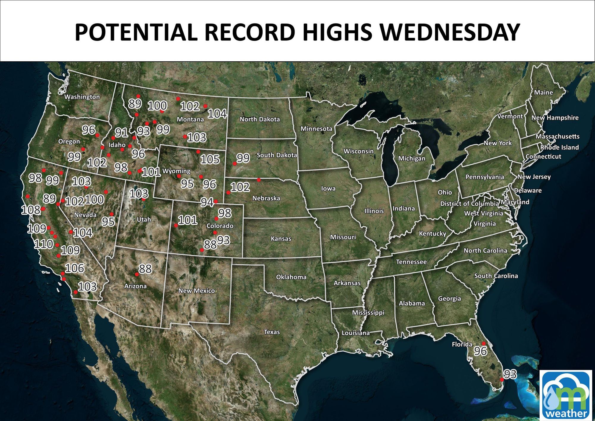
Look at all the records that are possible for Wednesday!
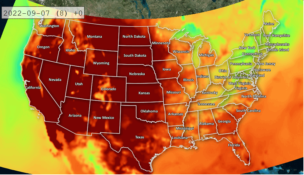
That's a huge area of the country in extreme heat.
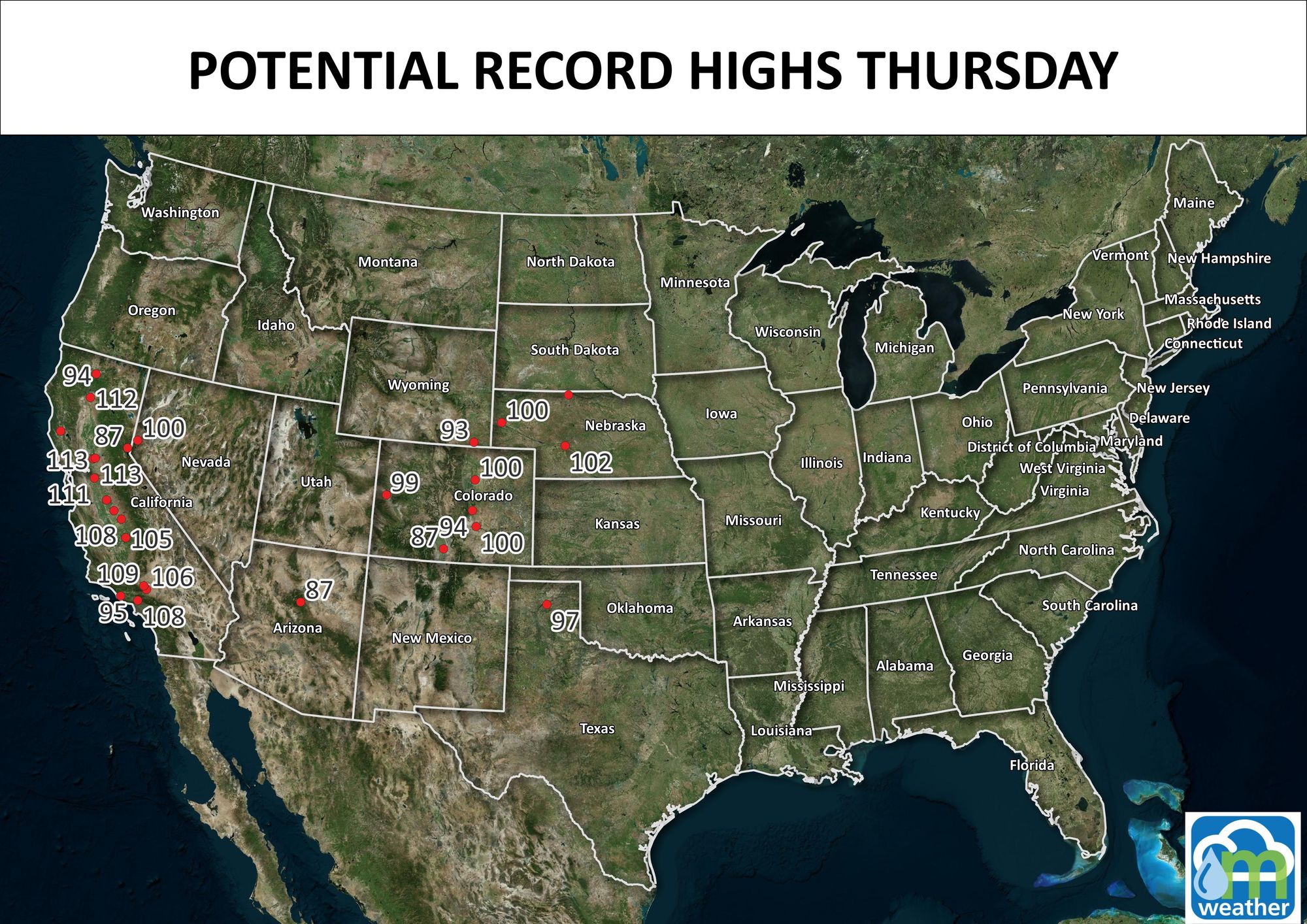
Now for Thursday we shrink that area into a few regions, California and Colorado.
That's an incredible, and historic, start to September for so many of us. There is that change on tap though.
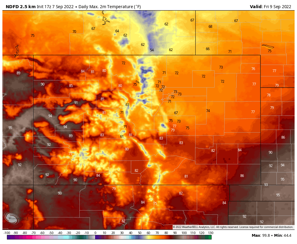
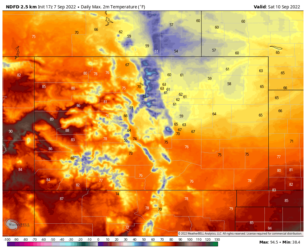
It begins Thursday in Montana and heads toward Colorado by Friday and Saturday. This simple animation will show you the cooler weather, a small area of it, shown in the cool colors that drop out of Canada and move over the Plains...briefly.

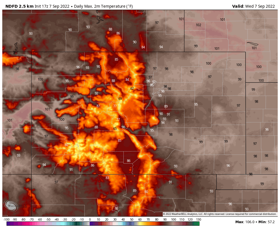
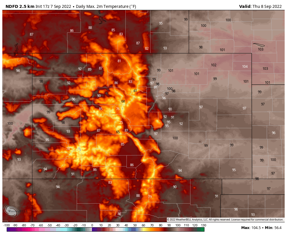
Daily highs for Wednesday, Thursday, Friday, and Saturday for Colorado are the next four images.
How does that look daily for Denver? Here:
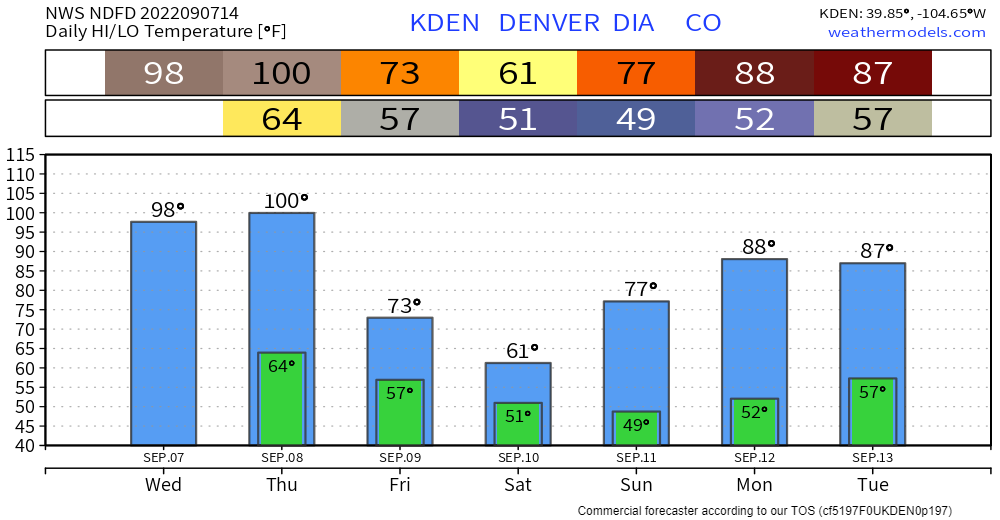
That's quite a drop... the last time Denver had a high temperature of 61 or colder was June 1st with a high of 58°.
There is a bit of moisture that may come through, too.
As of now, it doesn't look like too much but we will discuss that perspective in a future post as we get a bit closer. I just thought you might enjoy knowing there's a big cooldown on the way, yes?