Colorado Weather: Major cooldown with snow, rain, and wind this weekend

This weekend will have a major change in weather conditions as warm and windy conditions start things off, but things become cold and snowy/rainy to end.
Bottom line(at the top ;-)):
A strong cold front will create quick weather changes across the state this weekend. From wind, to temperatures dropping with rain and snow, it'll be a much different end to the weekend versus how it began. Although Denver and metro areas may see some snowflakes, this isn't likely to be our first snowfall of the season, but it will sure be feeling like autumn after the system swings through.
What's happening?
A strong system is over the Pacific Northwest, giving them much needed rain and snow considering the smoke and fires in the air there, which will be moving through Colorado the next couple of days and will leave a lasting impact on our temperatures.
The next three days:
The biggest threats will be wind, and winter-driving conditions, so let's discuss these first.
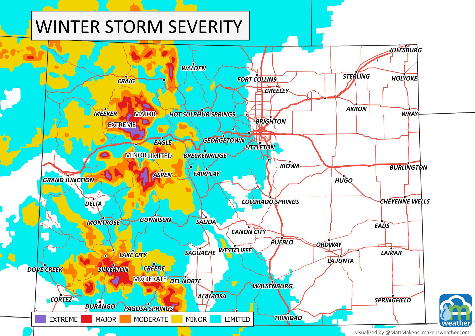
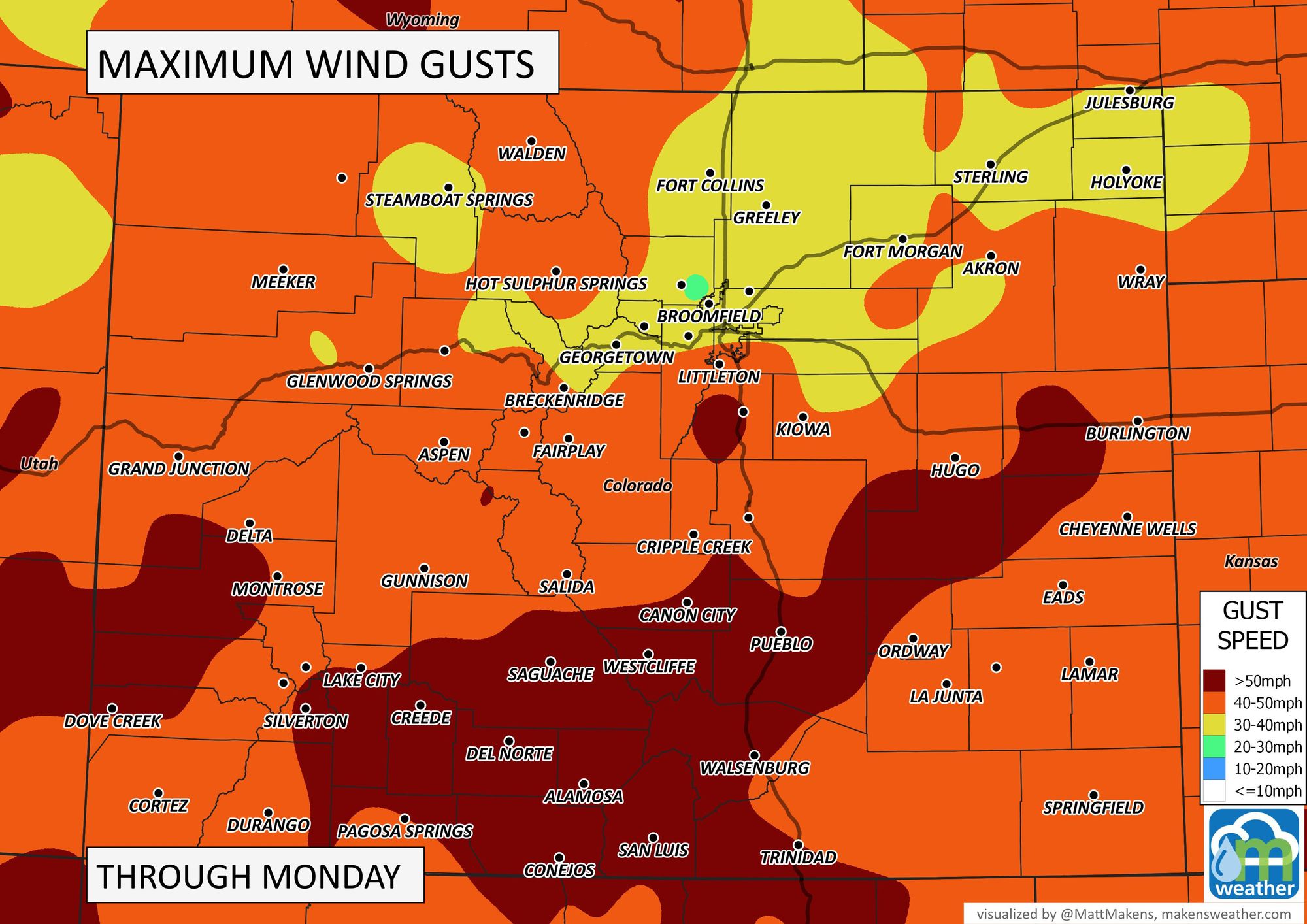
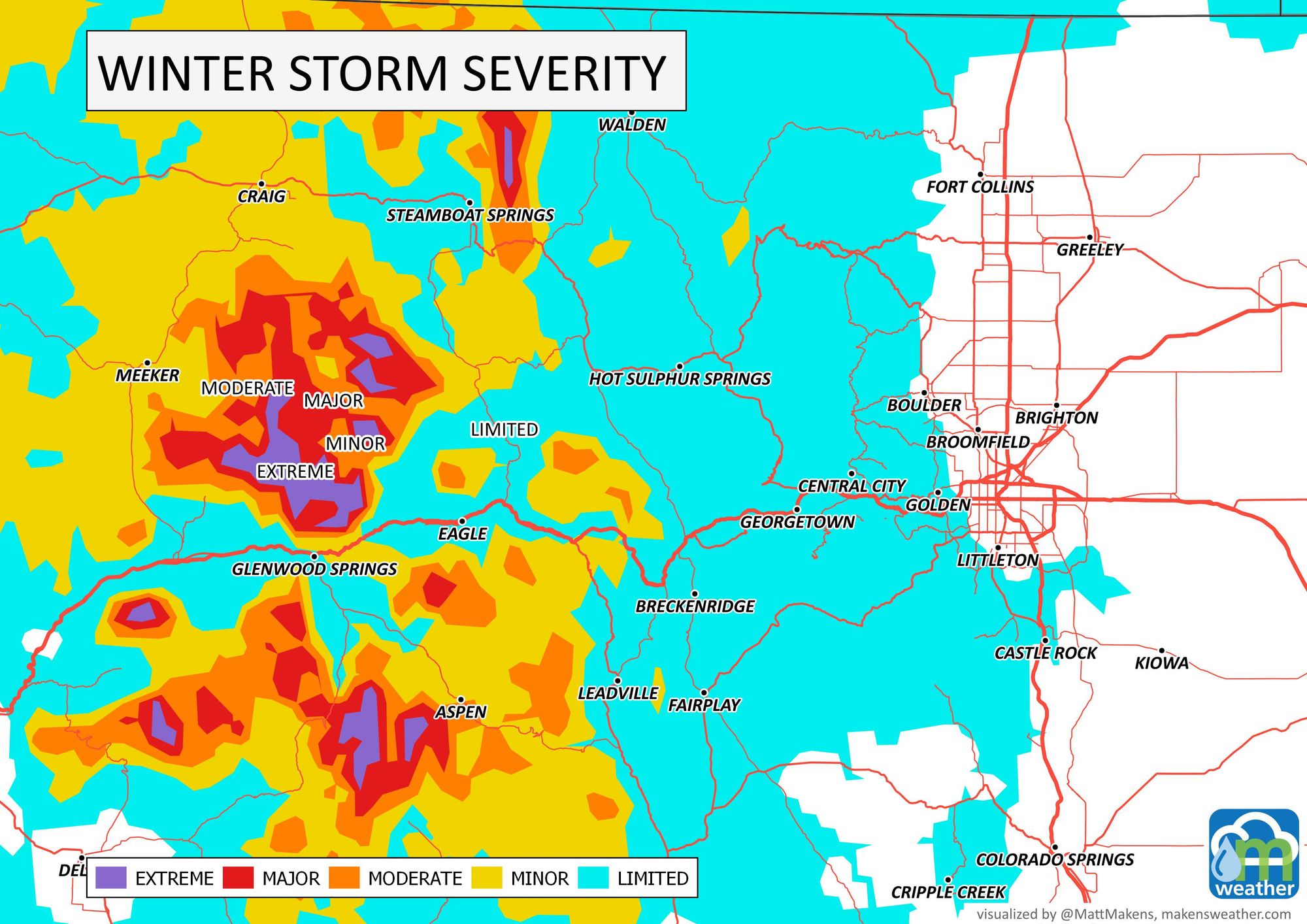
Wind gusts will be peaking at faster than 50 mph in some cases through Monday. From fire danger, to blowing dust, you will notice the wind at some point. The following map is to show peak-wind gust areas, not the timing of the wind.
Wind will be the first impact for the state, followed by areas of rain and snow, with snow creating some winter driving conditions during the next few days. Snow will be most difficult on drivers Sunday morning and midday.

Those are the biggest hazards, but you'll be feeling some cold too. Enjoy your Saturday...
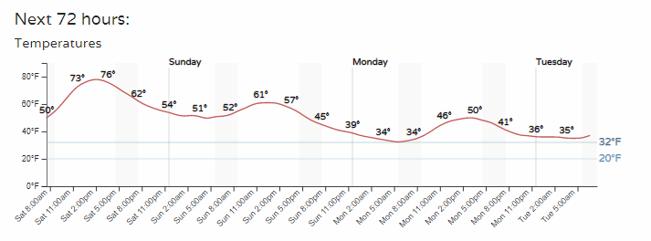
The temperatures will be on a steady drop, here's the hourly planner for Denver.
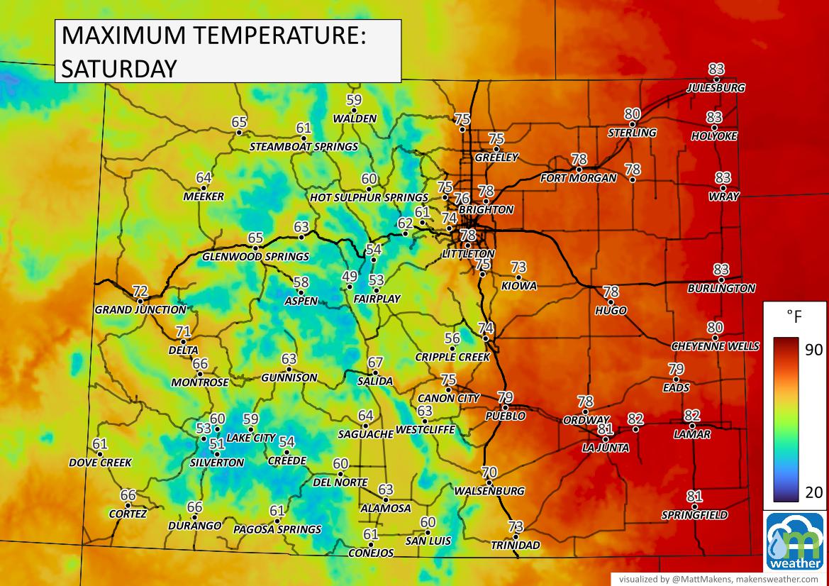
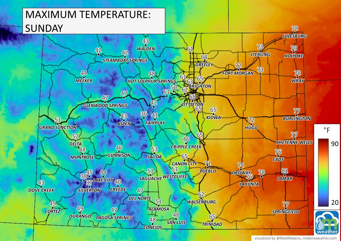
Here's how temperatures play out for the state through Tuesday morning.
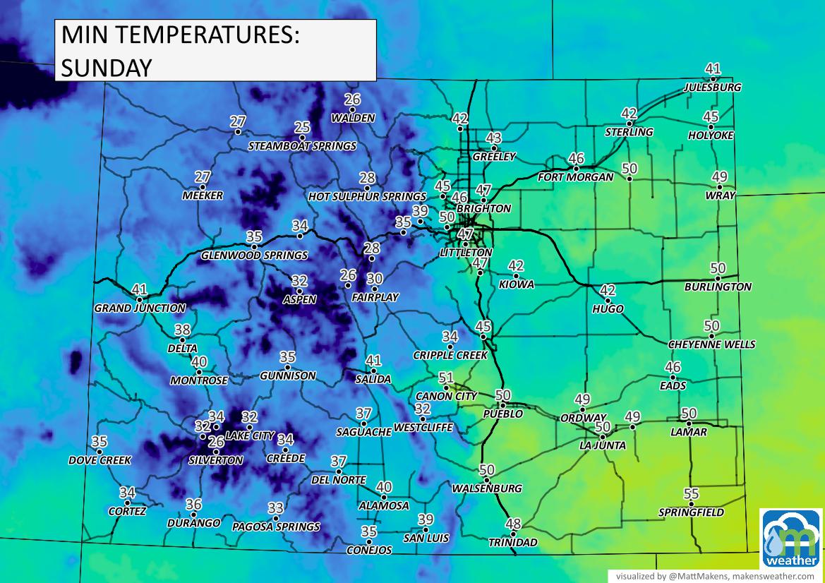
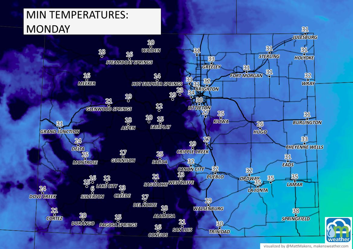
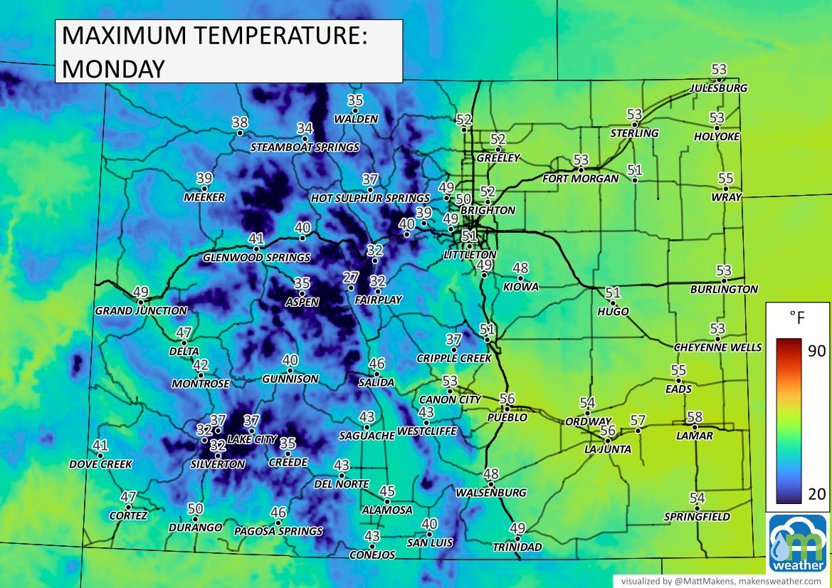
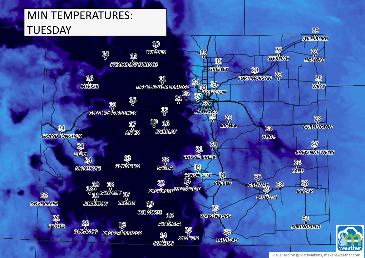
Definitely hitting a deeper freeze the next few nights.
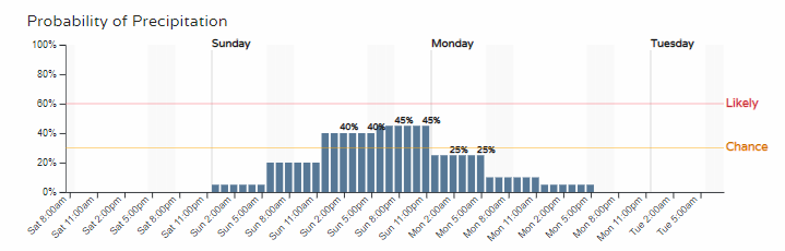
Now, in terms of precipitation. Here's an hourly look for Denver.
The three-day totals will look like this for total precipitation (combo of rain and snow). For the high country, it will be heaviest as the cold front moves through Saturday night through Sunday midday. For the metro areas and plains, we will have a few rain (perhaps some snow mixed in) showers moving through with the front in the afternoon and evening.
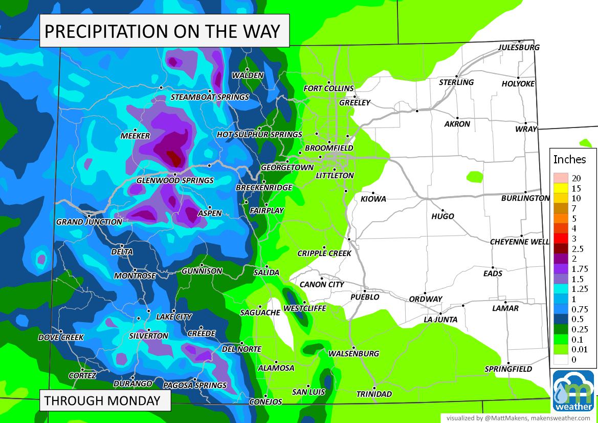
And, total snowfall shows areas nearing a foot if not more for the mountains. (Note, white on this map indicates less than 1" of accumulation. Should you see snow in Denver, and we certainly can, it won't accumulate to reach the next map-level.)
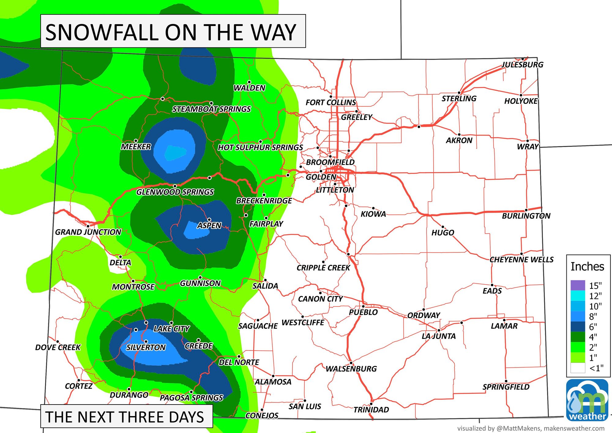
The heaviest snow will be in the mountains from Saturday night through Sunday midday. It may be so heavy that snow squall warnings will be needed to address snowfall rates.
Bottom line:
A strong cold front will create quick weather changes across the state this weekend. From wind, to temperatures dropping with rain and snow, it'll be a much different end to the weekend versus how it began.