Colorado weather: Snow storm to hit Monday through Tuesday

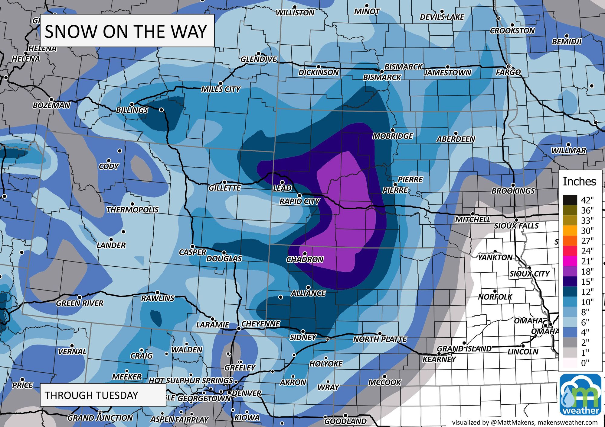
Although the brunt of the next system will slam the Dakotas and Nebraska with deep snow, Colorado will have its own impacts as we continue to watch for any changes to the storm's path that could dramatically increase the hazards here across the state.
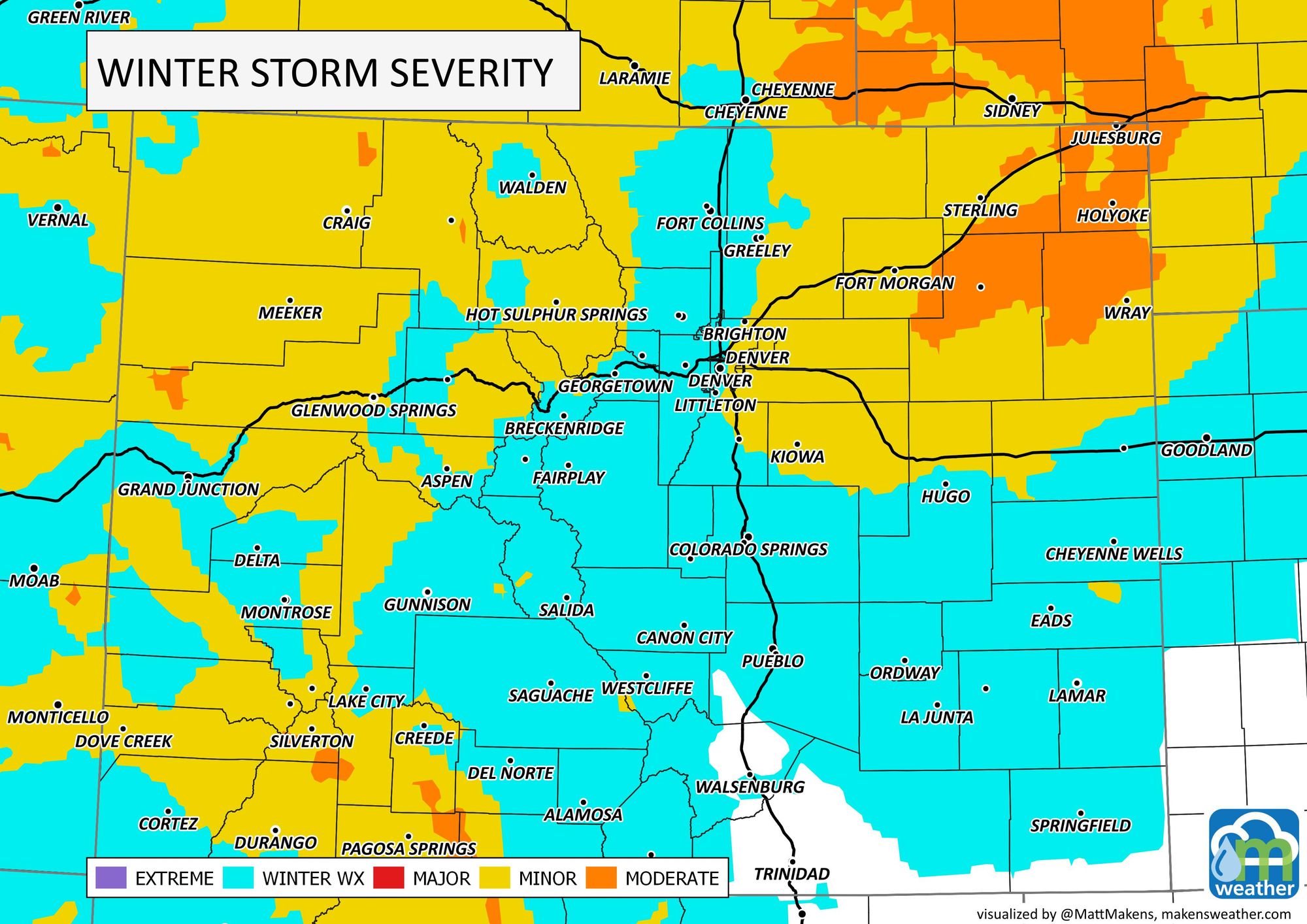
As it stands now, the storm will have an impact statewide, the most significant will be largely over the northeastern Plains. Portions of I-70, I-76, I-80, and I-25 will have difficult winter driving conditions, particularly Monday night through Tuesday.
As we discussed in yesterday's update, the main storm system is plowing through the West from there will head to the Northern Plains with a path the will put the center of the storm over Northeast Colorado, Southwest Nebraska, and Northwestern Kansas by Tuesday morning. The center of the storm is north enough to keep the biggest impact out of Colorado at this time, but this is something to be watched today and tomorrow. A southern shift in that center will bring widespread impact and a lot more snow to the area.
The impact on the Northern Plains states will be tremendous as the storm hits them Tuesday into Wednesday. We discussed the storm's impact in this latest video:
For home, in this post we are looking at the probabilities of snowfall from the data up through Sunday morning. The data has shown very little change in the past several days, and remains consistent.
From a Gamblers Chart perspective, we have the following probabilities, Denver has some of the healthier probabilities.
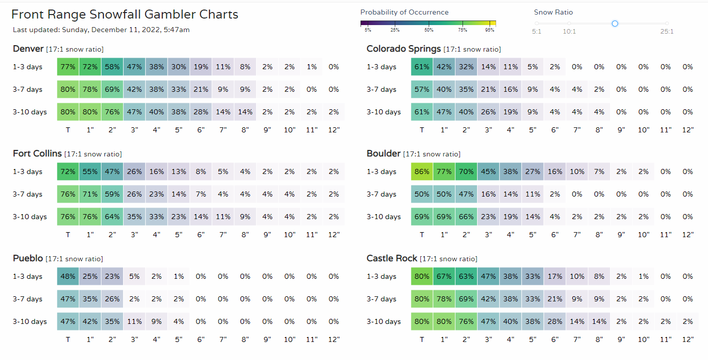
Take a look at the map version of most probable totals, and you'll see a relative lull along the I-25 corridor and adjacent foothills. Barring changes to the forecast, the deeper snow will hit west in the mountains and east of I-25 this time.
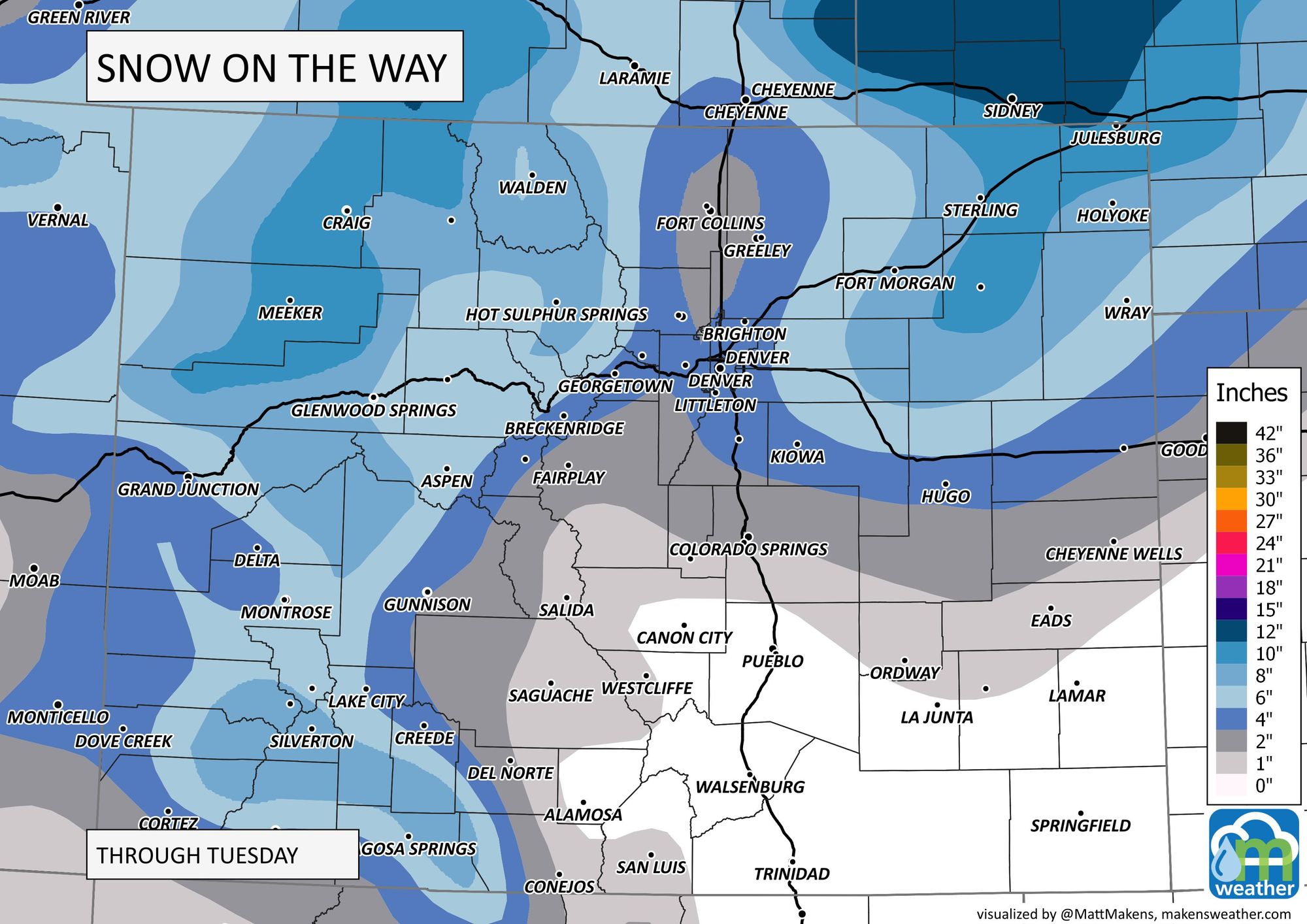
This breaks down to roughly the following:
- Colorado Springs: 0 - 3"
- Denver: 1 - 4"
- Denver (DIA): 2 - 5"
- Boulder: 1 - 4"
- Loveland/Fort Collins: 0 - 3"
- Fort Morgan/Sterling: 5 - 10"
As far as the timing of the action, here's an example using Denver, with the neighboring cities sharing a similar timeline.
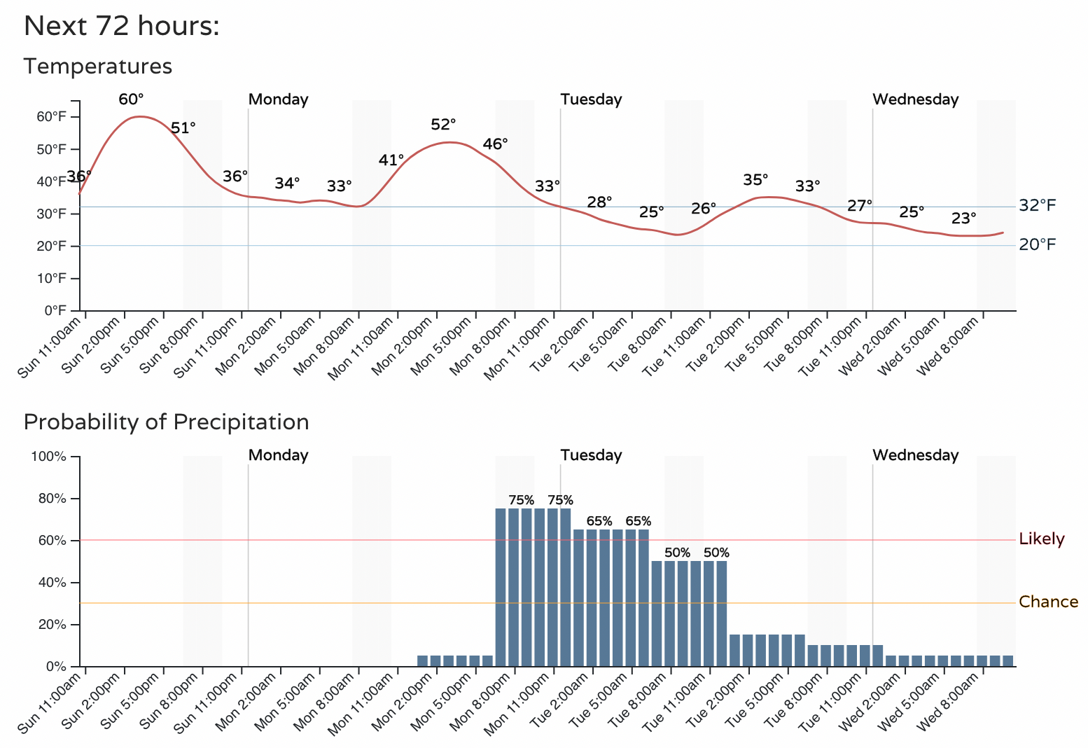
You can see the rapid onset of snow chances Monday, after a relatively warm day. Snow focuses its impact on the Tuesday morning commute, then trailing impact with colder temperatures later Tuesday into Wednesday morning.
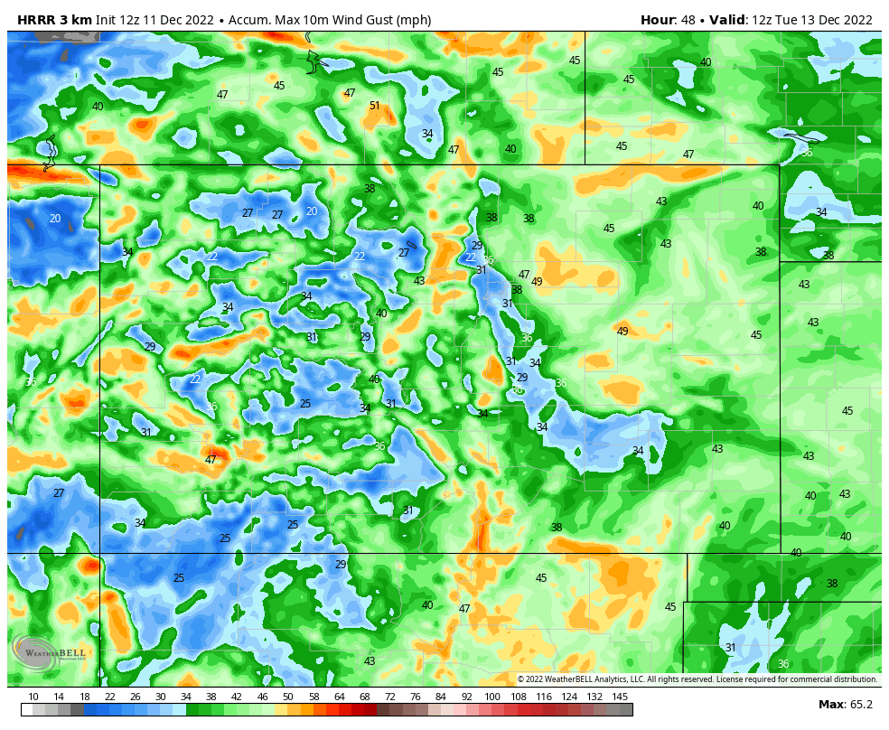
If you are curious about wind this time. Yes, we will have wind gusts driving through the change and to blow the snow around. This will be particularly problematic for travelers on I-76 and I-70. The following map shows peak wind gust speeds throughout the next couple of days but the wind will likely peak Tuesday morning for us.
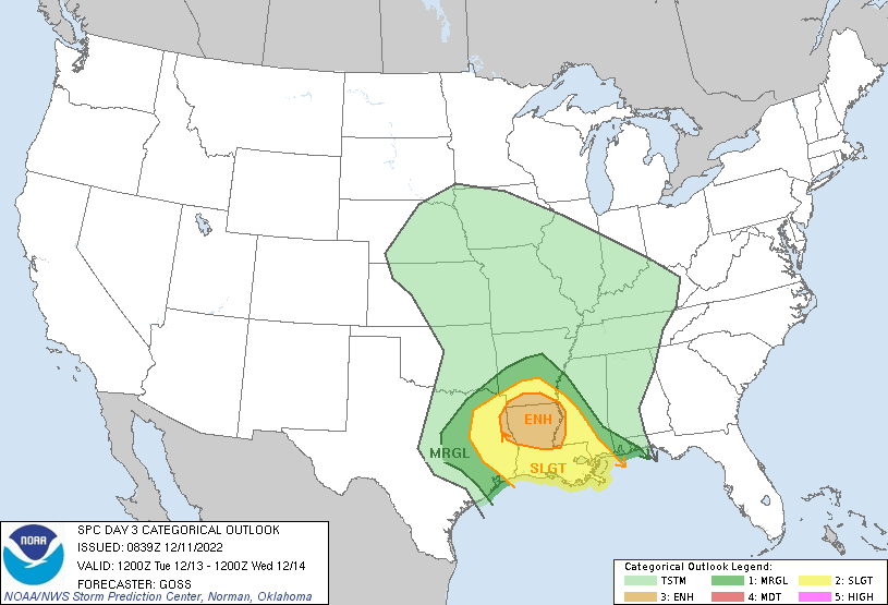
This is quite a strong system, even though the data through this post indicate a lower impact on Colorado. The impact will be huge for the Northern Plains in terms of snowfall, and the South will have a notable risk of damaging thunderstorms Tuesday into Wednesday. Here's the convective threat outlook, and tornadoes may very well be part of this same system:
Bottom line: We continue to watch the storm and its impact on the region. The storm's path remains north enough to bring moderate threats to our northeastern plains. Any variation to that storm path will dictate much larger impacts on us, so stay tuned for future updates we may bring regarding any such changes.