Pre-Christmas cold snap may be brief but dramatic as a present from the north comes early

We continue to track a very cold airmass set to slide south this week putting a good portion of the country in the deep freeze for Christmas next weekend. For Colorado specifically, it looks like the worst of the cold will come before the holiday weekend, with temperatures moderating a bit by Christmas Eve.
Just how cold are we talking? Well, those details aren't pinned down just yet, but Thursday looks awfully chilly in just about every scenario at this point.
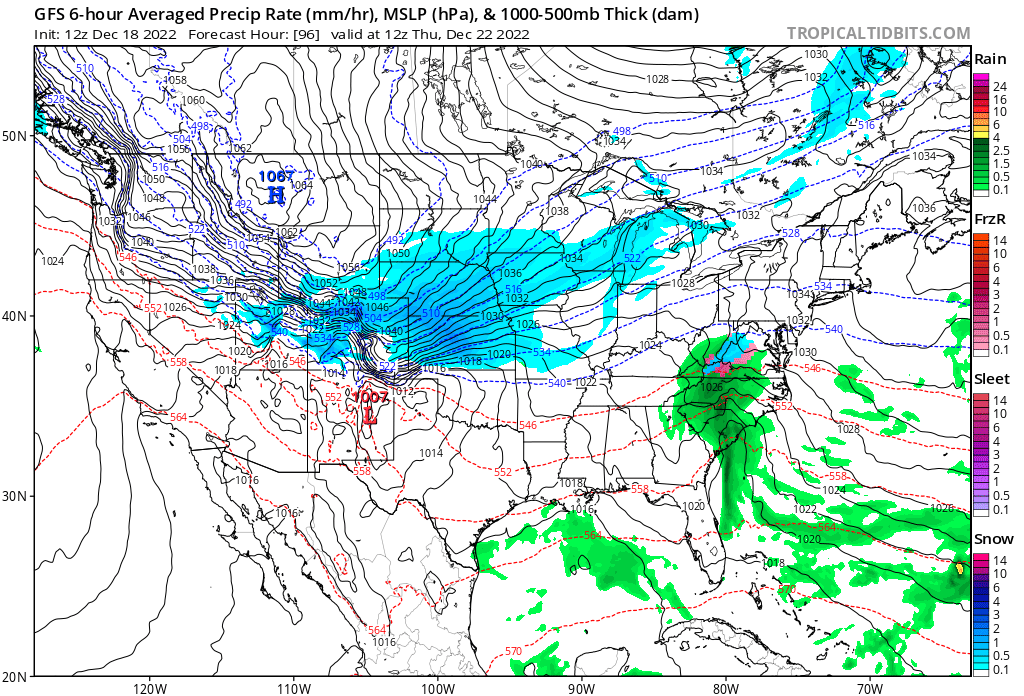
This post discusses our local region in detail, for a look at the arctic plunge for the entire country along with troublesome travel areas and rain/snow projections, we have that here:
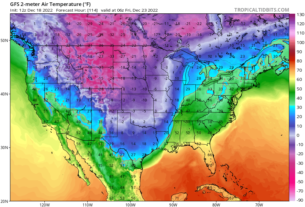
Back to local: For Denver, the "warmer" models show high temperatures in the single digits to about 10°F Thursday and overnight lows Wednesday night and Thursday night in the single digits below zero. Some colder solutions continue to indicate the potential we see our high temperature stay below zero on Thursday with overnight lows near -20°F below zero on Thursday.
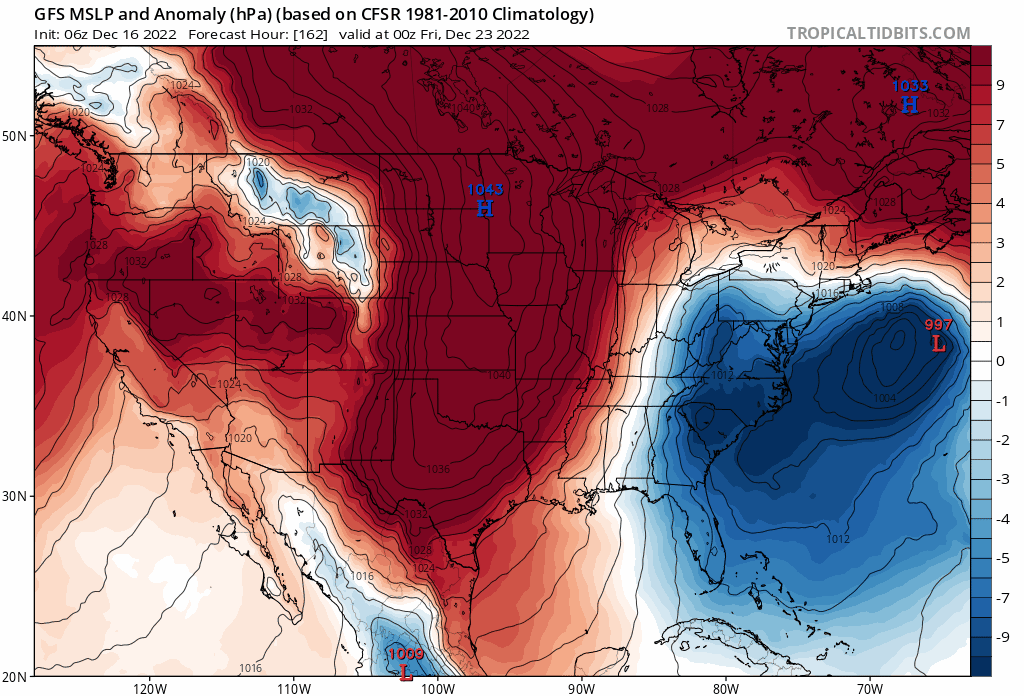
An impressive arctic high will deliver the bitter cold air to our region by the middle to latter half of the week. Some models indicate we'll see record-setting MSLP with this cold outbreak as models show a 1060mb high setting up somewhere north of us on Thursday (Wyoming/Montana or thereabouts).
All this to say we won't be alone in experiencing the cold later this week. Overnight lows as forecast by the GFS on Thursday night show much of Wyoming, Montana, and the Dakotas will see temperatures plummet 20 to 30°F below zero – with wind chills well below that. In fact, the Wind Chill Advisory advisory posted for eastern Montana states wind chills my drop to -45°F or colder later this week!
How cold we get will depend on a lot of factors, including how far west that high sets up as it comes south. After backing off the colder solutions for a couple of days, models are hedging back colder, and seem to be coalescing on this solution. You can see in the animation below, the high (blue H) has generally shifted west and south over the last 10 runs from the GFS, which will favor the coldest temperature anomalies to hug the Front Range of the Rockies, rather than progressing east – sparing us.
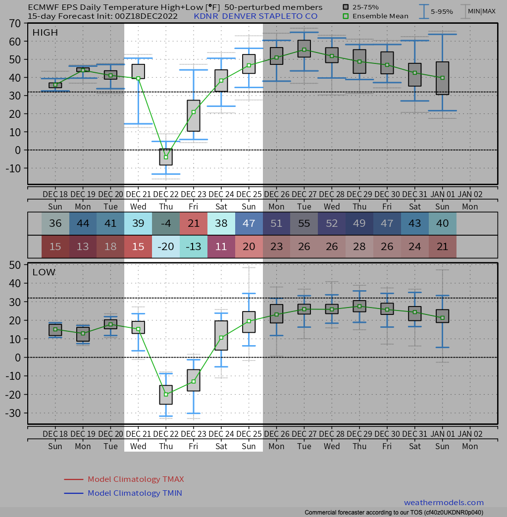
So, confidence is high that we'll see some very cold air across Northeast Colorado for the latter part of the week, the question remains how cold. GFS MOS guidances has a low of -17°F on Thursday and a high of -4°F, and a low of -17°F Friday then climbing to about 15°F Friday afternoon in Denver.
The European ensemble mean temperature forecast is in similar agreement, with -4°F for a high Thursday, and overnight lows near -20°F. The record low for December 22nd in Denver is -25°F, set back in 1990.
Brr!
Snowfall outlook
While we work out the details around the cold, the other part of the equation will be how much snow we are likely to see, if any at all.
Consensus here also appear to be growing, with most models showing at least some snowfall along the urban corridor and northeast plains Wednesday evening and overnight with the passage of the cold front.
Generally speaking, while these setups will reliably produce snow for our region, they are often be moisture-starved and therefor the cold is the bigger story vs the snow.
Still, at least a bit of accumulation looks increasingly likely from Wednesday afternoon through Thursday morning, with perhaps a couple of inches in spots to help get everyone in the mood for the approaching holiday weekend.
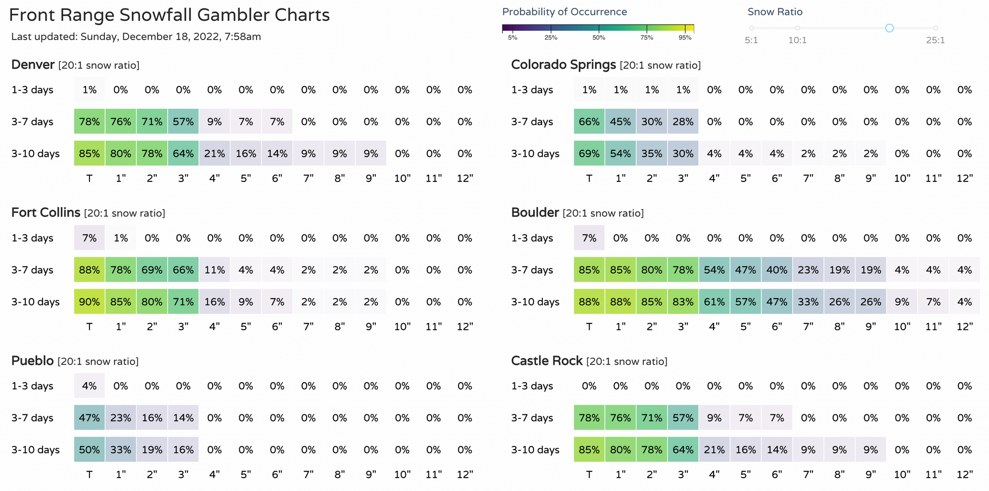
A look at our snowfall gamblers from this morning would indicate Denver could see a much as 1 - 4" of snow, while points northwest (Boulder) could end up with even a few more inches than that.
As with the temperature outlook, these numbers will change over the coming days. Most important at this time is to know that our relatively quiet weather in place to start the week is likely to shift much colder and perhaps snowier by midweek. If you have travel plans Wednesday PM or early Thursday consider adjusting if possible, and if not just keep an eye on the weather as we get closer so you can plan accordingly.