
Arctic blast: Dangerous cold remains on track for Denver & Colorado by Thursday

Potentially record setting cold is on tap for the Denver metro area in just a few days. Thursday's existing record low is -25° from 1990, and Friday's is -17° also from 1990. In data through Monday morning, it appears we will rival that Friday record-low temperature.
Here's more on the historical perspective of cold temperatures in Denver:
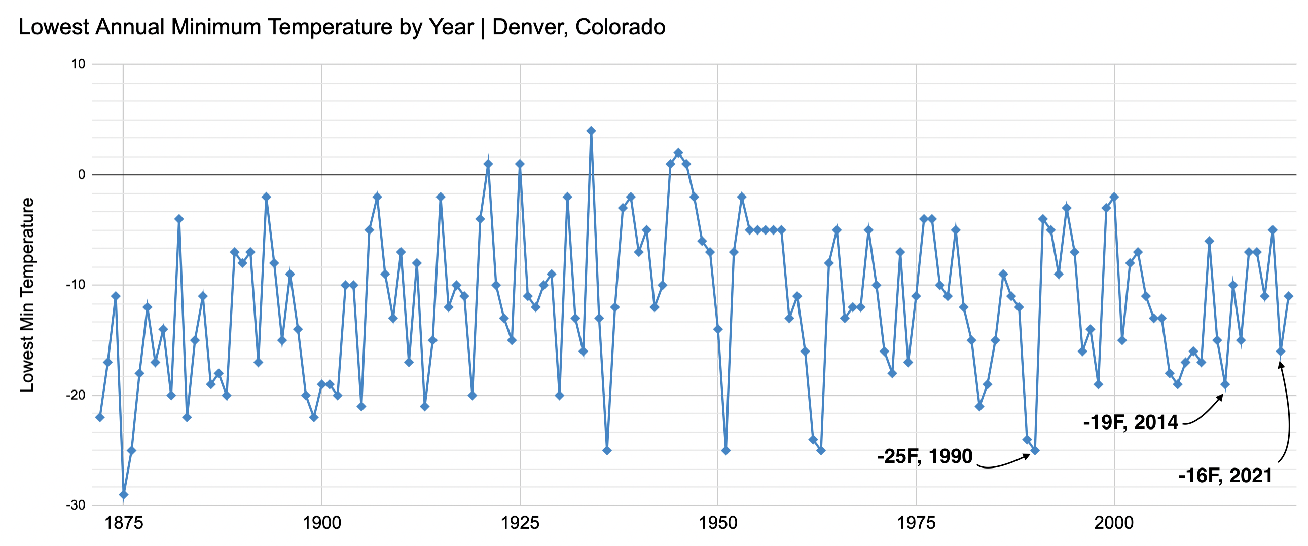
It's not uncommon for the city to drop below zero, it happens six times a year on average. It is, however, pushing the extreme to fall into double-digit below zero territory, which happens on average once to twice a year. The last double digit reading below zero was last February when Denver hit -11°F on the 3rd.
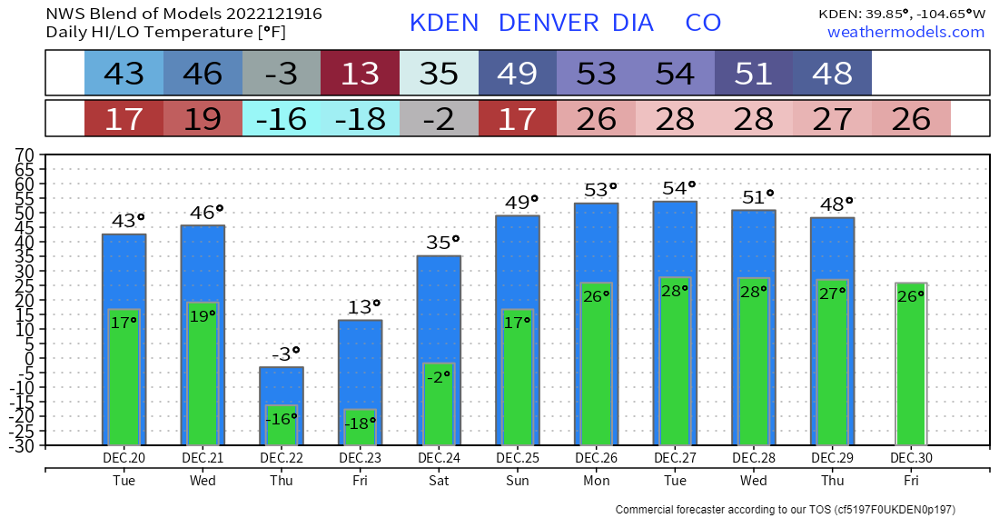
Using a blend of models to find an average guestimate on the magnitude of the cold this week, Thursday remains the coldest projected day this week; dangerously cold in fact. This image is meant to draw your attention to timing of the cold. We will get into specific forecast numbers in a moment. I will caution you, arctic outbreaks for Denver and the northeastern plains will recover more slowly than modeling can usually portray accurately, consider that when getting too excited about the warmer temperatures by Christmas Eve and Day, I'll be surprised if they are anywhere near as warm as models think.
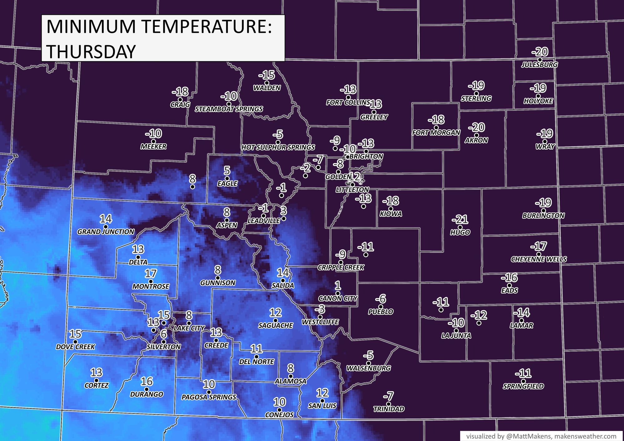
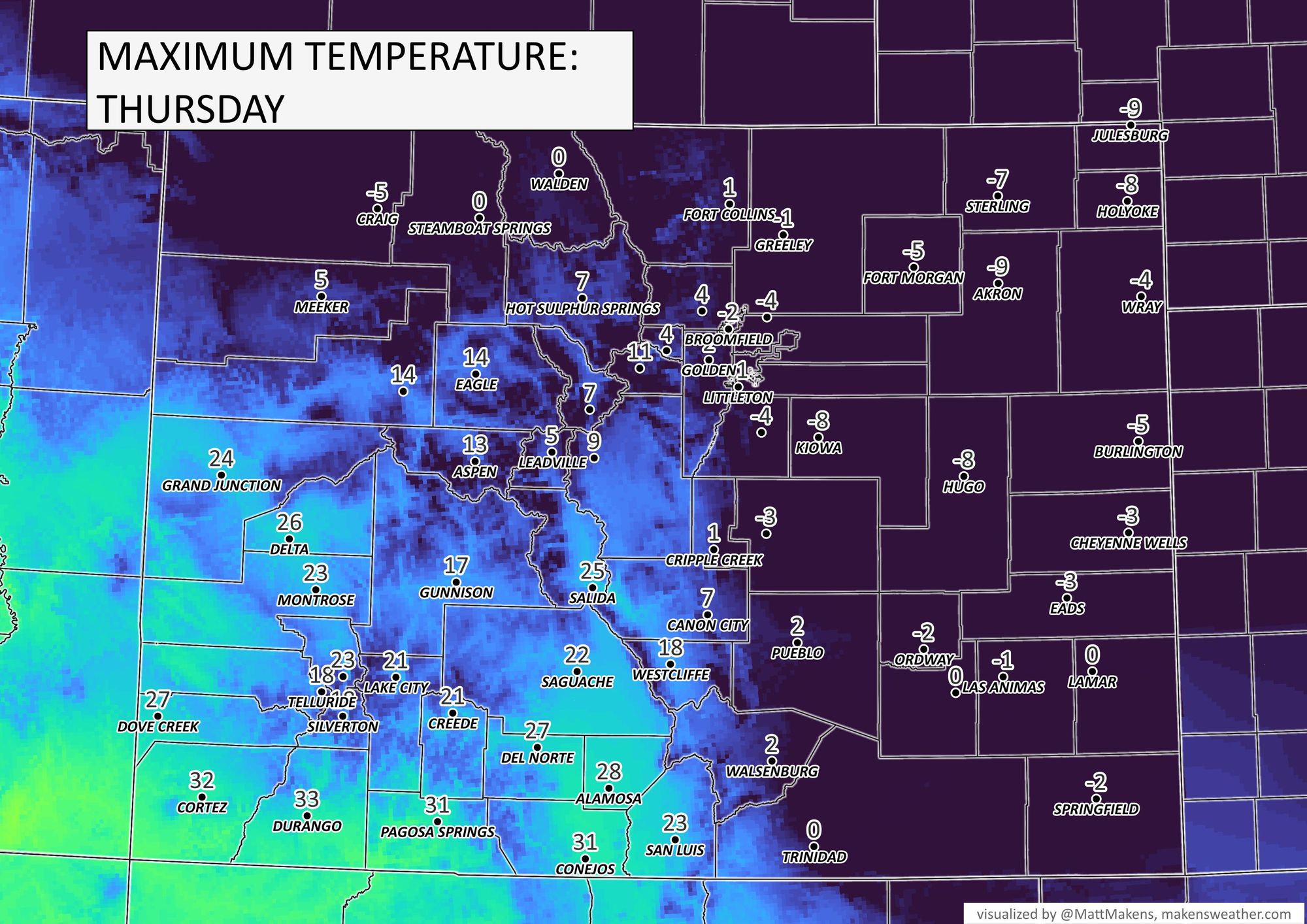
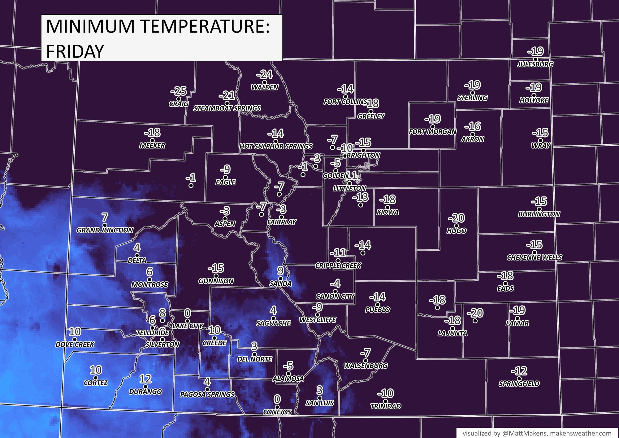
Let's take a look more specifically at Thursday morning through Friday morning temperatures across Colorado.
"Of note: the last time Denver had a high below 0 was February 5, 2014. And, the last time Denver had a high below the forecast of -5° was December 21, 1990 (-7°)" -NWS BOULDER
The images shown is not considering the wind - wind chill values will be much much colder! There's a Wind Chilly Watch in effect now. We may calculate wind chills as low as -50°F across parts of Eastern Colorado!
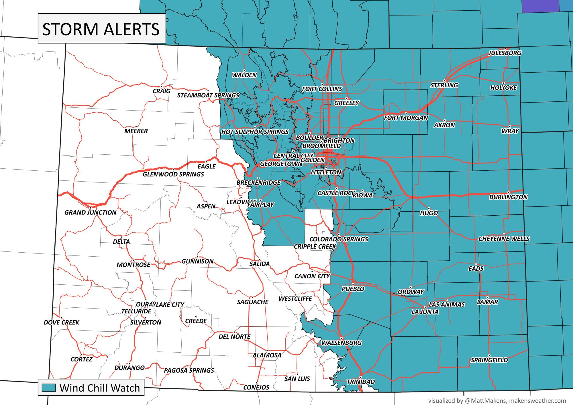
...WIND CHILL WATCH IN EFFECT FROM WEDNESDAY EVENING THROUGH FRIDAY MORNING...
* WHAT...Dangerously cold wind chills possible. Wind chills as low as 50 below zero.
* WHERE...Portions of central, east central, north central, and northeast Colorado.
* WHEN...From Wednesday evening through Friday morning.
* IMPACTS...The dangerously cold wind chills could cause frostbite on exposed skin in as little as 5 minutes.
PRECAUTIONARY/PREPAREDNESS ACTIONS... The combination of wind and cold temperatures will create dangerously low wind chill values. Avoid outside activities if possible. When outside, make sure you wear appropriate clothing, a hat, and gloves.
With this cold there will also be a chance of snow. Here's a look at the hourly chances for the Denver area, incoming Wednesday evening:
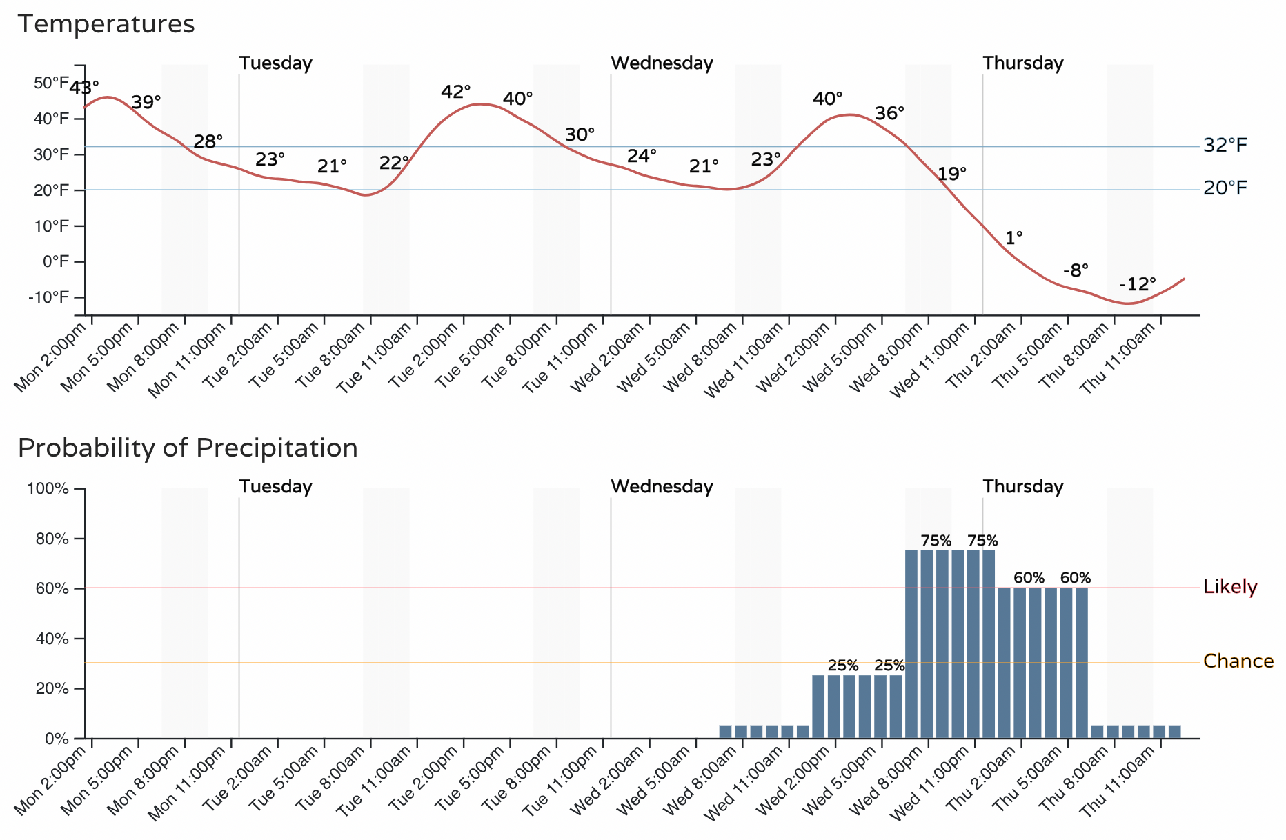
As that snow falls with such a rapid drop in temperatures there may be areas of icing on roadways. Consider also the snow will change quickly from wettest early on to driest/fluffiest with the arrival of the cold.
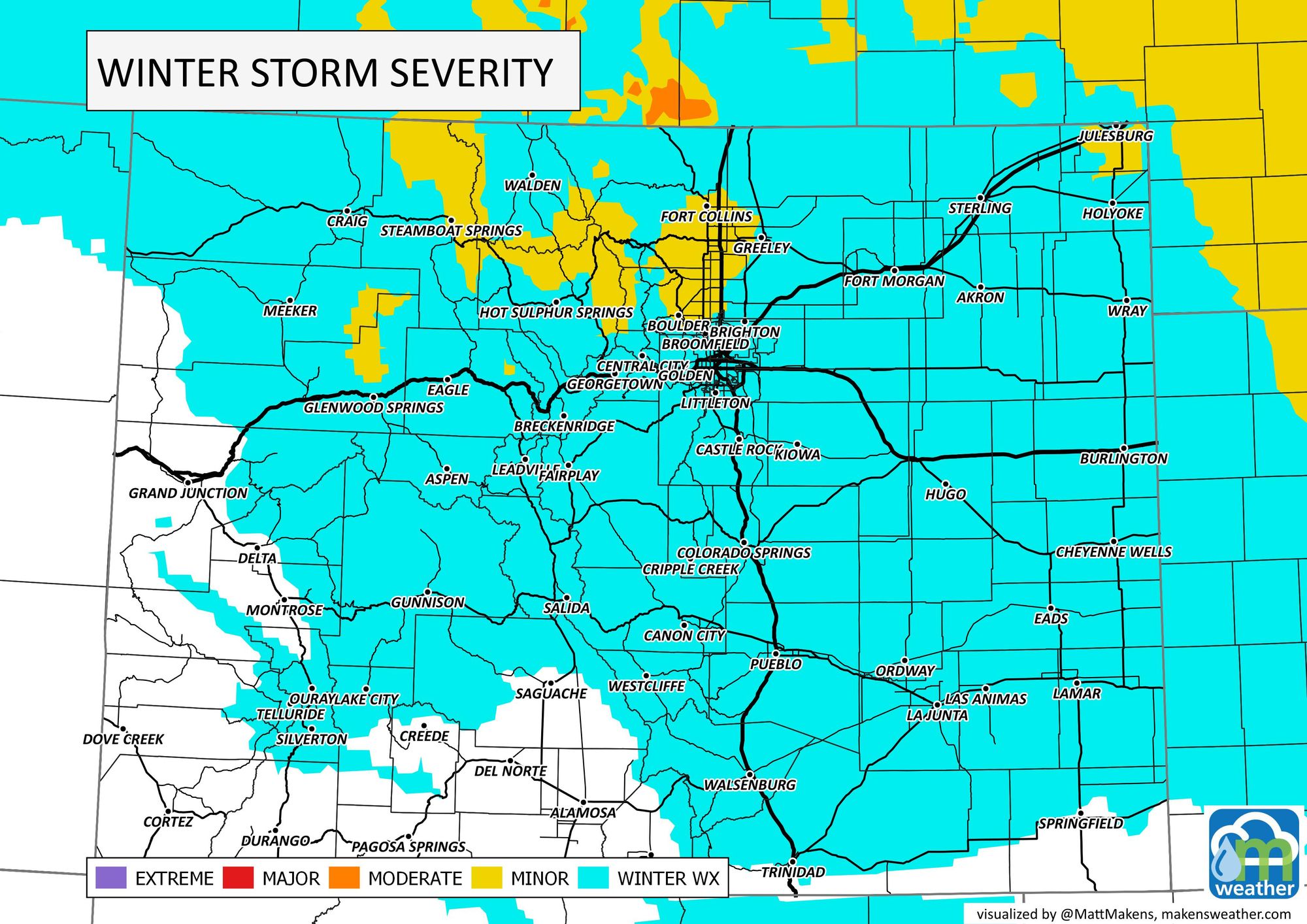
Travel impact as estimated right now for late Wednesday through Thursday morning.
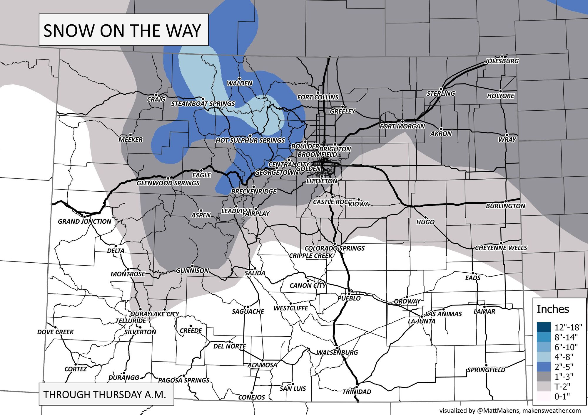
With rapidly changing snow ratios, the totals are going to be a bit tricky to pin down, especially this early, but here is a rough idea of the totals that are possible across the state:
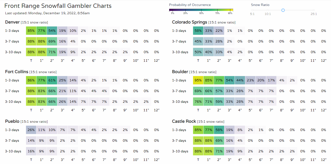
Those are most probable as of the latest data and in looking at the Snowfall Gamblers we produce for Insiders, we have:
And, for those of you about to travel, this cold is extensive! Here's the latest national perspective.