Colorado weather: Alerts issued ahead of extreme snowfall in northern mountains, extreme cold in metro areas

The next round of snow and cold will be quite substantial. For the northern mountains, well over three feet of snow will be possible through Tuesday, and for the metro areas, the arctic cold will set in Sunday through Tuesday morning.
Let's begin with the alerts, I anticipate more but these have been issued as of this posting.
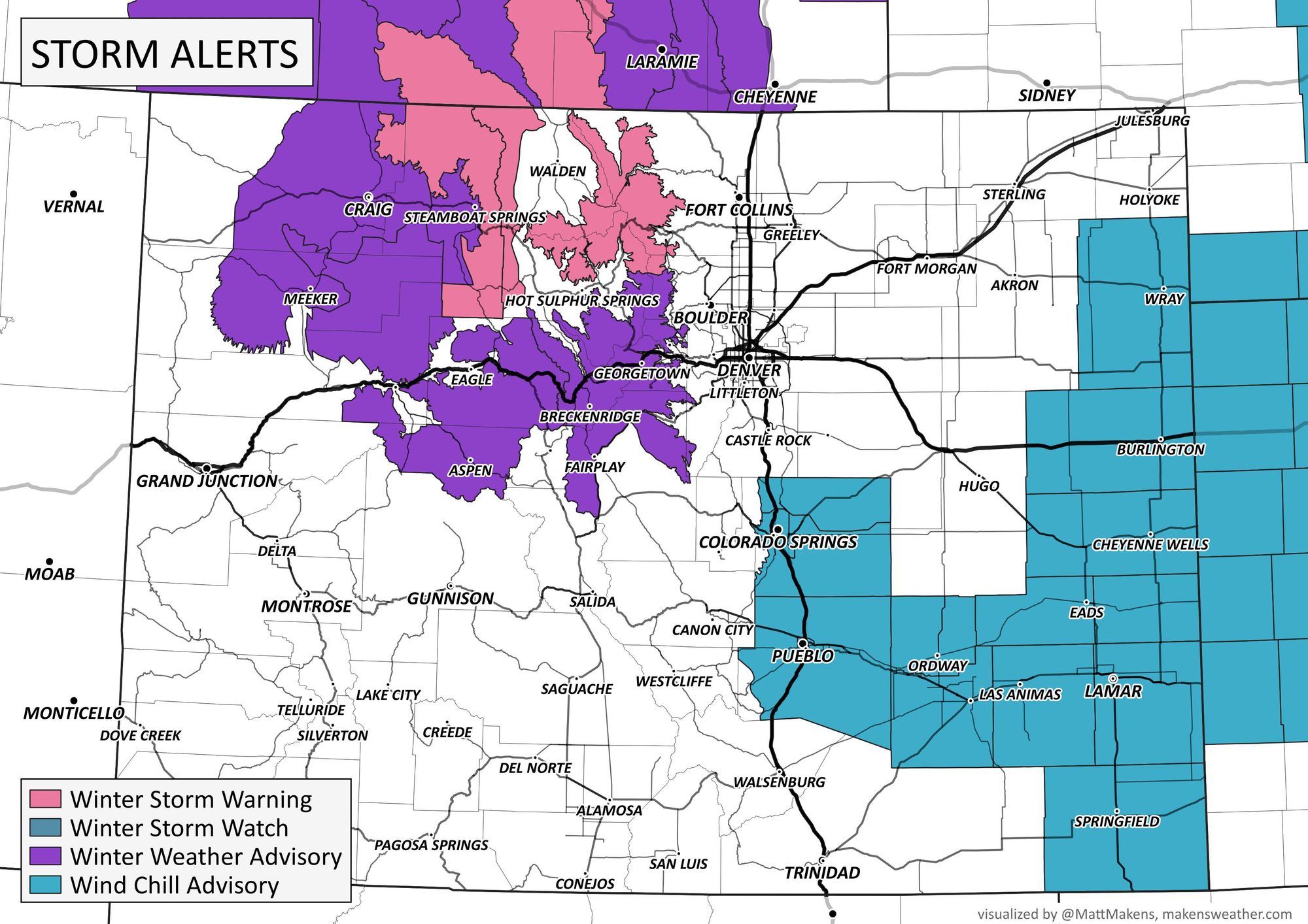
Nothing is currently in effect for the Denver area, but Colorado Springs will be on the look for extremely cold wind chill values of -25 overnight tonight and again Sunday night through Monday morning. Depending upon your school district policies, I won't be shocked to read of schools on a delayed start Monday, at least, due to cold in parts of the metro and/or Plains.
Let's look at two hourly planners, one for Denver and the second for Colorado Springs so you can get a sense of when the cold will move in.
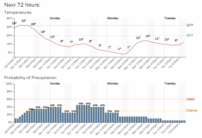
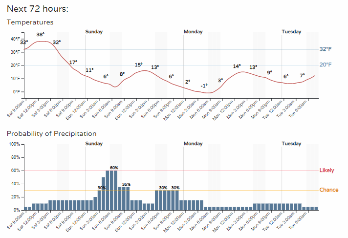
If the cold timeline didn't grab your attention, I bet the snow chance timeline did.
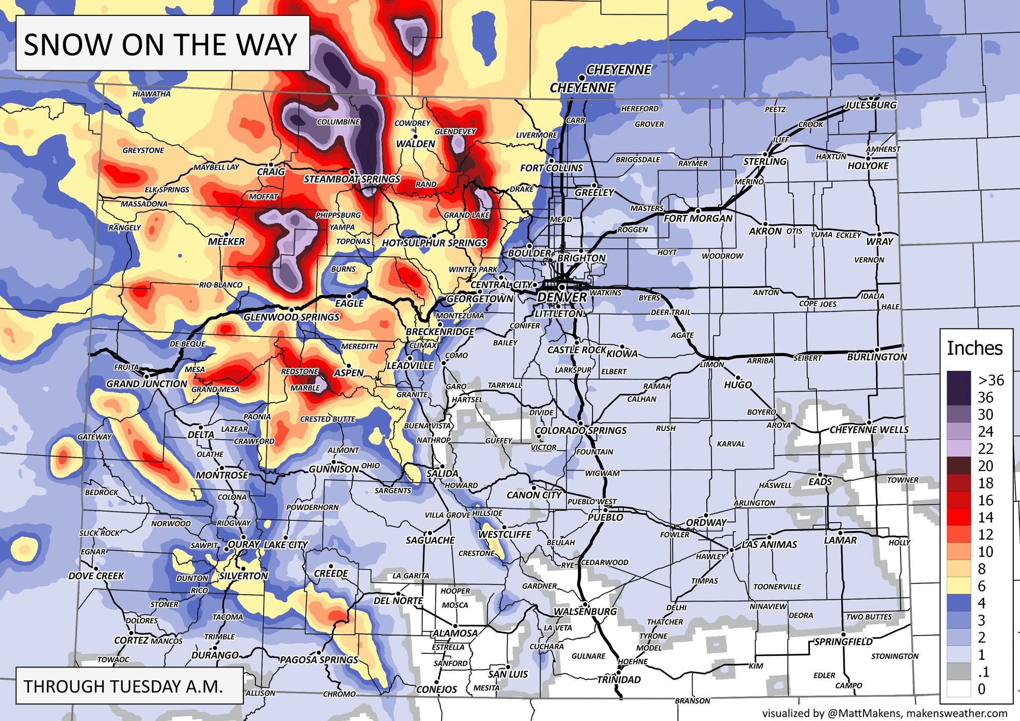
Periodically snow will fall, but it still doesn't look overly impressive for the metro areas, but it is darn impressive near Steamboat Springs. From Rabbit Ears Pass northward through the Medicine Bow-Routte National Forests and the eastern edge of Steamboat Resort, there will be more than two feet coming and some isolated pockets through this region of more than three feet through Tuesday!

Let's zoom that map down onto the Front Range.
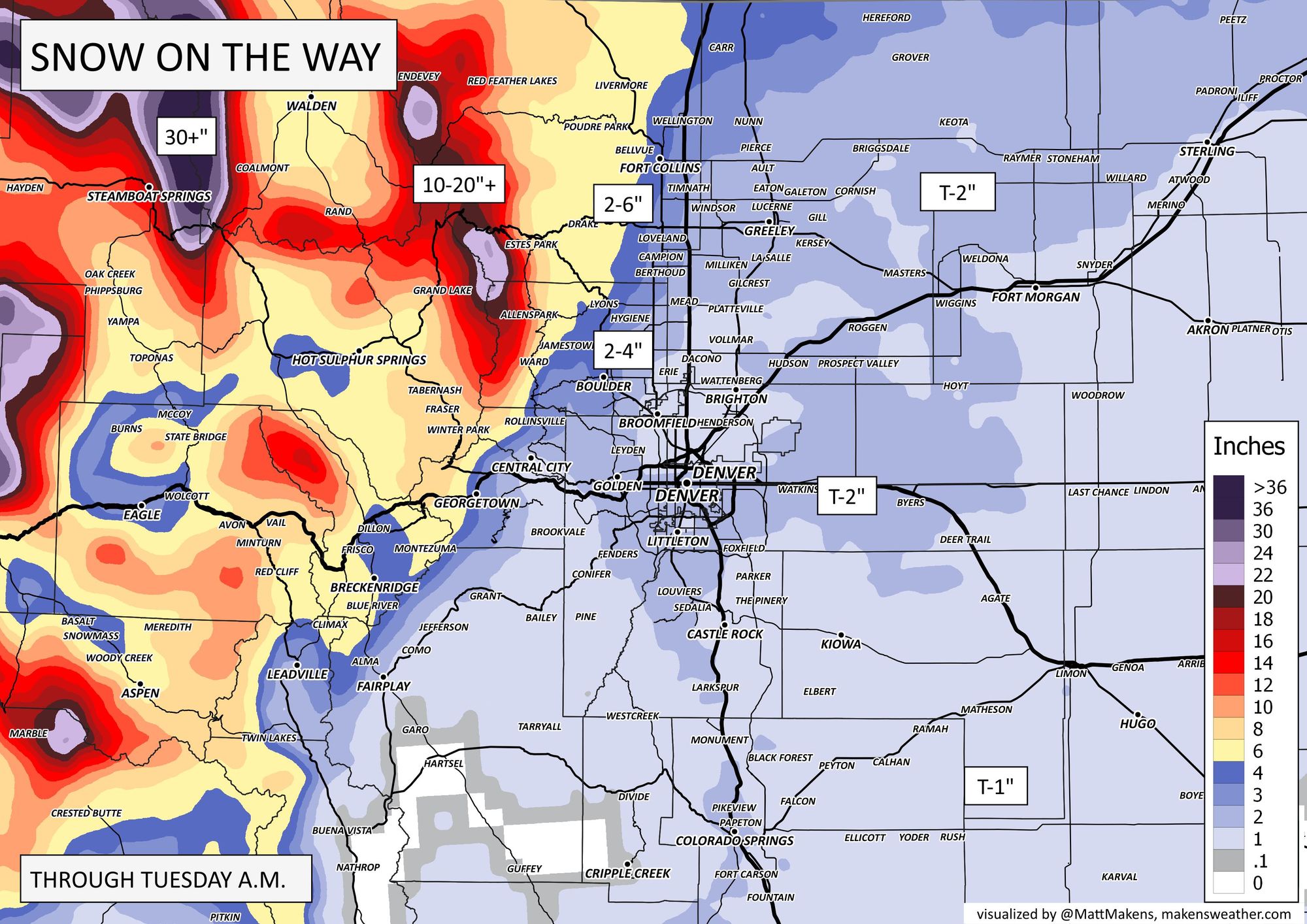
There will be some higher totals northwest of Denver, into the foothill locations from Boulder toward Fort Collins. The vast majority of the metro area from the Springs to Cheyenne will see a little bit (Trace to 3" or so).
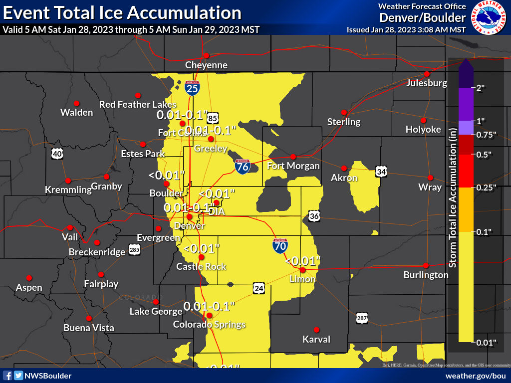
There will be ICE in addition to snowfall, which will be an additional impactor on the roads/sidewalks/etc. Total ice will come from low clouds and fog that move in with the cold.
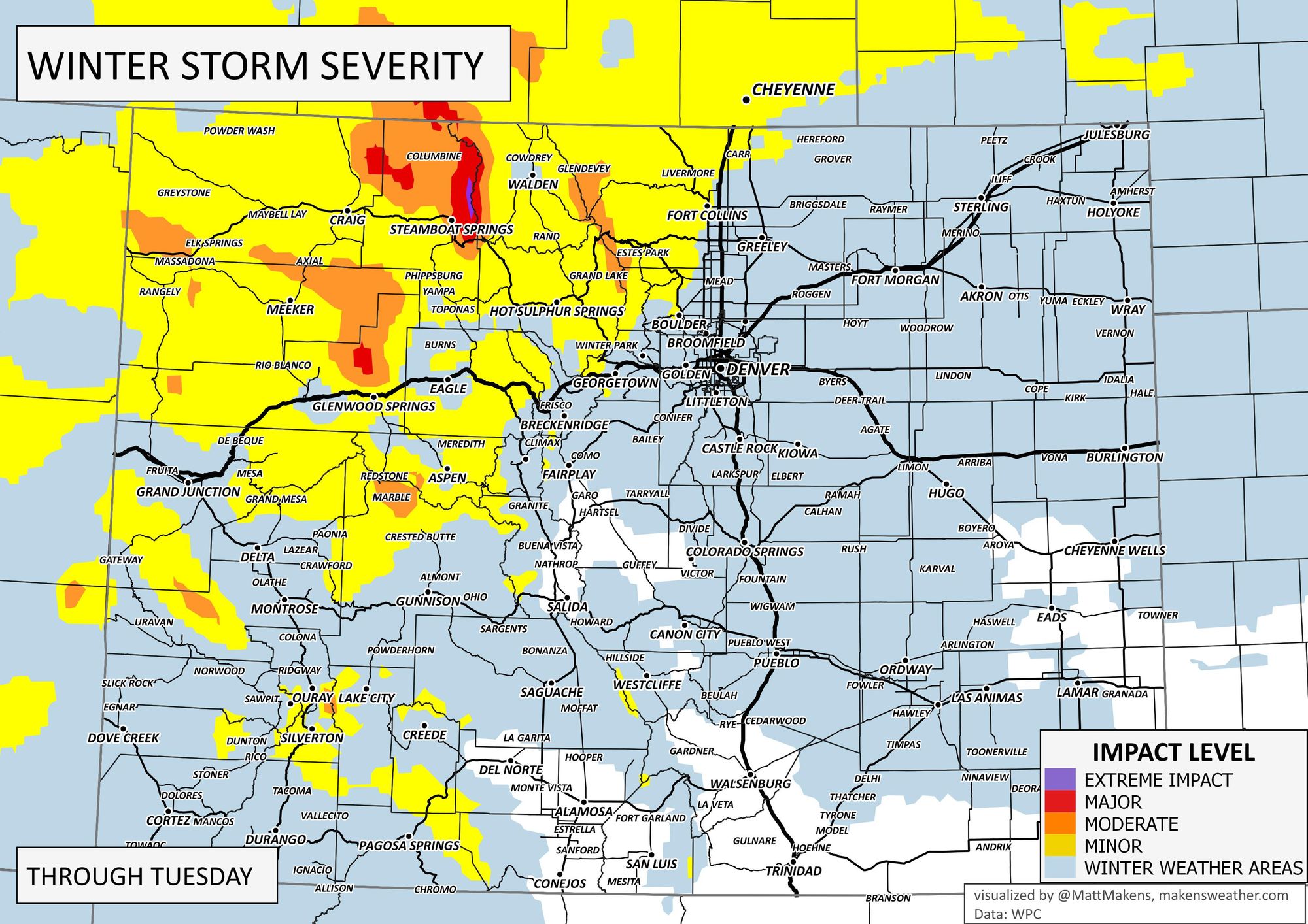
If you look at the overall impact of this event, HWY 40 will be a booger over Rabbit Ears Pass, with impact areas more limited elsewhere.
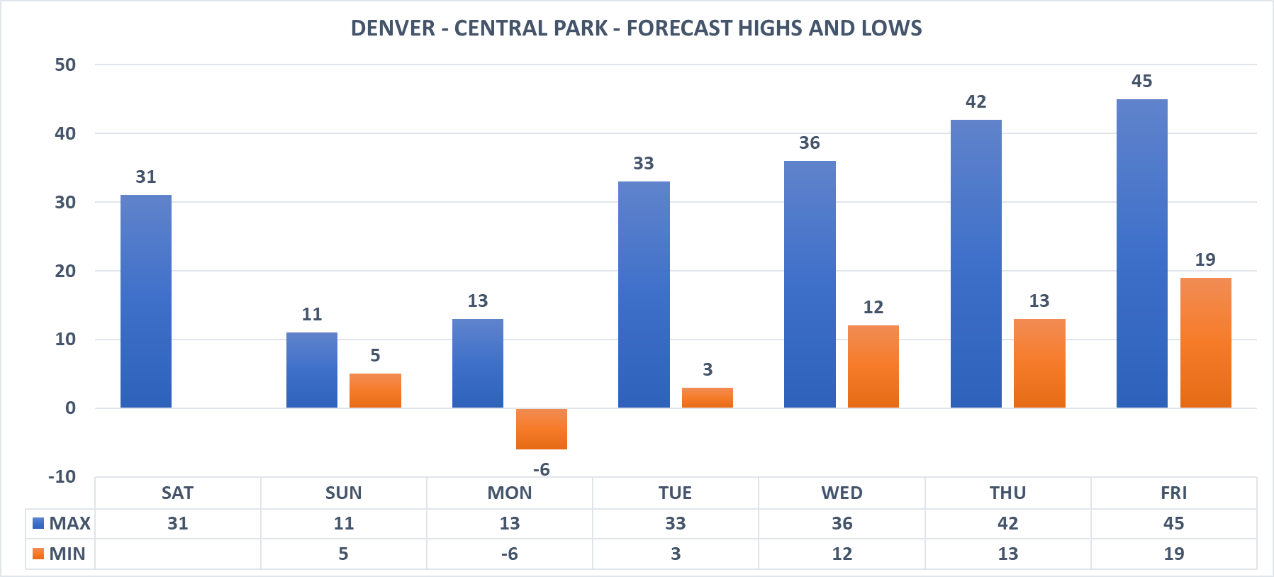
In terms of the cold, yes, it is cold but not historically so in terms of daily record lows.
This arctic blast's impact will continue until gradually clearing after Tuesday morning.
Keep up posted with conditions at your location by entering comments below, and don't get left out in the cold - subscribe to our email list today, it's free, and we just send you an email when there's important information to deliver.