
Denver weather: Dangerously cold start to the week, snow for some

The cold is now the biggest talking point, as outside of the DEEP snow in the northern mountains, we mainly have dangerous wind chills to expect through Monday morning.
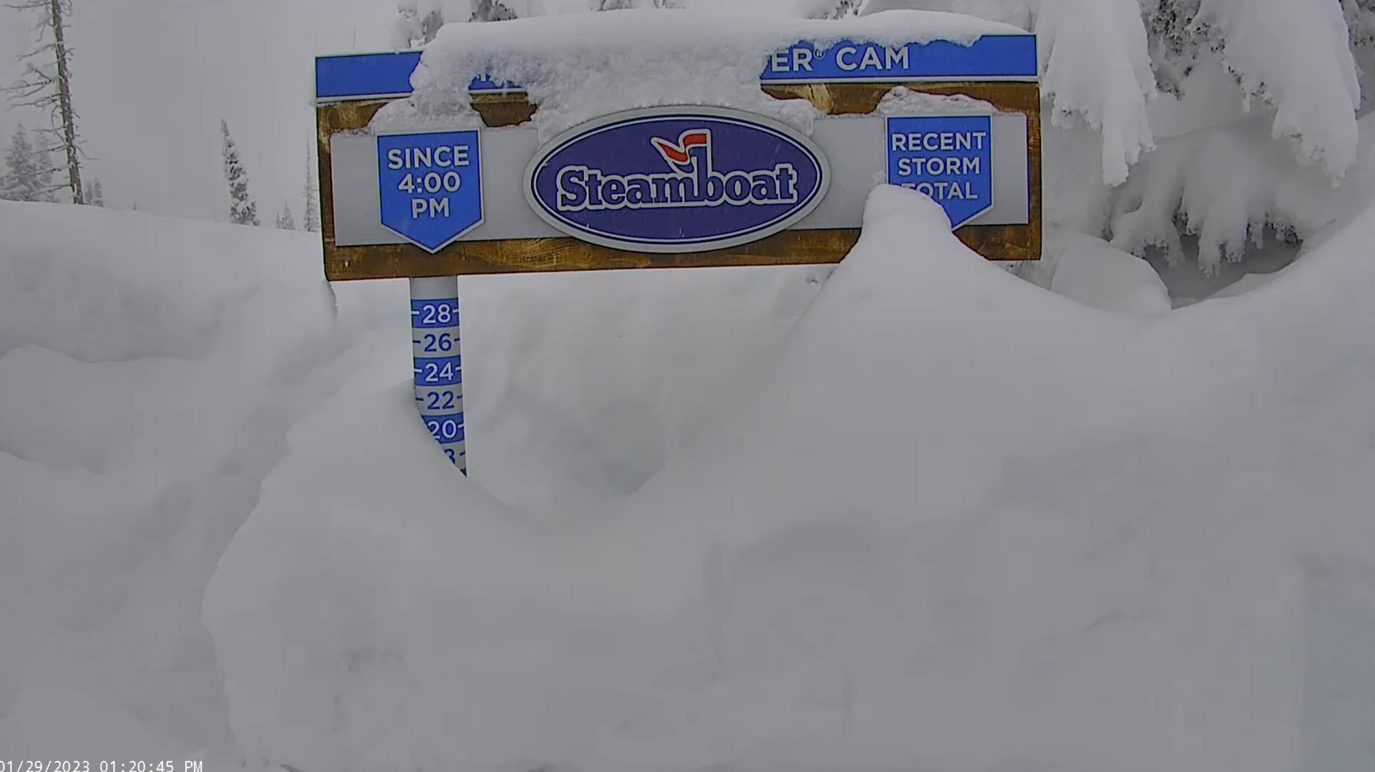
Let me geek out first, as if I don't always geek out, but look at this live camera from Steamboat Resort, 49" this week at the summit!
I hope they don't clean off the snow stakes before you can see this, but in case they do, here's a quick screen grab from early this afternoon. ☃️ ⛷🏂
With freshies on our mind, let's talk about the ongoing cold snap.
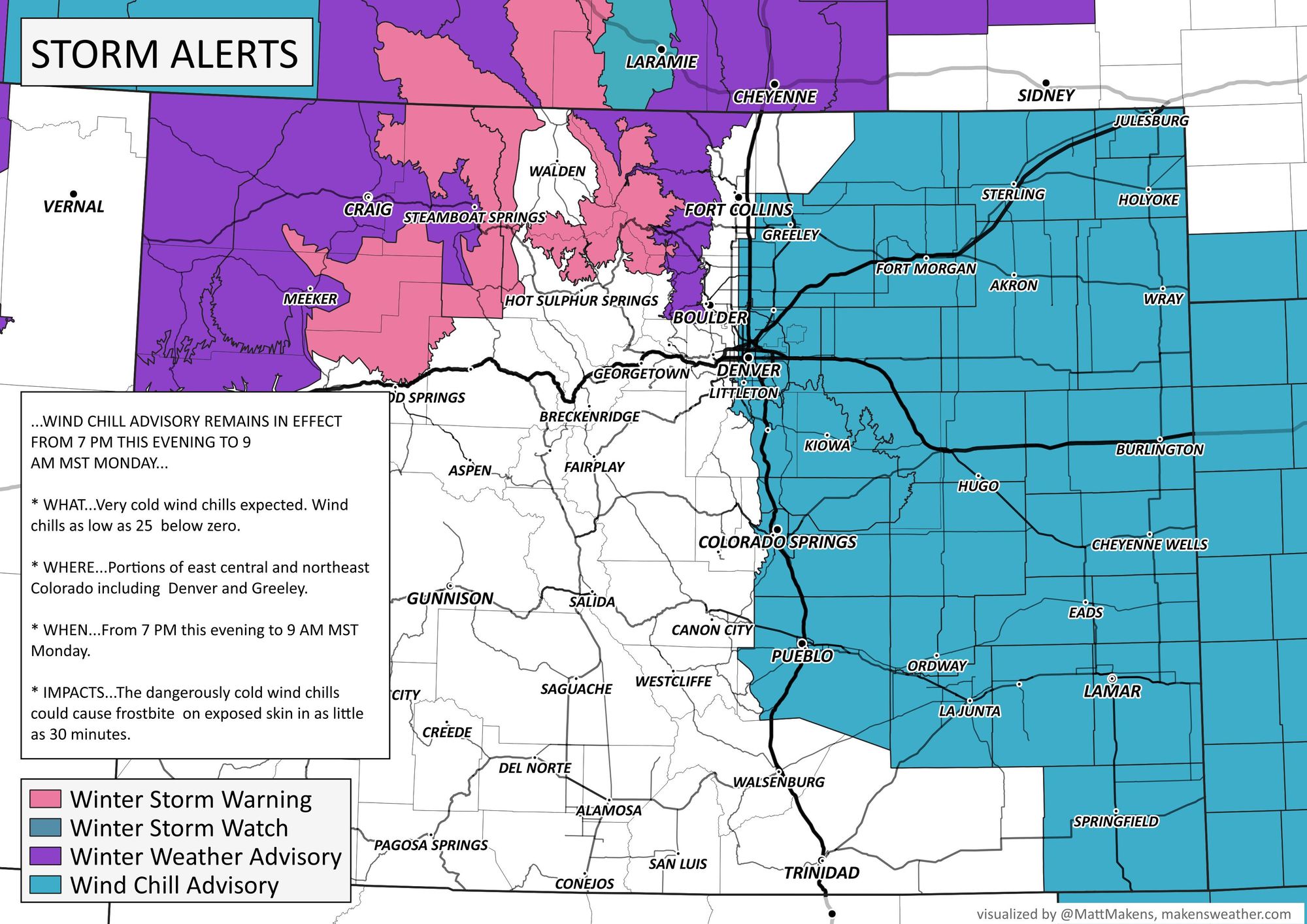
The cold that's taken over the metro areas and Plains Sunday will stick around through Monday before we start a gradual warming process Tuesday. It's the cold overnight ahead combined with wind that leads to some dangerous wind chills. For that reason, there's a wind chill advisory in place for the metro areas and Plains. Some wind chills will drop to -25°F.
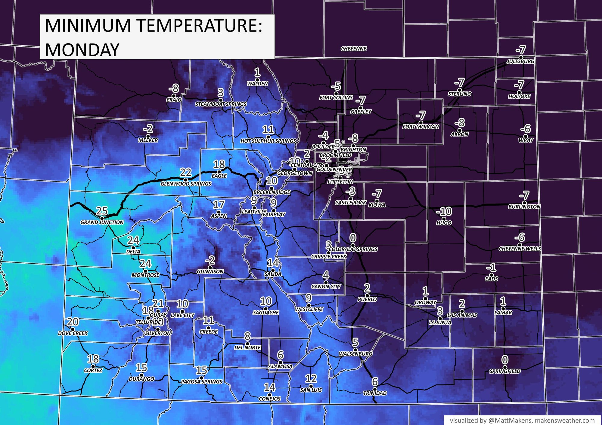
For Monday's low temperatures we have:
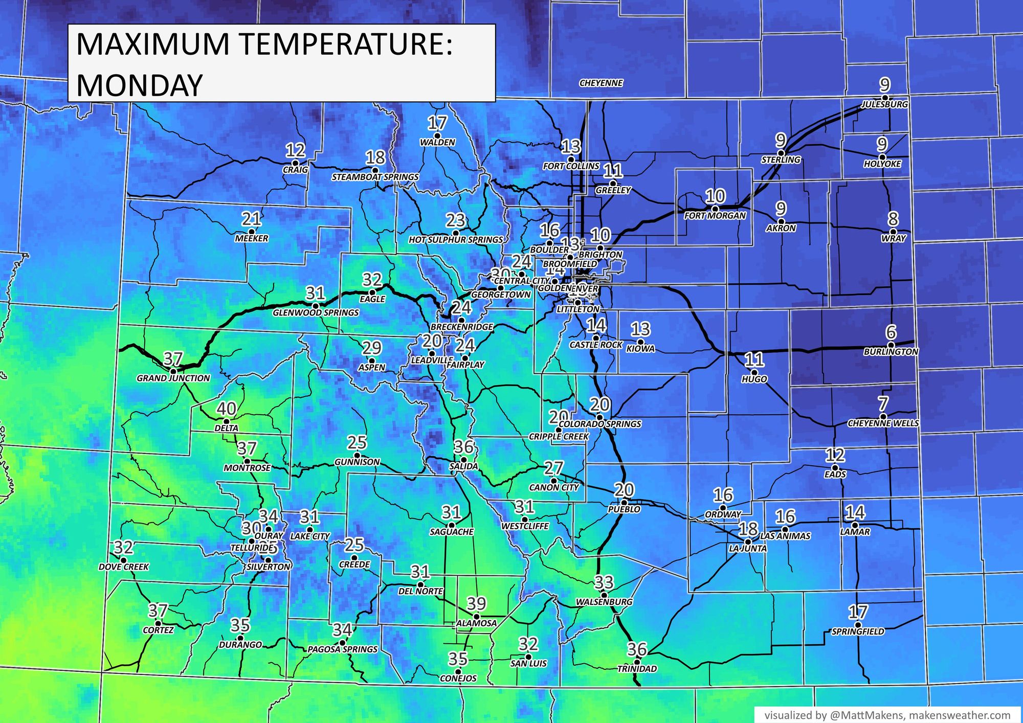
For Monday's high temperatures we have:
With the cold, there will be areas of fog (leading to icing) and some additional snowfall. In terms of snow, the heaviest remains in the mountains but some pockets of heavier snow will be positioned between the foothills west of Denver to Fort Collins.
Boulder and Fort Collins both have odds of greater than 30% to reach at least three inches of snow just today and tonight.
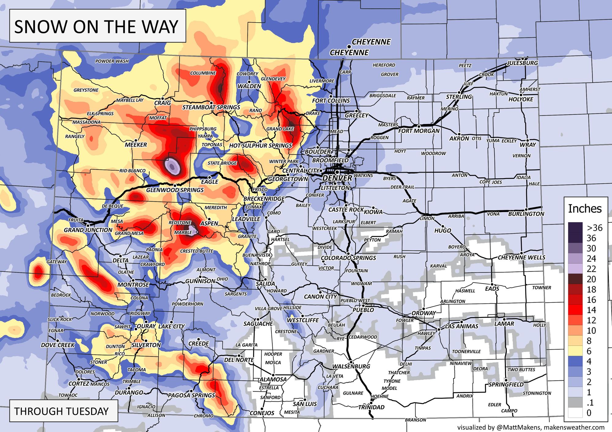
Here's the snowfall projection from Sunday morning through Tuesday for the Front Range, then a state view.
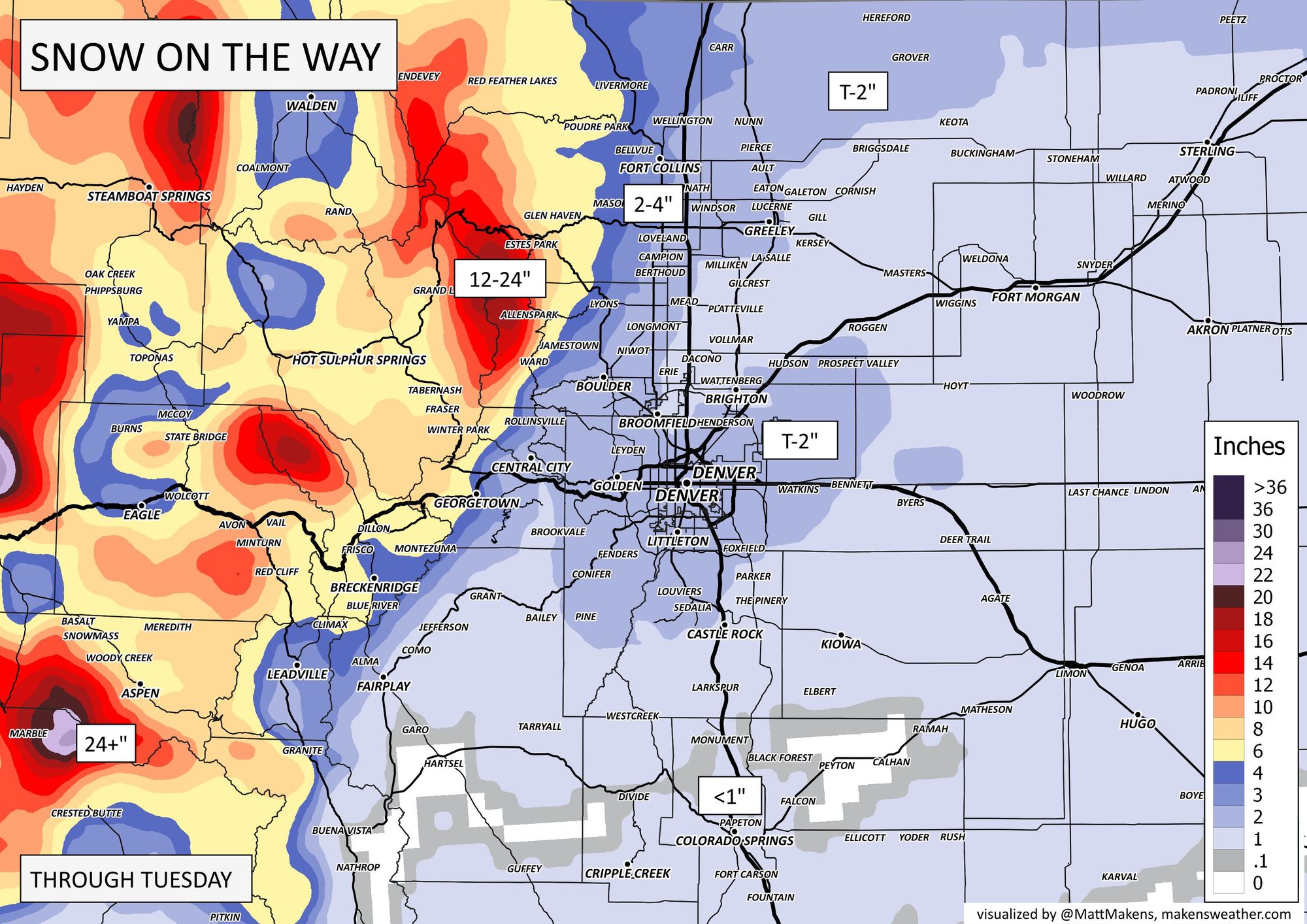
For the metro areas, it isn't really what I would call much of a snow machine but the foothills may do 'okay.' This latest storm sequence is really more of a cold producer, and that's the biggest issue for the city.
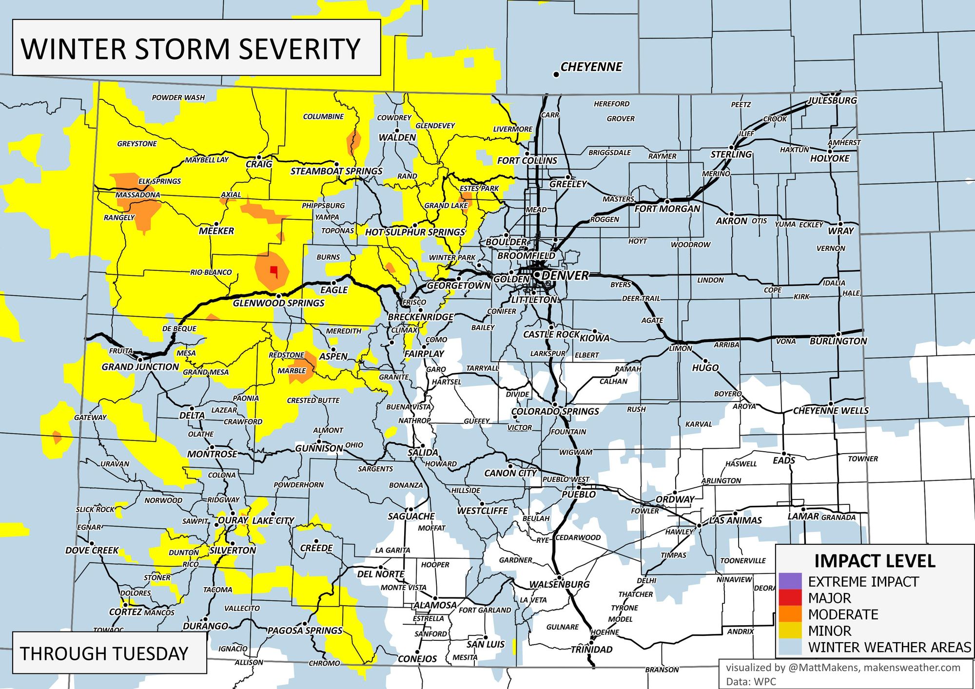
The overall impact level is shown here for drivers headed out Sunday night through the commutes Monday.
Let's wrap it all together with timelines from Fort Collins to Denver and then Colorado Springs. The greatest snow chance continues to favor the northern areas through the night and Monday as you see:
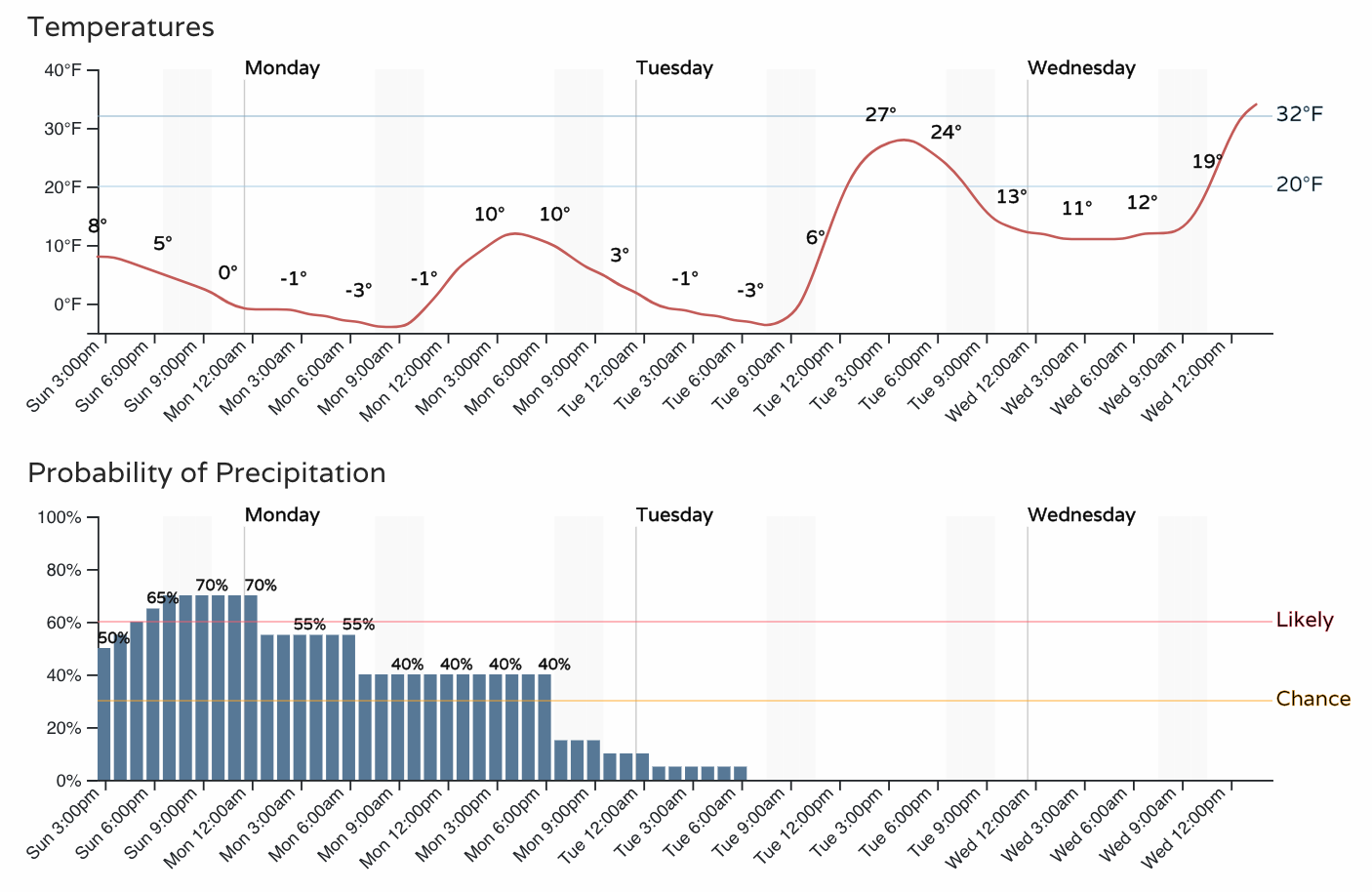
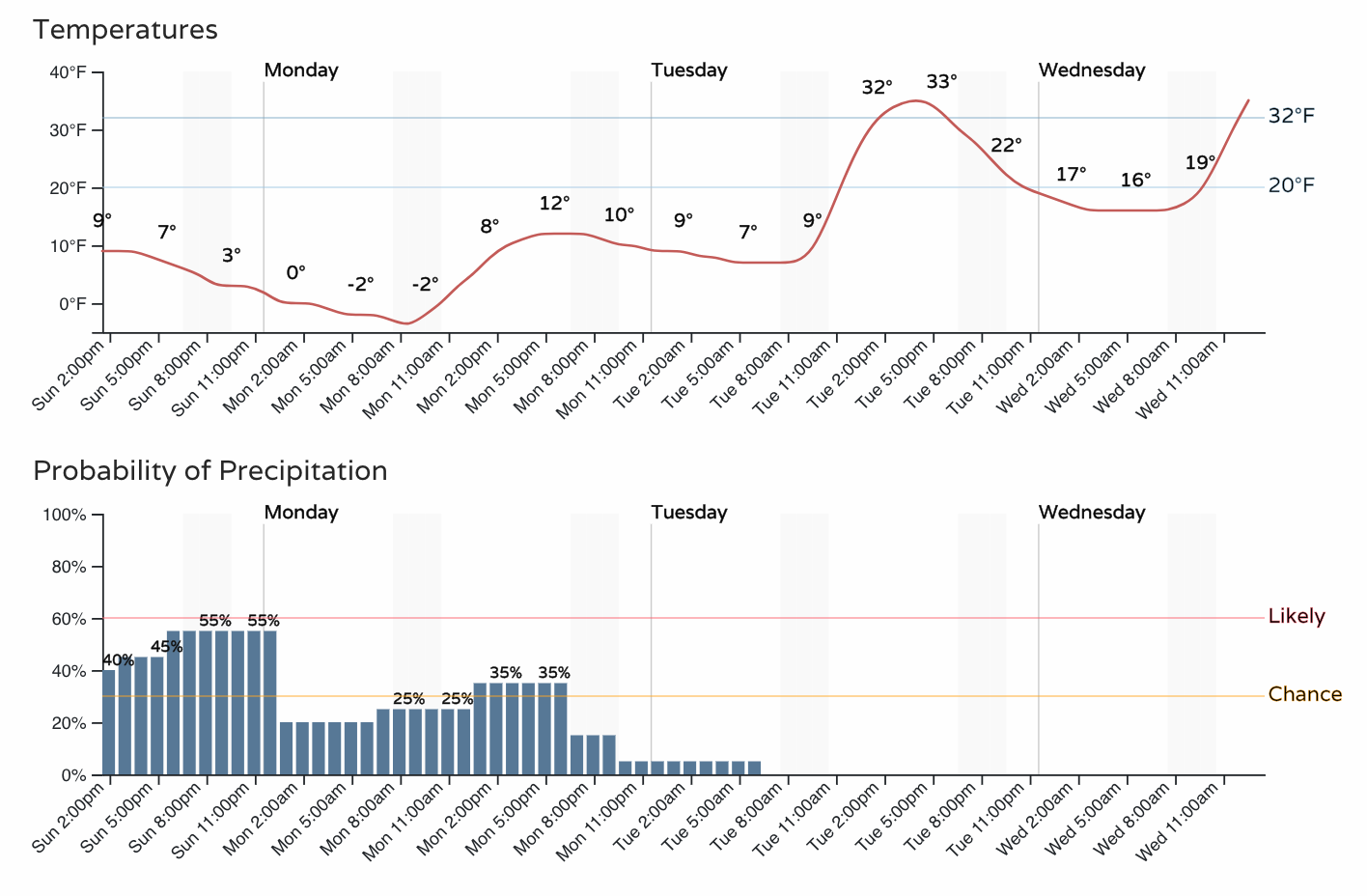

Tuesday, many of us hit freezing and warmer and then we'll have 40s coming later this week. So, overall an impactor, but not like the cold outbreak before Christmas.
Keep up posted with conditions at your location by entering comments below, and don't get left out in the cold – subscribe to our email list today – it's free, and we just send you an email when there's important information to deliver.