Denver area not done with the cold and snow just yet; Winter Weather Advisory issued

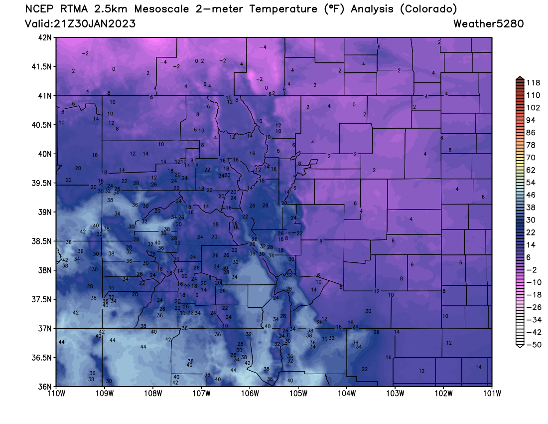
You don't need us to tell you it's cold outside, but we'll tell you anyway: it's COLD outside! Here's a look at temperatures across the region as of mid afternoon Monday:
We've got a bit of a warming trend in the forecast, but we'll have another night of frigid temperatures and a bit more snow to get through first.
Here's the hourly planner for Denver:
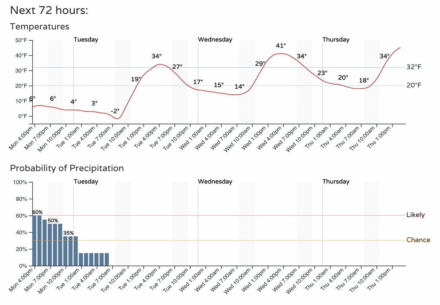
Temperatures, currently in the single digits, will drop below 0F again tonight before warming into the mid 30s Tuesday.
The chance of snow will remain in the forecast through at least midnight before we finally see a lack of precipitation probabilities in the forecast by Tuesday morning. It's been awhile!
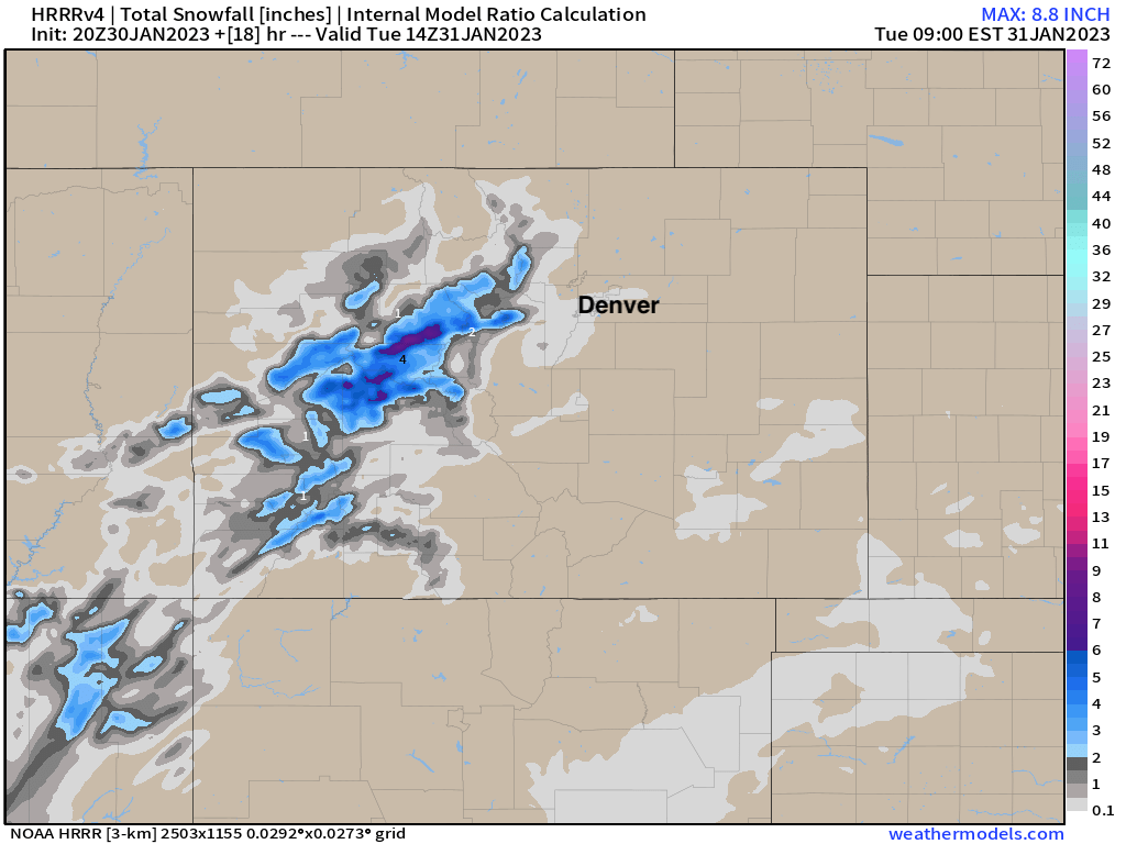
Not everyone will see snow, let alone impactful snow this afternoon and evening, but a few bands will continue to peel off the hills just as they have the last several days, and where they do we'll see an impact to roadways and travel.
The latest HRRR shows one of those bands right over Denver, albeit with very little accumulation, but it's there nonetheless. Most of the snow we see through the evening will amount to 1" or less, but a locally heavier band could set up and produce 2 - 3" of snow if it does.
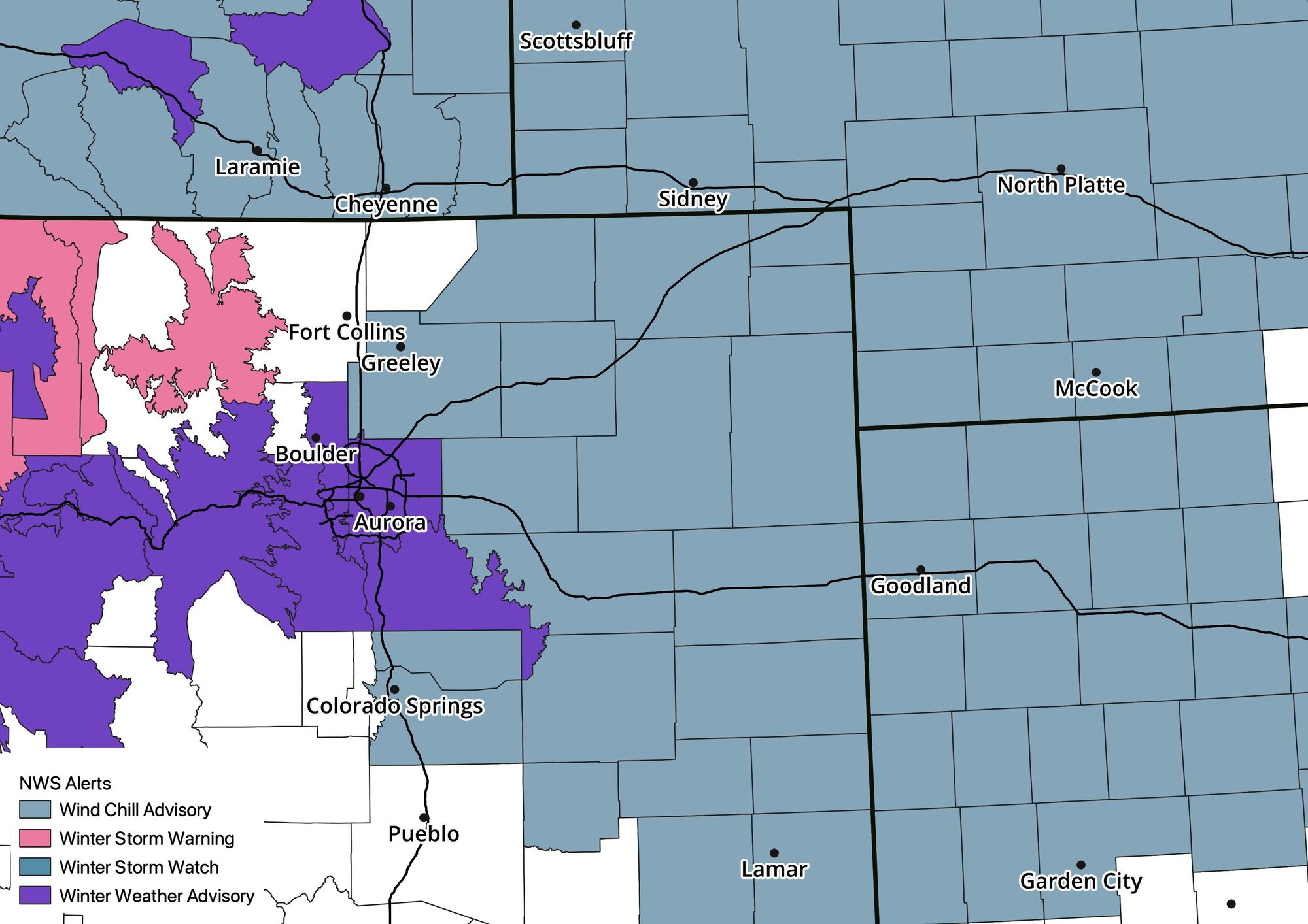
Here's a look at the latest advisories from the NWS, with the Winter Weather Advisory for Denver expiring at 8pm tonight, and the Wind Chill Advisory in effect through 8am Tuesday.

Stay warm, let us know if you see snow!