Wind and fire danger spreads from Colorado to New Mexico into Kansas and Oklahoma

There's a problem this time of the year when we hit these dry spells and temperatures warm - wind and prairie fires.
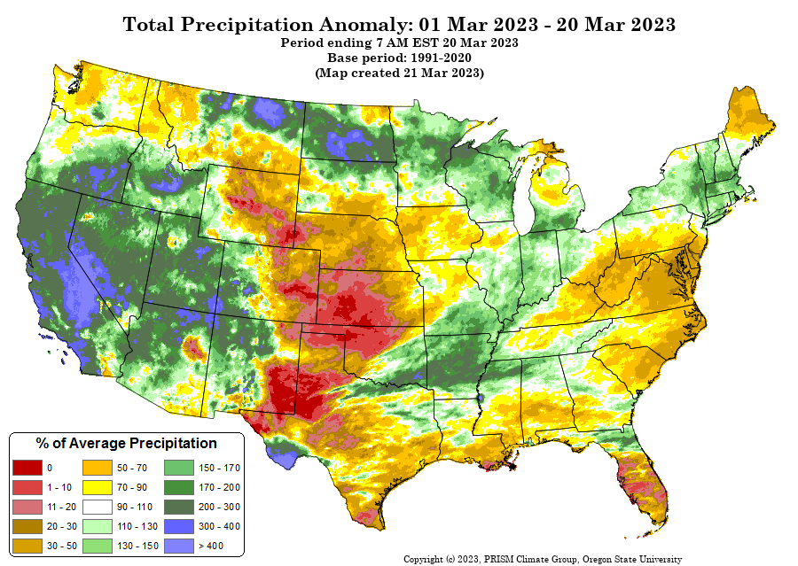
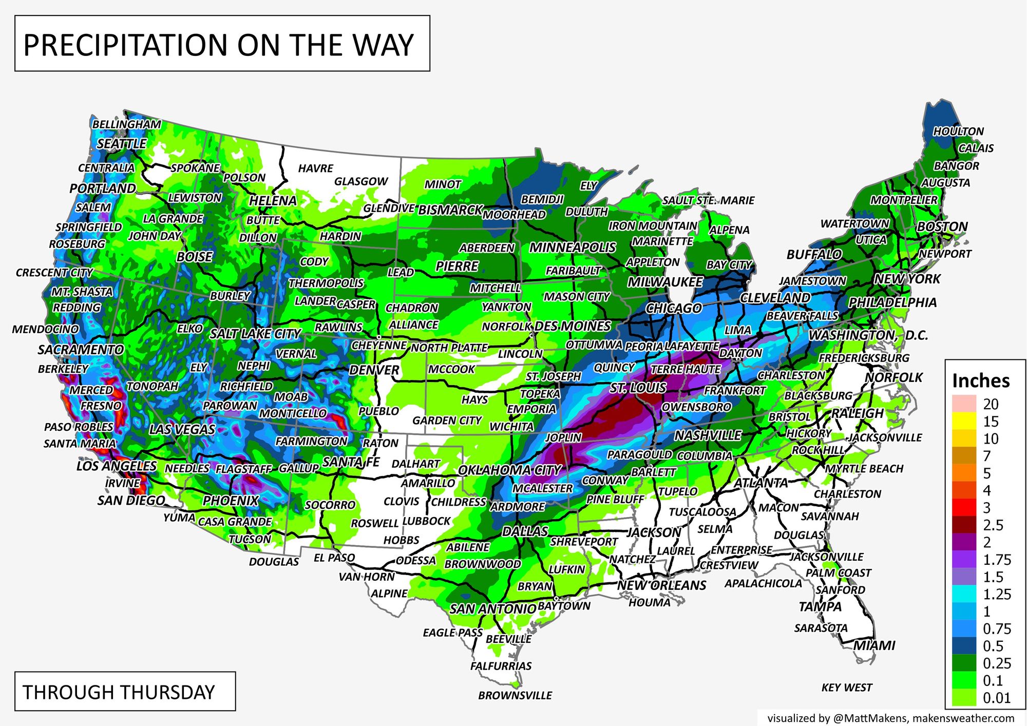
Look at the precipitation map for the month to date shown as a percentage of average, and you'll see the bullseye of dryness over the High Plains.
This, added with the existing drought in the same areas, is problematic right now as vegetation still largely dormant or coming out of dormancy is more kindling than it is of grazing value.
So, we have to watch for wind events that can trigger wildfire dangers across those plains. The setup includes stronger winds the next couple of days, especially Wednesday.
The wind event is already occurring with a storm system across the western U.S., same storm that will be dropping significant snow and rain on the West, too. The wind will move over the Rockies and onto the Plains Tuesday night through Wednesday.
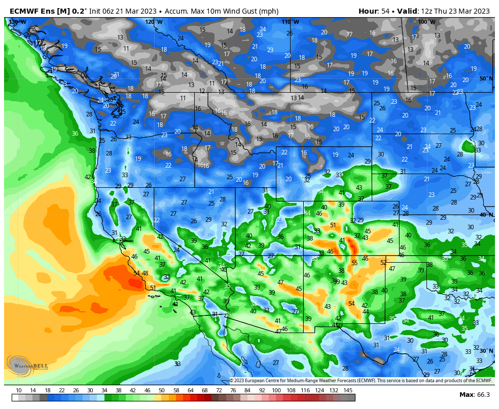
Shown here is the estimated max wind gusts from now through Thursday morning. Anything shaded in the yellows, oranges, or warmer colors represents winds hitting more than about 50 mph. This covers the high country as well as southeastern Colorado, New Mexico, and into western reaches of Kansas, Oklahoma, and Texas.
Due to the wind, with very little moisture, the alerts in place include wind and fire dangers.
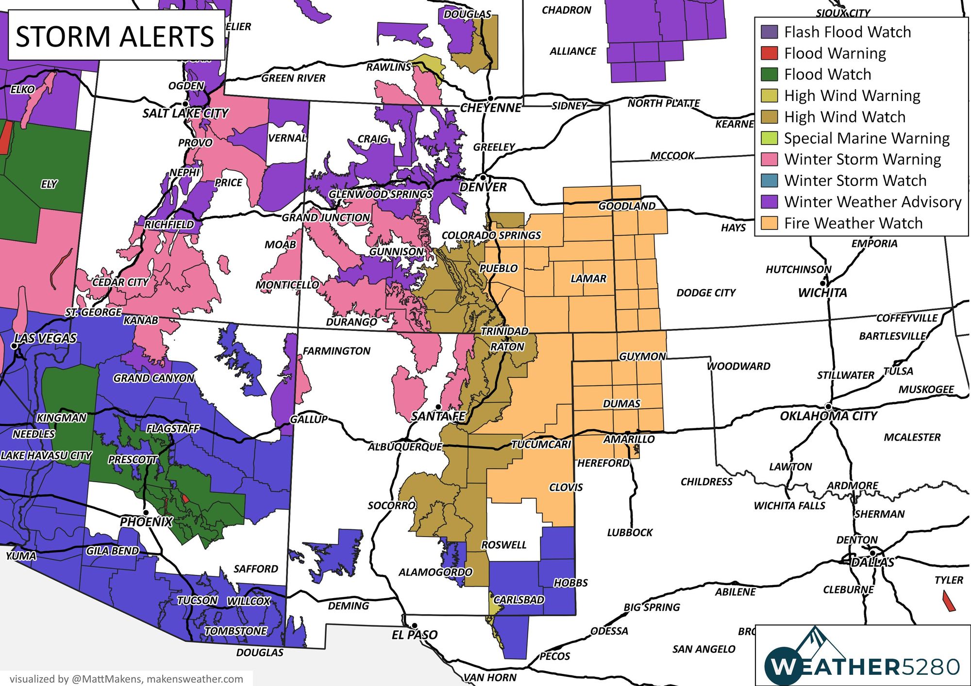
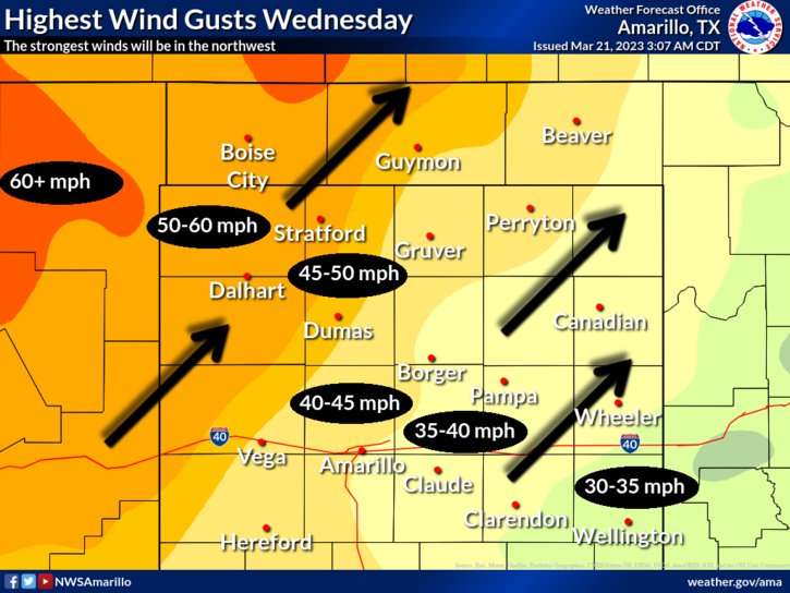
From the NWS in Pueblo:
* Winds...Southwest 35 to 45 mph with gusts up to 70 mph.
* Relative Humidity...As low as 15 percent.
* Impacts...Blowing dust could dramatically reduce visibility. Any fire that starts will rapidly spread. If you smell smoke, report it to local authorities. If you burn today (Tuesday), make absolutely sure that the fire is extinguished before the intense winds strike tomorrow, on Wednesday.
Unlike the Plains, there's plenty of moisture and then some for the West. Many parts of California to Nevada and Arizona are receiving too much water at the moment.
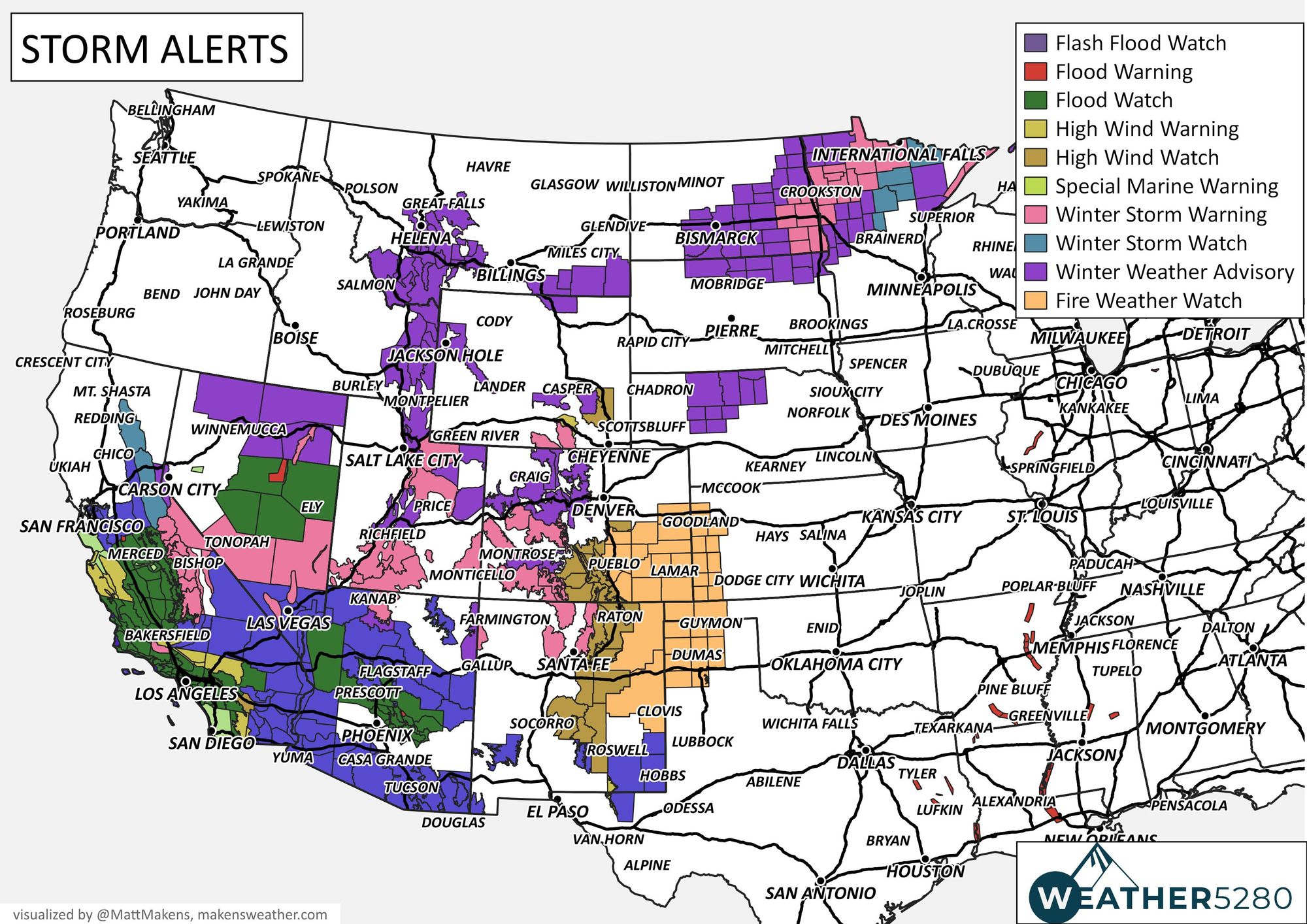
The moisture is pretty much zapped by the time it hits the Continental Divide, with the exception of some snow for the Northern Plains.
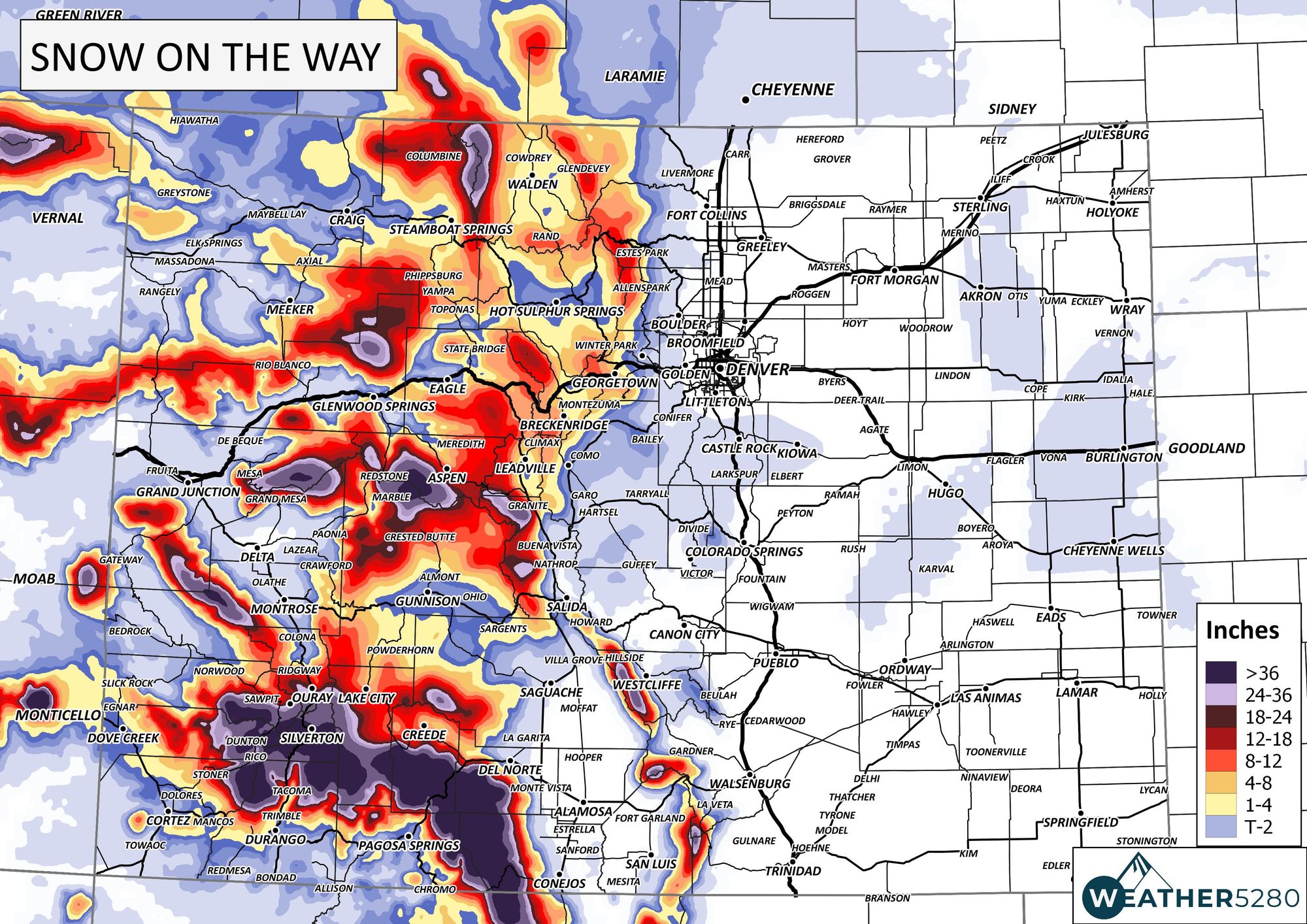
Looking at that, snow, now, we have potential for some significant accumulations in isolated mountain ranges, and a fair amount for the Plains through Thursday.
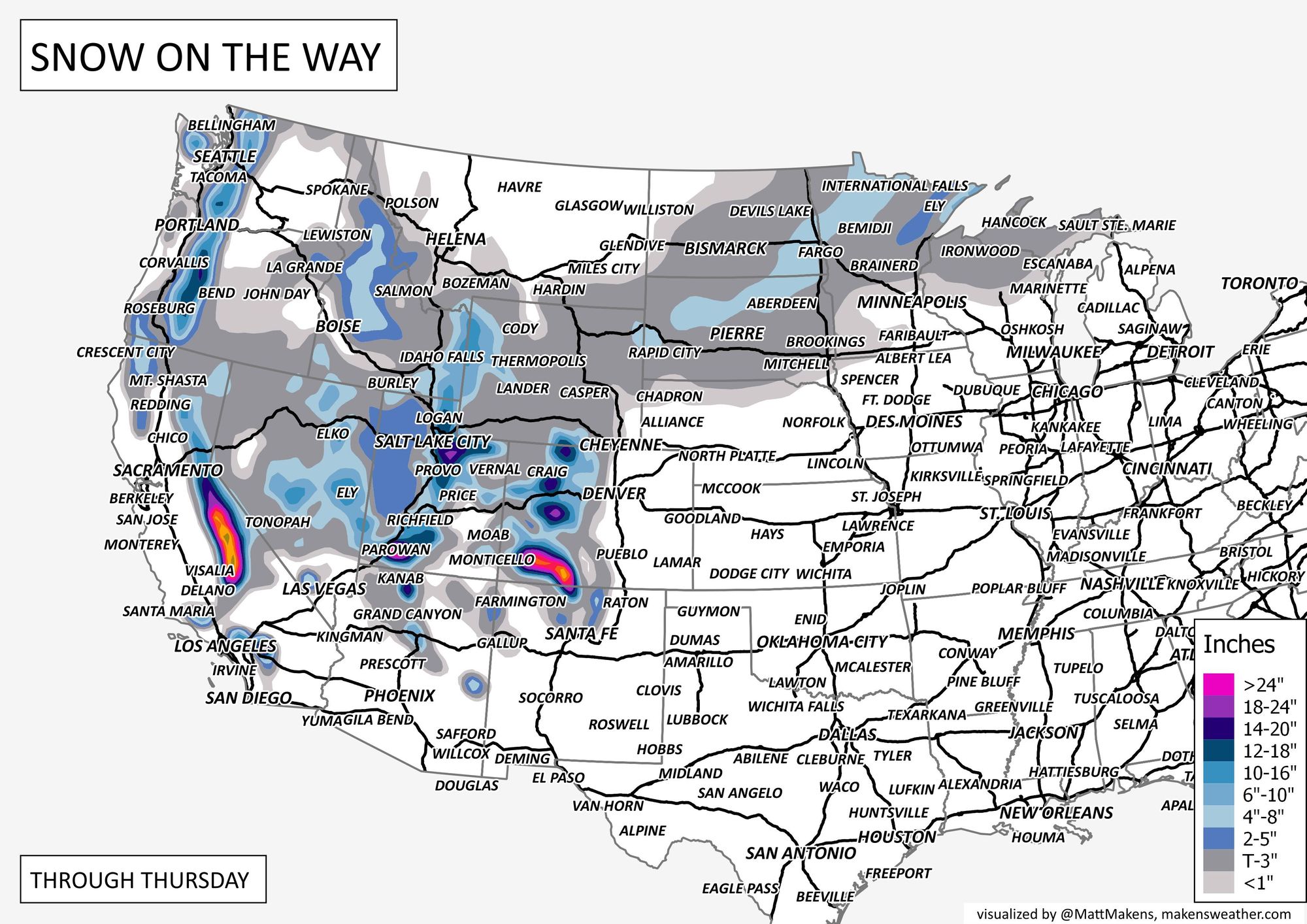
In terms of total moisture, there is plenty to go around with the exception of the fire danger region of the Plains which is largely missing out through Thursday.
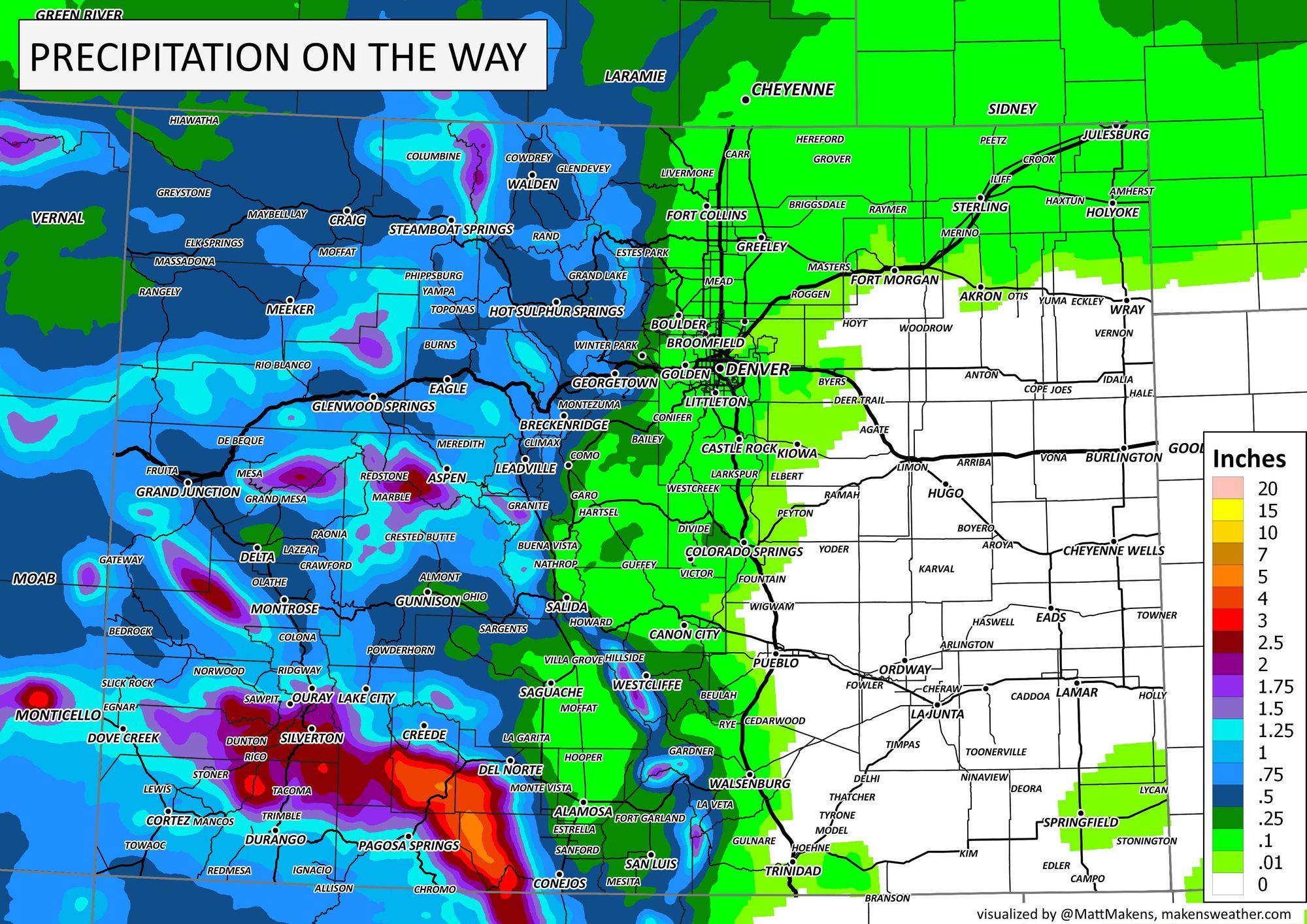
Across Colorado, as we discussed in yesterday's post, there will be significant snow in our San Juans with more limited areas of moisture elsewhere for a few days. The next best chance for Denver and the Front Range for some precipitation is this weekend, although we may catch some rain and snow Wednesday.
Total precipitation across Colorado is shown here.
And total snowfall through Thursday also:
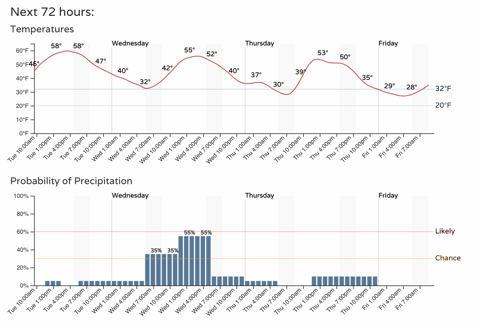
For now, we have the following timeline for the next three days, don't forget to throw in some wind!
We'll have more on the weekend potential in a future post – subscribe to our email list today – we send you an email when there's important information and Colorado forecasts to deliver.