Fort Collins wakes up to most snow, will the rest of us catch up this weekend?

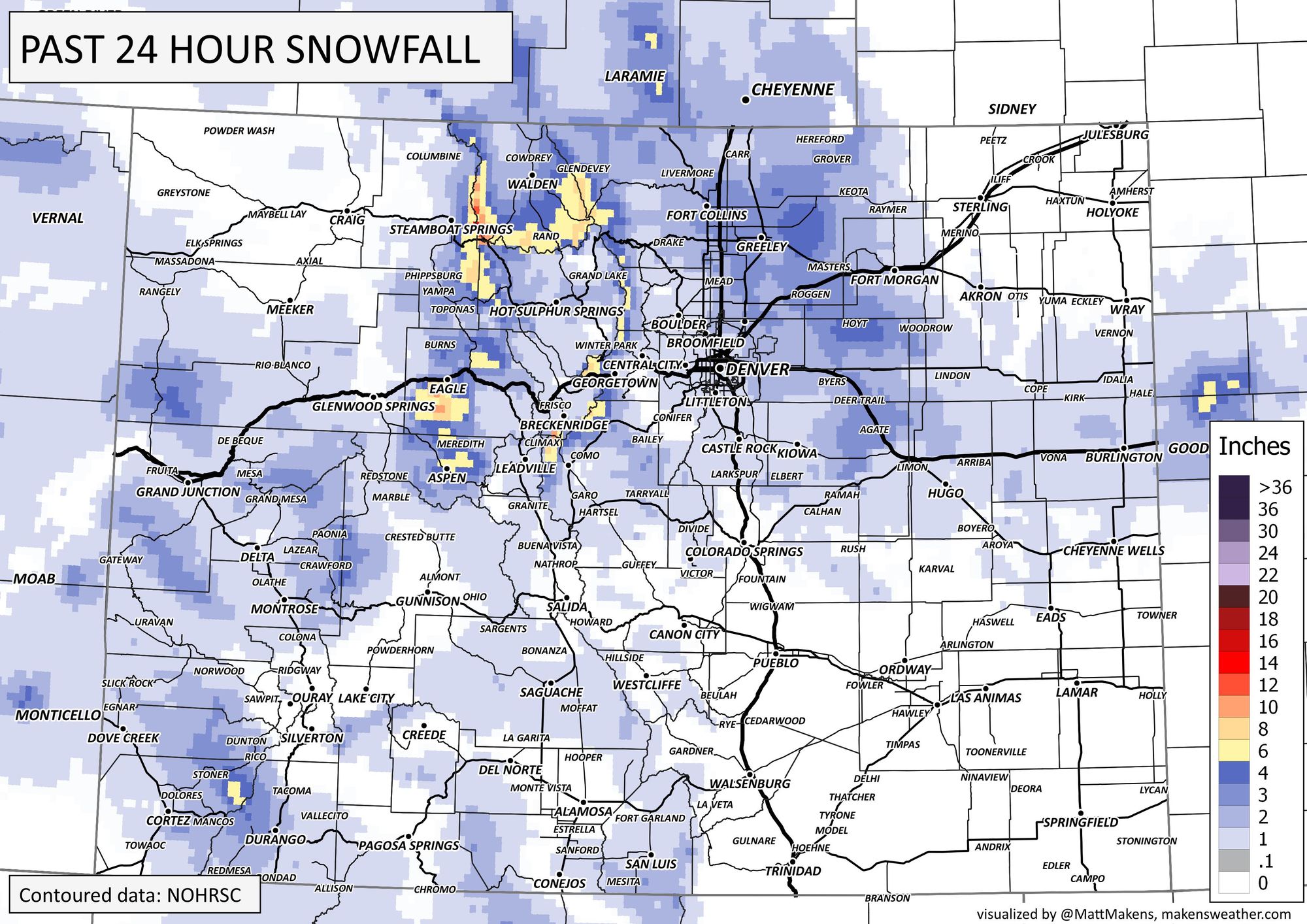
Fort Collins, out of metro area locations, had four to five inches of snowfall since yesterday. The storm pattern may deliver more snowfall to the metro areas this weekend, but the next heaviest push of snow will come Monday.
First, let's look at the snowfall from Fort Collins last night.
SW Fort Collins. Up late tonight and getting rewarded with some moderate to heavy snow. Looks like 3 or 4 inches accumulation as of 1 am. #cowx @BianchiWeather @CReppWx @weather5280 @MattMakens @NWSBoulder pic.twitter.com/UMPGUVIBuC
— Howard Gebhart (@GebhartHoward) March 25, 2023
Gooood morning from NW Fort Collins near Rocky MTN HS where we have ....4 inches of Spring snow (on the deck). Color me surprised 😮. @NWSBoulder @weather5280 #cowx #fortcollins pic.twitter.com/7dN6qcQ9fk
— Daniel Amerman (@QuirkyGardener) March 25, 2023
Woke up to a solid 4” in Fort Collins! ❄️ #cowx @NWSBoulder @weather5280 pic.twitter.com/ufOPTzr7kX
— Brian Nunnery (@briannunnery) March 25, 2023
The totals from the past 24 hours are shown here.
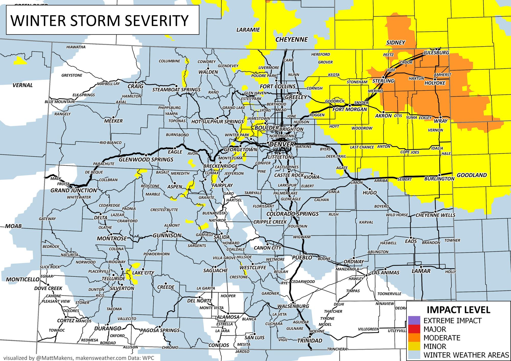
That heavy snow from Fort Collins has shifted east and will focus on the Northeastern corner of the state today. The winter weather advisory continues for this part of Colorado through the afternoon.
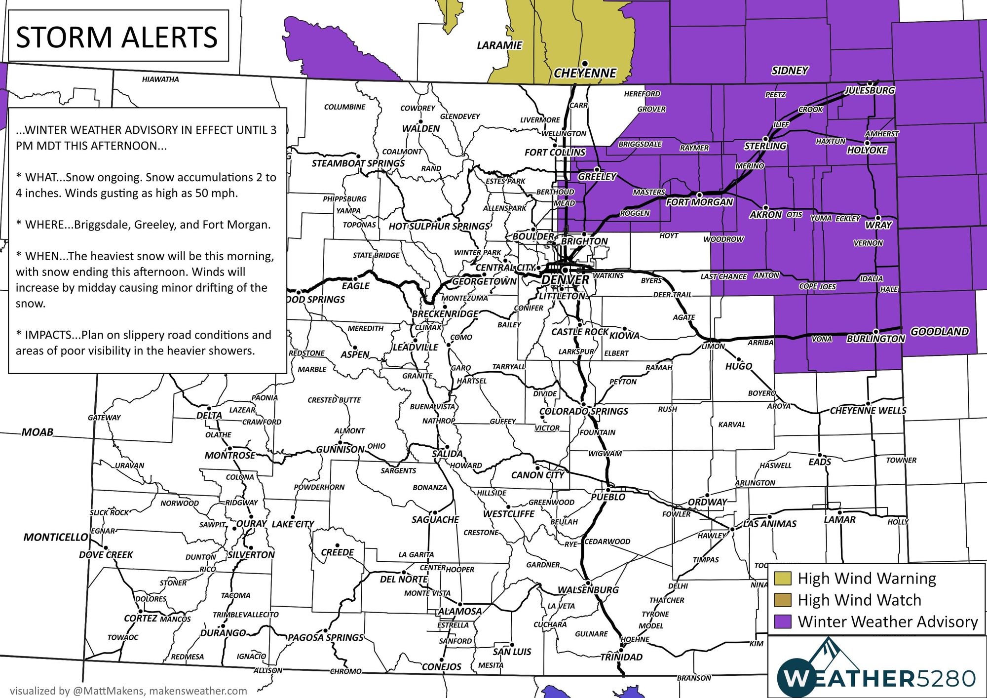
Areas near Sterling, Wray, Holyoke, and Julesburg will have the snow through the afternoon and will also have some impacted travel.
Roads will remain slick for awhile, too. This is from after most of the accumulation passed, but NoCo still had strong wind with freezing temperatures.
Ouch! Jackknifed semi on I-25 southbound just south of the Carr exit. Strong crosswinds in this area #cowx #wind@NWSBoulder @KDVR @weather5280 pic.twitter.com/mhk9RYFtGA
— Chris Crosby (@Chris_Crosby) March 25, 2023
Let's watch the projected radar imagery as the storm moves out of the state today, then you'll see additional precipitation move into the Western Slope and mountains tomorrow, with some additional scattered showers for the metro areas and Plains, too. As the animation moves into the Monday timeframe, heavier showers return to the Plains with a second dose of heavier snowfall. Some of what you see here may be rainfall, but most will be in the form of snow.
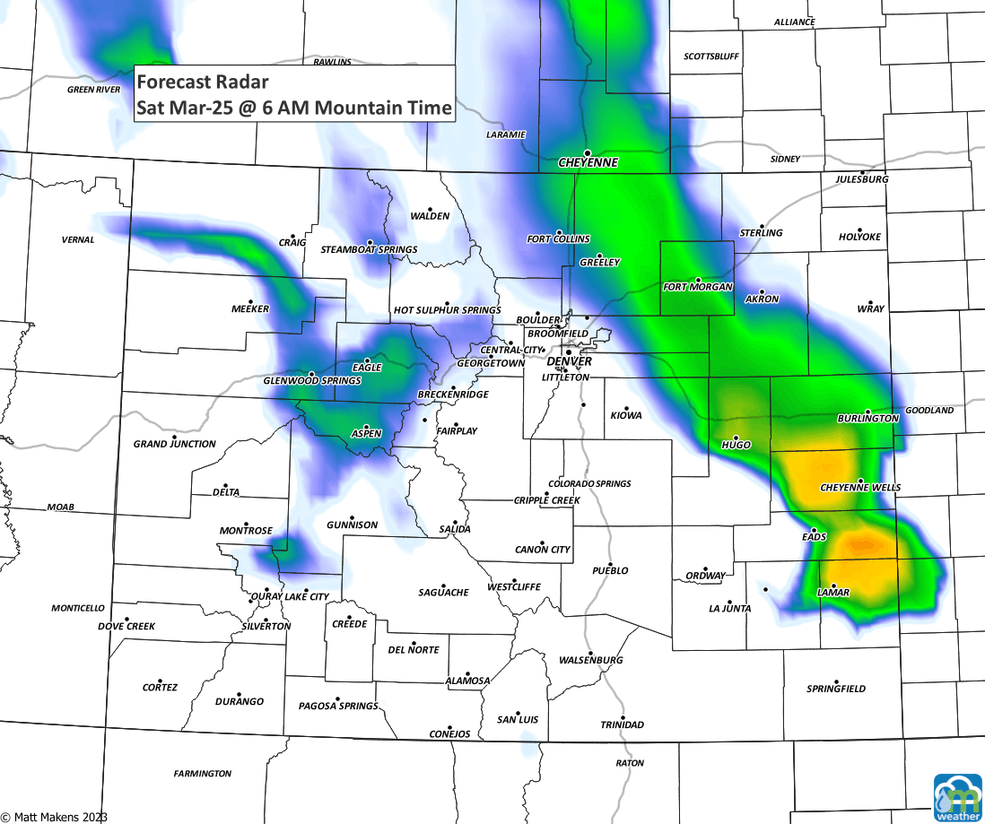
That animation shows two defined 'waves' of activity. Let's break down what falls this weekend versus during the next three days.
First, through Sunday evening, again most of this will be today, with more isolated stuff tomorrow..
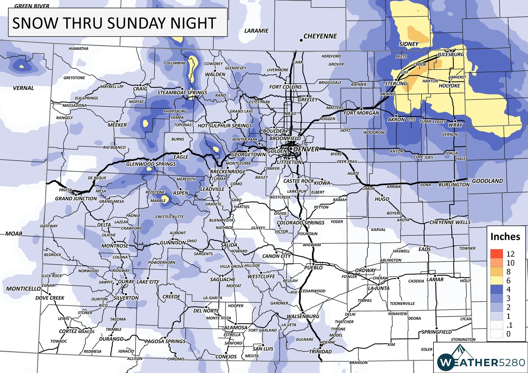
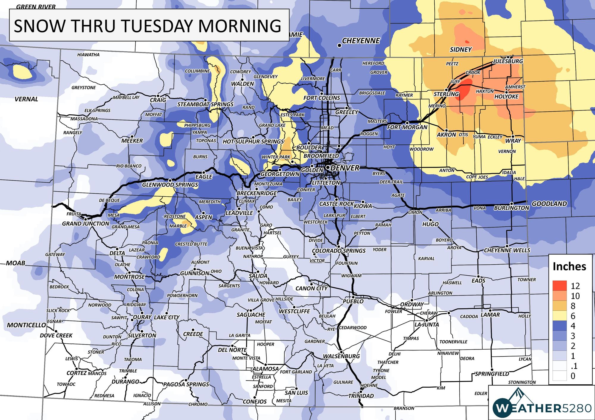
Now, the total through the next three days is really most from what comes Monday.

Here's an hourly planner for Denver and then one for Colorado Springs to show the progression of temperatures and precipitation the next 72 hours.
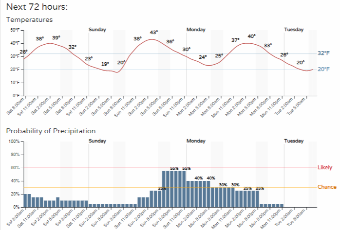
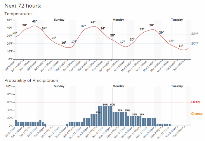
As you look at those timelines, some of the peaks of shower chances occur with temperatures into the 40s. We could see rain and snow the next few days, as mentioned before with the radar forecast.
As we like to say here at Weather5280, "Don't get left out in the cold," – subscribe to our email list today – we send you an email when there's important information and Colorado forecasts to deliver.