Friday storm update: Rain and snow across much of Colorado today and tonight

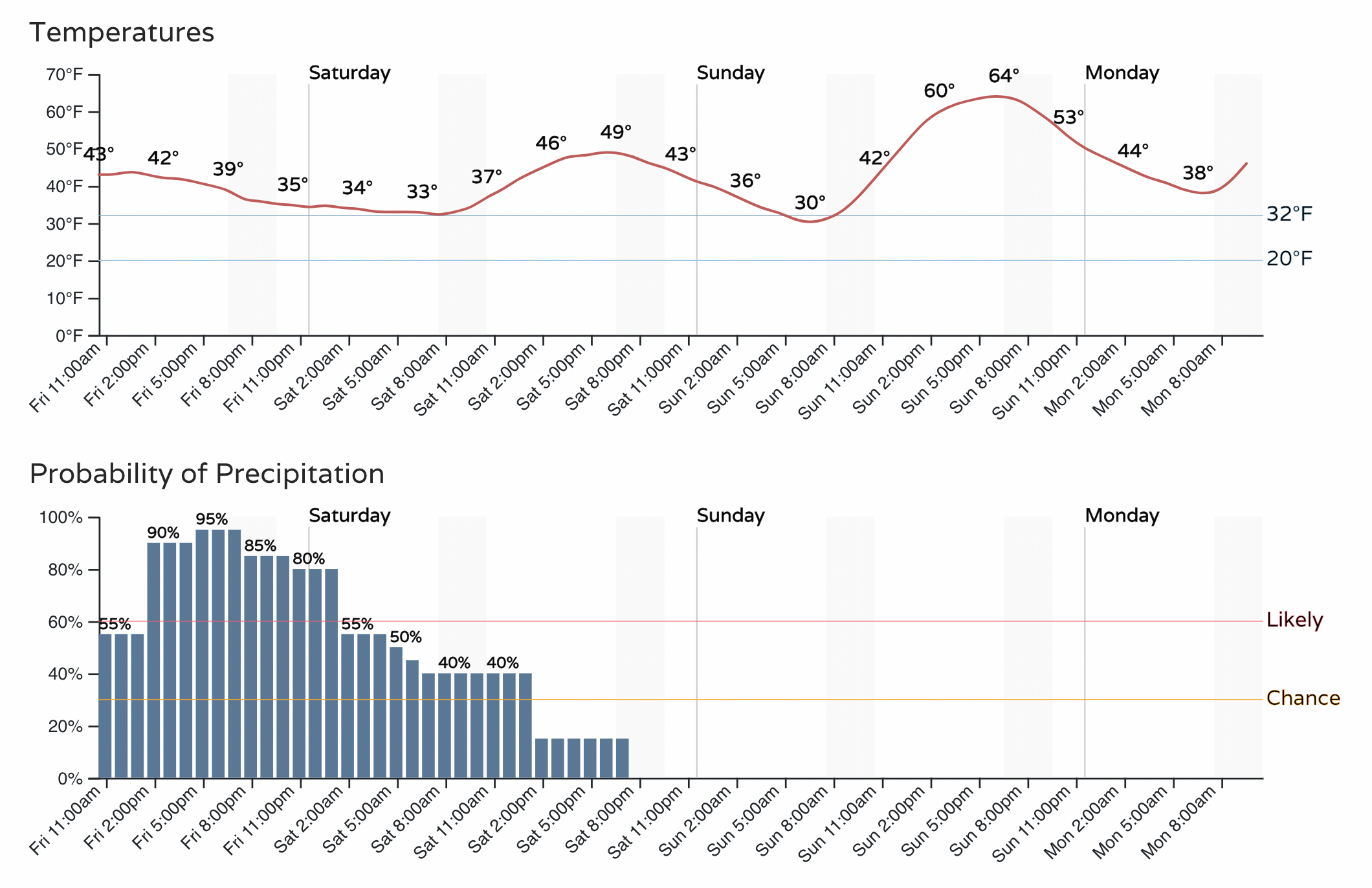
Chilly air has moved back into Northeast Colorado this morning after a record-setting warm first half of the week. Temperatures are mainly in the 30s and 40s across NECO, with 40s and 50s this morning south of I-70. We won't do a whole lot better than this today, with temperatures gradually falling for most areas by mid-afternoon.
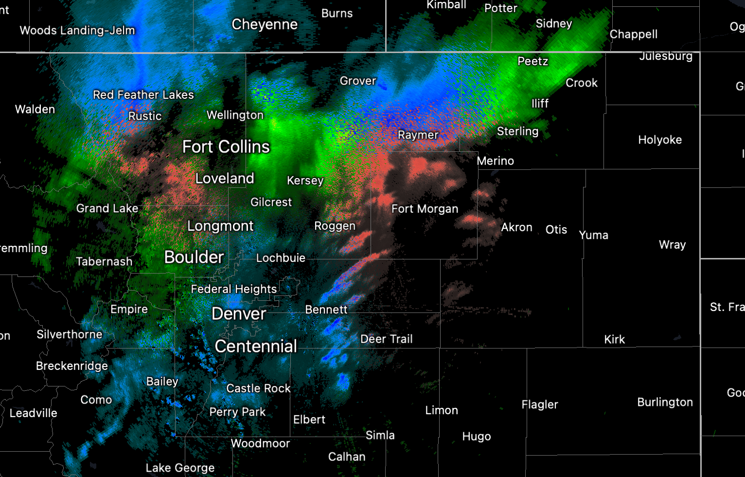
We've already watched some heavy snow falling across parts of the high country, with even a bit of mixed precipitation across the far northern plains. Parts of the northern metro area have seen appreciable rainfall through the mid-morning hours, and this will continue off and on through Friday night.
The hourly planner for the Denver area is below, with main change from yesterday is to push the chance precipitation a bit earlier.
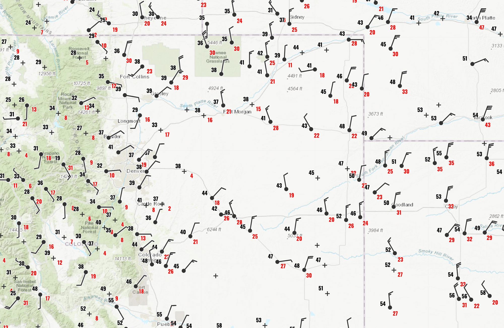
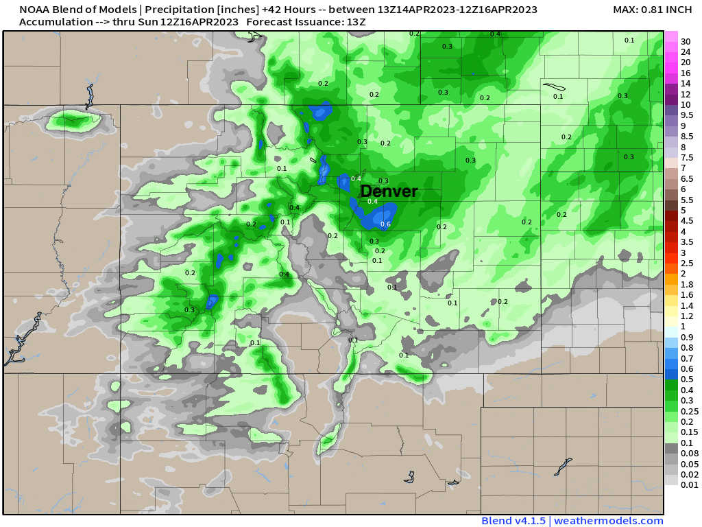
The blend of models continues to show precipitation totals from 0.1 to 0.6" across the area, with Denver in the 0.2 - 0.4" range, and foothill/Palmer Divide seeing that potential for upwards of 0.5" of liquid by tomorrow morning. I'll take it!
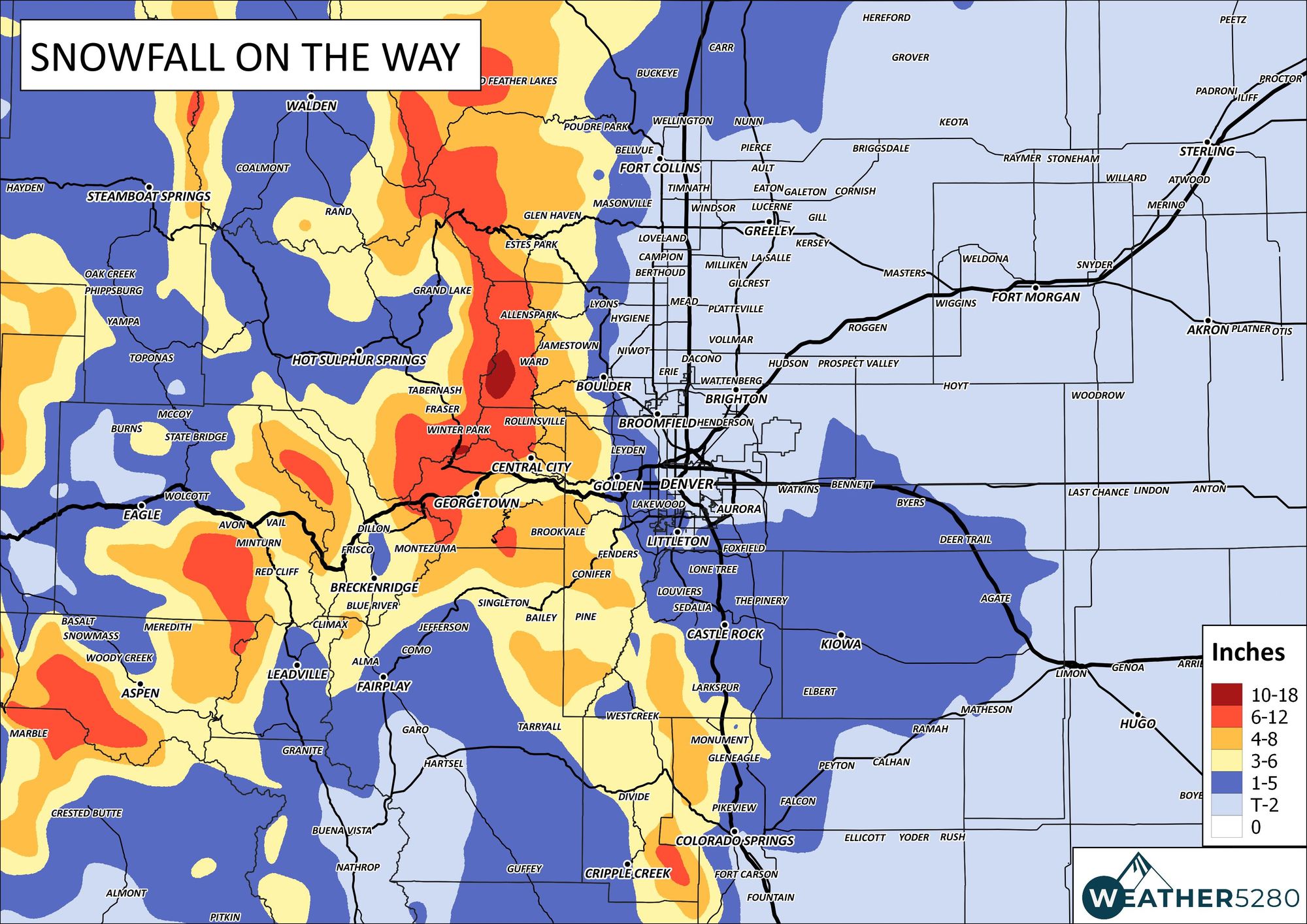
The big question remains if and if so how much snow we are likely to pick up from this event. For the urban corridor cities like Colorado Springs, Denver, and Fort Collins, expectations aren't high, but some "boom" potential exists. Part of the issue is appears today may not only be the temperatures, but the fact that we might not keep precipitation going long enough tonight for that changeover with dropping evening temperatures to occur everywhere.
The 3km NAM model shows a good burst of heavy snow along the northern urban corridor later tonight, which would equate to another boom snow for Fort Collins. The vast majority of data does not support this. The main areas for concern with regard to snowfall later today and tonight remain the foothills west of Denver and the Palmer Divide. Anything outside of that is likely to be from a more brief, but perhaps heavy, convective snow shower moving through.
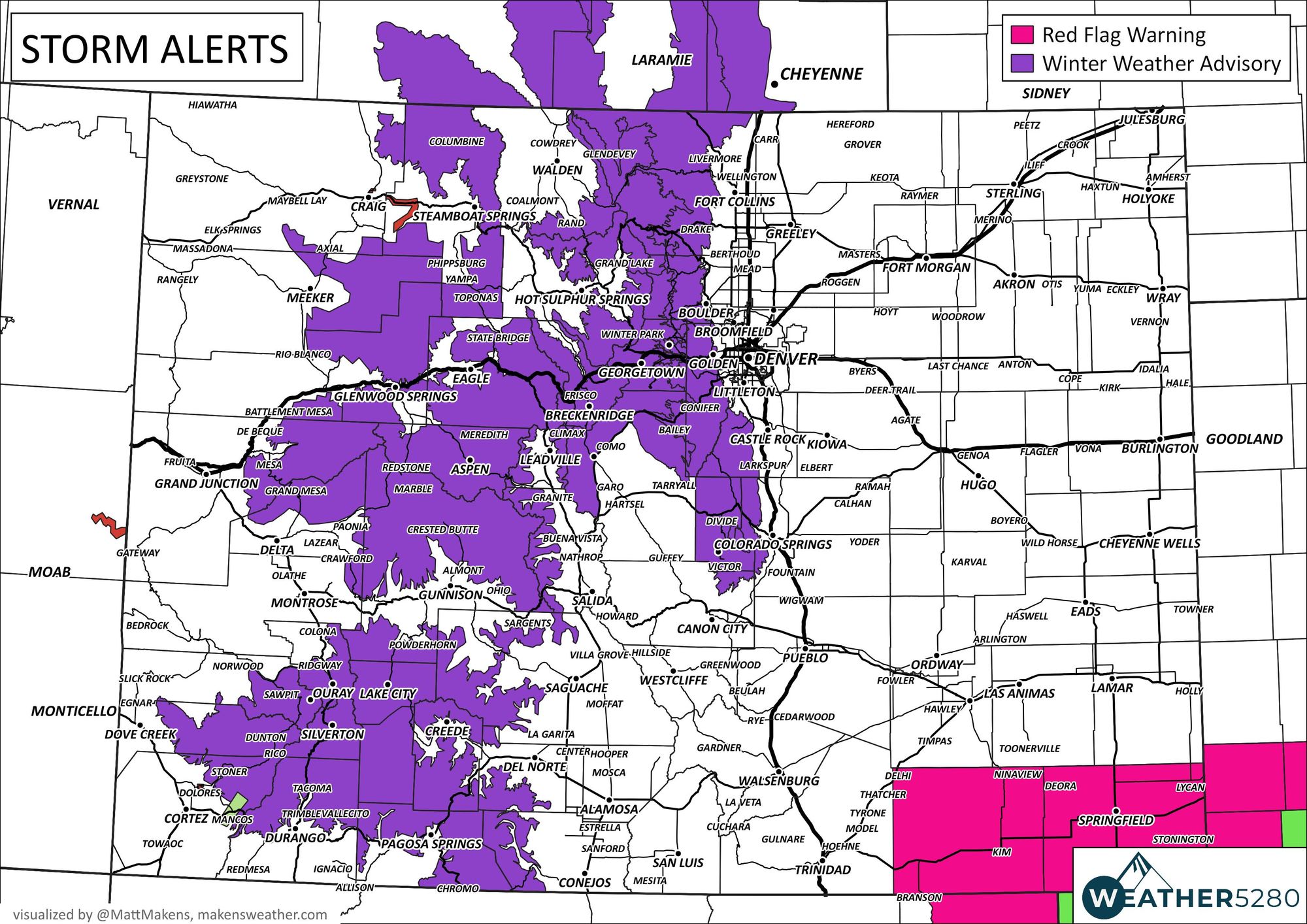
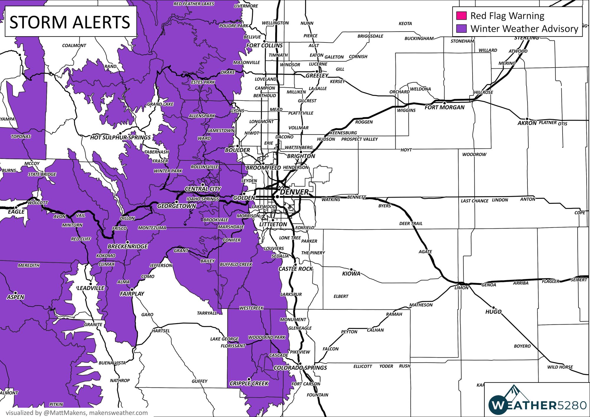
With that, the existing advisories from the NWS continue to make good sense:
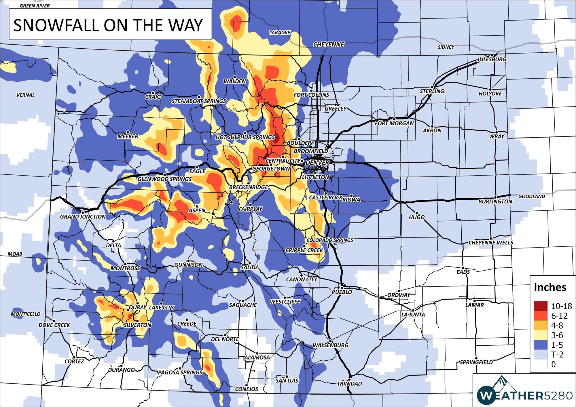
And we won't adjust our snowfall forecast all that much this morning either, see below:
Rain and snow come to an end Saturday but temperatures remain on the cool side. Warmer by Sunday, with highs back in the mid 60s for the metro area.
Let us know how much rain and snow you see!