Denver Area Weather: Tornadoes, funnels, and hail

There were a number of storms over the mountains Tuesday and just a few over the metro areas and plains, but those that did pop up were strong enough to produce a landspout tornado, funnel clouds, and larger hail.
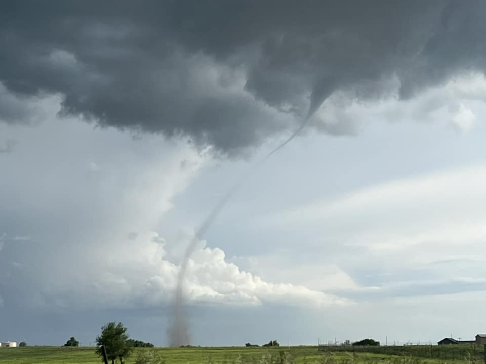
Mark Oster spotted a landspout tornado not far from Platteville.

A little landspout, probably the same as the previous just a different view, near Firestone from Chad Flaugher.

Cindy Lyons captured this from CR 22 near CR41 looking northeast.
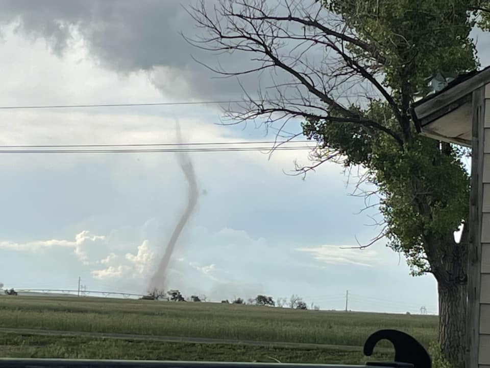
Down in/near Aurora:
Just called in this funnel cloud over Aurora. Roughly near 225 in Mississippi. This is looking east northeast from Iliff and Havana@NWSBoulder @weather5280 @BianchiWeather #cowx pic.twitter.com/pjkqj2bttl
— Chris Crosby (@Chris_Crosby) June 6, 2023
Same spout. pic.twitter.com/pd6pZ7Rul8
— Chris Shackelford (@shack_attack52) June 6, 2023
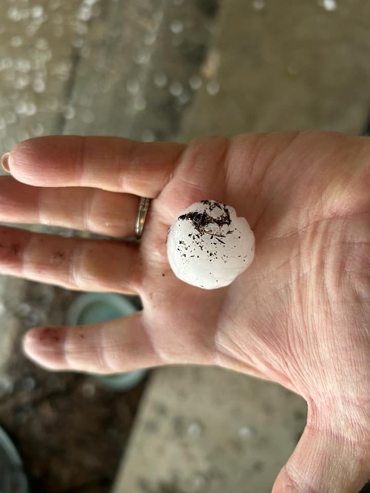
And Jacqui Snow had near quarter size hail in Parker.
That's pretty active for just having a few storms around.
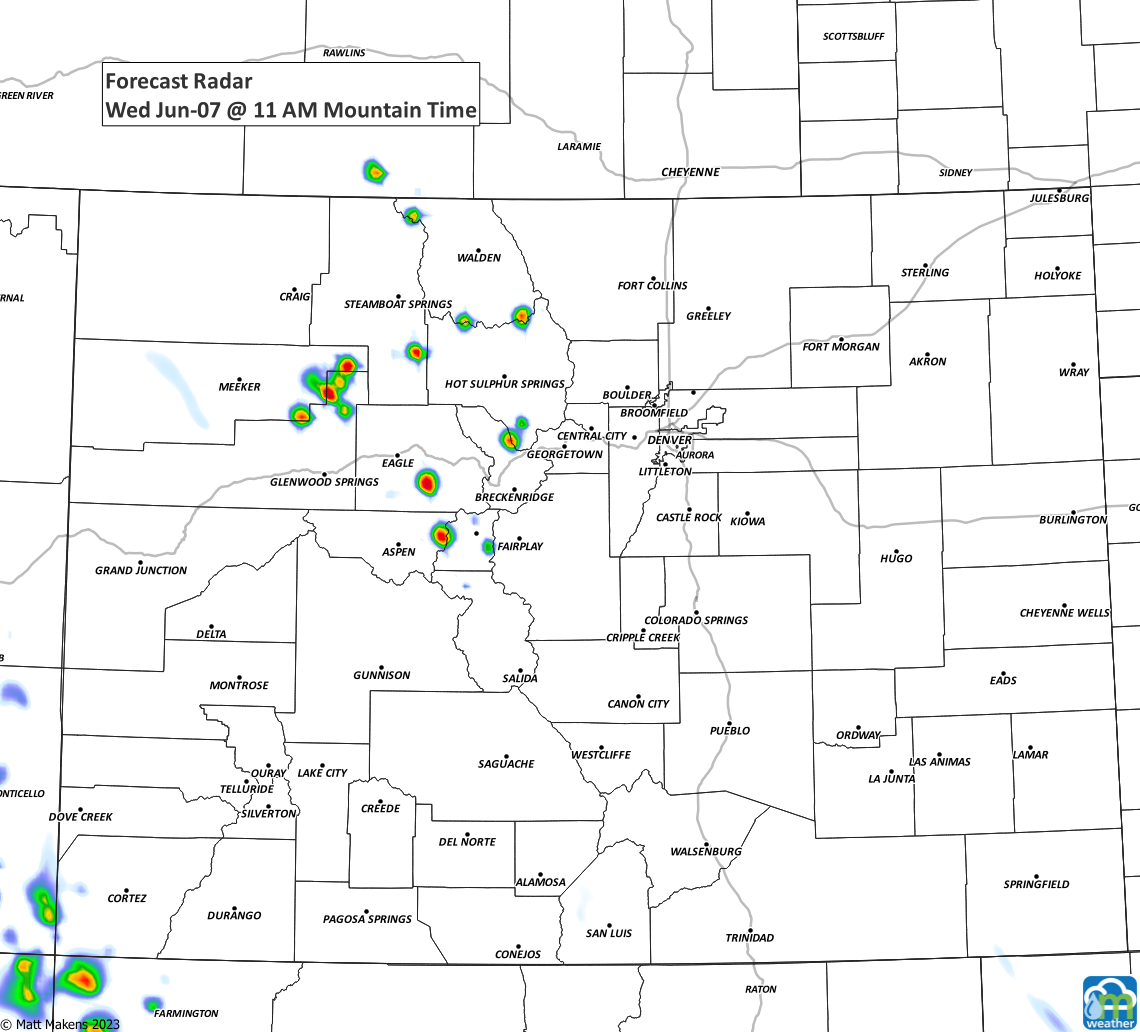
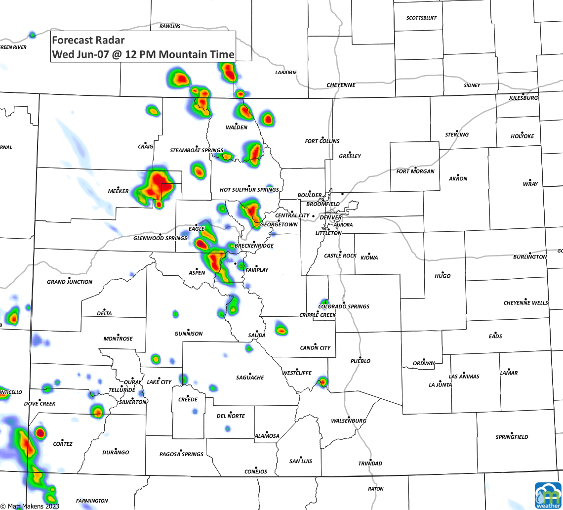
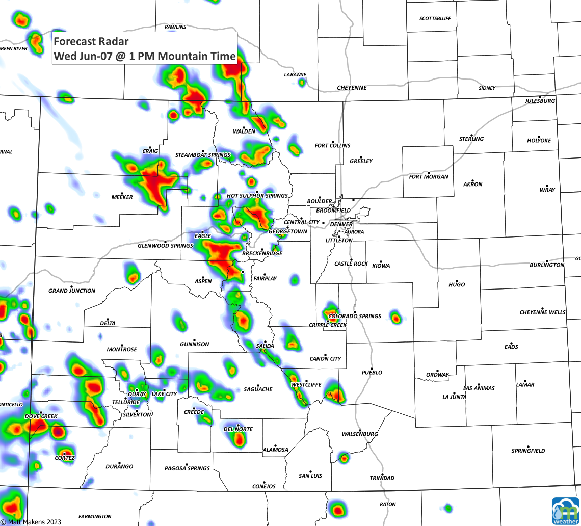
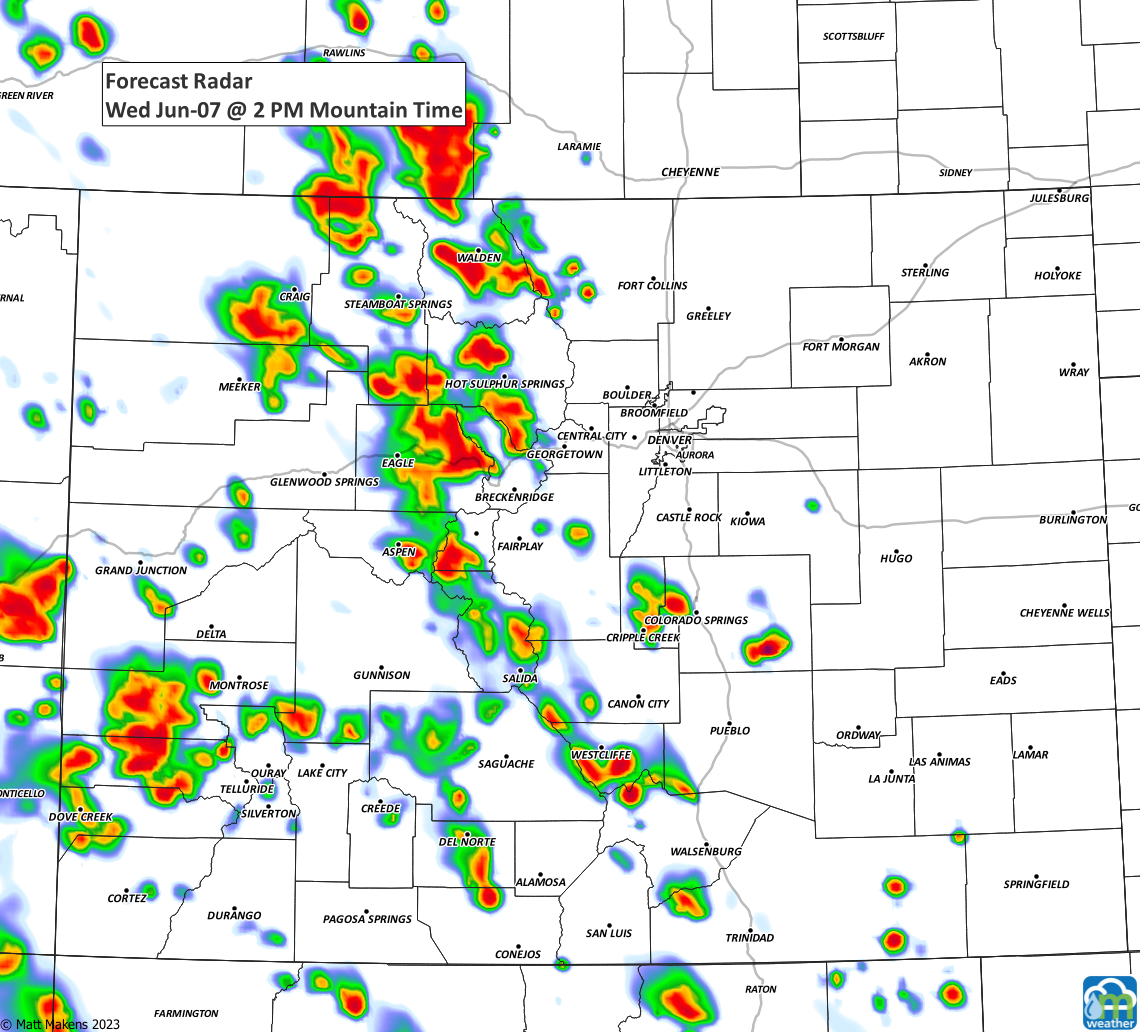
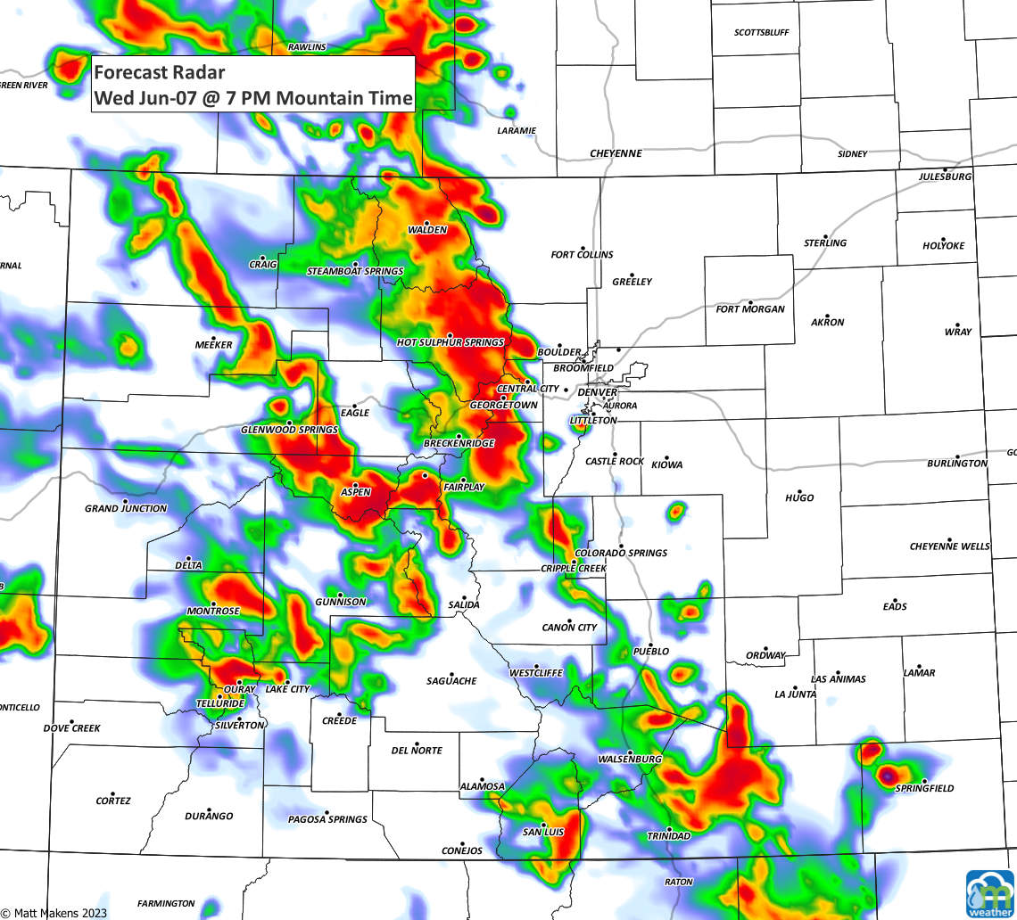
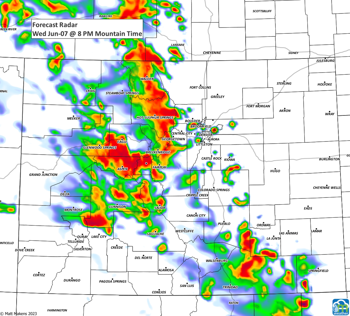
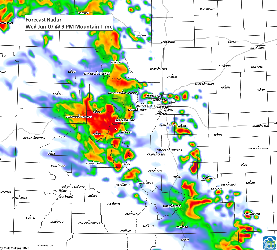
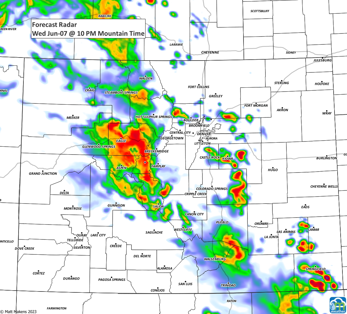
Like yesterday, today's threat for severe weather - overall - is low. Some scattered storms floating through to watch out for. Here's the timeline for today through the next couple of days.
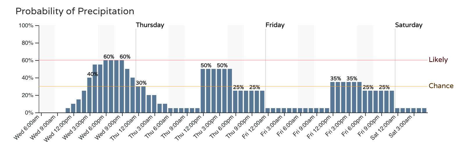
To serve as a rough estimate, +/- an hour or so, here are images to show the most likely times and locations for today's storms.
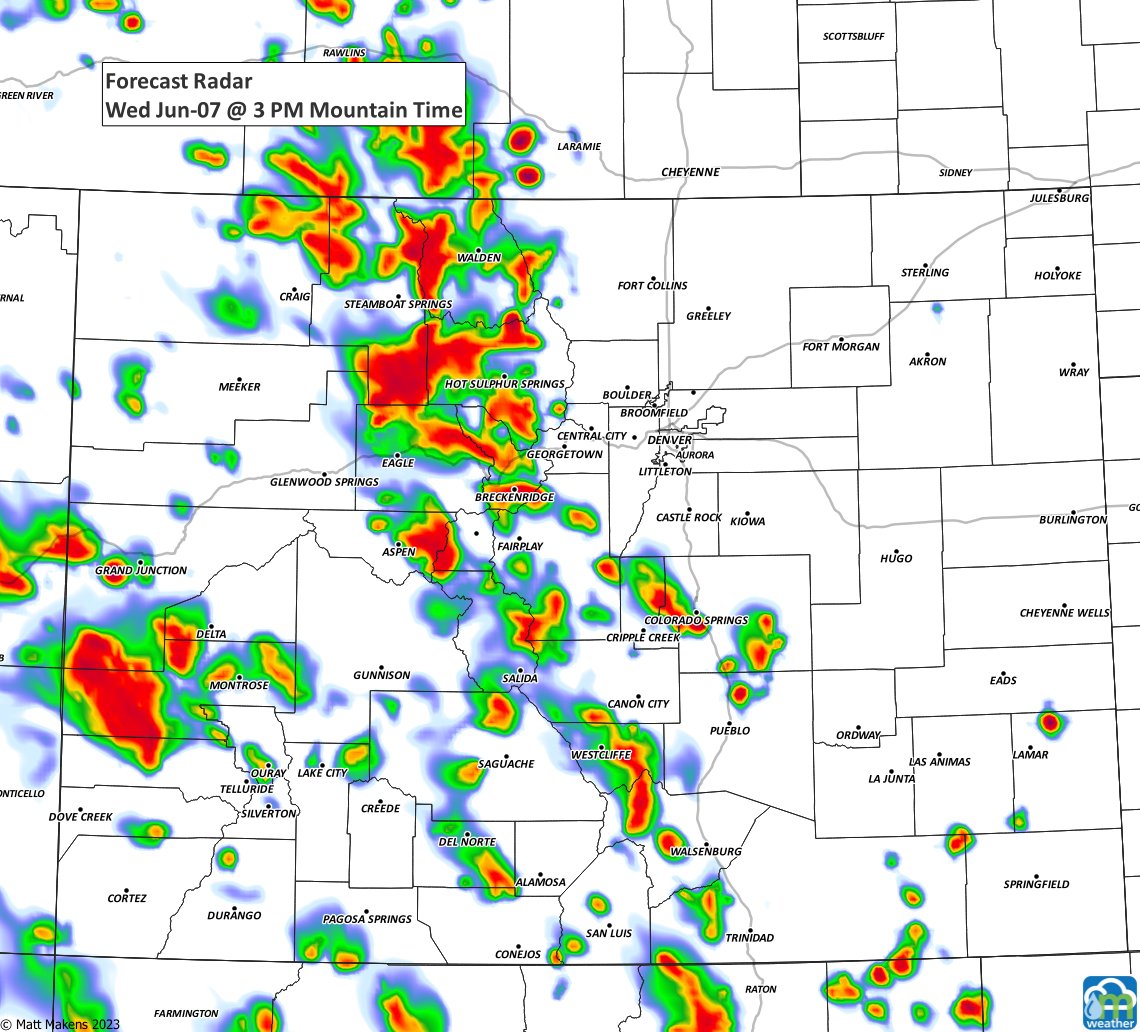
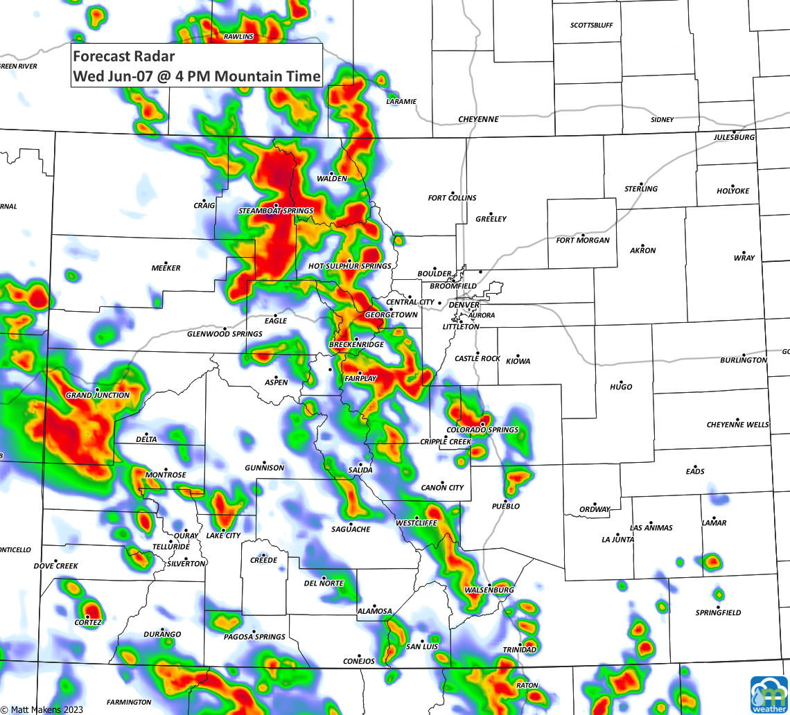
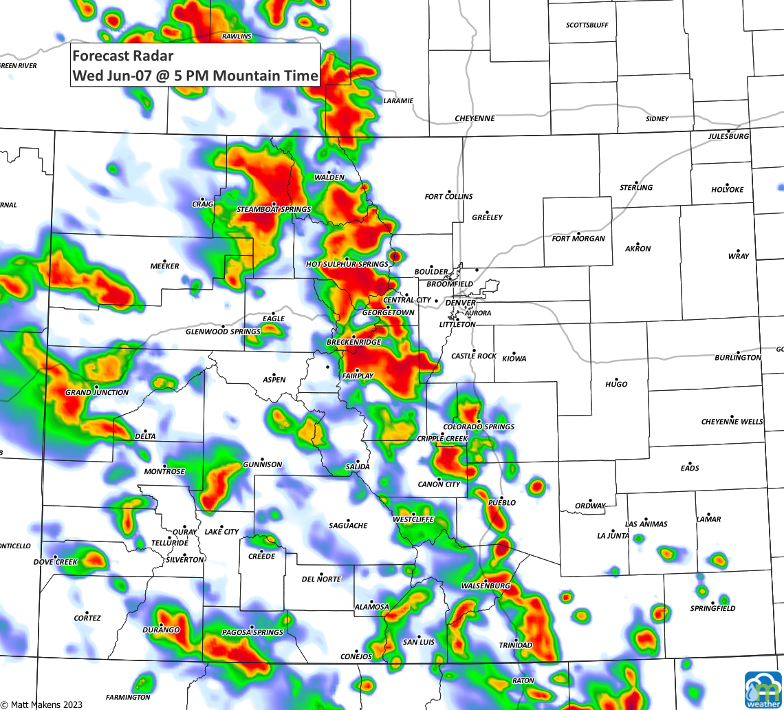
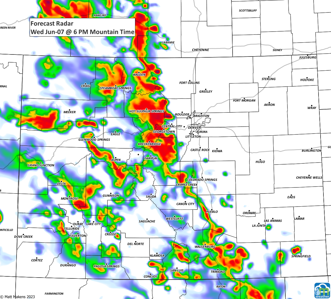
As you know, scattered storms continue through the workweek with mild temperatures - slightly below average - in the 70s. The next cool/rainy day is potentially this Sunday, but we will address that in the future.