
More storms in the forecast for Eastern Colorado, some could be severe

Another active weather day on tap across the region as we head into the latter half of the weekend. Today's storms will feature gusty winds, heavy downpours, hail, and even an isolated tornado.
The latest HRRR shows storms building over the foothills by midday, then gradually pushing east across the plains this afternoon and evening. As they do, some storms will become severe.
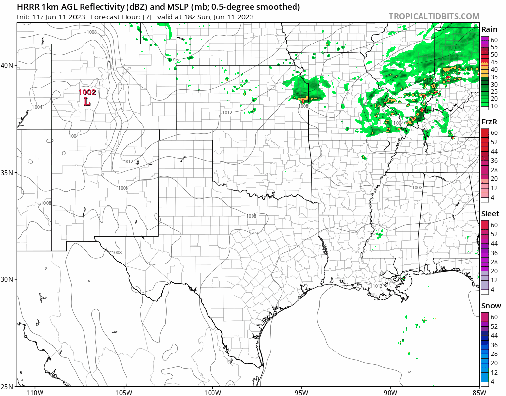
The greatest severe threat looks to be from Denver south along the I-25 corridor, then points southeast. In looking at the HRRR above, it does seem as though the Palmer Divide will be favored for some of those stronger storms today.
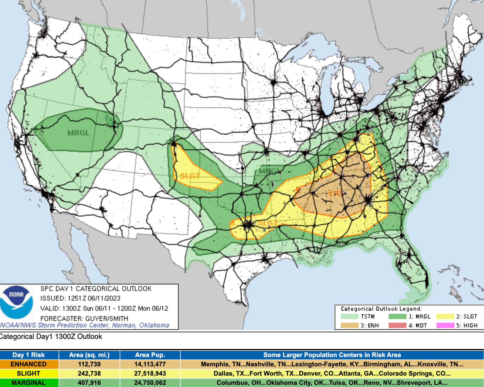
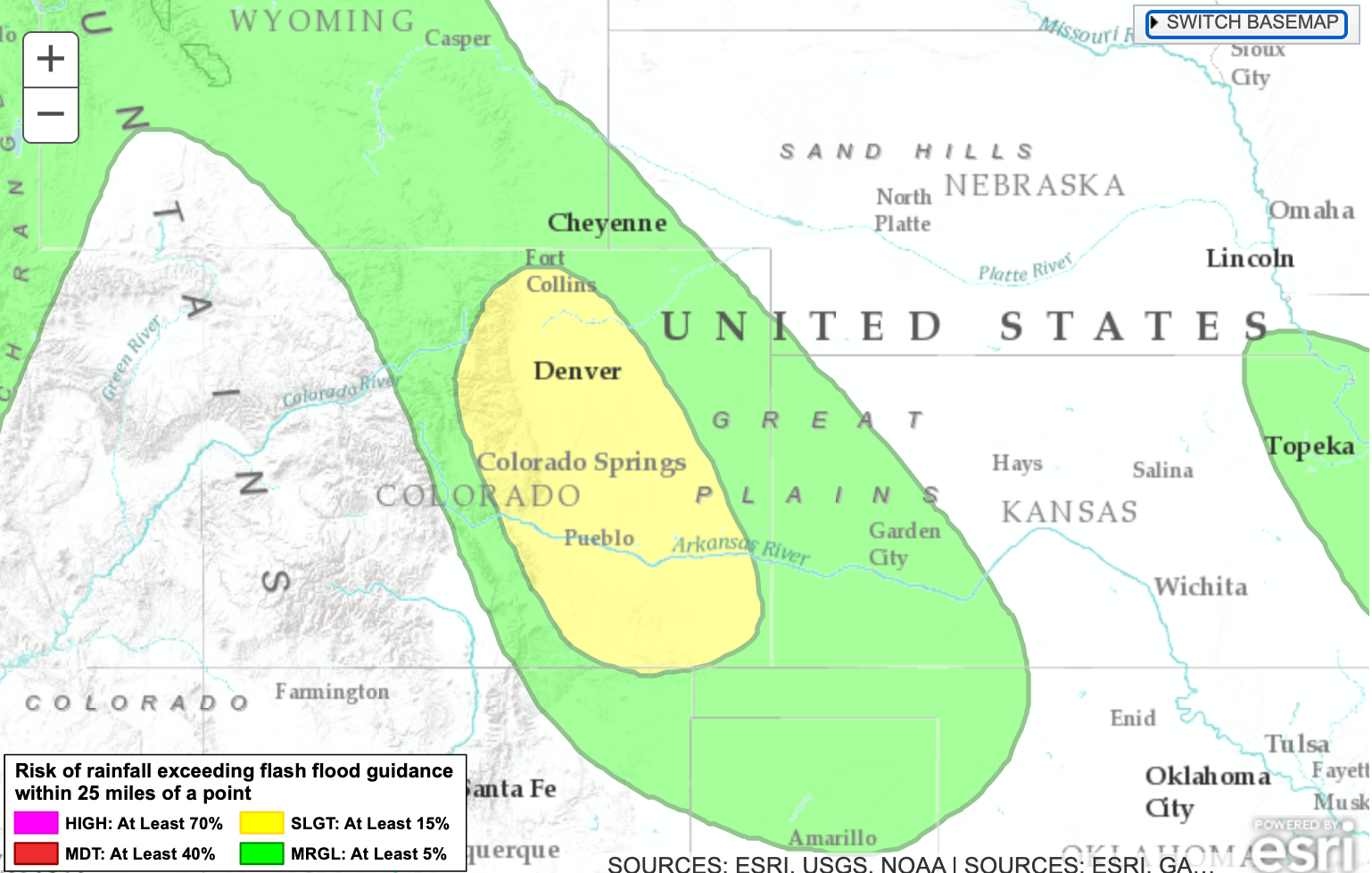
In addition to the wind, hail, and tornado threat, heavy rain will be a possibility as well, with flash flooding a concern under the heaviest storms.
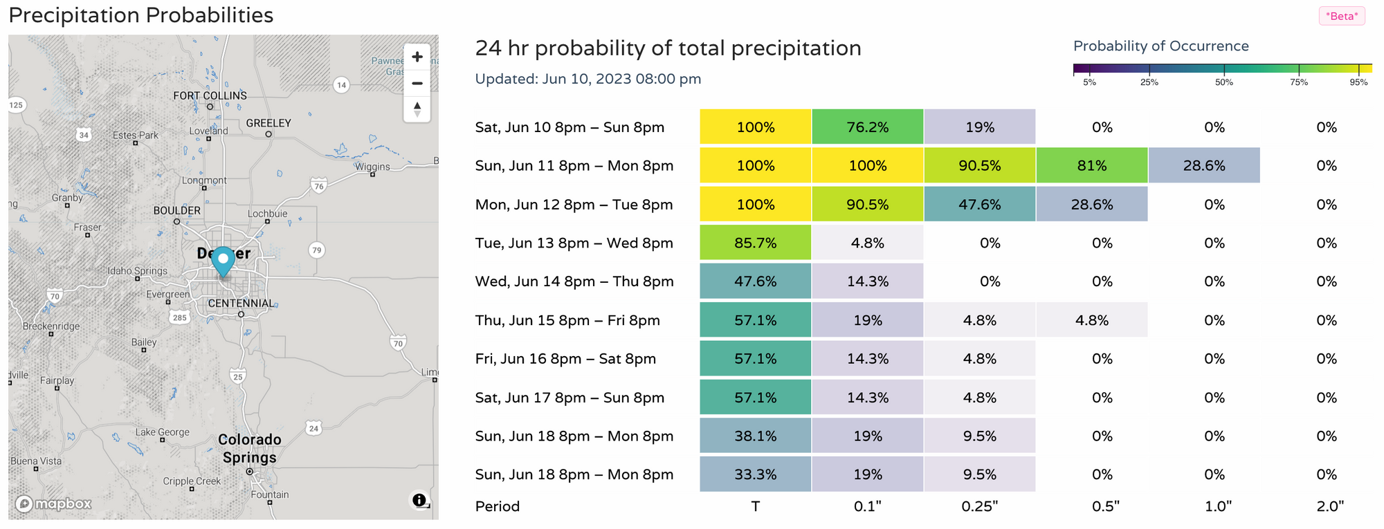
While no Flash Flood Watch is currently in place, you can see in the graphic below that the areas in yellow are at a heightened risk for those heavy rainers today:
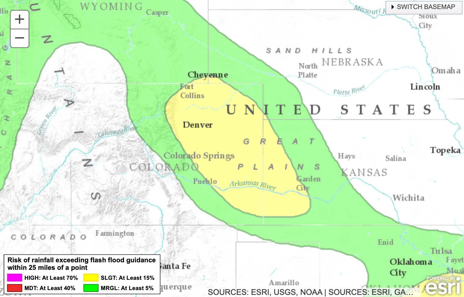
And again tomorrow:
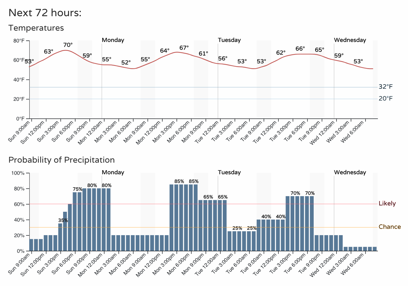
Given the above, no real surprise here that Denver's precipitation chance's are quite high over the next couple of days. The hourly planner shows highs in the upper 60s to near 70 through Tuesday, with afternoon storm chances in the 70 to 80% range over the next three days:
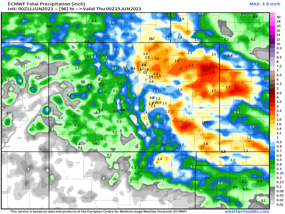
Models are quite bullish on precipitation totals for the period, showing a good portion of eastern Colorado picking up more than 1" of rain through Tuesday. With the convective nature of today's storms some of these totals will vary greatly, but it could be that tomorrow's rain is even more widespread than today.
Here is the latest precipitation forecast from the Euro:
With fairly healthy probabilities in place:
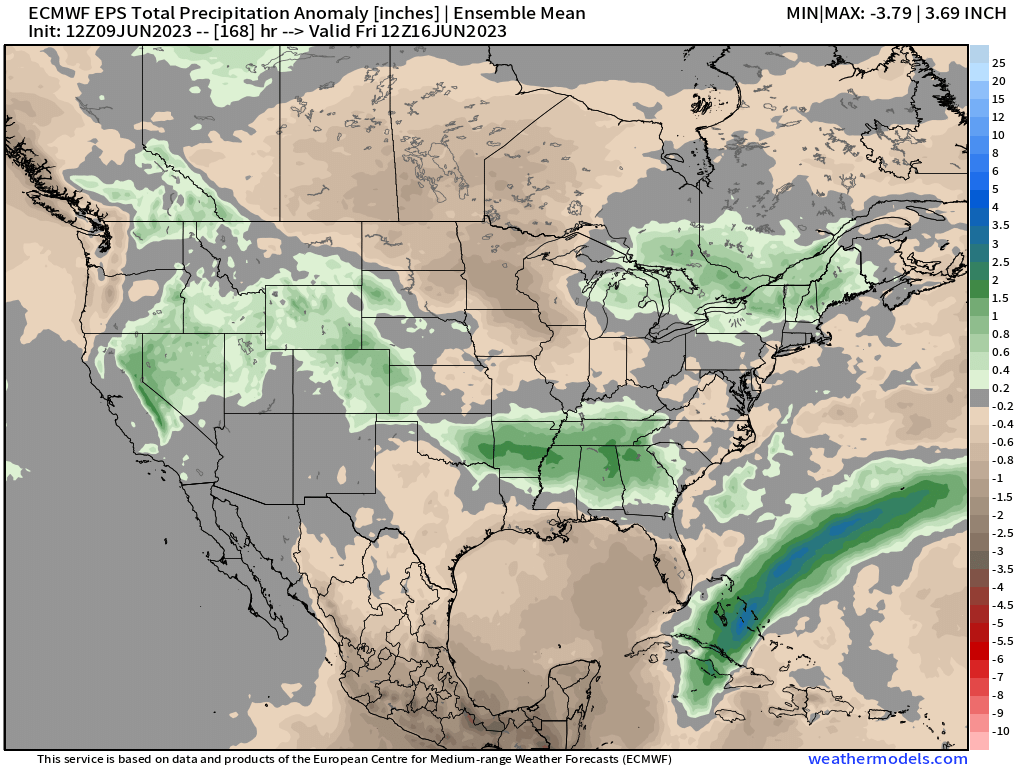
The forecast continues to look a bit quieter as we head into the latter half of the week, but daily storm chances will still be possible, even if more scattered in nature. We discussed this in our latest Insider post late last week:
Please be sure to subscribe to stay ahead of all the weather thrown our way!