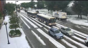
Boulder gets pounded with hail and flooding rain midday Monday

Flooding and accumulating hail hit Boulder, Colorado Monday, especially inconvenient for those trying to grab a bite for lunch.
This guy attempted to cycle through the flooded area… all while another car got stuck. Mind you, firefighters were on scene telling people to turn around. @KDVR @channel2kwgn @PinpointWX 🤷🏼♀️ pic.twitter.com/VqQGc0hlVf
— Courtney Fromm (@courtney_fromm) June 12, 2023
That's not snow on the ground in Boulder, Colorado... It's hail! pic.twitter.com/aOhdqJ7AND
— The Weather Channel (@weatherchannel) June 12, 2023
Significant flooding now as severe hailstorm continues in Boulder. #cowx https://t.co/xp7o0DaRPr pic.twitter.com/ZQlU72fxKx
— Daniel Swain (@Weather_West) June 12, 2023
Watch as the storms developed late Monday morning.
Stormy lunch! #cowx pic.twitter.com/D3LHkPKTla
— Matt Makens (@MattMakens) June 12, 2023
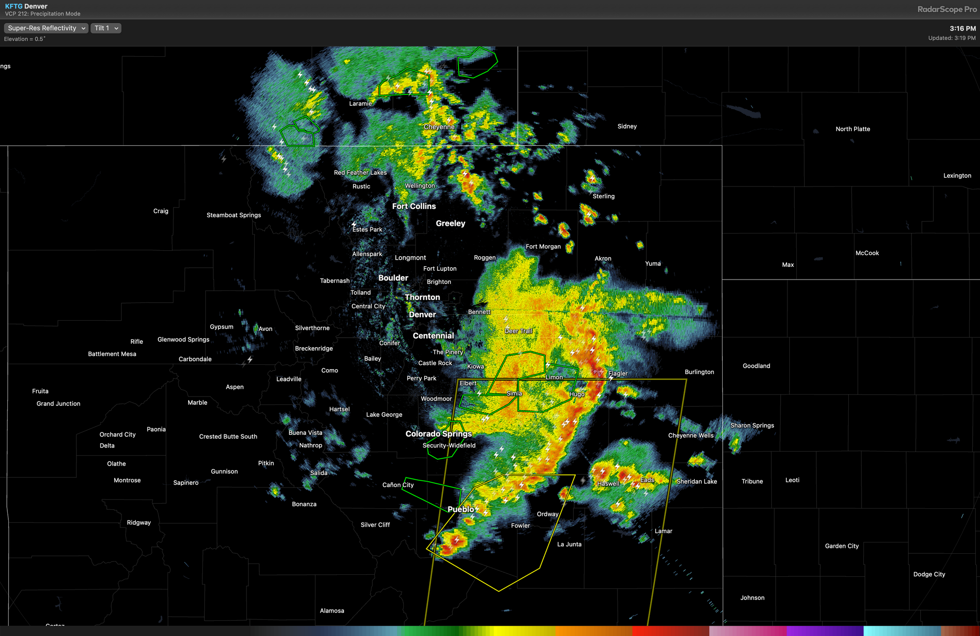
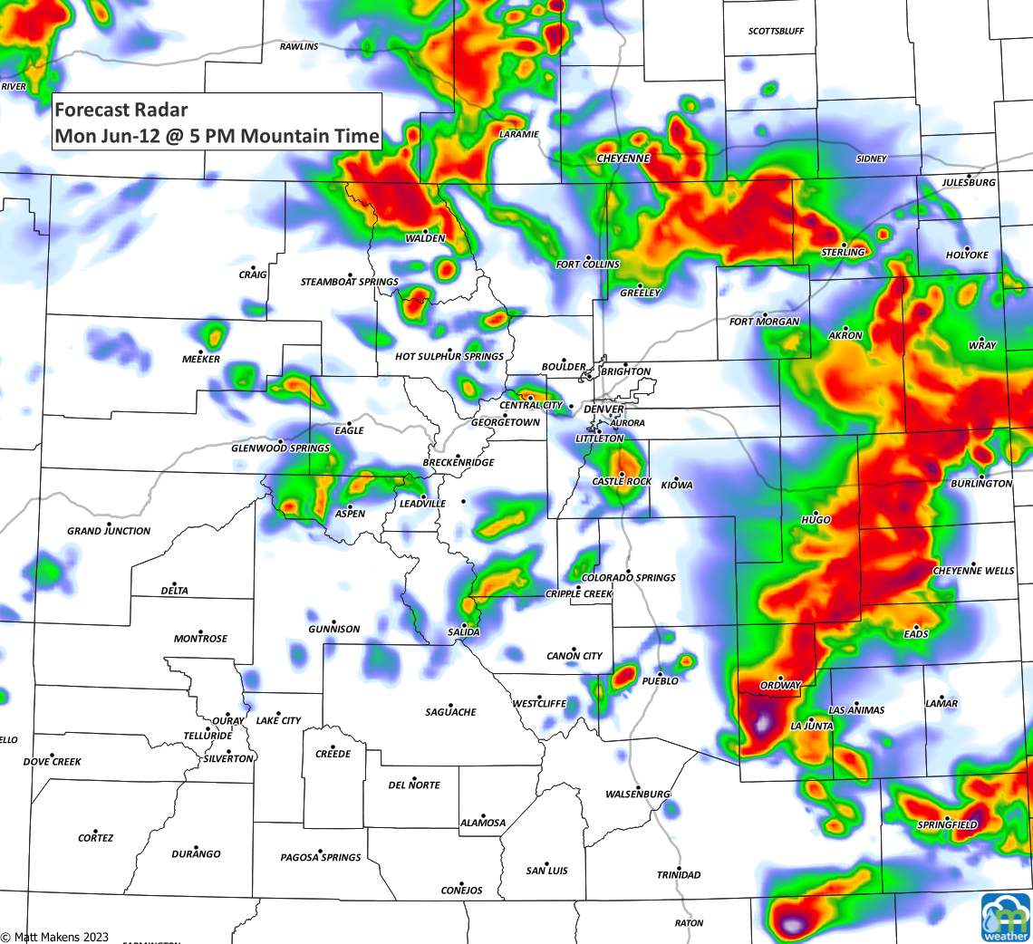
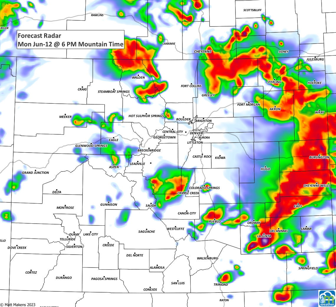
By the afternoon, there was a powerful line of thunderstorms marching over the Plains.
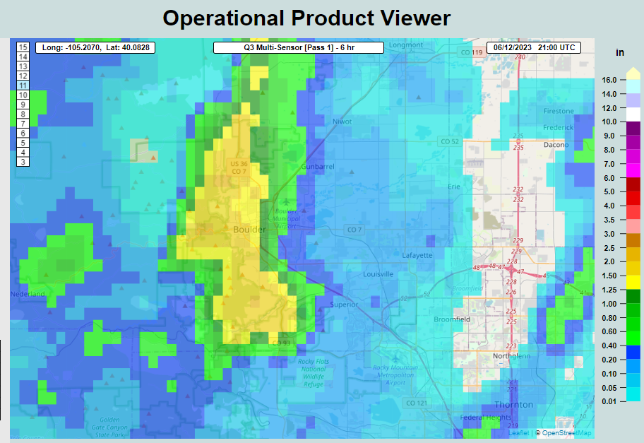
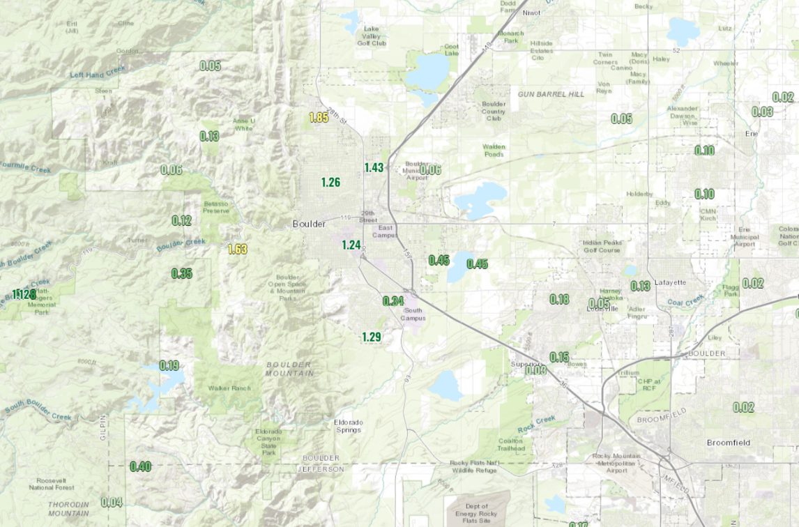
Instrument estimated precipitation around the Boulder area was mostly in the 1 to 2" range.
And the total precipitation from a few gauges in the area.
Most reported hail with that rainfall, mostly small sizes but accumulating to one to two inch depths exacerbated the flooding that was on many of the city streets. There was one report of quarter-size hail southwest of Boulder.
As the biggest thunderstorms move east toward Kansas the rest of today, isolated storms may pop up over the higher country and metro areas.
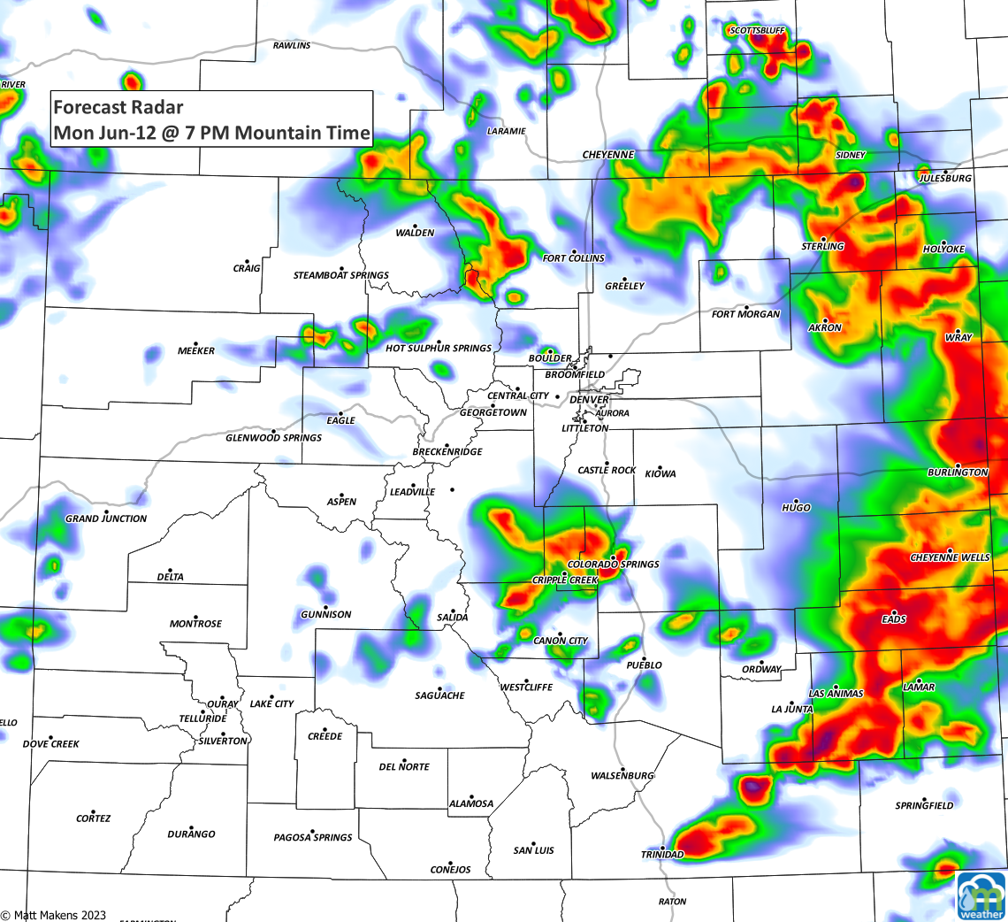
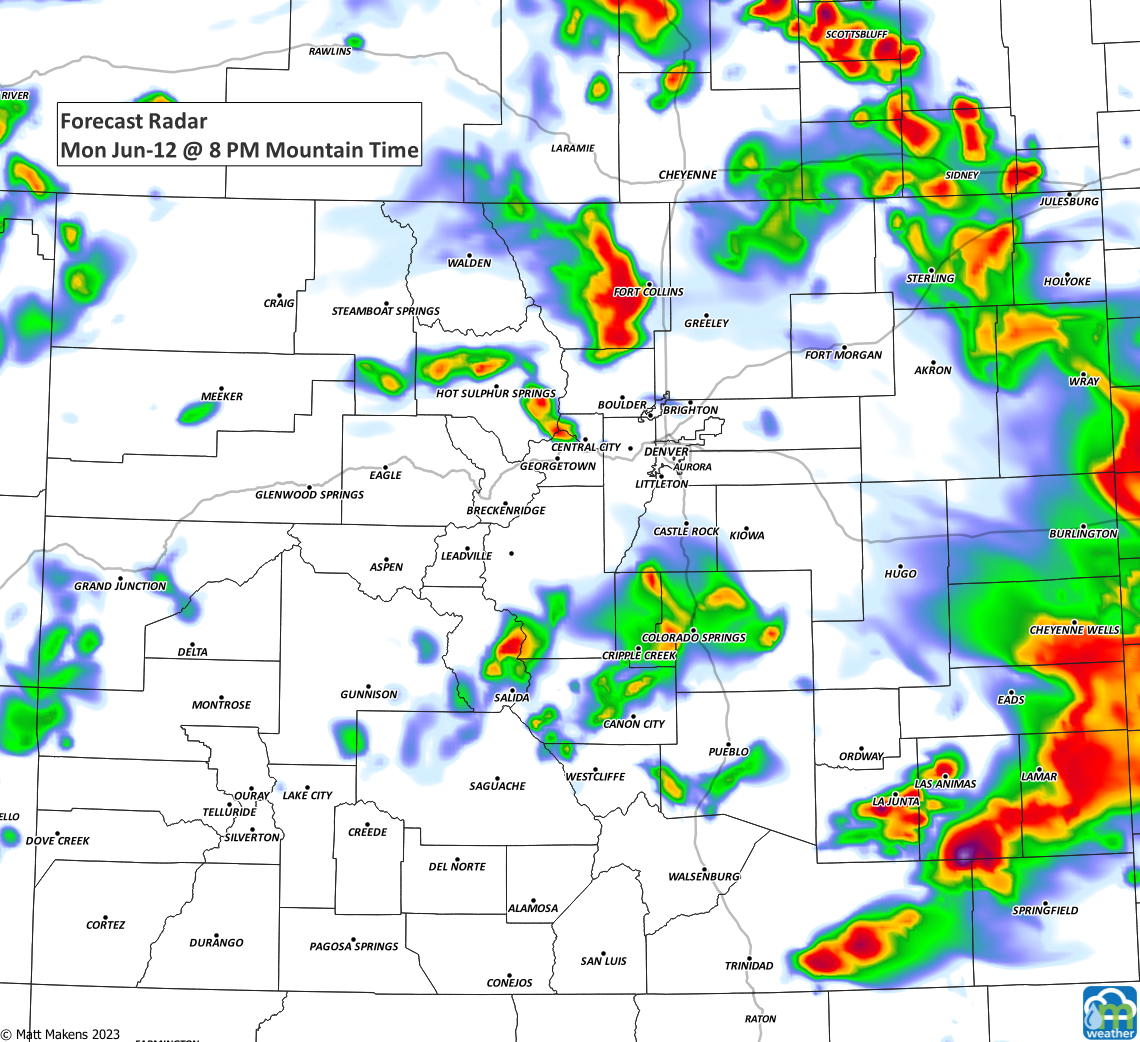
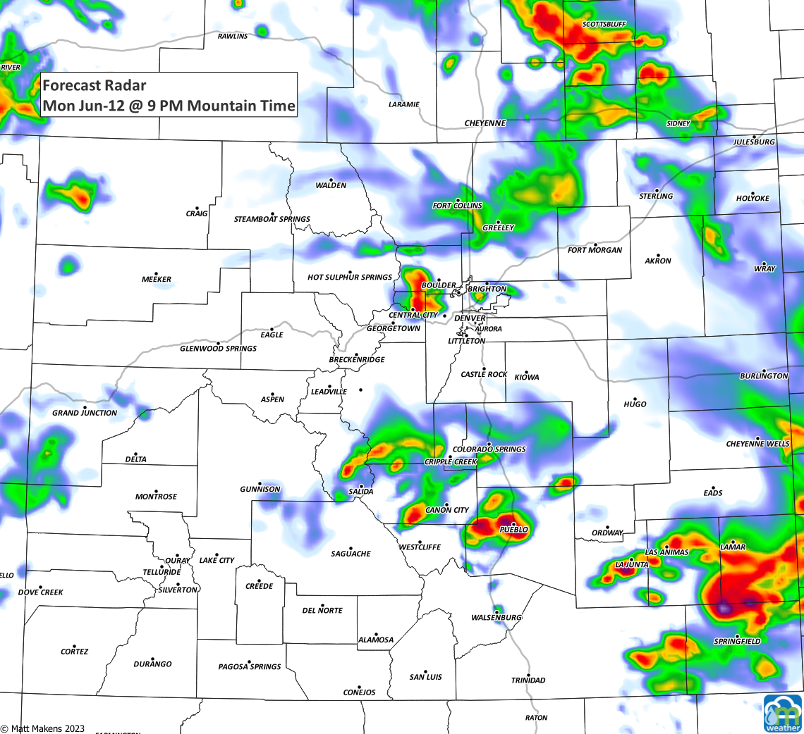
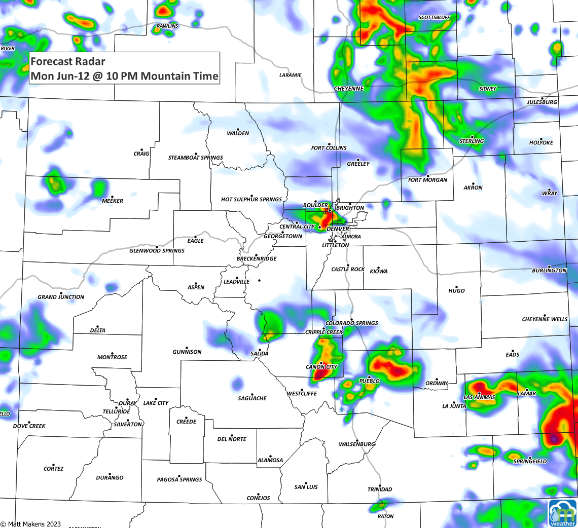
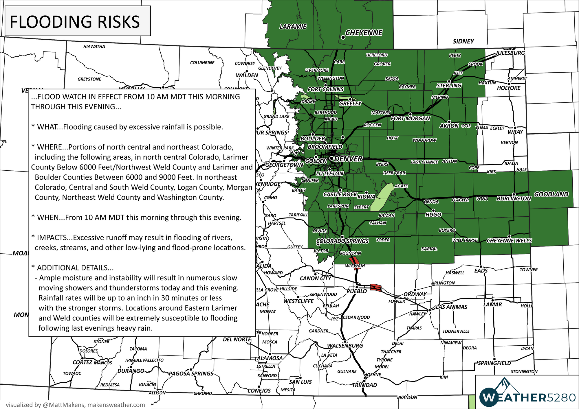
Remember, a flood watch continues until the storms wrap up late tonight.