Denver Weather: Storms continue, increased risk of flooding

Storms haven't stopped rolling over the state, with strong storms early Monday morning.
Storms keep on rollin’. Another active day for #cowx. Flood watch is in effect for all of Northeastern Colorado through the evening. pic.twitter.com/nS9LdKuqkH
— Matt Makens (@MattMakens) June 12, 2023
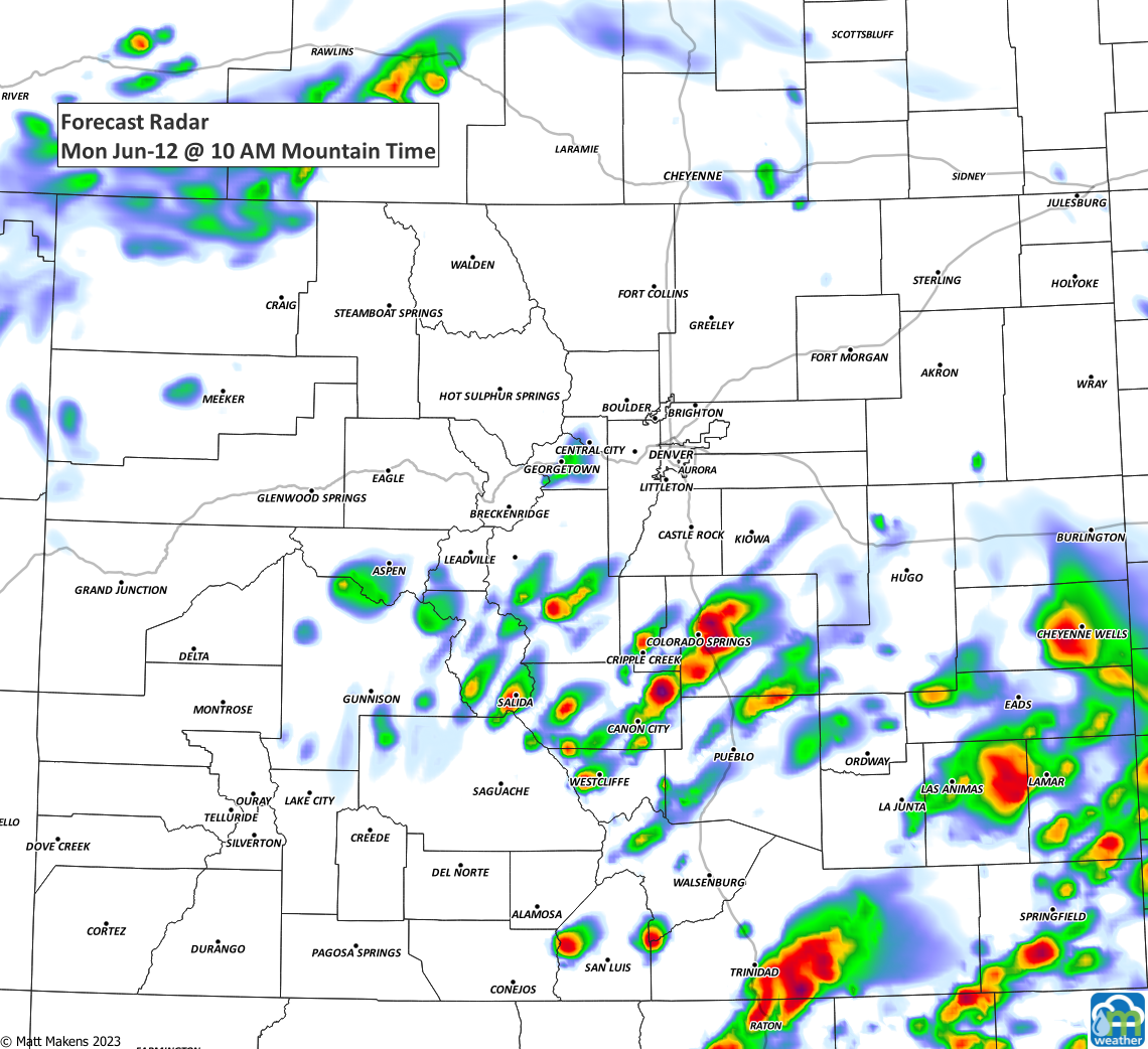
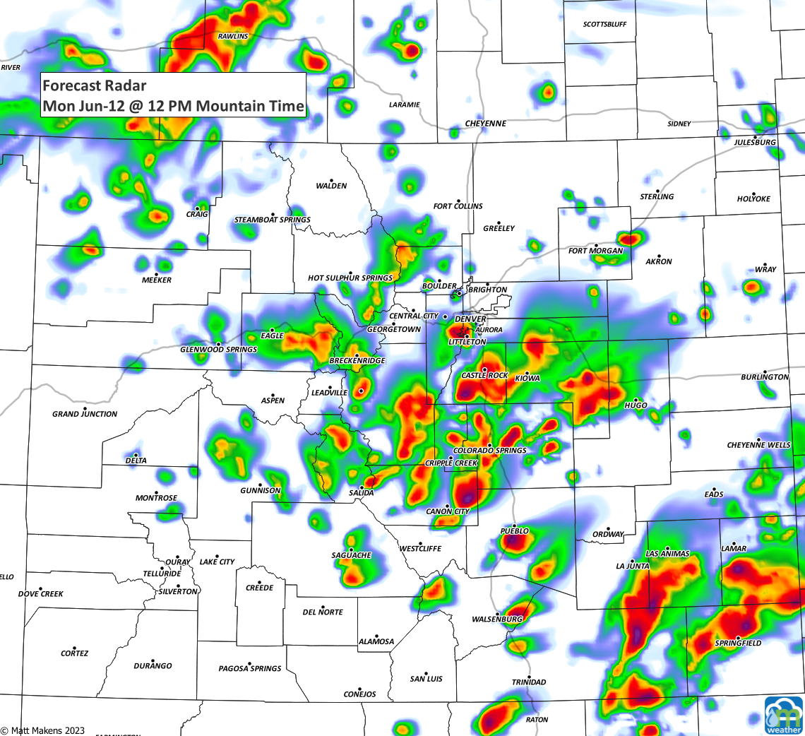
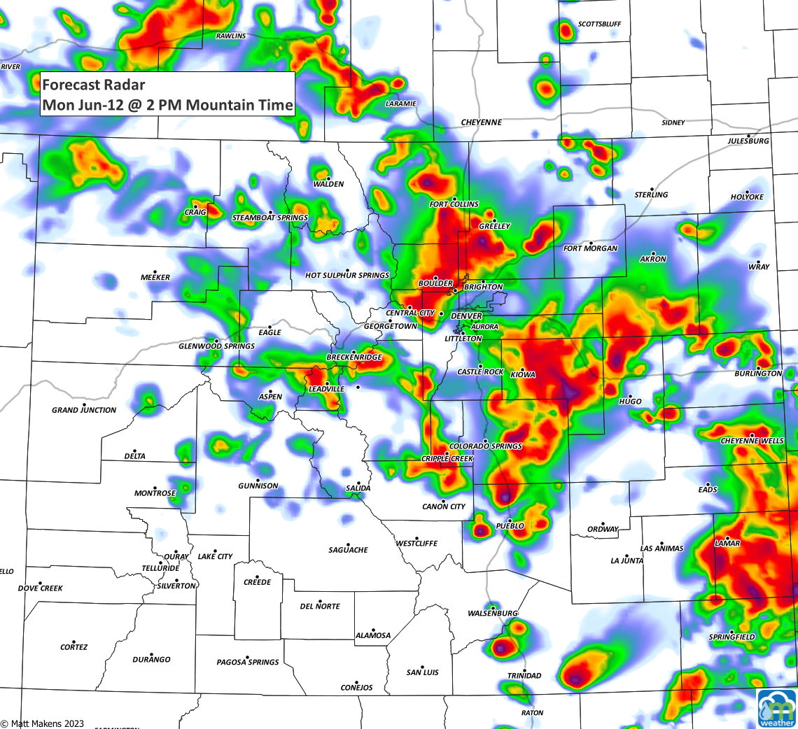
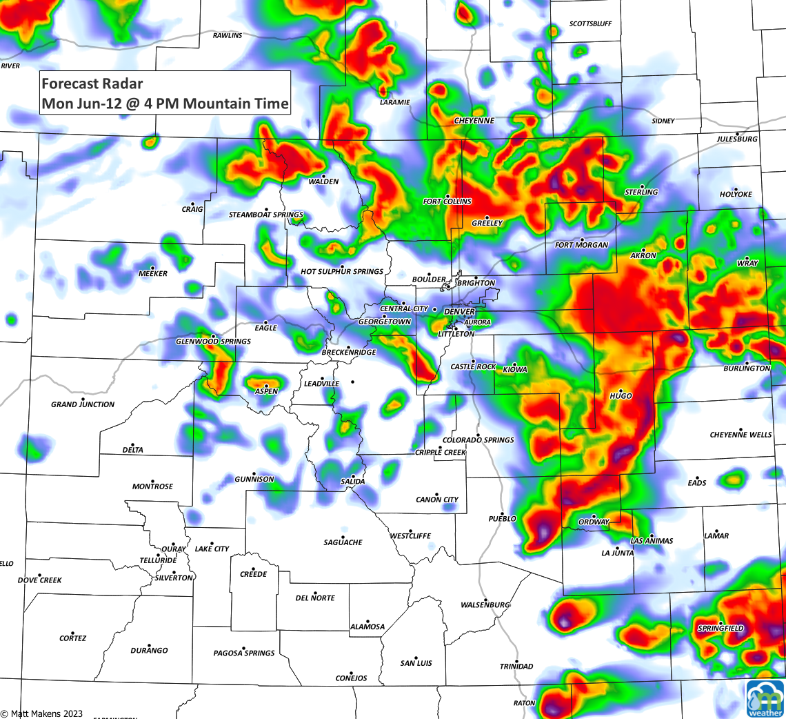
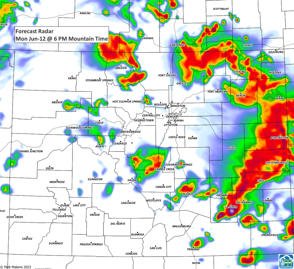
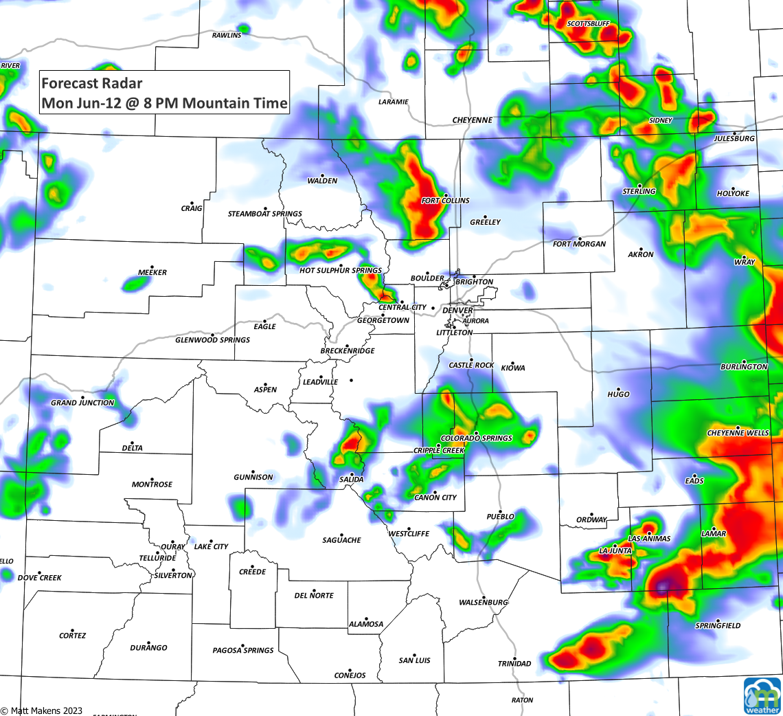
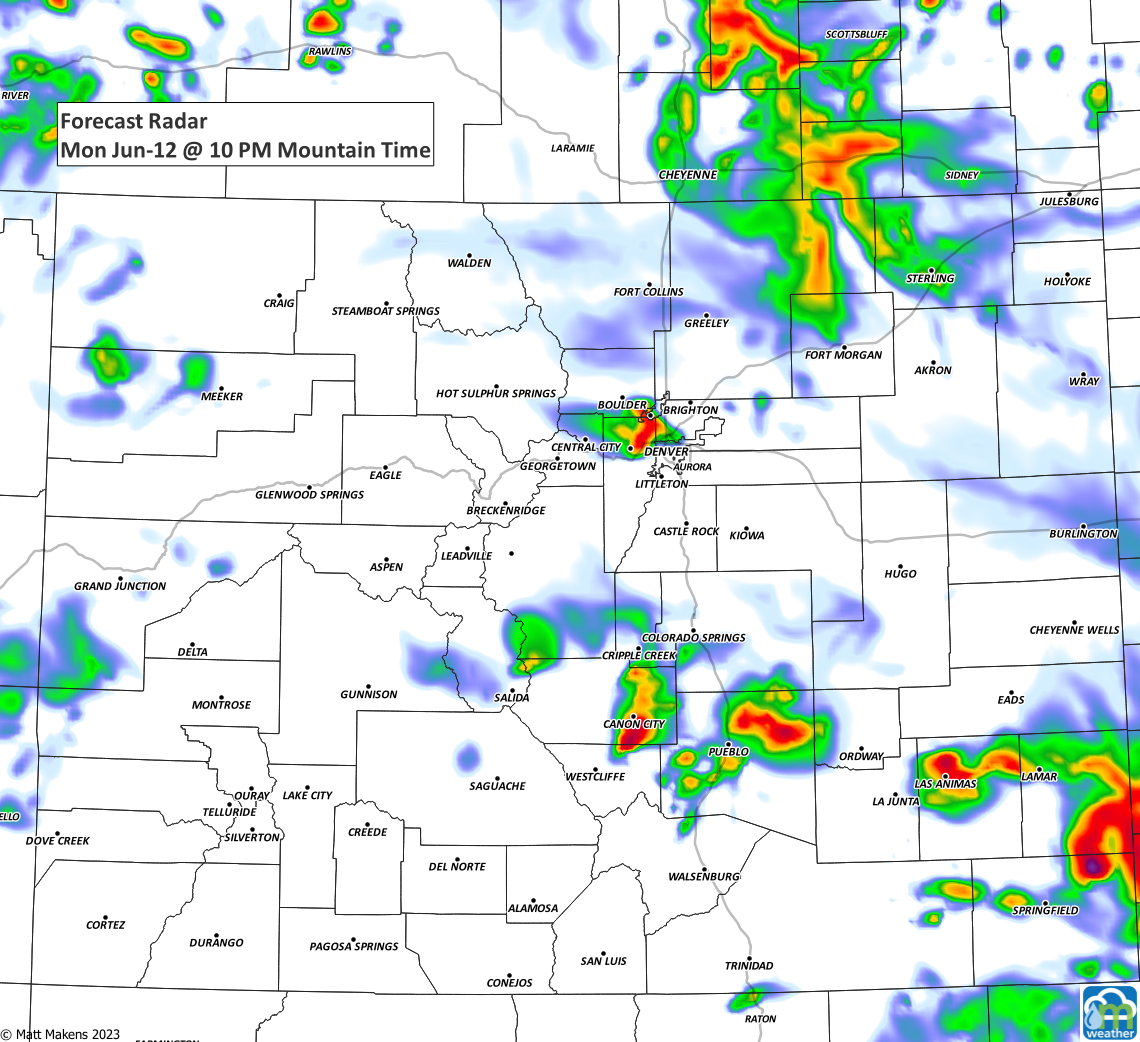
Additional storms throughout the day will primarily carry hail and heavy rainfall - heavy enough that there's a flood watch issued for most all of northeastern Colorado (including metro areas) through this evening.
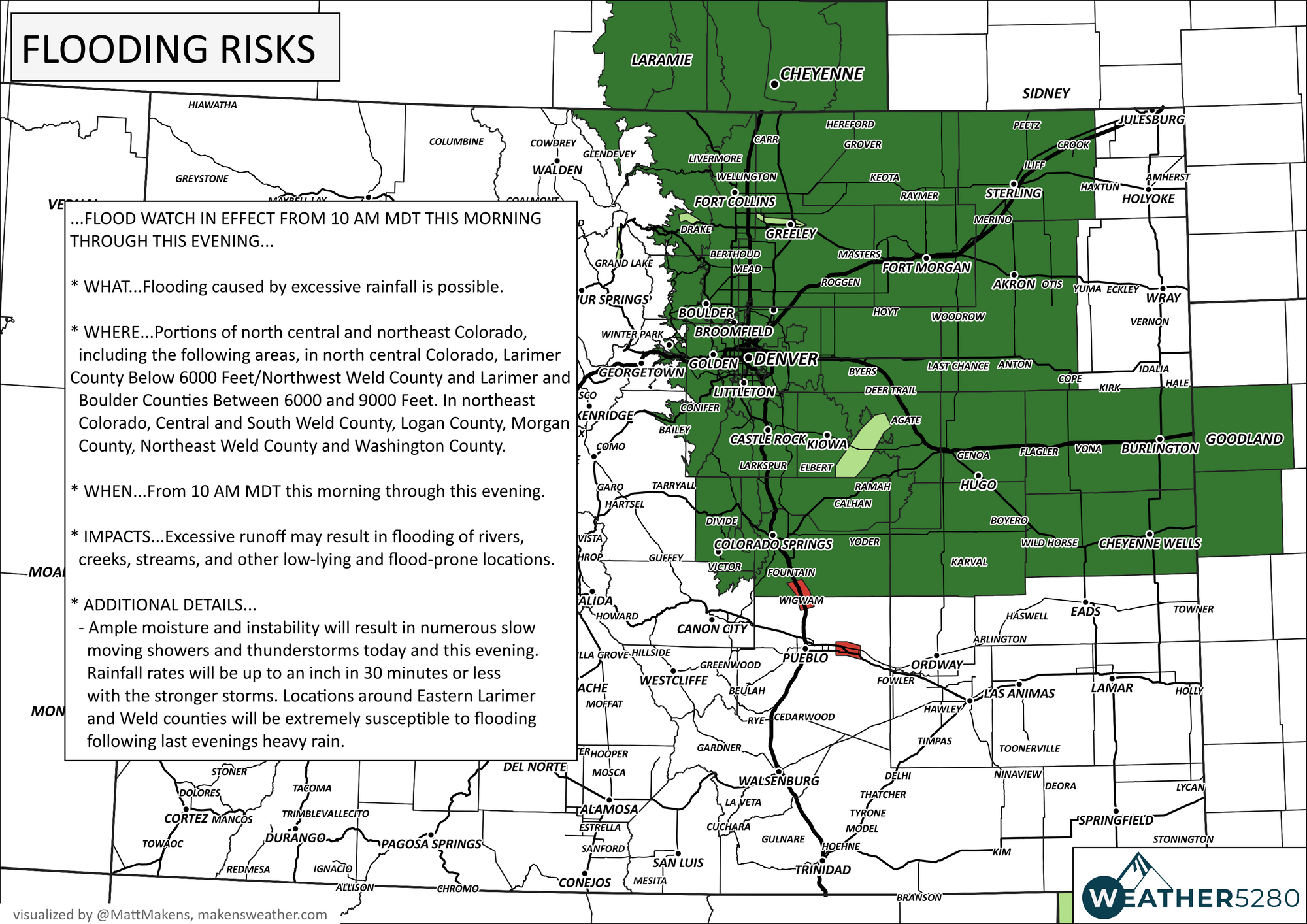
The issues today being:
Ample moisture and instability will result in numerous slow
moving showers and thunderstorms today and this evening.
Rainfall rates will be up to an inch in 30 minutes or less
with the stronger storms. Locations around Eastern Larimer
and Weld counties will be extremely susceptible to flooding
following last evenings heavy rain.
So, we may be looking at more 'waterfront properties'.
1. 9" from this evening's insane rainfall in east Fort Collins. On the plus side, temporary waterfront property! #cowx pic.twitter.com/5yWw8ePOvP
— Bill Line (@bill_line) June 12, 2023
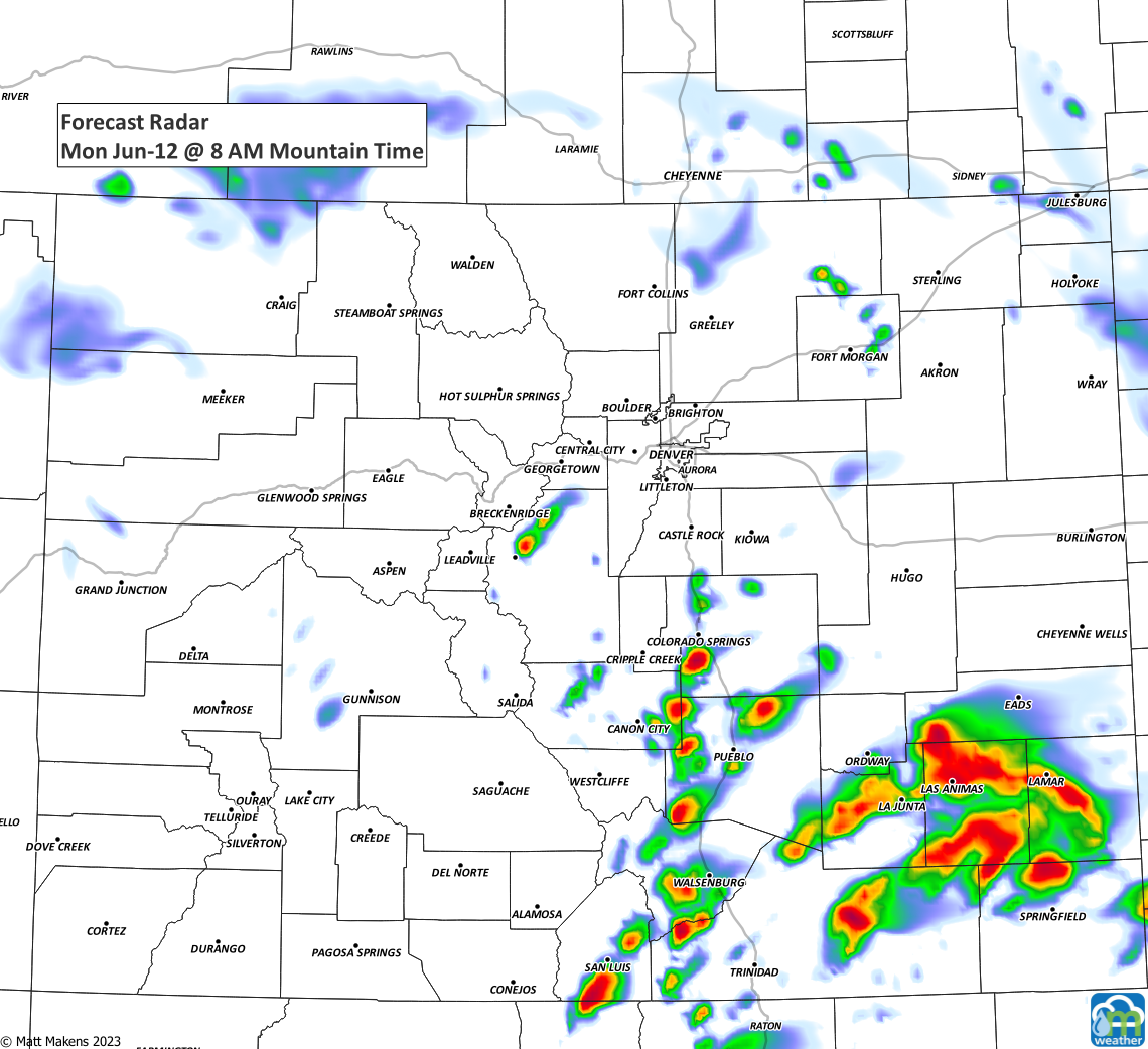
Here's a walk-through of the estimated storm position and timing throughout the day.
If you can pass along your rain reports down below in the comments section, we'd be very thankful. If you are looking for a new rain gauge or a new weather station for Father's Day, here are our recommendations based on our personal use of each.
Tempest°: (Enter "weather5280" at checkout to receive an additional 10% off)
Ambient Weather WS-5000
KestrelMet 6000
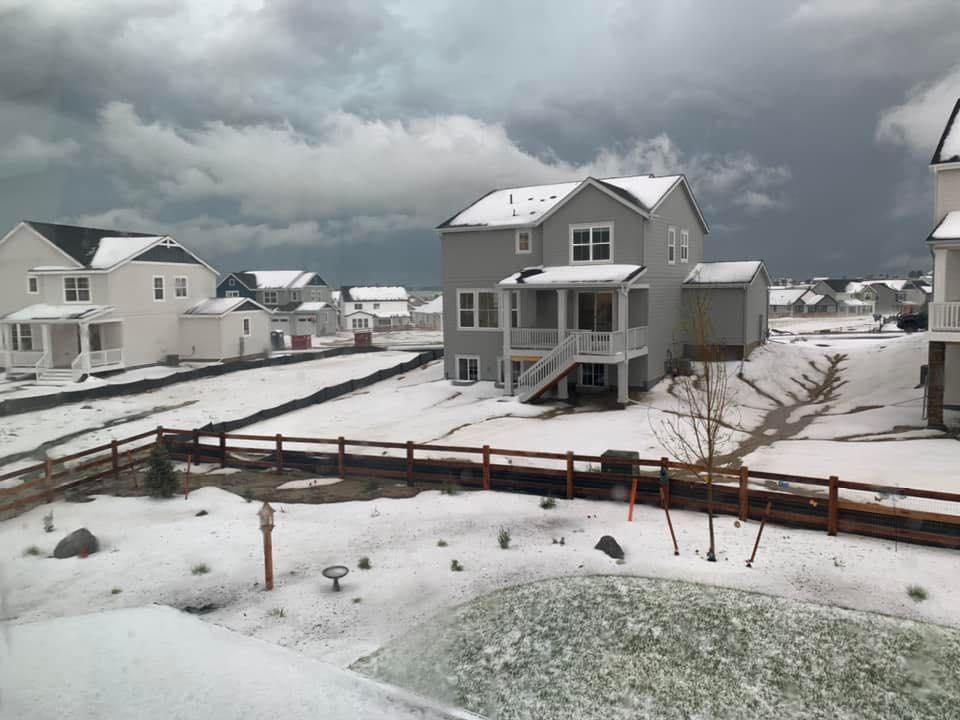
In addition to the heavy rainfall, there may be the accumulation of hail as we saw yesterday, too.
Yards of accumulated hail in Elizabeth late Sunday.
— Matt Makens (@MattMakens) June 12, 2023
📷Linda Bowman Schaer. pic.twitter.com/nRBt6xevfW
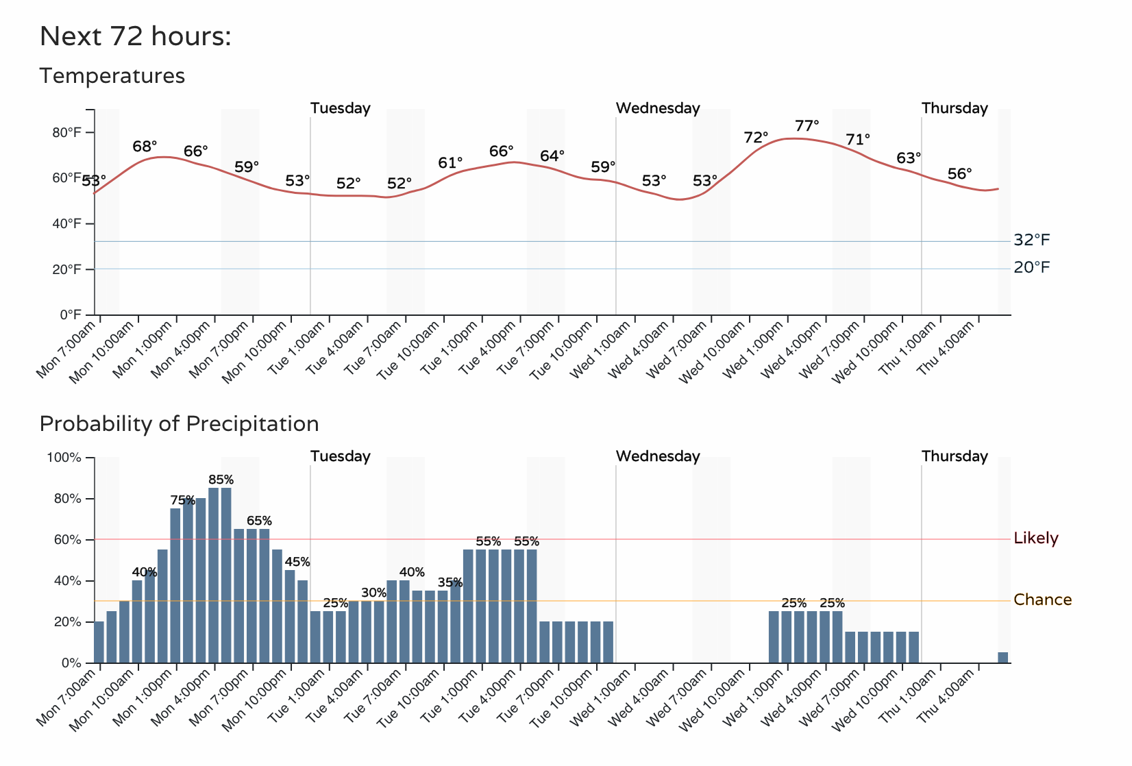
Putting it all together, we clearly have a wet day on tap. The next three begin to see the rain potential drop as temperatures recover.