Colorado weather: Showers and storms to end the week, Flood Watch in place, a drying trend for the weekend

We're kicking off another afternoon of showers and storms across the state ahead of the weekend will feature, yes, a chance for storms but also a bit of a drying trend – perhaps.
A look at the radar shortly afternoon noon today shows those storms building across the area. We'll continue to see plenty of activity across eastern Colorado through the afternoon and evening before things quiet again tonight.
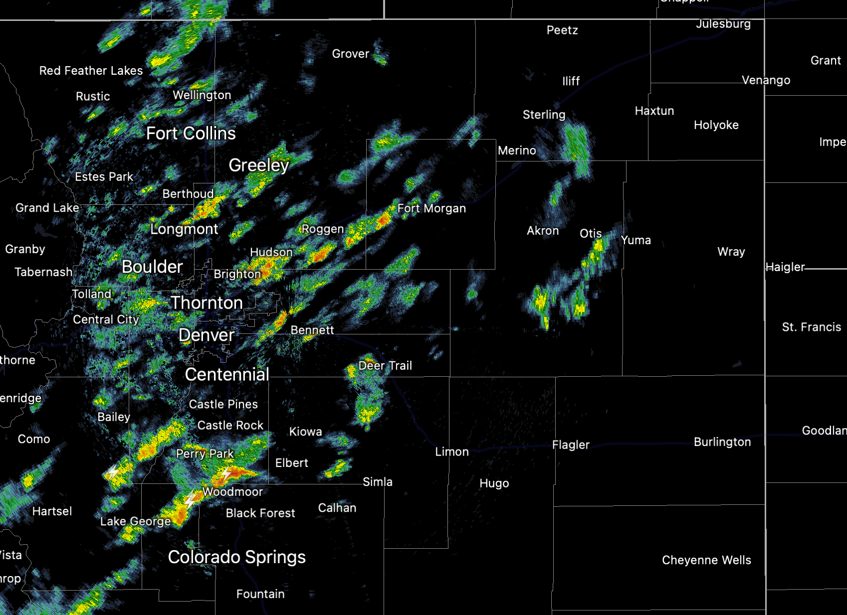
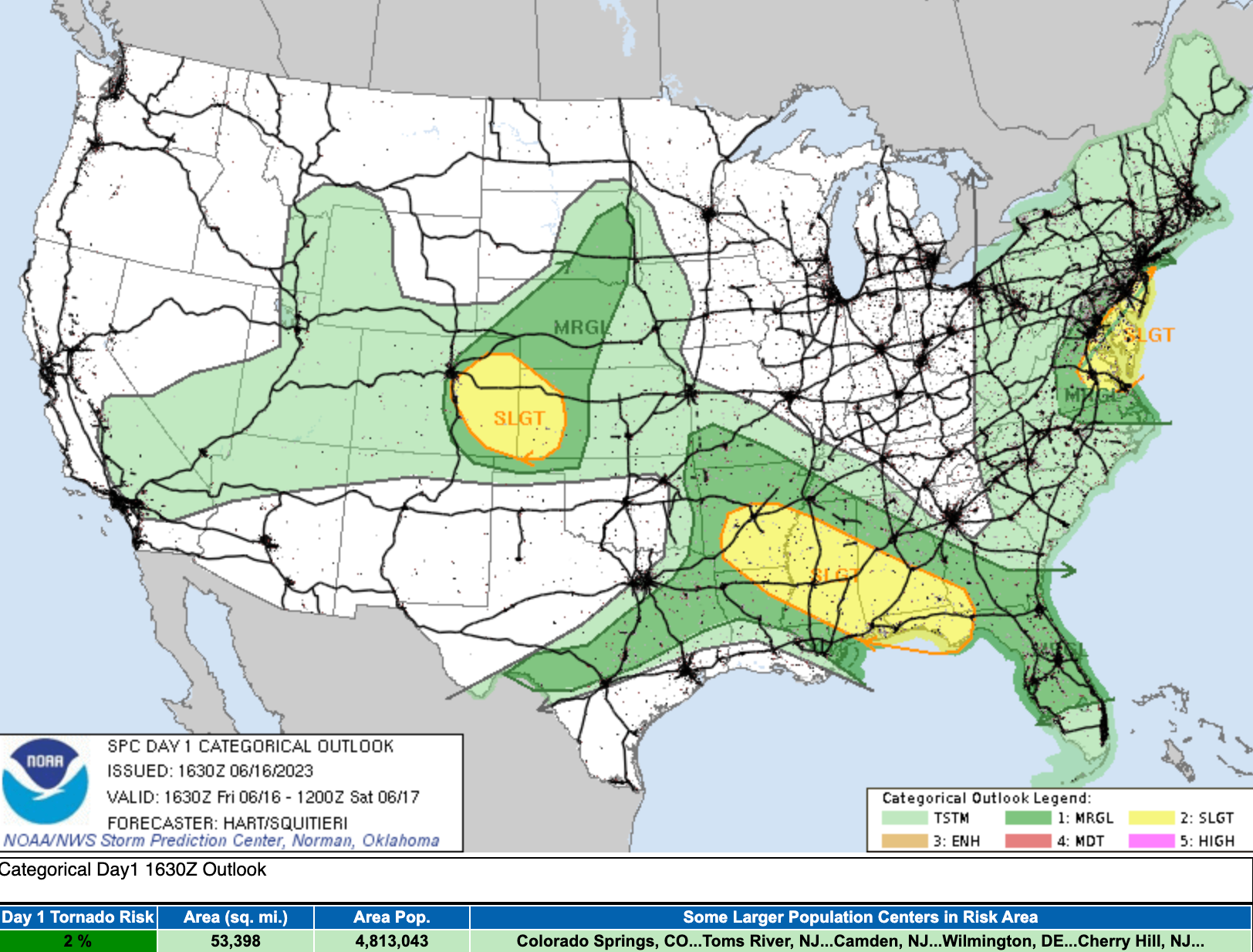
In fact, some of these storms are likely to turn severe this afternoon, particularly for areas east and southeast of Denver. The latest SPC outlook for severe weather today is below:
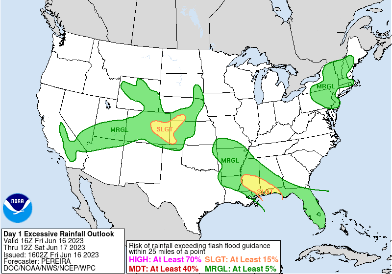
In addition to some severe storms, wind and hail being the primary threat, we could see some flooding again today across the region. The WPC has a Slight Risk for excessive rainfall/flash flooding across the area this afternoon, with south-central Colorado and the northern Front Range urban corridor (including Denver) under a Flood Watch until 10pm.
WHEN...From Noon MDT today until 10 pm this evening.
IMPACTS...Excessive runoff may result in flooding of rivers, creeks, streams, and other low-lying and flood-prone locations. Extensive street flooding is also possible.
ADDITIONAL DETAILS... - Numerous showers and thunderstorms will develop this afternoon and continue into this evening. The stronger storms will be capable of producing 1 to 2 inches of rain in an hour or less, and there may be repeated rounds of heavy rainfall. While the highest threat will be over the Palmer Divide and in the Cameron Peak burn area, flash flooding will also be possible in urban locations including the Denver metro area.
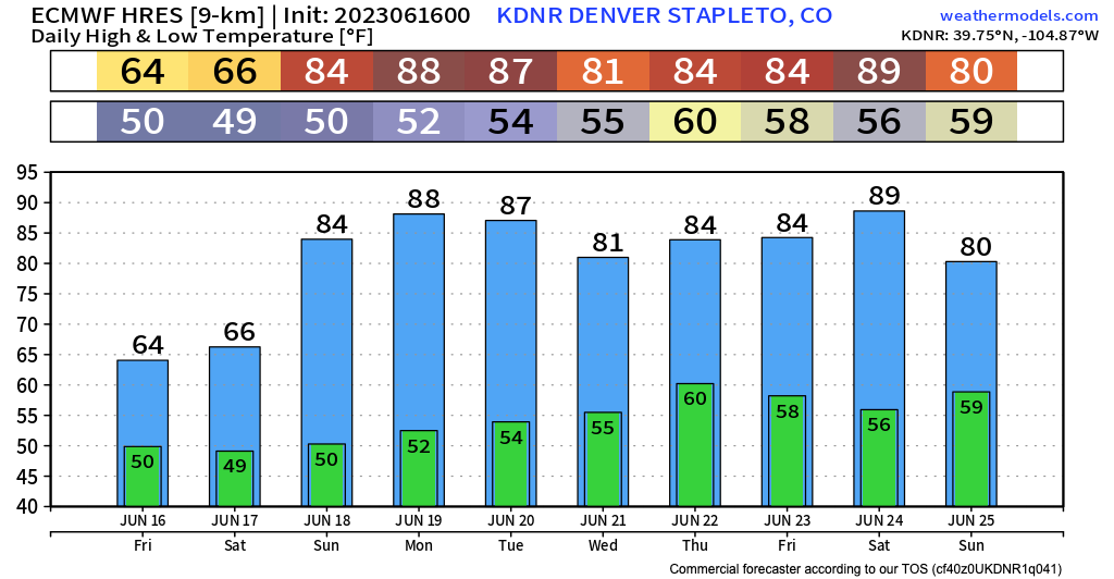
Another cooler than average day is on tap Saturday for the Denver area before we begin a bit of a warmup for the latter half of the weekend.
Denver's average high for the date is 84°F and latest guidance has Saturday topping out at just about 70°F with about a 50% chance of afternoon storms.
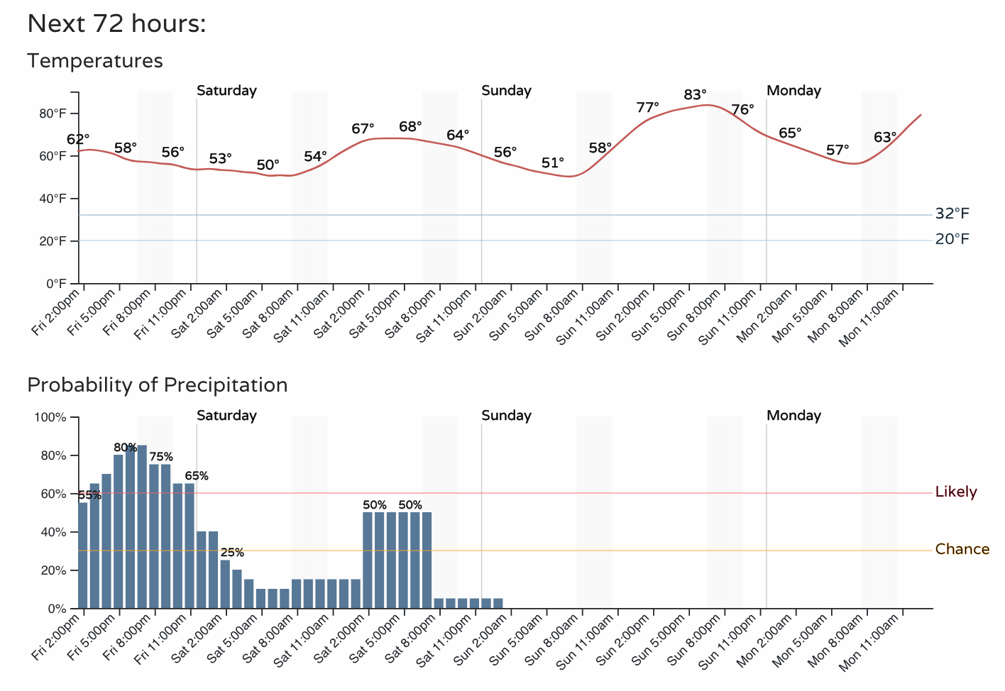
Noteable in the graph above is a lack of precipitation probabilities for your Sunday! Temperatures will also climb to near average on Sunday for Denver.
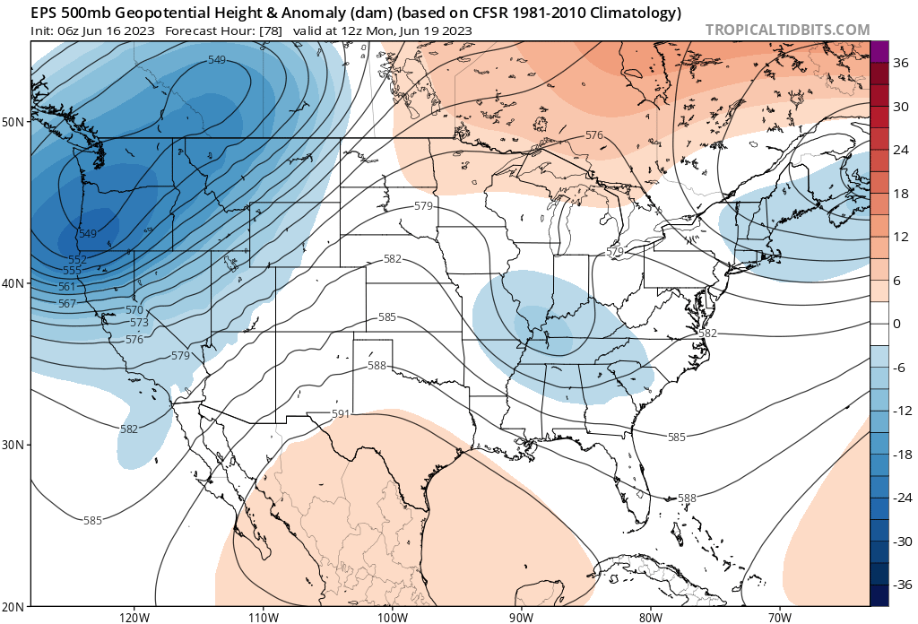
This is part of a bit of a shift in our pattern as we end the weekend and start next week. A ridge builds overhead and should deliver us a few quieter weather days, as well as some more summer-like temperatures.
The Euro has Denver approaching 90°F by Monday: