Colorado Weather: Large hail event taking shape

Large hail and tornadoes are possible in parts of Colorado today, including the metro areas, and the chance continues into the evening and overnight. We have a dynamic setup with a cold front moving in late today, which will act to combine plenty of warmth and plenty of humidity.
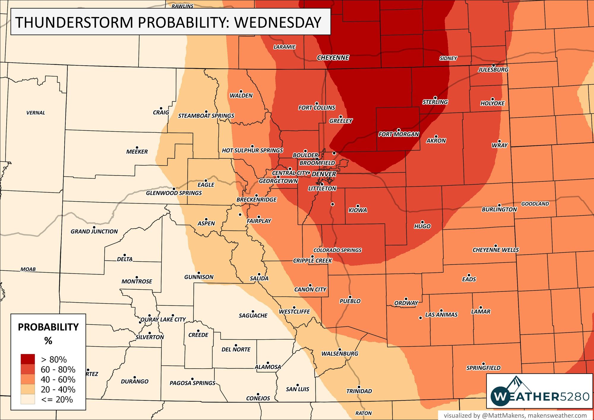
Here are the overall chances for storms and locations.
Of that area, there are increased risks from damaging thunderstorms as shown here. EDIT (11:00 AM) the following image is new as the threat has increased from what was originally posted.
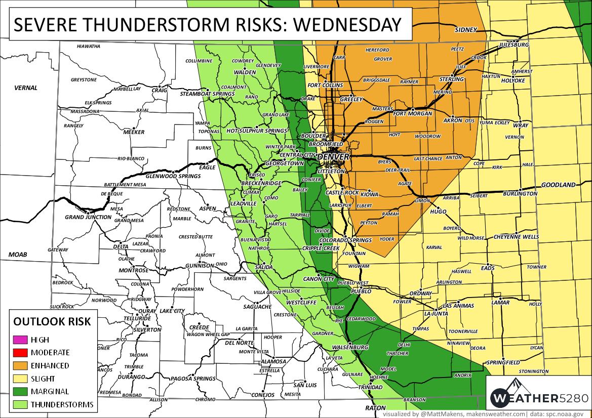
The "slight" risk area contains the ingredients needed for some rather severe thunderstorms. Very large hail, damaging wind, and isolated tornadoes will be possible. So, cars into the garage and cover the plants for late today, and keep them undercover for the night.
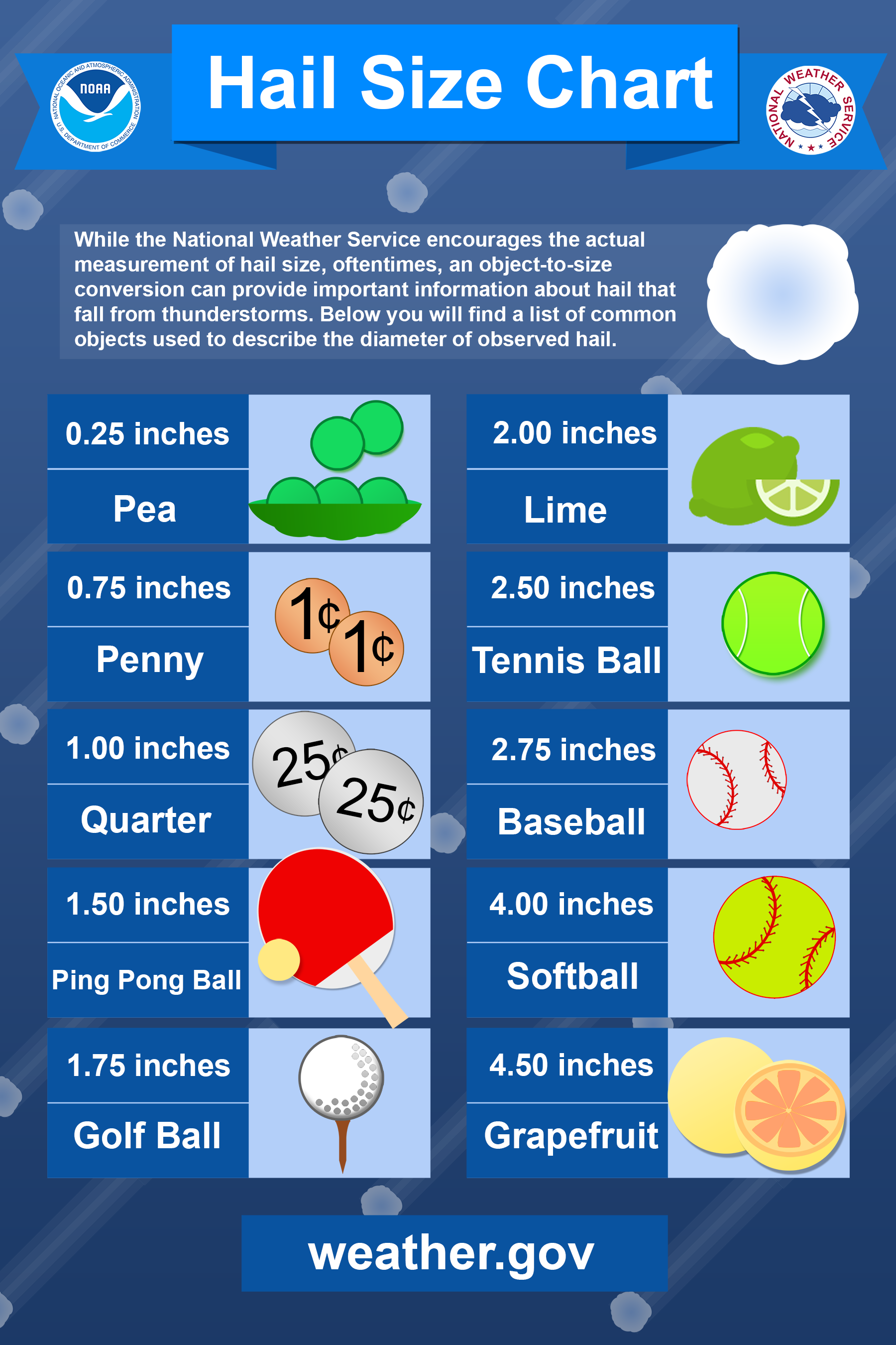
Today's setup can include hail from 1.5" and larger, which is golf balls and bigger.
As the following images show you, the risk of storms goes well beyond sunset.
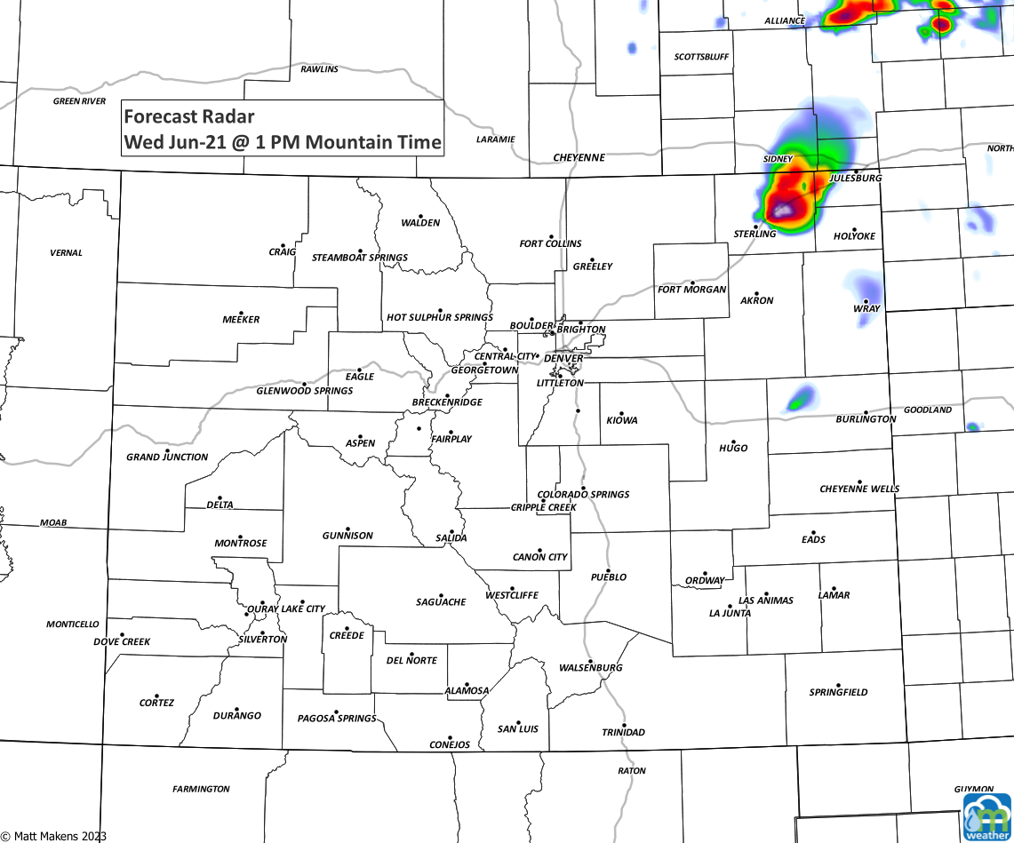
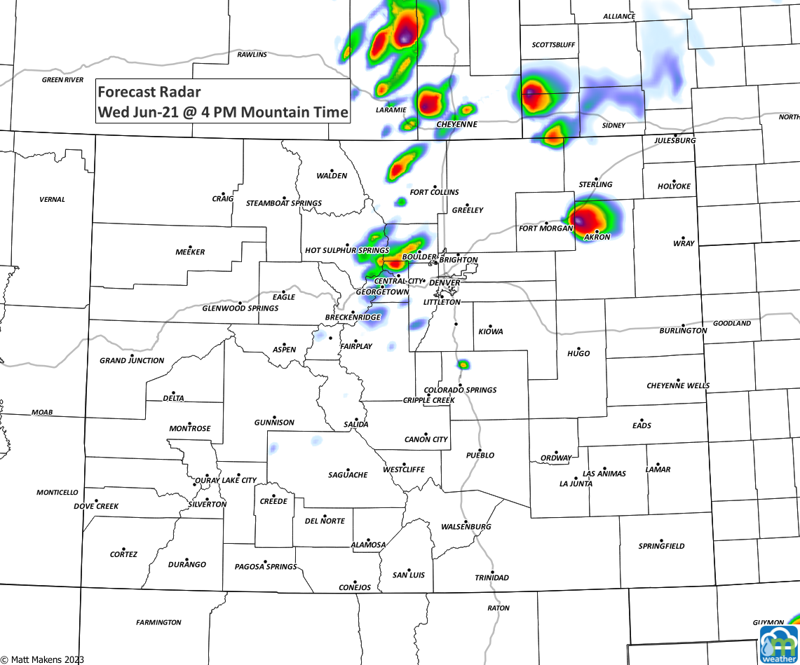
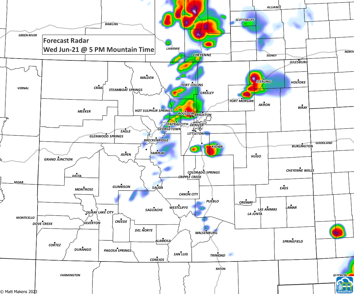
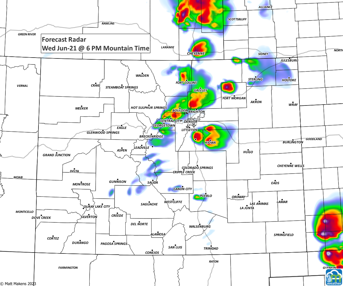
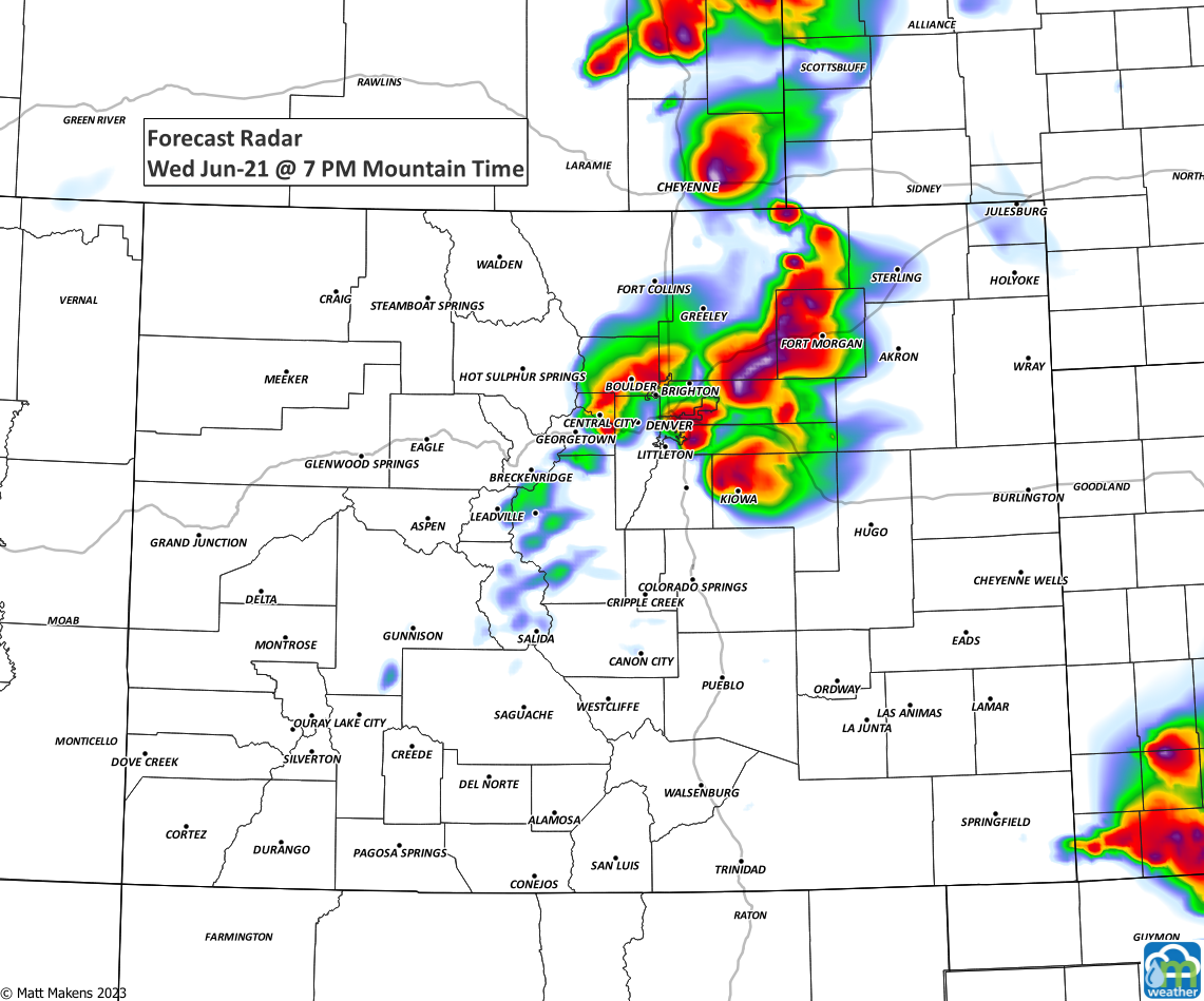
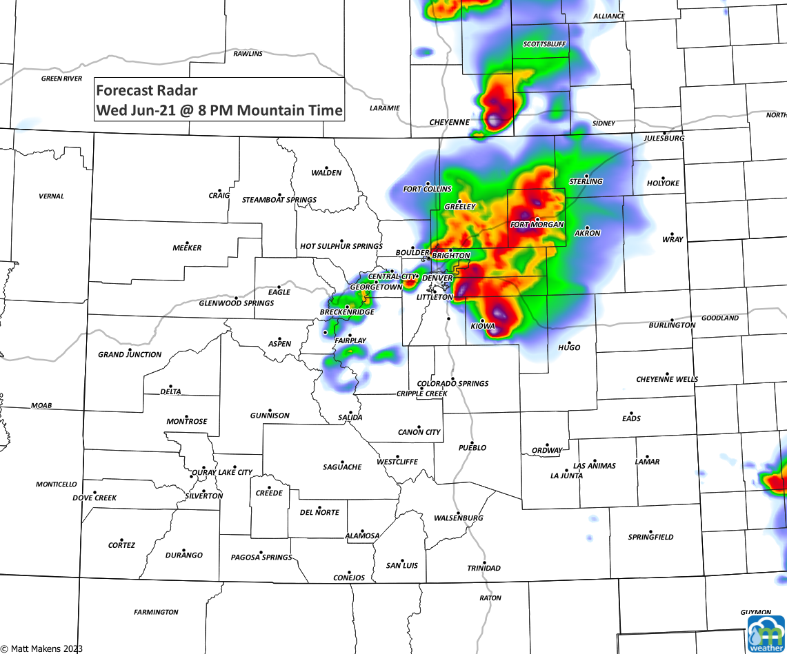
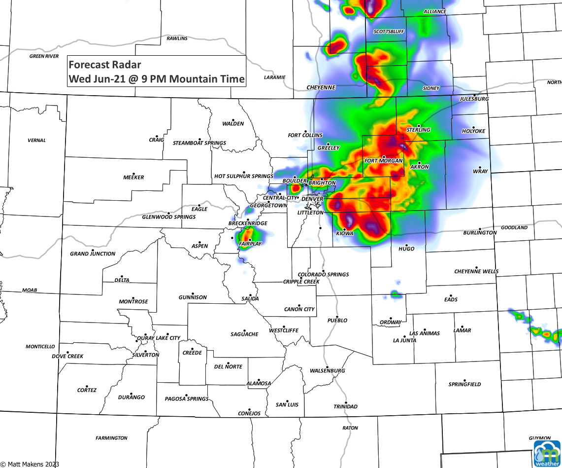
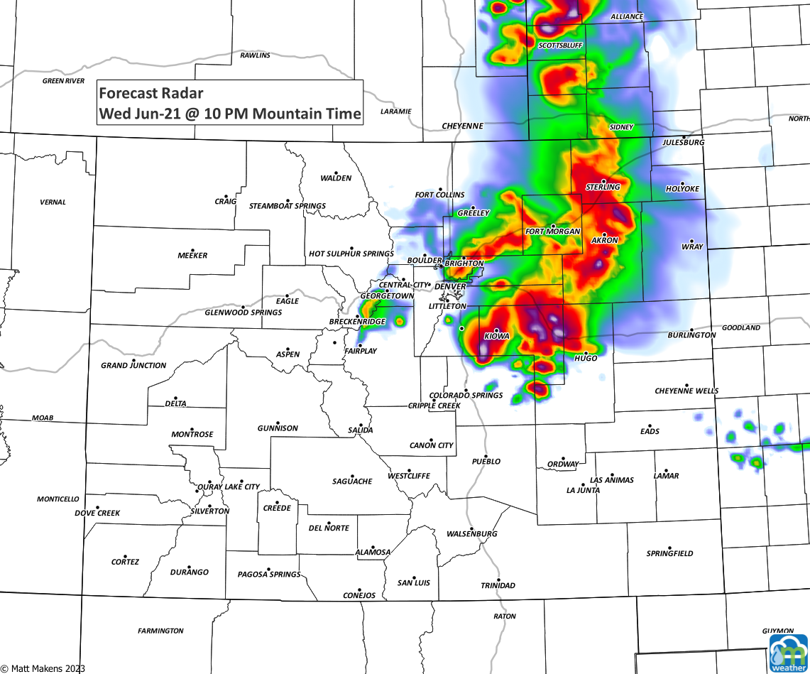
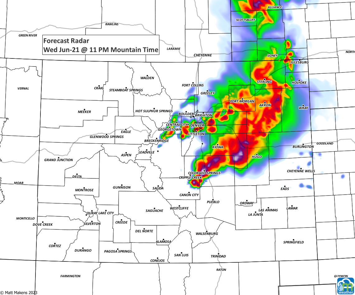
The worst of the weather will occur with the placement of the cold front by this evening, which is likely to be right near the metro areas. Should that front decide to stop somewhere east, well that's where the biggest storms will stay.
Morning data sure looks like an active late day for us in Denver and Colorado Springs, though. Here's an hourly planner, which shows more activity again tomorrow.
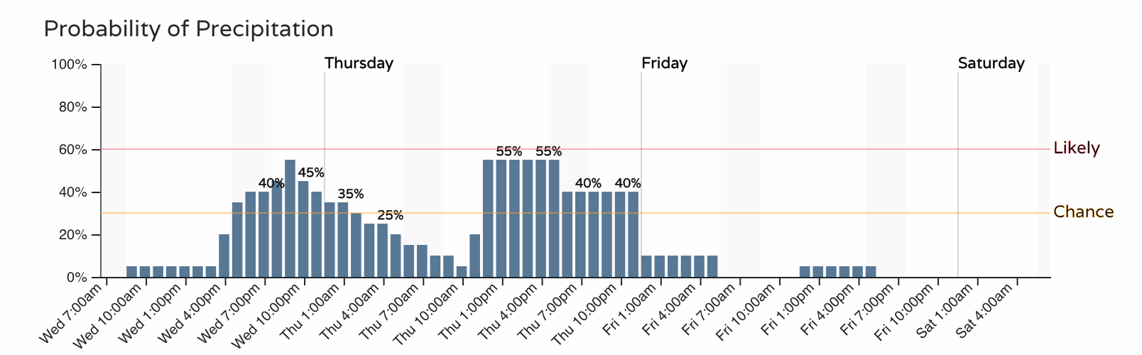
Thursday's storms also have the chance of being severe. The exact areas will come down to where tonight's storms finally die out and any cloud cover and wind patterns left behind them, plus where the front decides to sit Thursday afternoon.
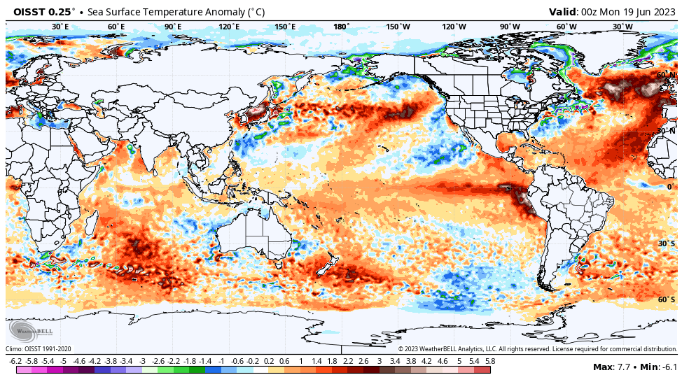
We will have more on that risk later. Has this active weather pattern been part of the bigger El Niño picture? Our members have access to the latest post discussing the state of things: