Denver weather: Active thunderstorm days ahead, Canadian wildfires

Wednesday is relatively quiet as compared to the next two days when we will see an increase in thunderstorms and some could be severe. If you've been needed a rain to help the landscape, you may have just that.
Considering the wet spring, there are a lot of wildfire fuels that are drying out leading to the fire danger across western Colorado. The Spring Creek Fire is burning northeast of Grand Junction. Here's a satellite perspective on the smoke as that fire grew (estimates of 3,000 acres as of this post).
Evolution of Spring Creek Fire and smoke plume in western Colorado yesterday observed by GOES-West 1-min Geocolor+Fire Imagery. #cowx pic.twitter.com/NkenN9pMYo
— Bill Line (@bill_line) June 27, 2023
We'll have more on the wildfire smoke and air quality in a moment.
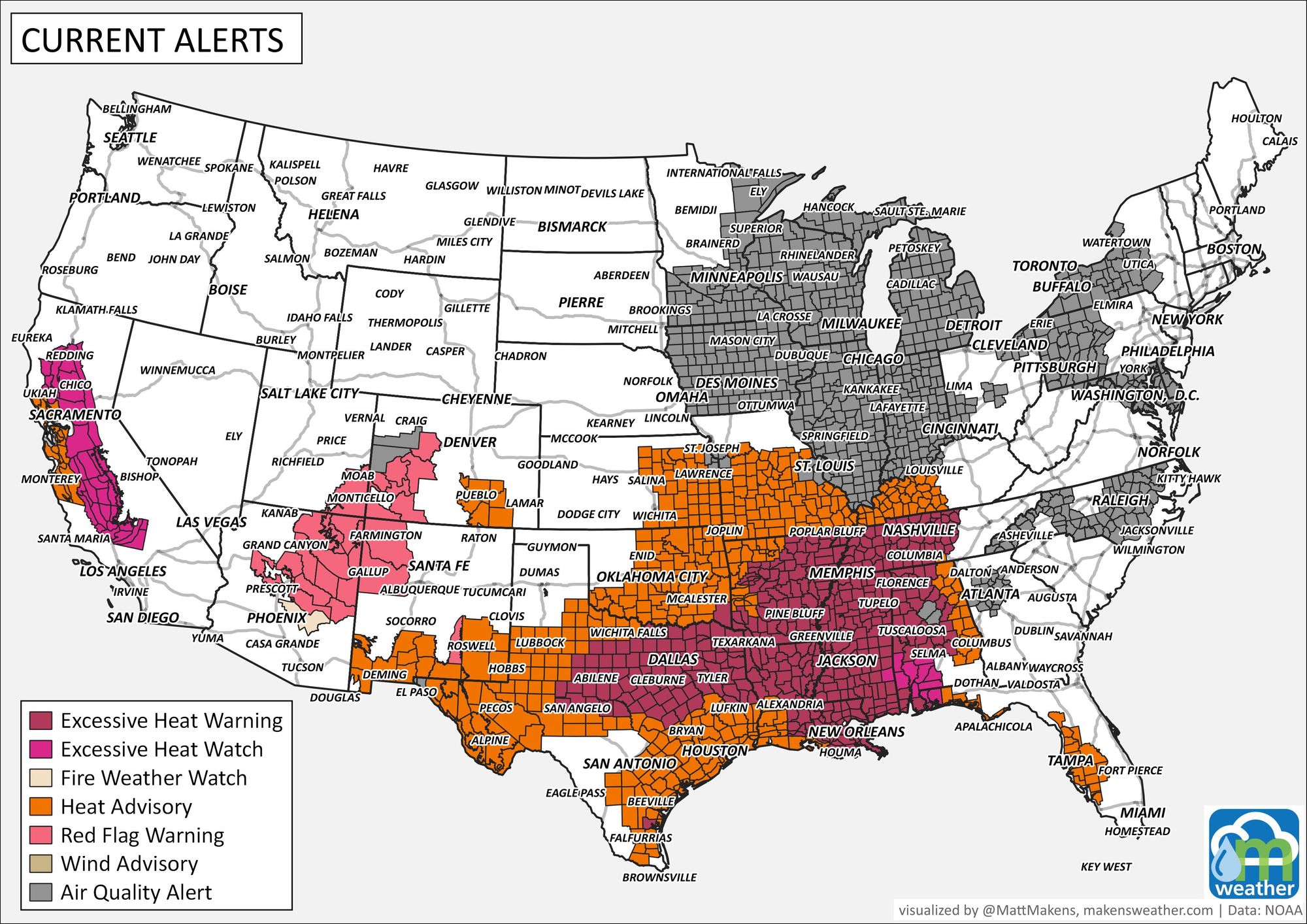
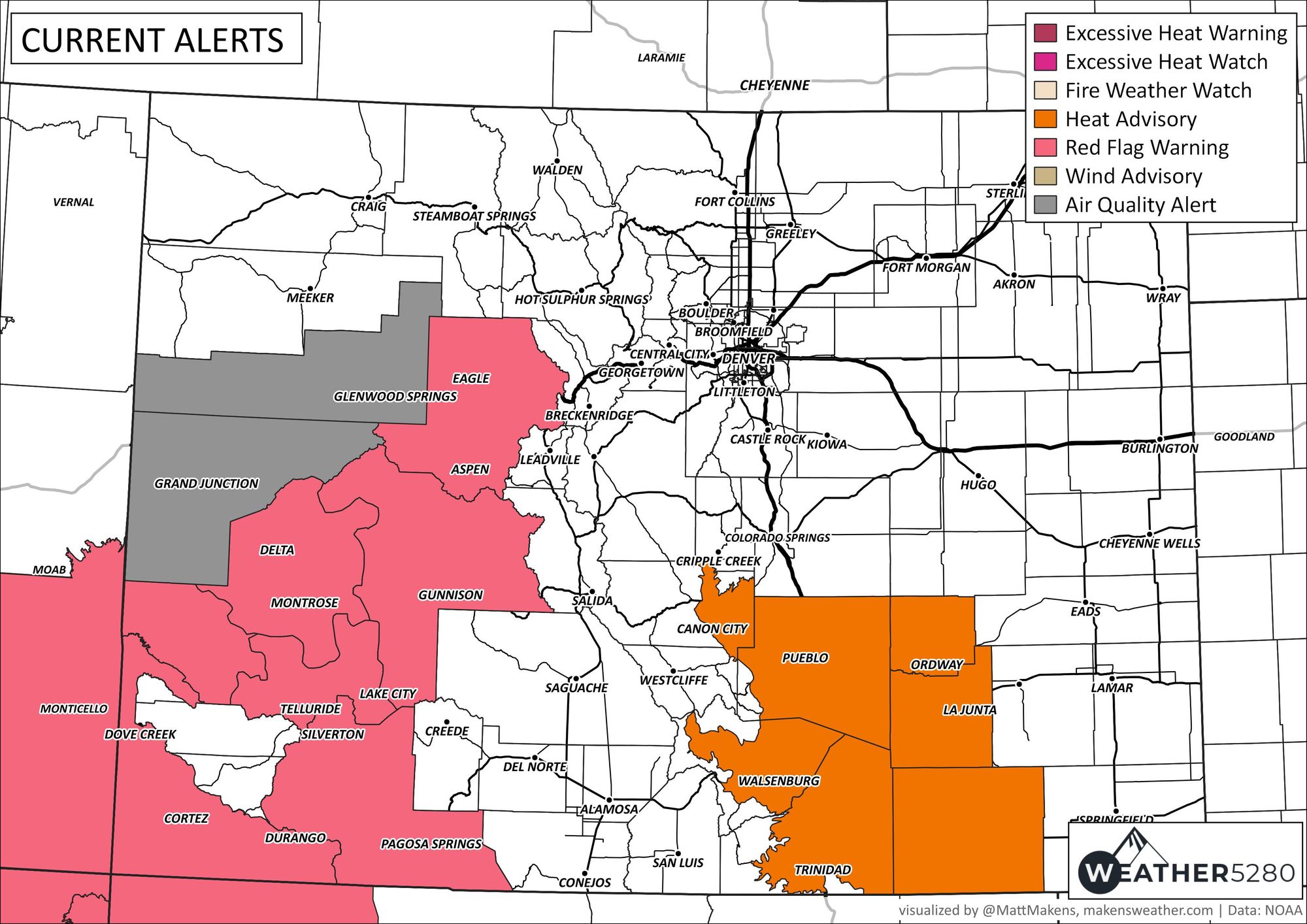
Considering we've heated up as well as dried out, the active alerts across the state this morning are all heat/fire related.
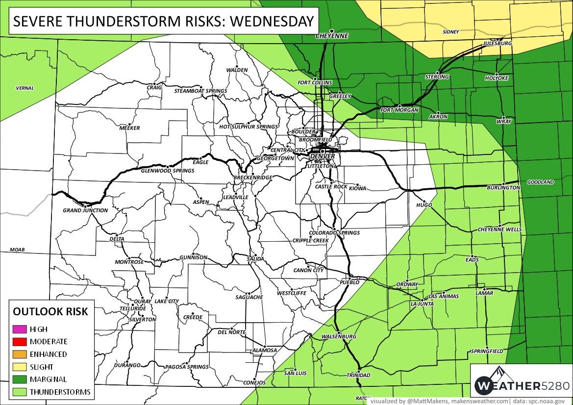
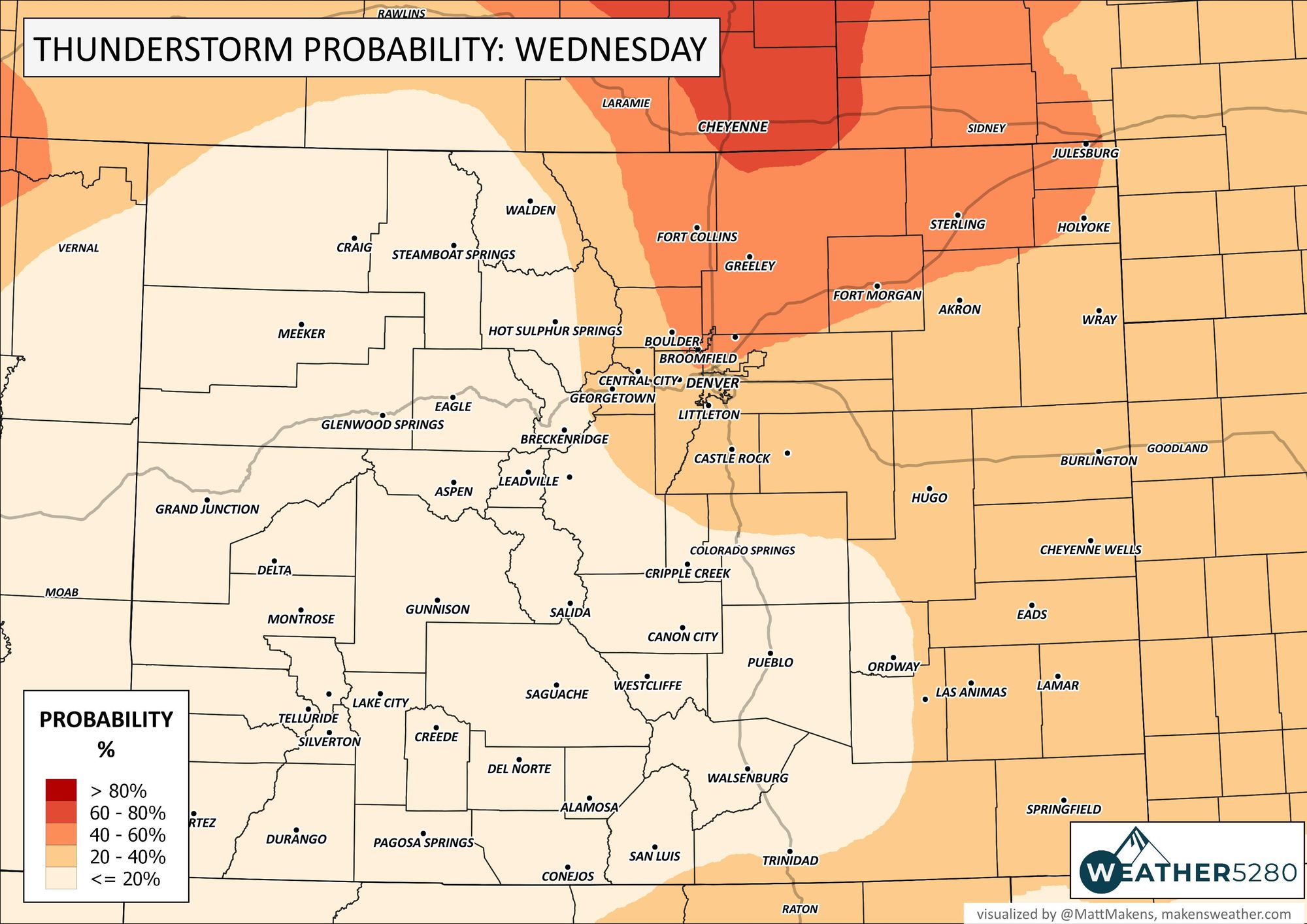
But, for those seeking rain - for today, the thunderstorm chances are highest across Wyoming and Northern Colorado. This map shows the chances, but really represents the chance for storms through Thursday morning, not just Wednesday alone.
And the severe weather threat level to the region today:

For Thursday, numerous storms are expected and this is potentially the busiest severe weather day before the strongest storms drift southeast away from the area Friday; however, a number of storms remain for Friday - it is the strongest of them that will drift southeast.
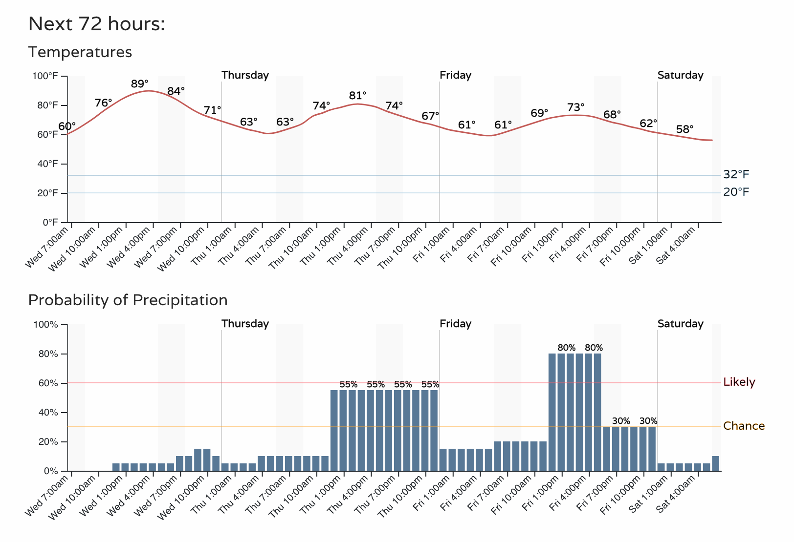
Putting those three days together, here's the hourly planner through Friday:
We'll have more on storm risks for Thursday and Friday in future posts. Now, let's revisit wildfire smoke and air quality.
There will be a lot of headlines about air quality and smoke from the Midwest to the Northeast - these areas are still impacted by thick smoke from Canada (some of that smoke is covering Europe!), plus additional fires in the US are also contributing.
Here's an animation of the smoke followed by an alert map showing the extent of this hot/smoky pattern.
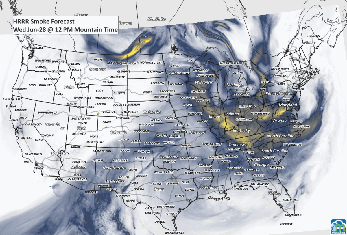
Notice, Colorado has some air quality issues from other fires including our own. Here's the alert map again on a big scale to see the magnitude of this hot/smoky pattern the country is in currently.