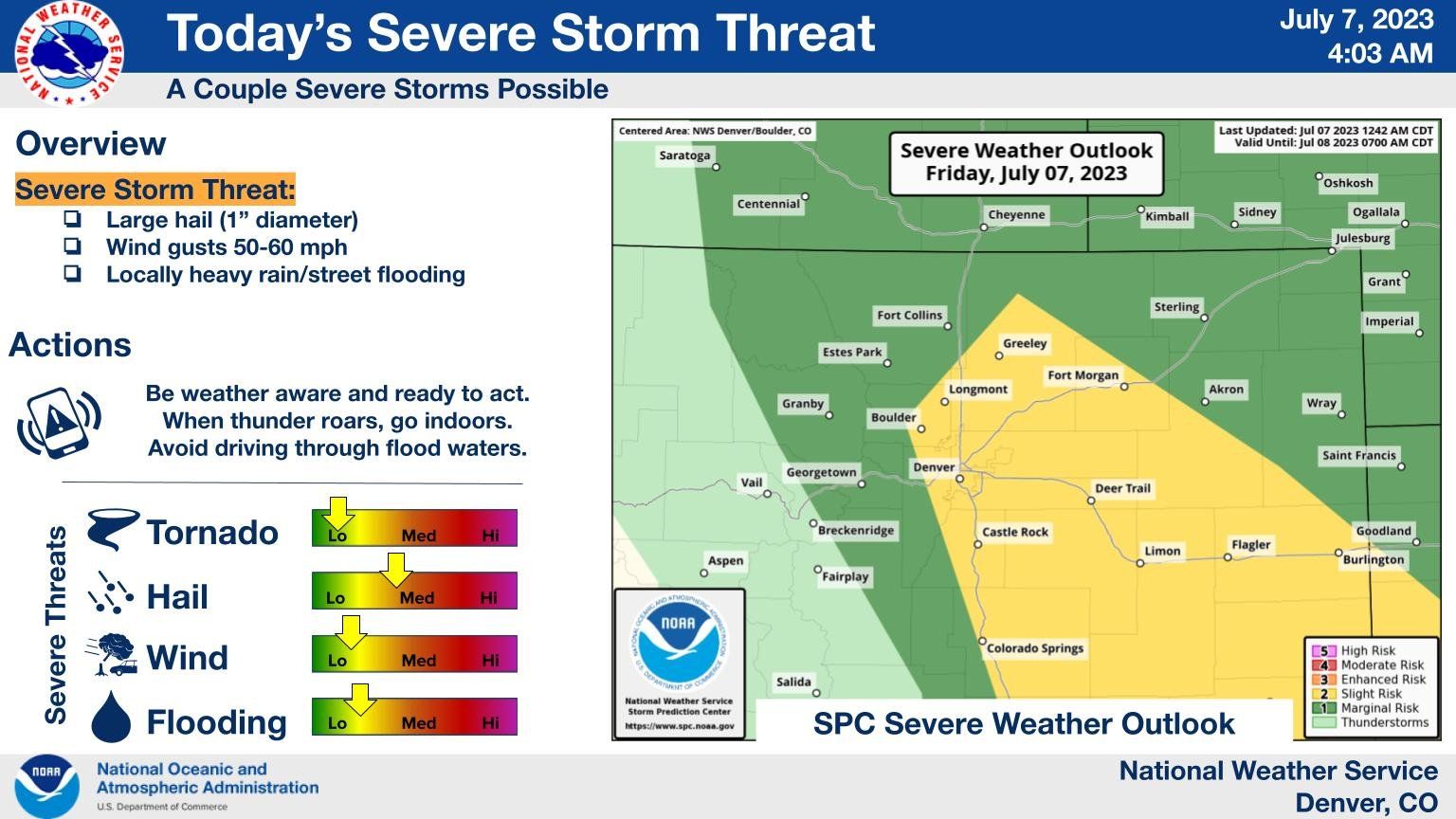
Colorado weather: Friday's severe weather outlook and weekend forecast

Yesterday's severe weather was focused over eastern and southeastern Colorado. Some locally heavy rain was observed along the northern urban corridor, but no severe storm warnings were issued.
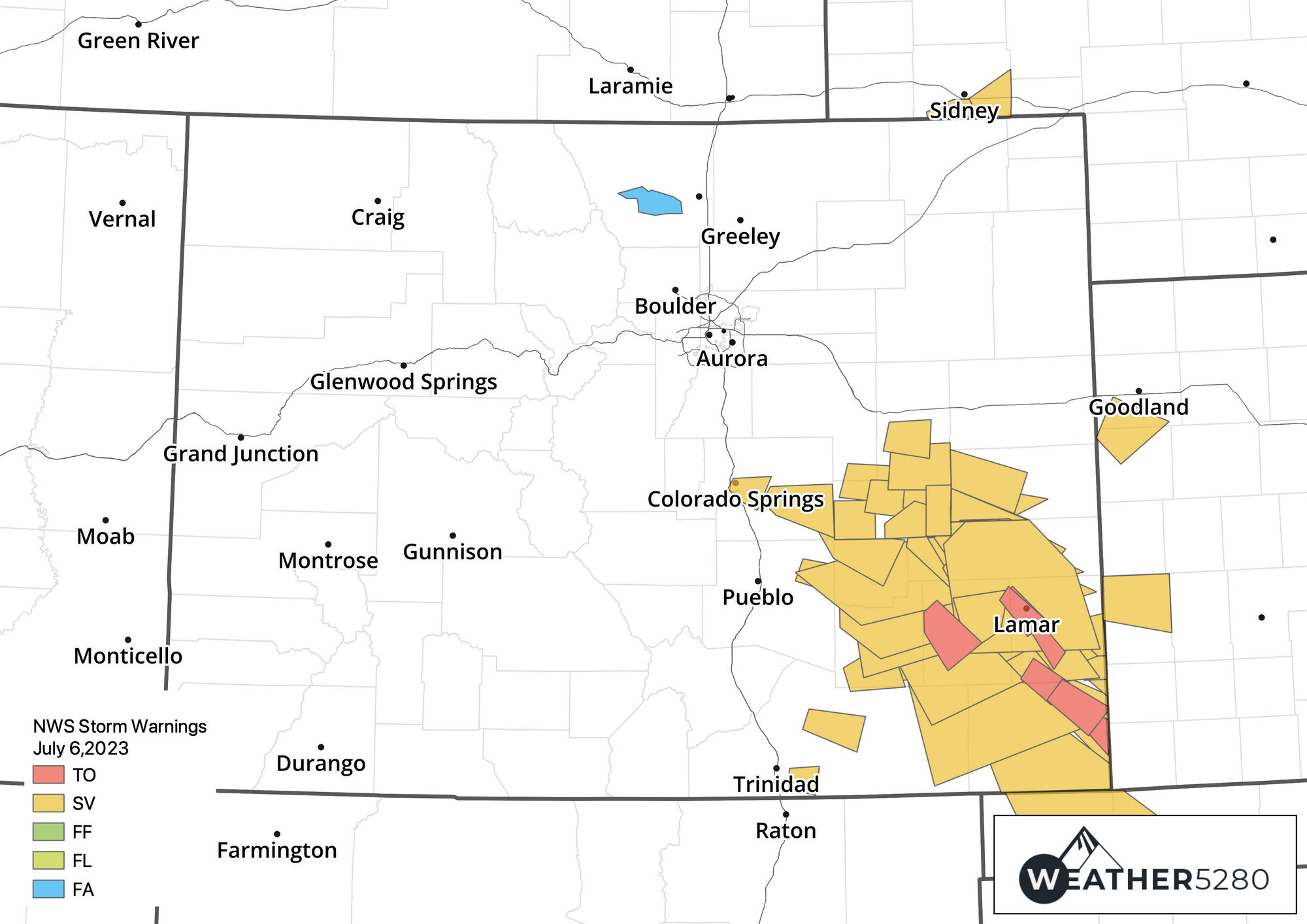
While a landspout tornado was observed north of Watkins, all storm-based warnings issued Thursday were focused over the southeastern part of the state which had a very active evening. Below is a look at the warnings issued Thursday by the NWS:
And the landspout tornado east of Denver:
Landspout looking north of I-70 0.5 mi N of Watkins at. 356 PM @NWSBoulder @BianchiWeather @weather5280 pic.twitter.com/czYPouVXF2
— Noah Brauer (@NOAABrauer) July 6, 2023
Brief landspout just west of the Spaceport earlier at approximately 3:54pm @NWSBoulder #cowx pic.twitter.com/bSx1SjLsPF
— Zach Hiris (@ZachHiris) July 6, 2023
Across Southeast Colorado hail was a big issue, as well as several other reported tornadoes. Here's a look at baseball size hail north of Haswell, CO on Thursday:
Baseball size hail 8 miles north of Haswell, courtesy of Michael Zimmerman #cowx @NWSPueblo @NWSBoulder pic.twitter.com/jQxn1g3WXu
— Brian Bledsoe 🐊 (@BrianBledsoe) July 7, 2023
Rinse and repeat: more severe weather forecast into the weekend
We will continue to see strong storms across eastern Colorado at least through Saturday as the active pattern continues.
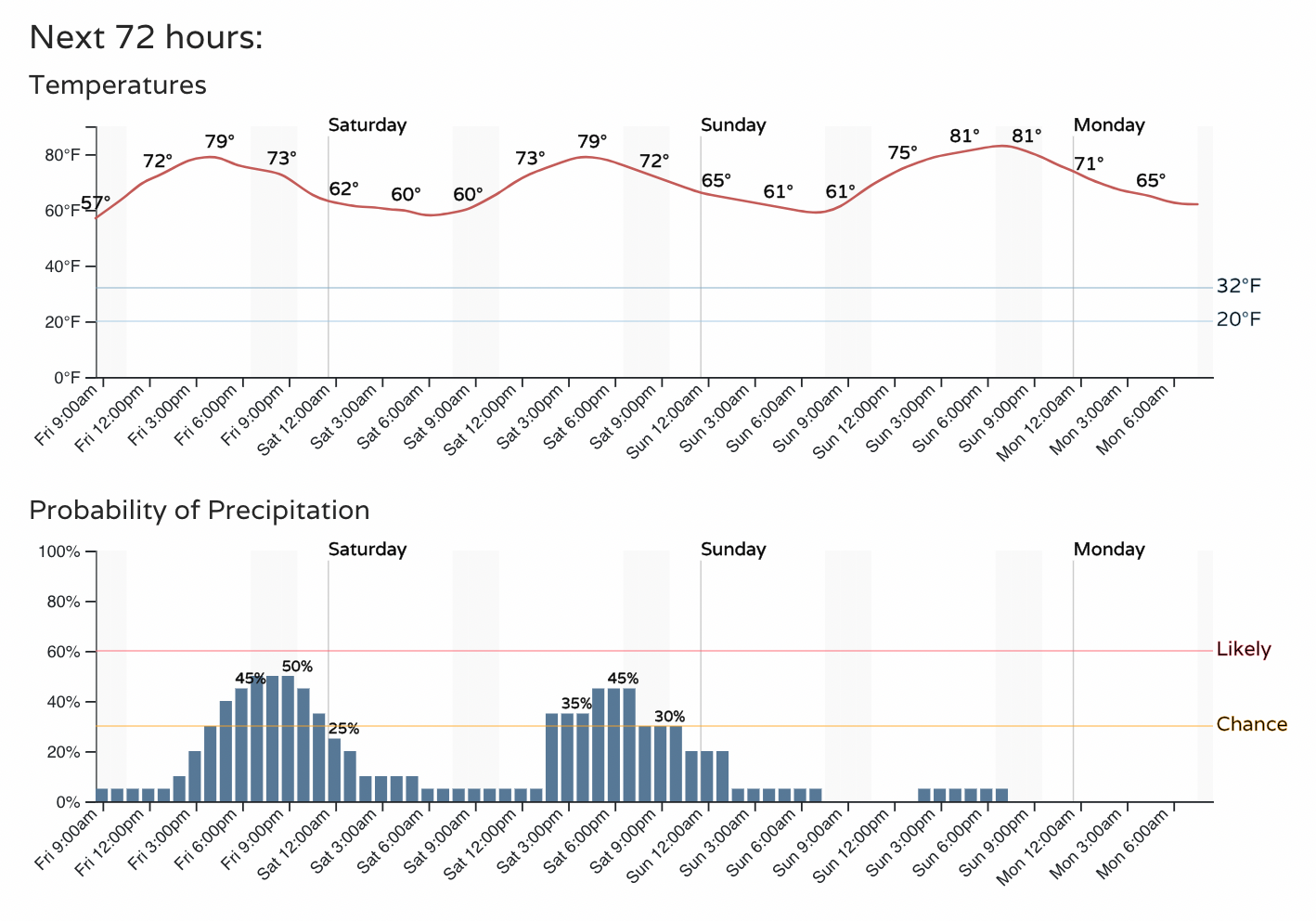
For the urban corridor that equates to about a 40 to 50% chance of storms today and tomorrow before a drier day is expected Sunday. Temperatures will be in the upper 70s to low 80s each of the next three days.
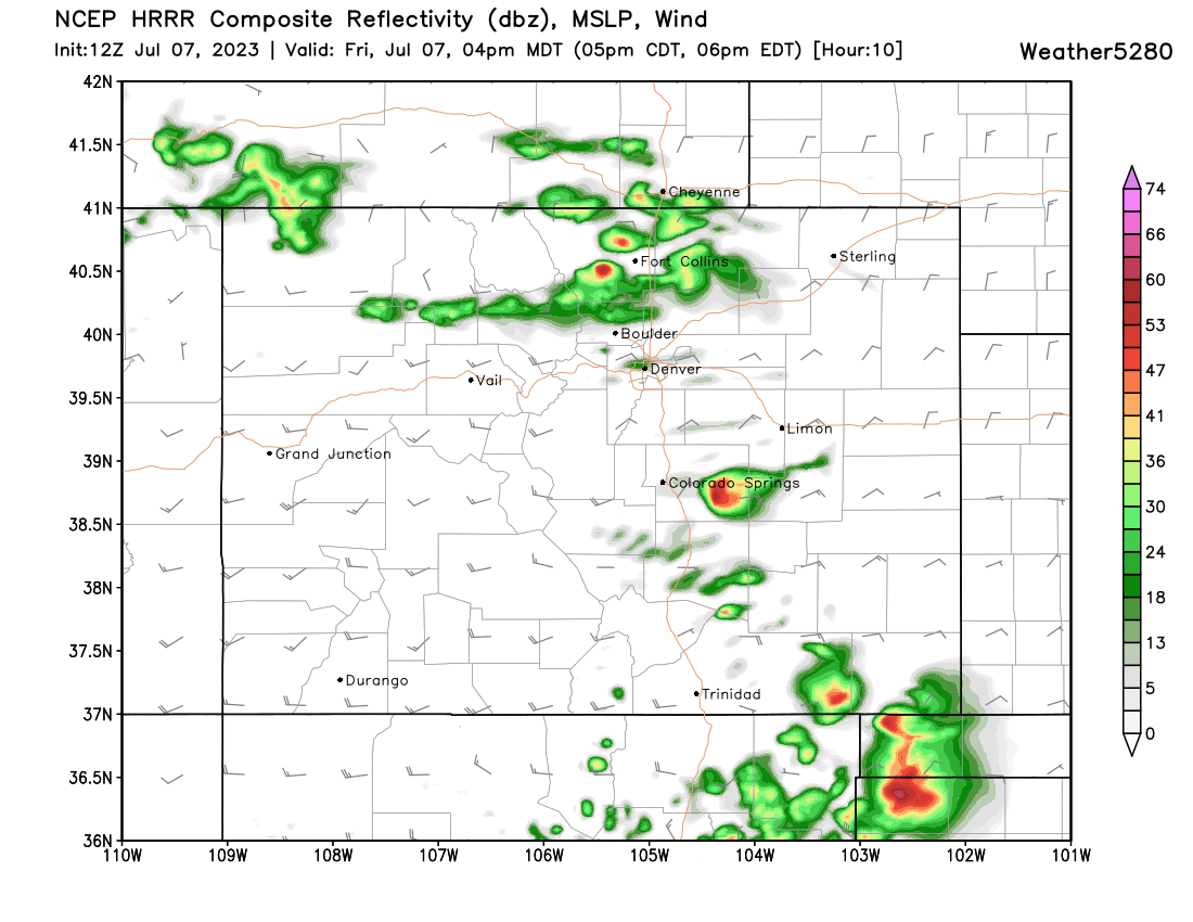
The severe weather threat will be greatest south of Denver, but that does not rule out a severe storm moving through the metro area this afternoon. Look for gusty winds, hail, and locally heavy rain to be the primary threat from today's storms.
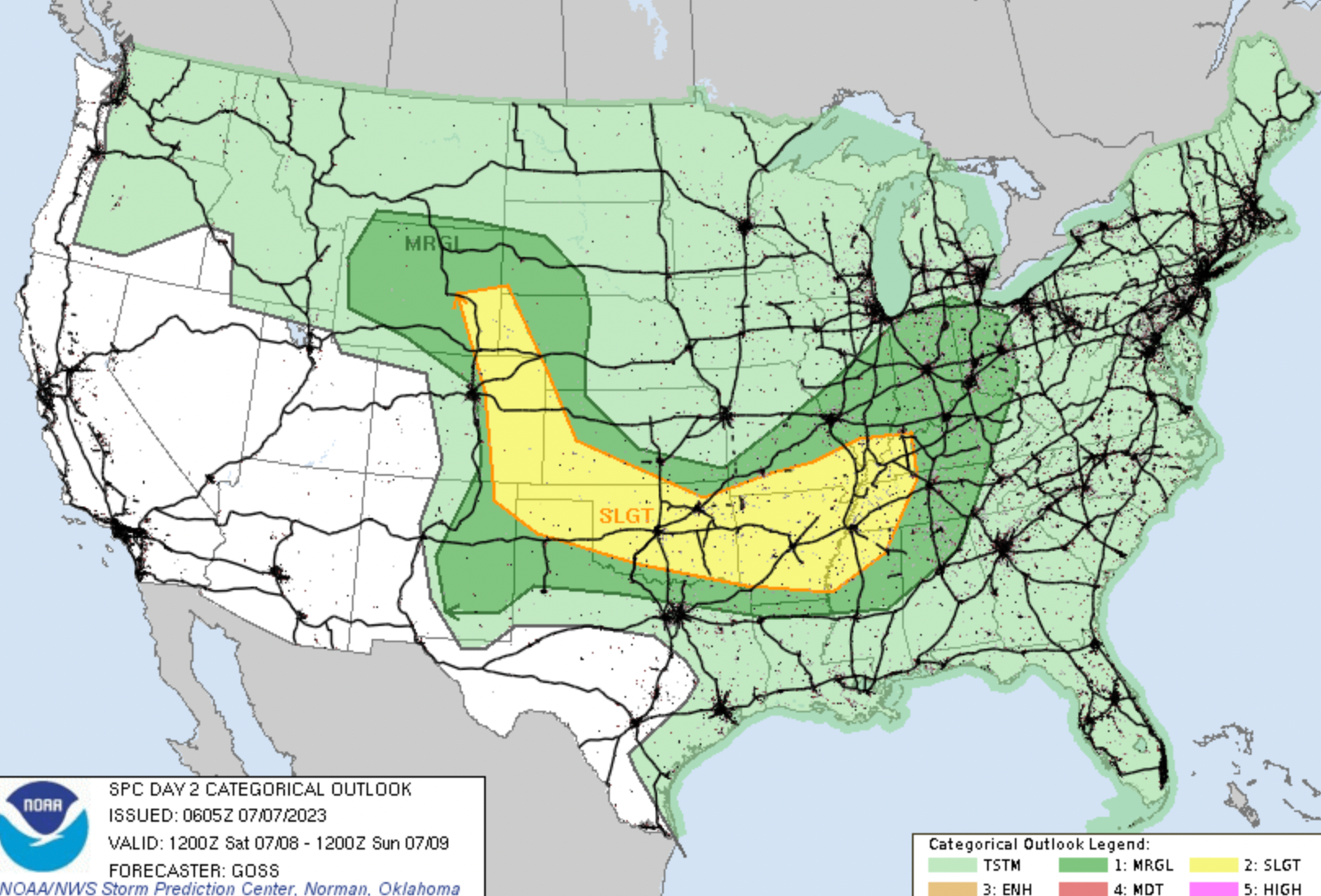
The severe threat Saturday may nudge a bit eastward, but virtually all of eastern Colorado will once again be under the threat of severe storms Saturday afternoon.
In short, remain weather aware as we end the week and head into the weekend. It looks like Sunday will feature a lower storm chance than we will have seen in many days – but as is always the case with summer storms, best to stay on top of the forecast in case that changes.