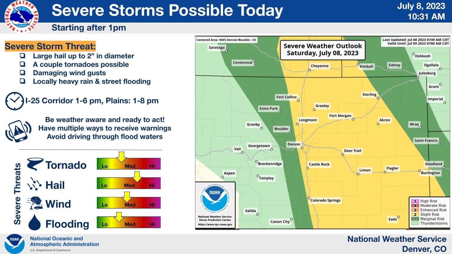
For Denver and Eastern Colorado, another round of severe storms in the forecast Saturday

Another day and another round of severe storms forecast to roll across Eastern Colorado this afternoon. Some of those could turn severe, with damaging wind, hail, a tornado and locally heavy rain all a possibility with storms that develop later today.
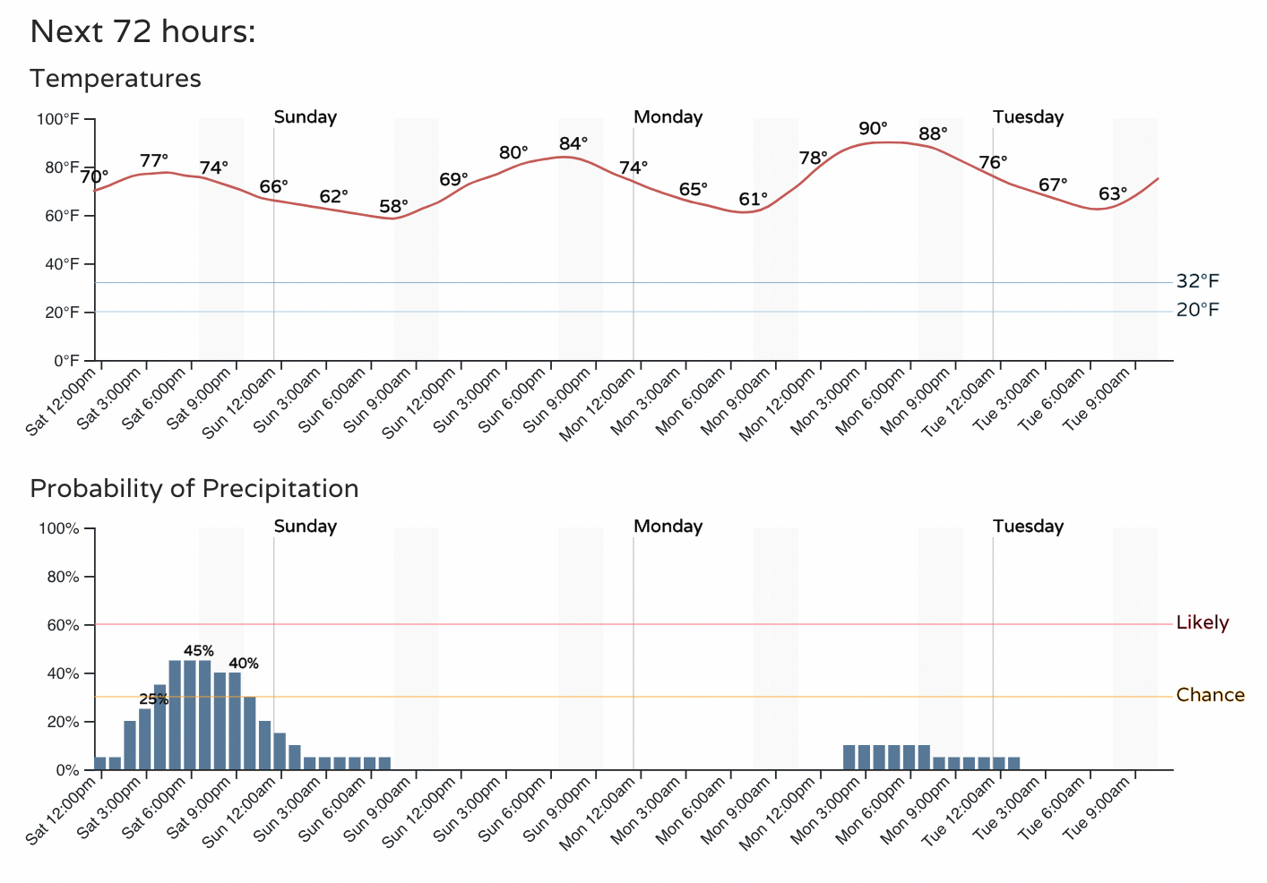
For the Denver area, look for highs to top out in the upper 70s to near 80°F, with about a 40 to 50% chance of storms by mid to late afternoon. Storm chances decrease tonight, and will remain on the low side Sunday.
The threat for severe weather covers most of eastern Colorado today, including the urban corridor. Hail will be the greatest threat from storms that develop this afternoon, but the SPC has the Denver area in the 2% tornado risk as well. The area in yellow below indicates those areas with the greatest chance for seeing storms turn severe today.

Like yesterday, not everyone sees the storms.
The latest HRRR shows storms getting going between noon and 1pm, with cells kicking off up and down the urban corridor at that time.
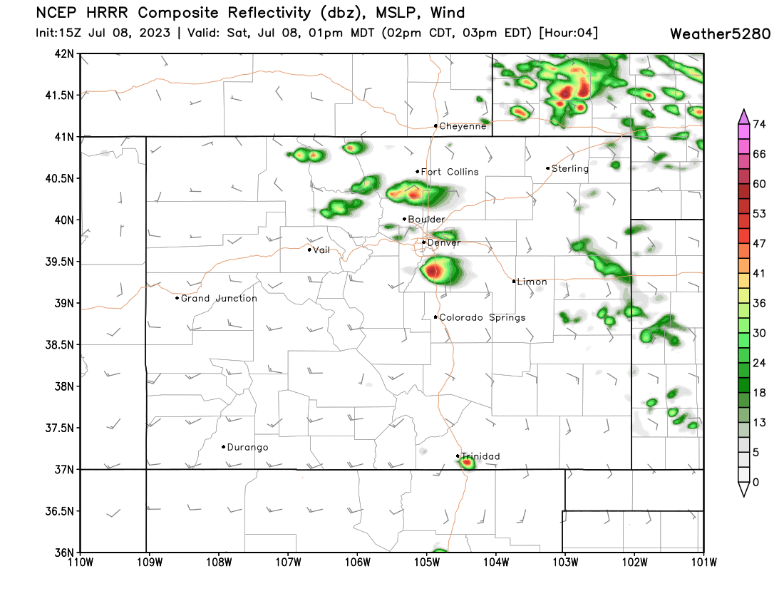
By 4pm we see some strong storms developing across the plains and to the north...
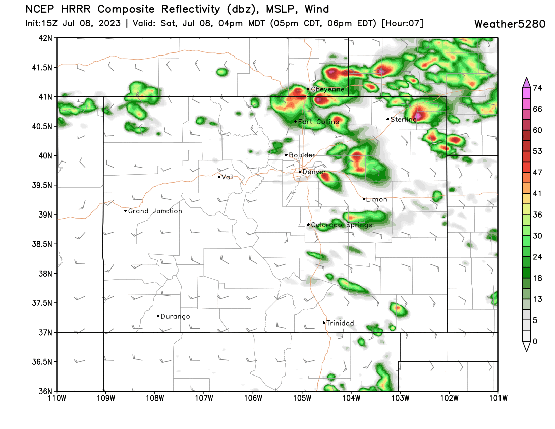
With more storm development continuing into the evening...

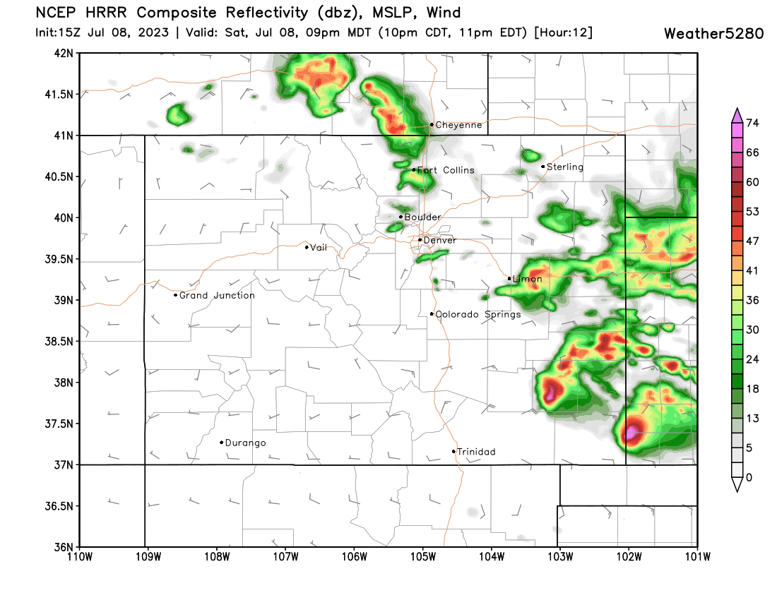
With the strongest storms eventually getting well southeast by 9pm, some of these storms will be quite strong:
We won't be storm-free across eastern Colorado on Sunday, but overall coverage will be lower. The SPC as a Marginal outlook for severe weather on Sunday across the eastern half of the state at this time, with most models showing just isolated storms across the plains Sunday afternoon, and minimal activity for the urban corridor.
