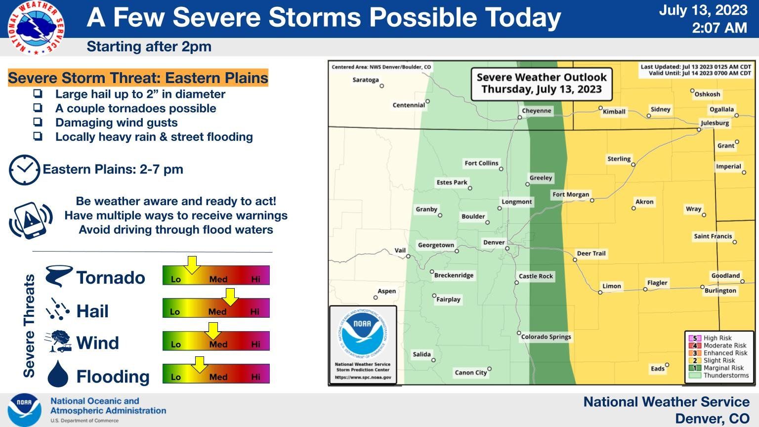
Severe storms possible across the eastern plains of Colorado, isolated storm threat for Denver area

We are tracking a bit better storm chances today across Eastern Colorado, particularly for areas east of the urban corridor. For Fort Collins, Denver, Colorado Springs the storm chance remains on the low side – though we do see a bit of an uptick in those chances today, even for these metro ares.
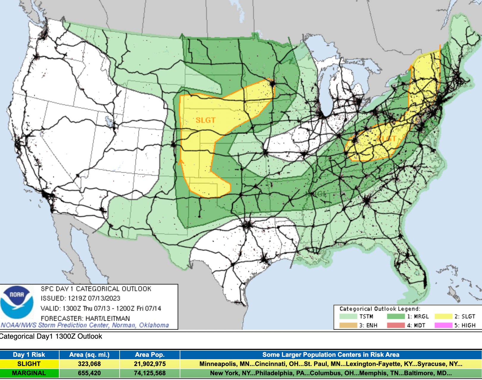
The latest SPC outlook shows that the threat for storms to turn severe will be greatest across the Eastern Plains vs up against the mountains. The great will extend into neighboring states across the central plains as well.
For storms that do develop this afternoon, hail and damaging wind will be primary concerns:
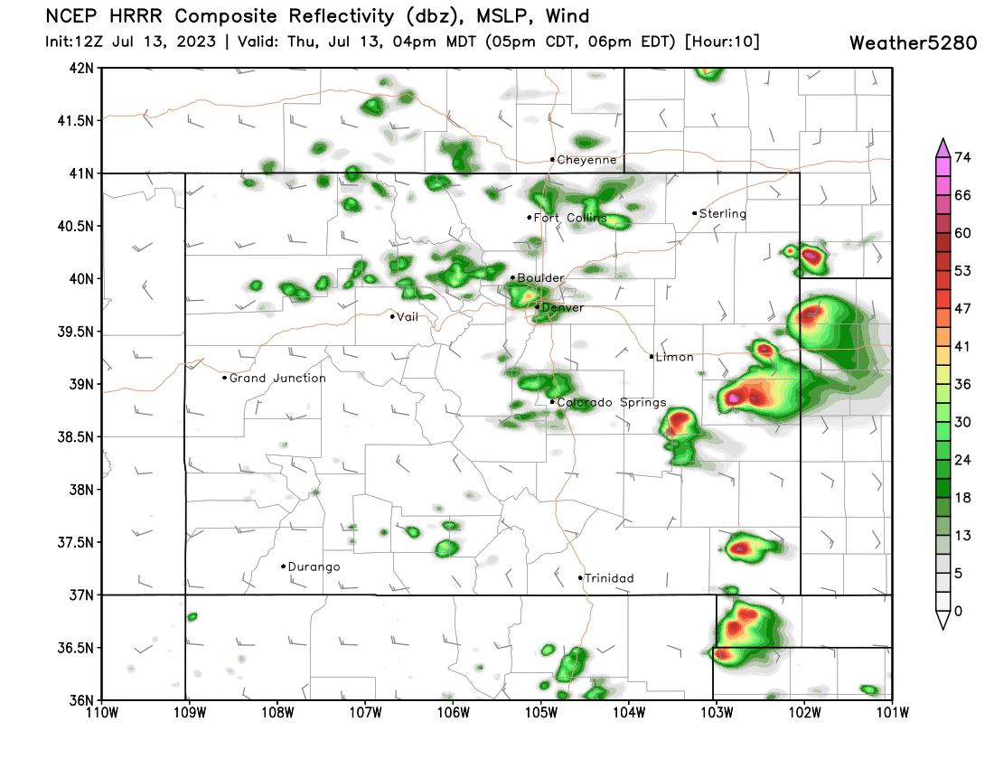
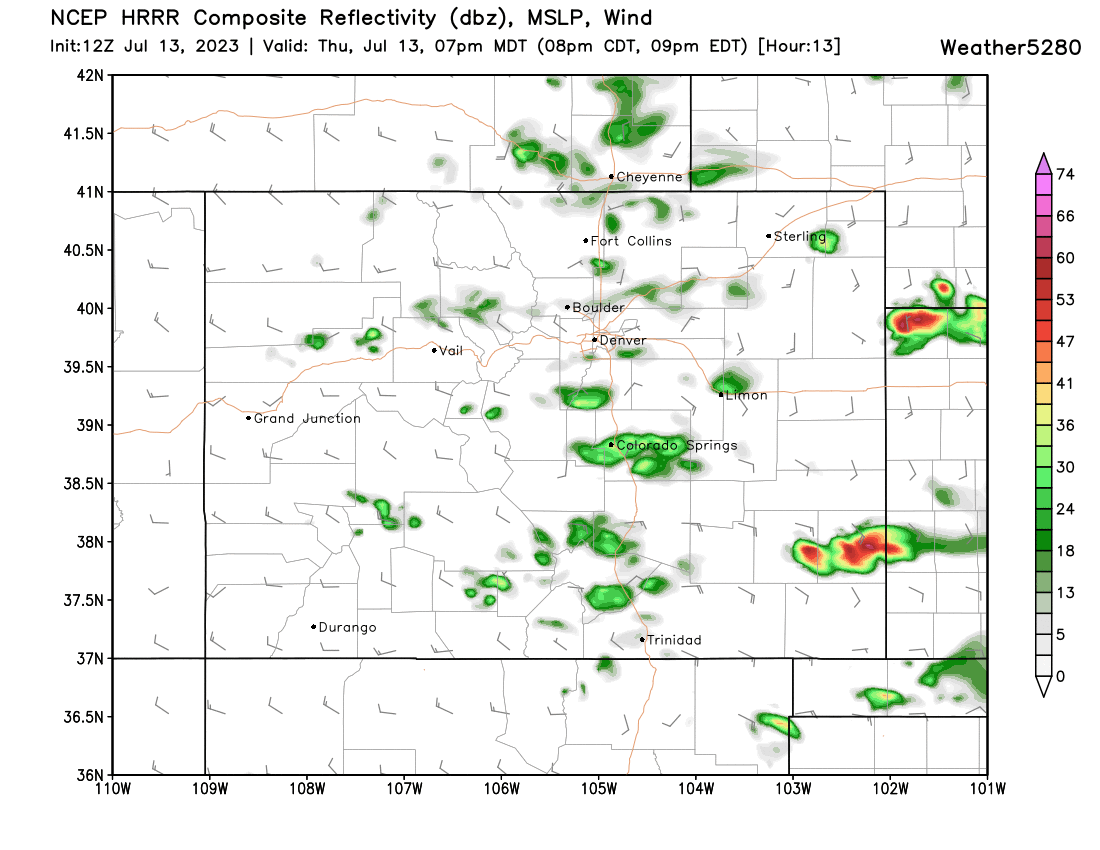
The latest HRRR shows some impressive discrete supercells developing across the far eastern plains by 3 to 4pm this afternoon. Closer to the hills we see some afternoon showers/storms peel off the mountains, but their coverage and intensity is expected to be much more muted.
By 7pm just a few gusty showers for most of us with still a few bigger storms out east:
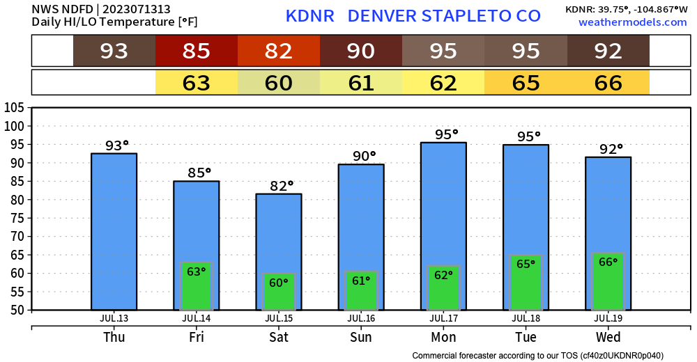
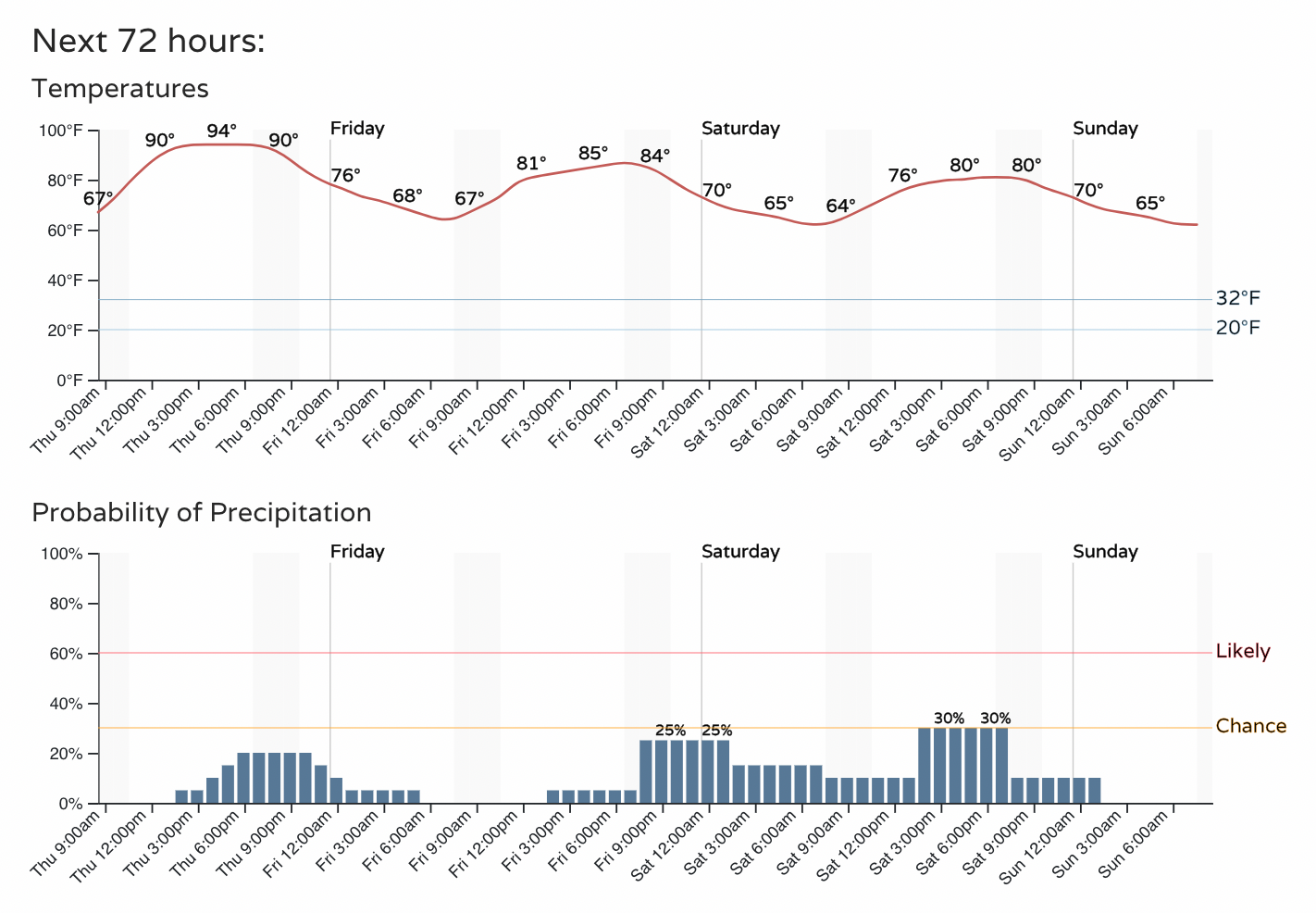
For the Denver area today's weather won't have much of an impact on our hot temperatures. Highs are forecast in the mid 90s with about a 20% chance we'll see a passing shower, perhaps more high-based in nature than anything else:
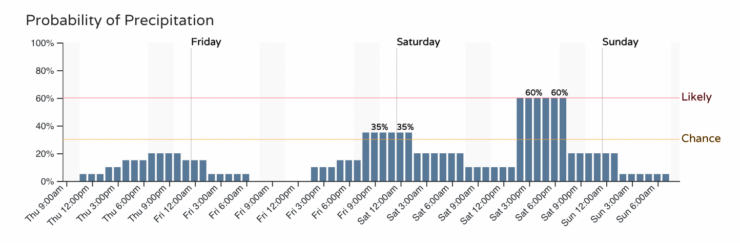
A similar idea for Colorado Springs, where we may actually see a better chance for storms as we head into the weekend:
Good news is, that along with a bit better chance for rain as we end the week/begin the weekend we are still looking at a bit of relief from the heat as we discussed earlier this week. The relief, however, may be short-lived, with highs forecast to quickly climb back into the 90s by perhaps Sunday, or latest early next week. Summer!