Colorado weather: Stormy Thursday for Denver, Eastern Plains; Flood Watch issued

Expect more rounds of storms Thursday after this morning's early morning storms move through as energy moves across Colorado later today. For Denver and Colorado Springs, expect chances of storms with the strongest of which to be severe on the Plains.
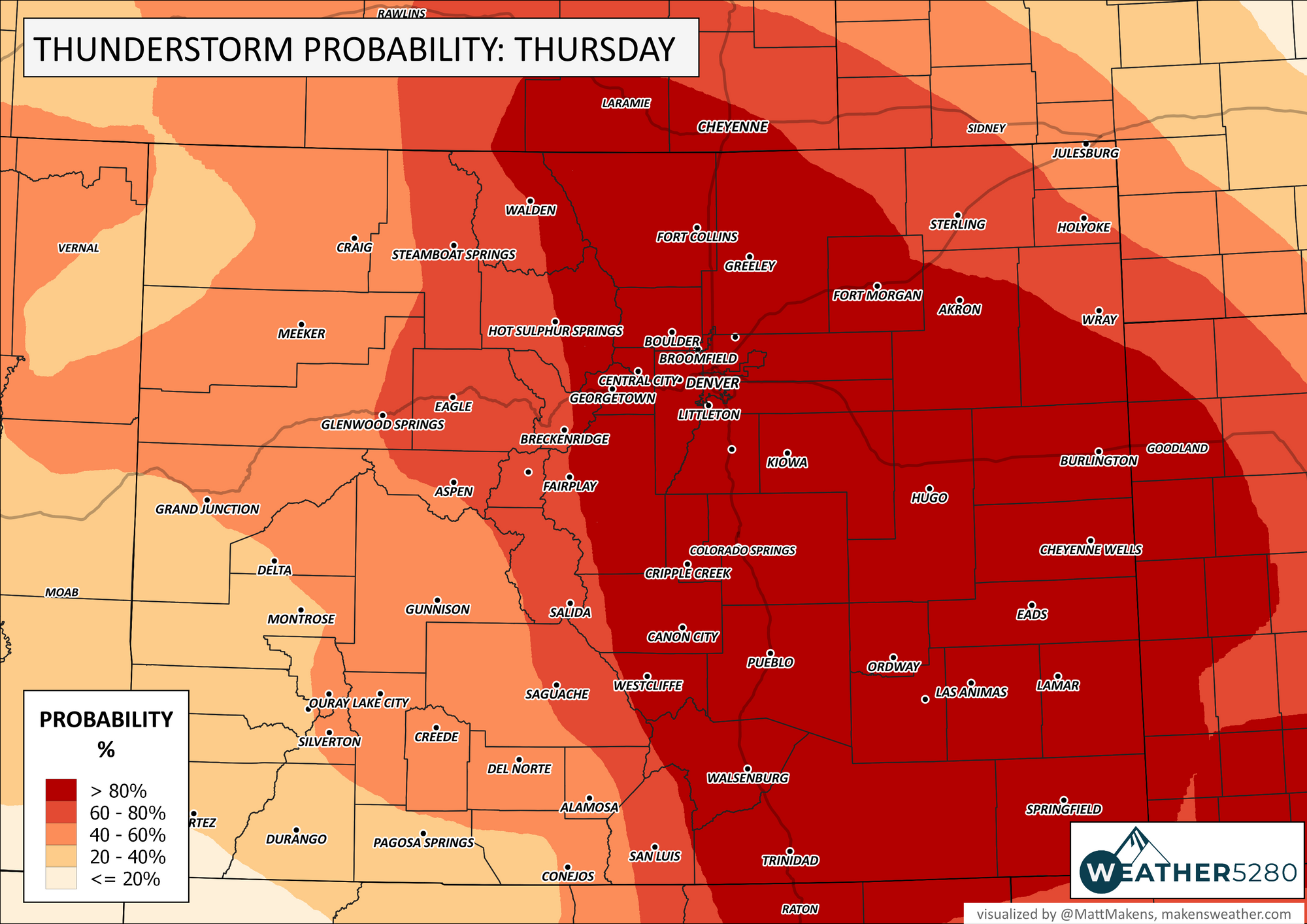
In total, we have a high likelihood for storms today, and the highest chances run through much of the state east of the Divide.
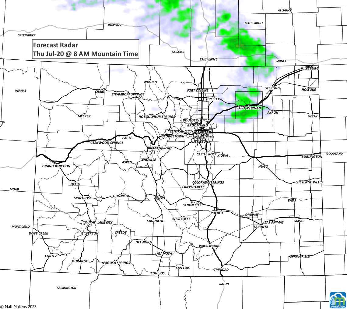
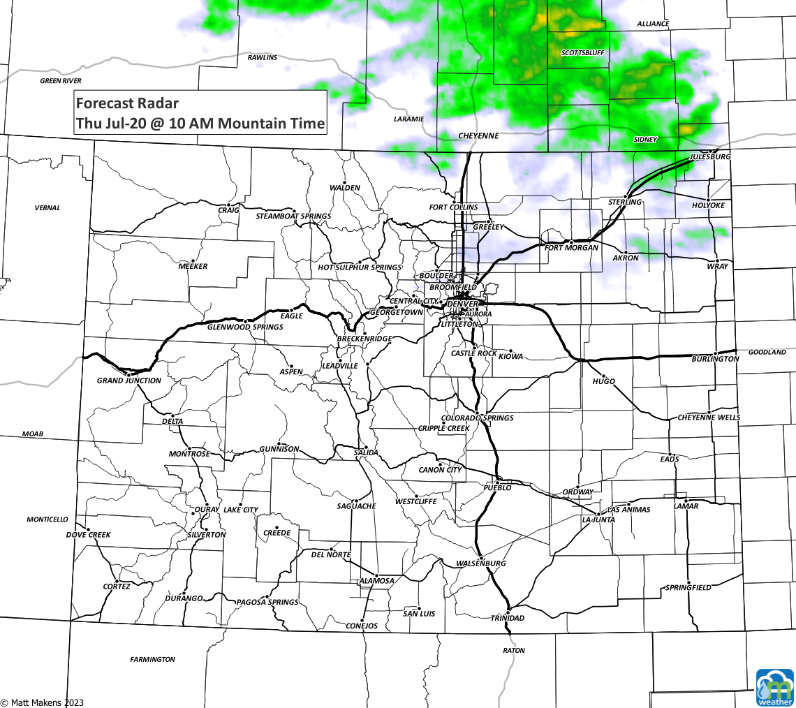
Scattered showers and storms moved across the metro areas early this morning will continue to head east (I picked up just over 0.25" on my Tempest° <enter 'weather5280' at checkout to get 10% off on of those units> and a bit less beside the house in my tipping bucket) . These are just going to give some rain and lightning.
Heavy rain continues rolling east with these early thunderstorms pic.twitter.com/iKzoxC8iKK
— Matt Makens, Makens Weather (@MattMakens) July 20, 2023
Here is a time-series of today's storms from this morning through evening.
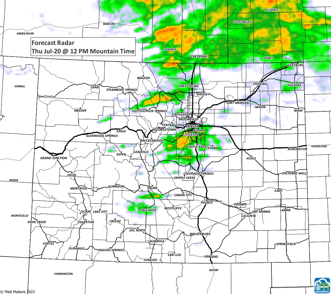
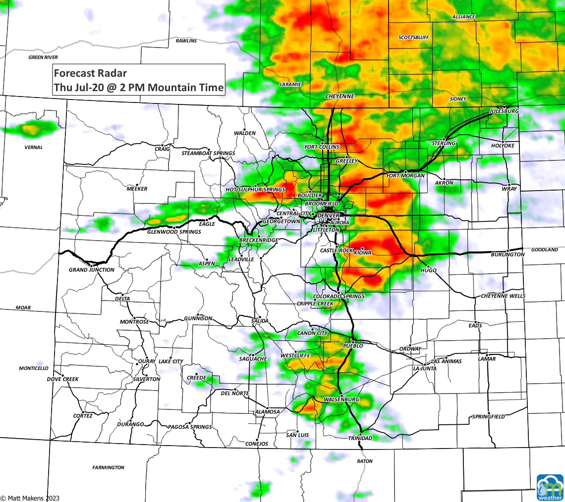
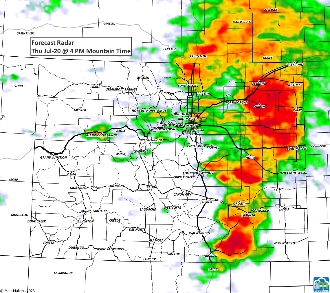
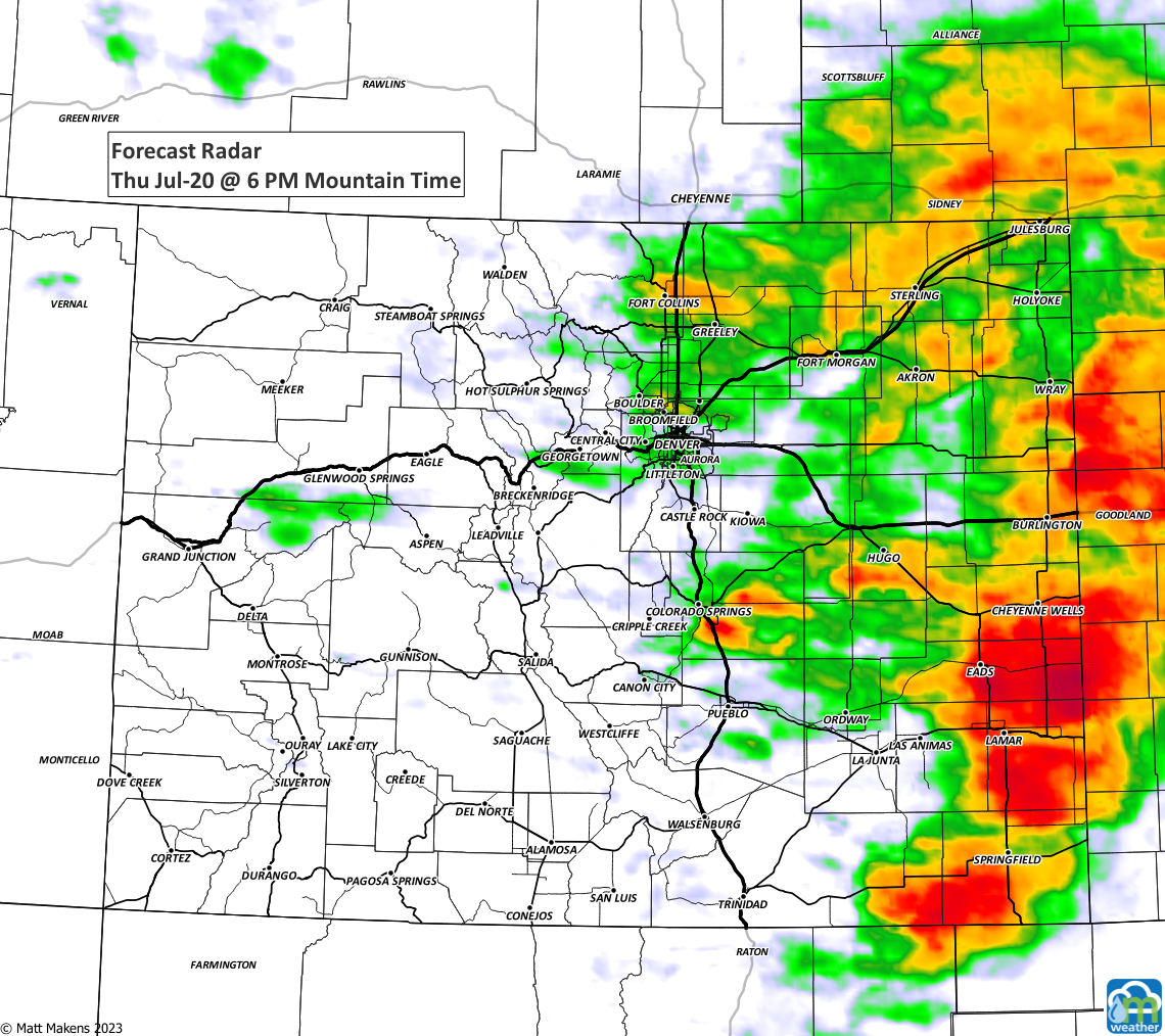
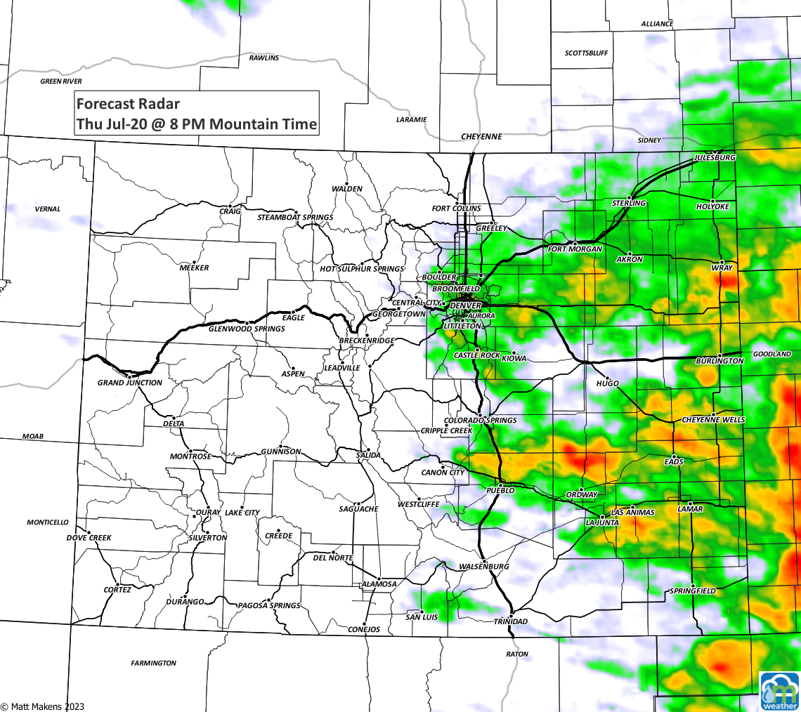
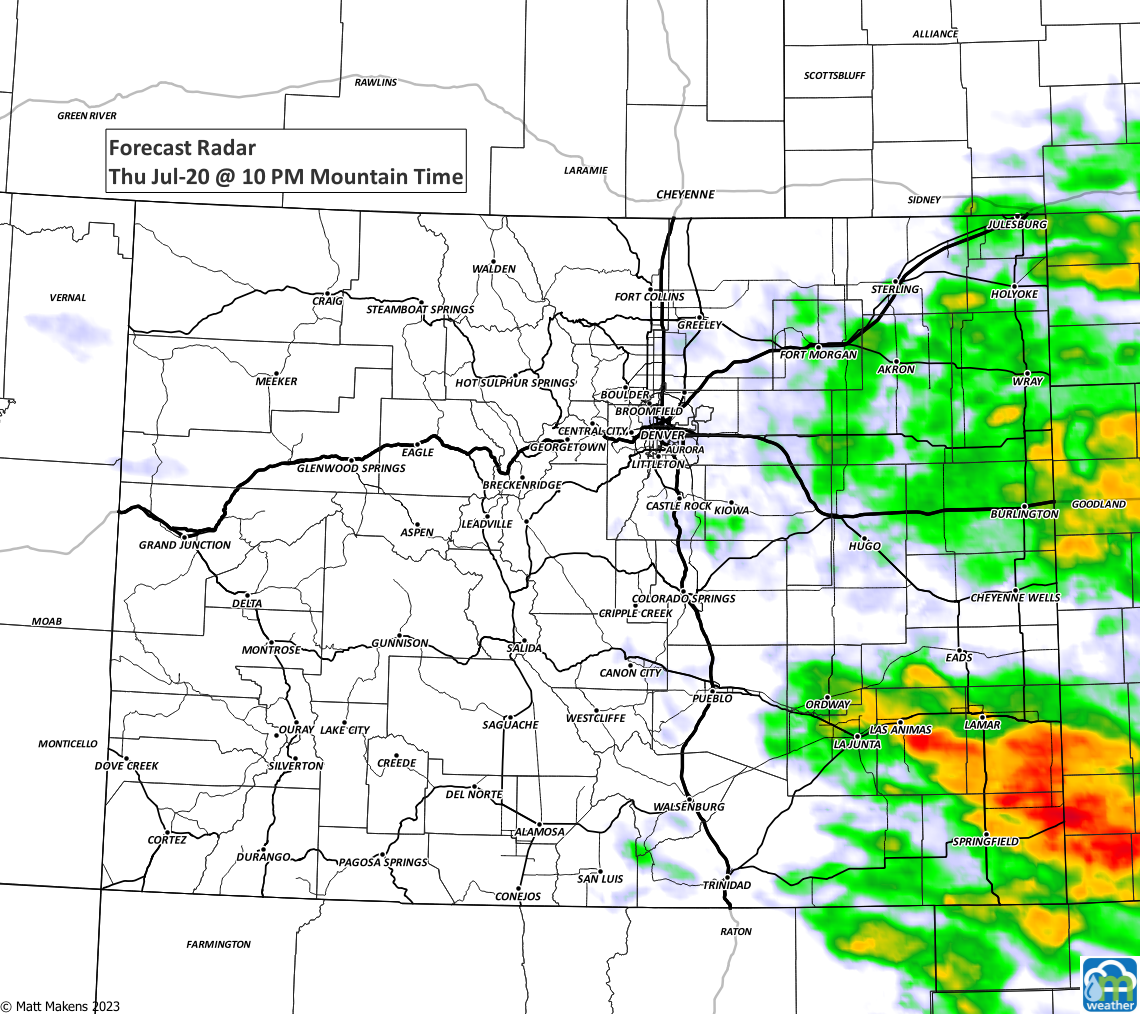
Later today, an area of energy moves across the state. This will create a number of thunderstorms this afternoon and evening. These may become severe across the plains, with hail up to tennis balls, damaging winds, very heavy rain, and isolated tornadoes.
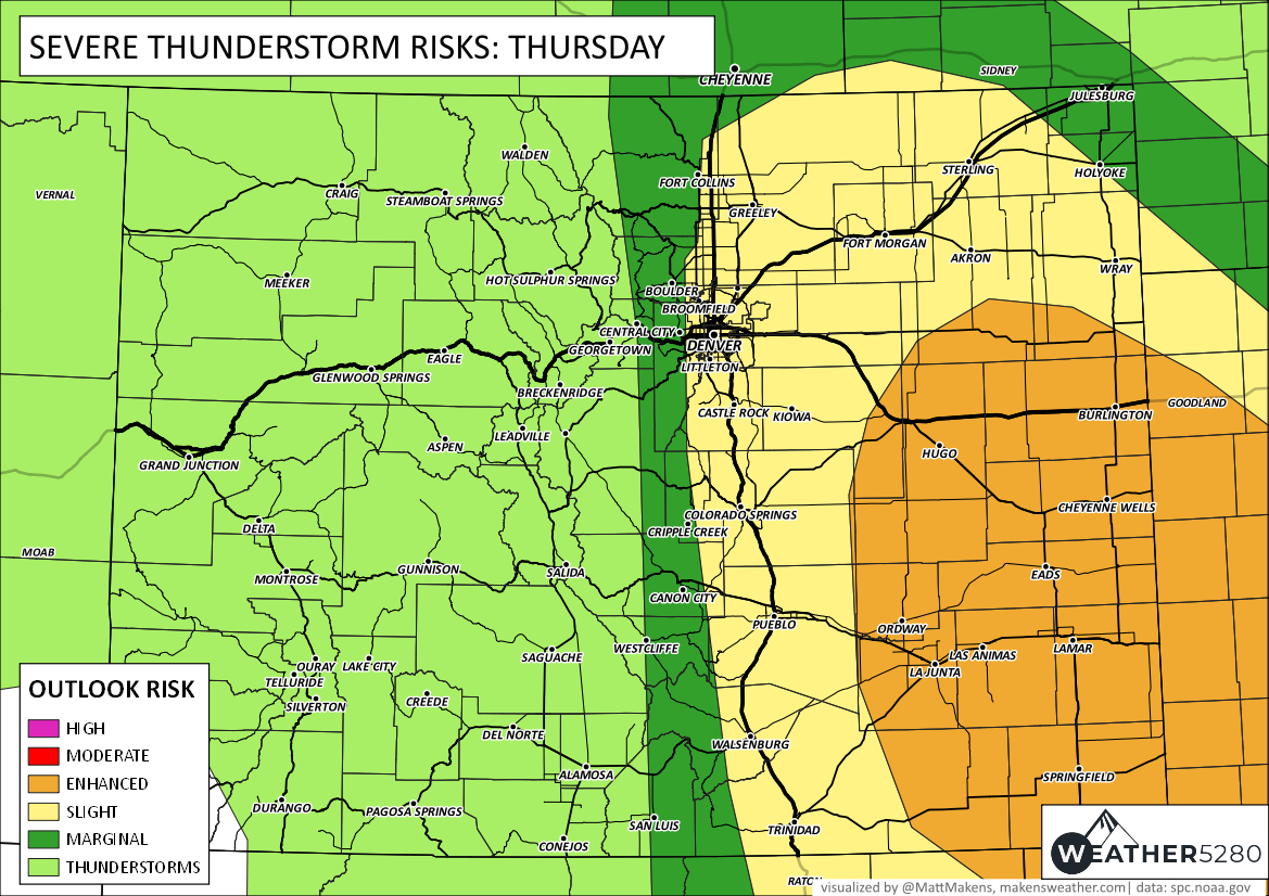
The highest risk area is enhanced for eastern/southeastern parts of the state, though most of the I-25 corridor along the Front Range is at a Slight Risk for severe storms today.
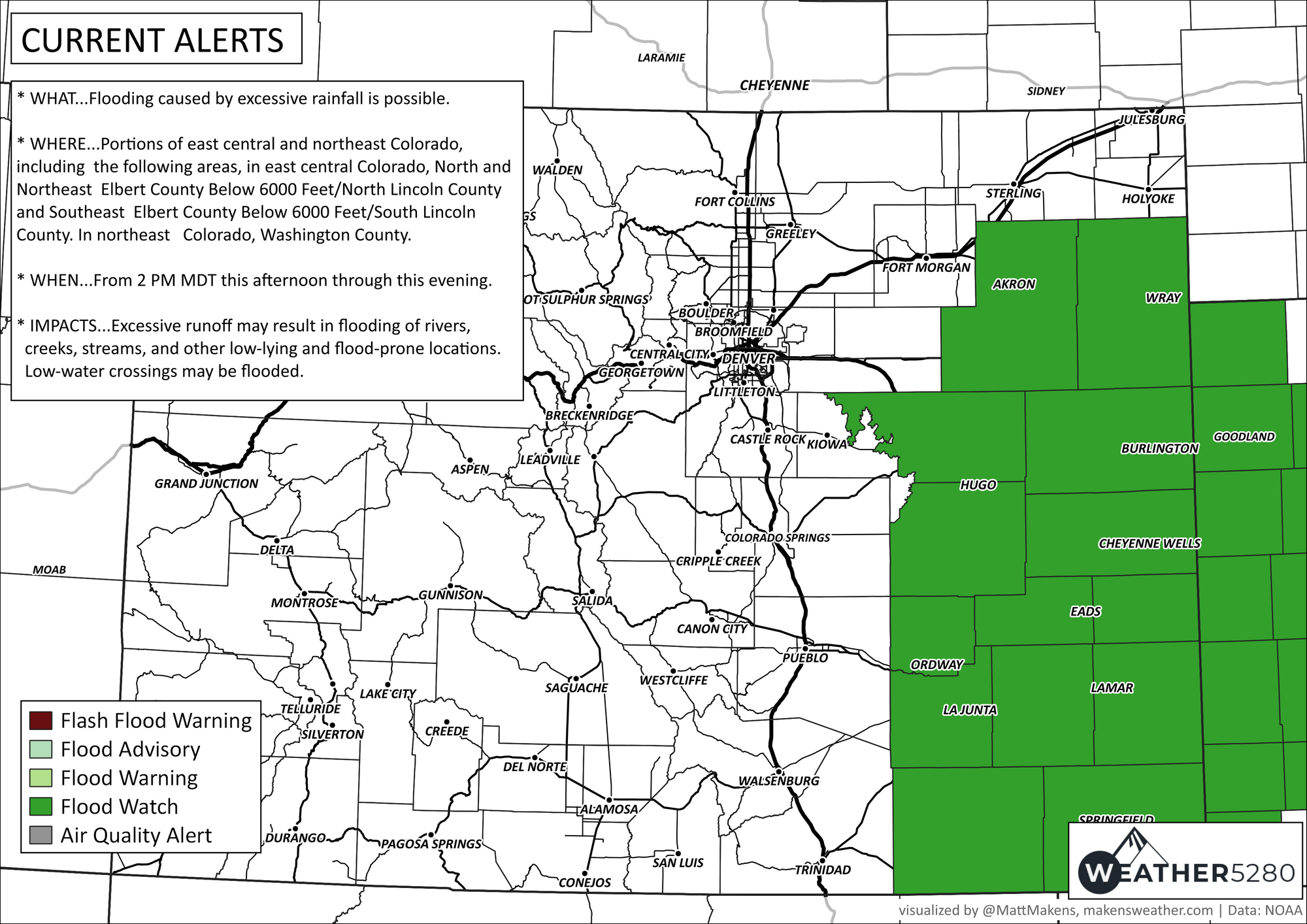
In addition, a flash flood threat is expected over several Plains counties, with a Watch in place for areas east and southeast of Denver:

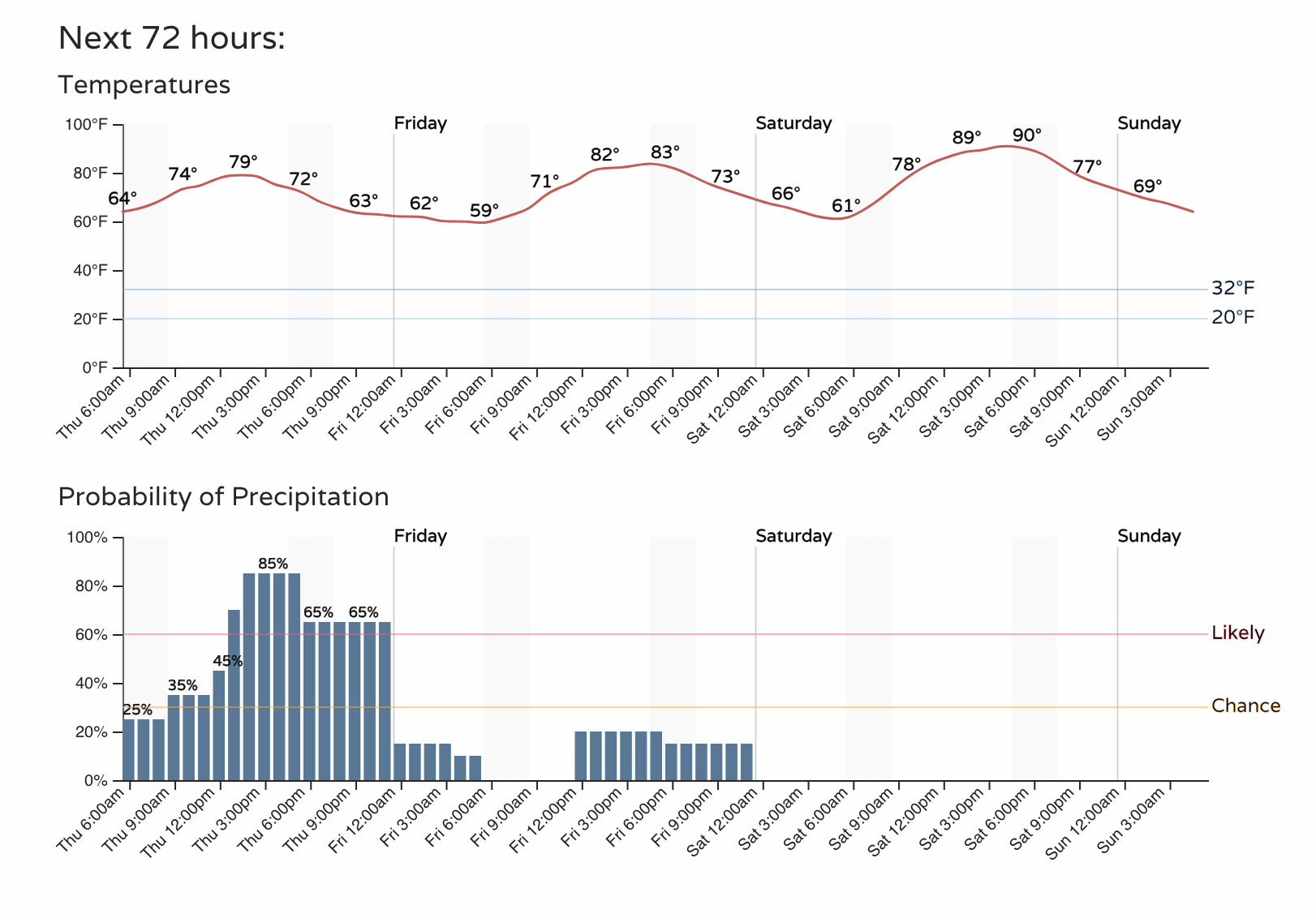
Beyond today, however, the storm chance quickly drops again. Here's a timeline of both precipitation (bottom) and temperatures (top). We'll be getting hot again... soon.
Please keep us posted on the progress of the storms today and if you are seeing hail, wind, flooding, etc. in your area. If you'd like to be getting the "heads up, hey there is a forecast to be aware of" style emails from us, you can sign up for those for free by clicking here.