
Colorado Weather: Summer's heat continues, throw in some thunderstorms

For metro areas, temperatures will run in the 90s. For the higher country, expect 70s to 80s. All-in-all warm weather for the weekend. Throw in some daily thunderstorms in the afternoon and evening and we have a "classic Colorado" weekend.
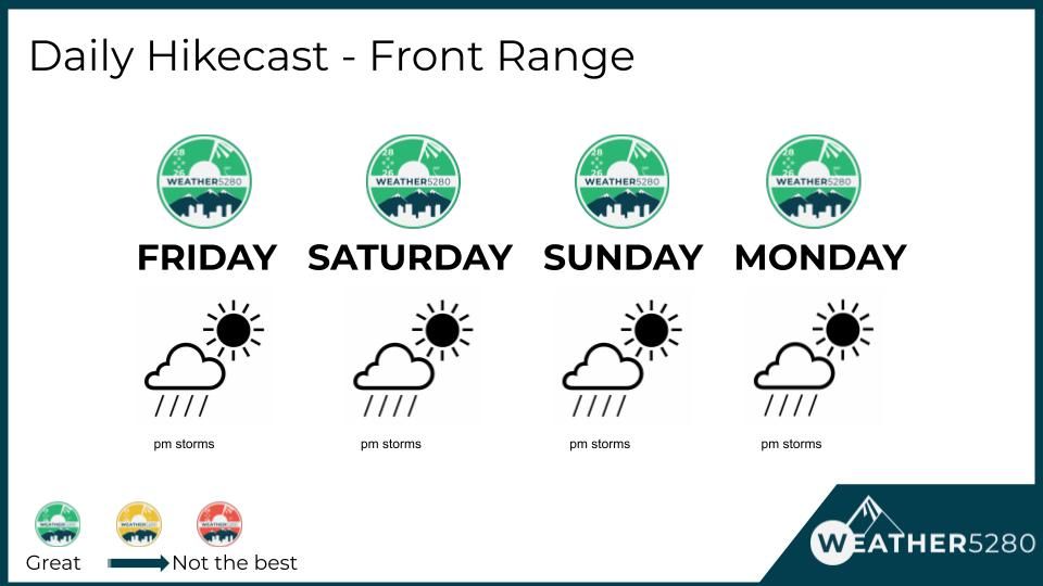
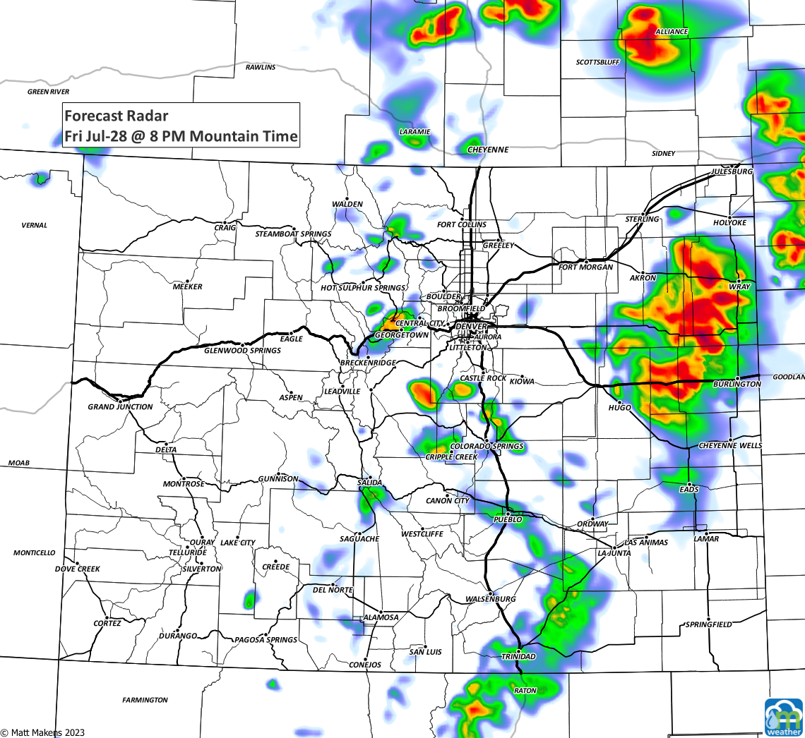
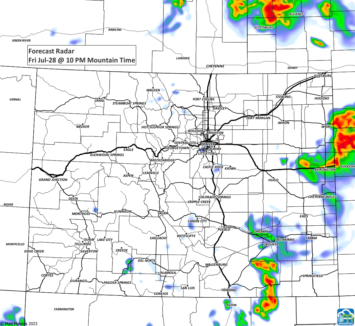
For Friday, we can run through your storm timeline for Colorado.
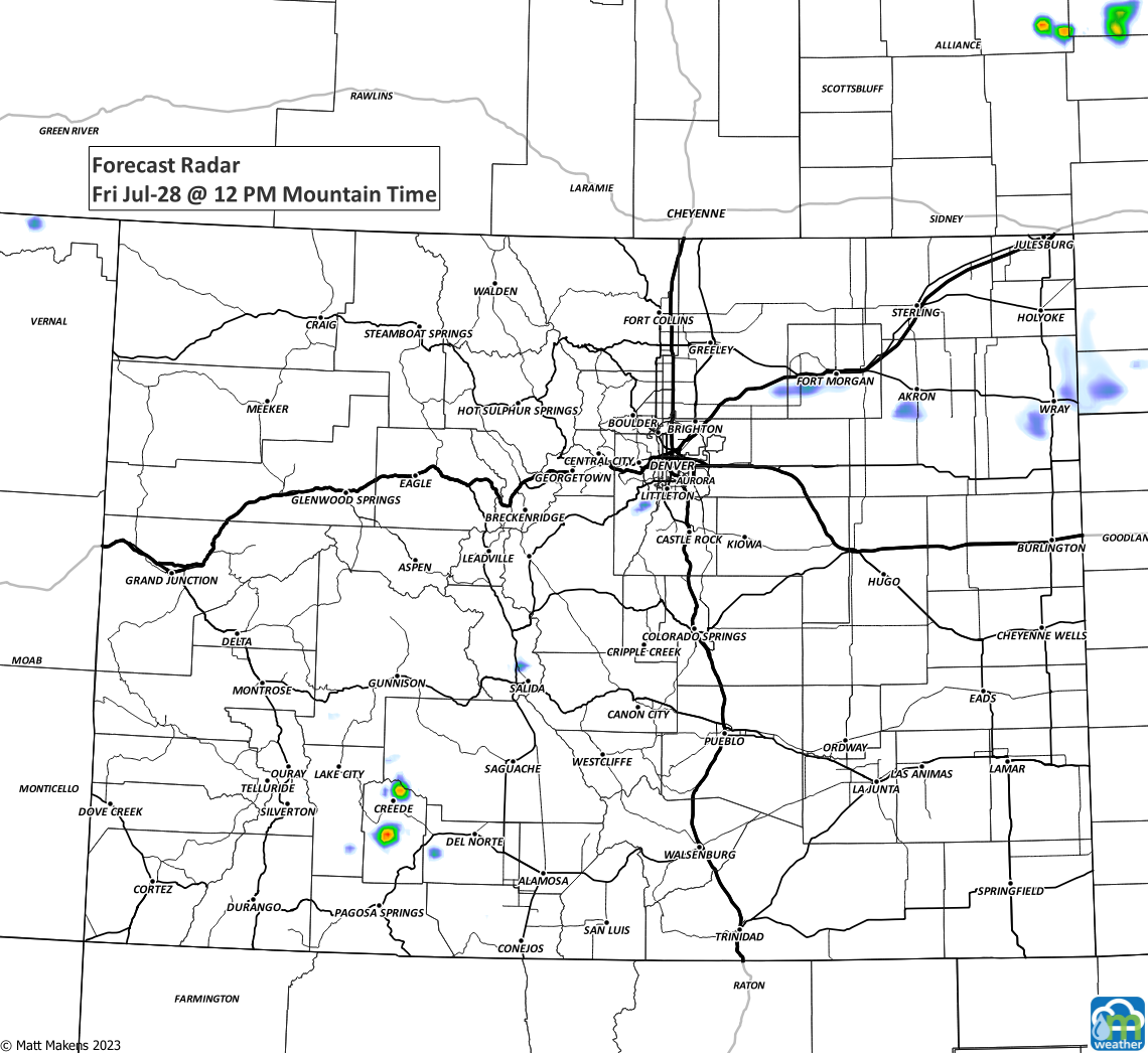
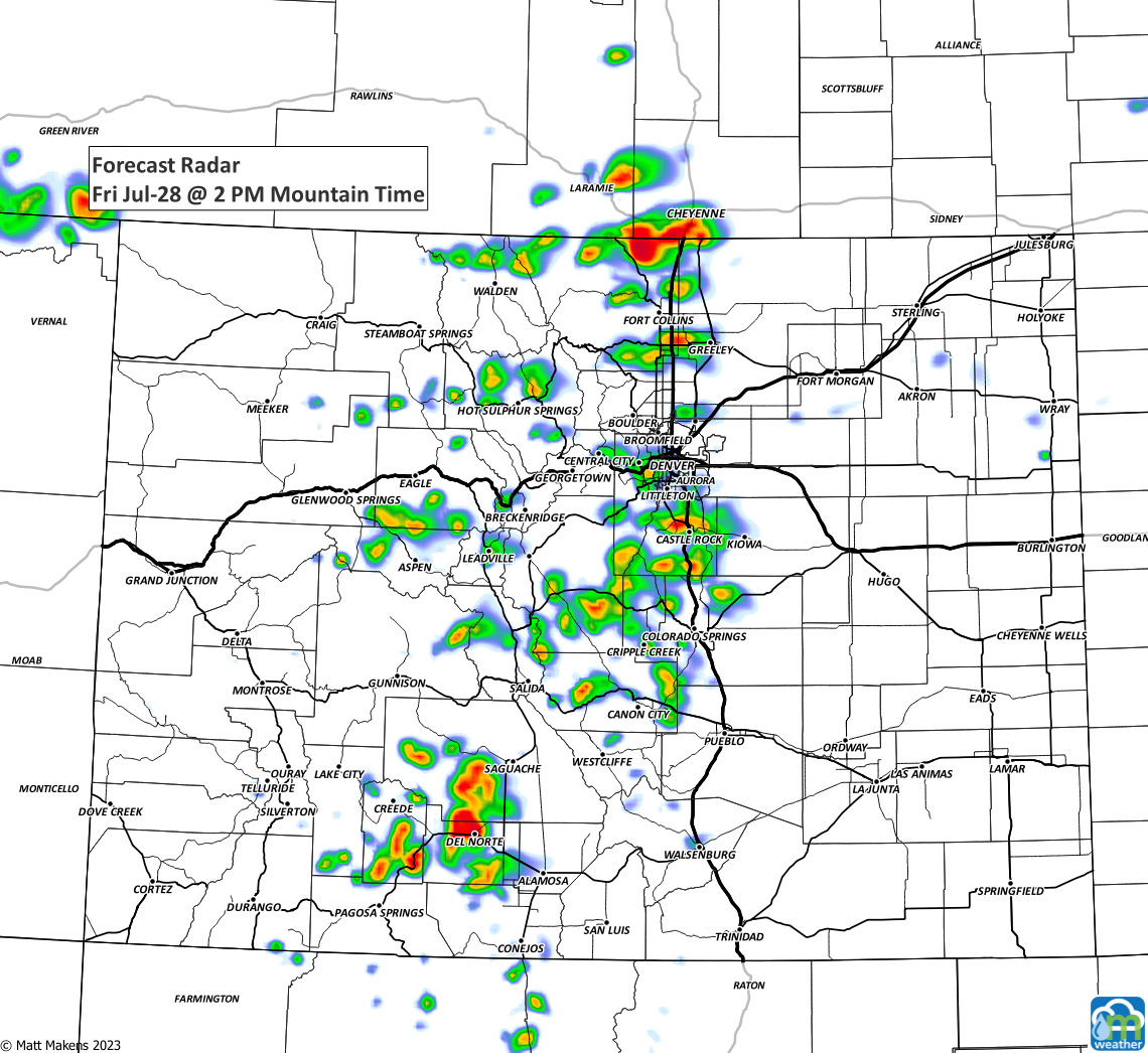
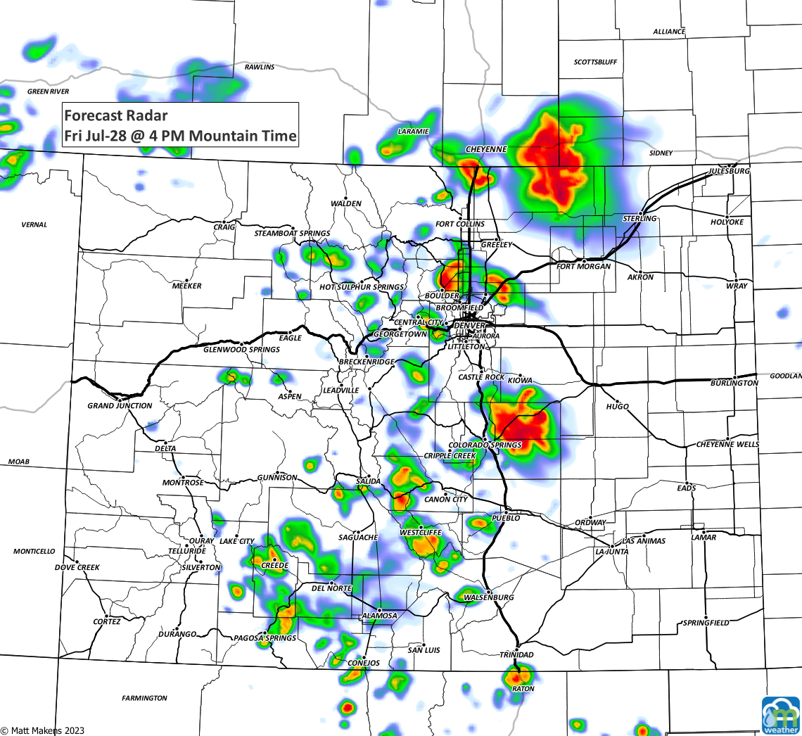
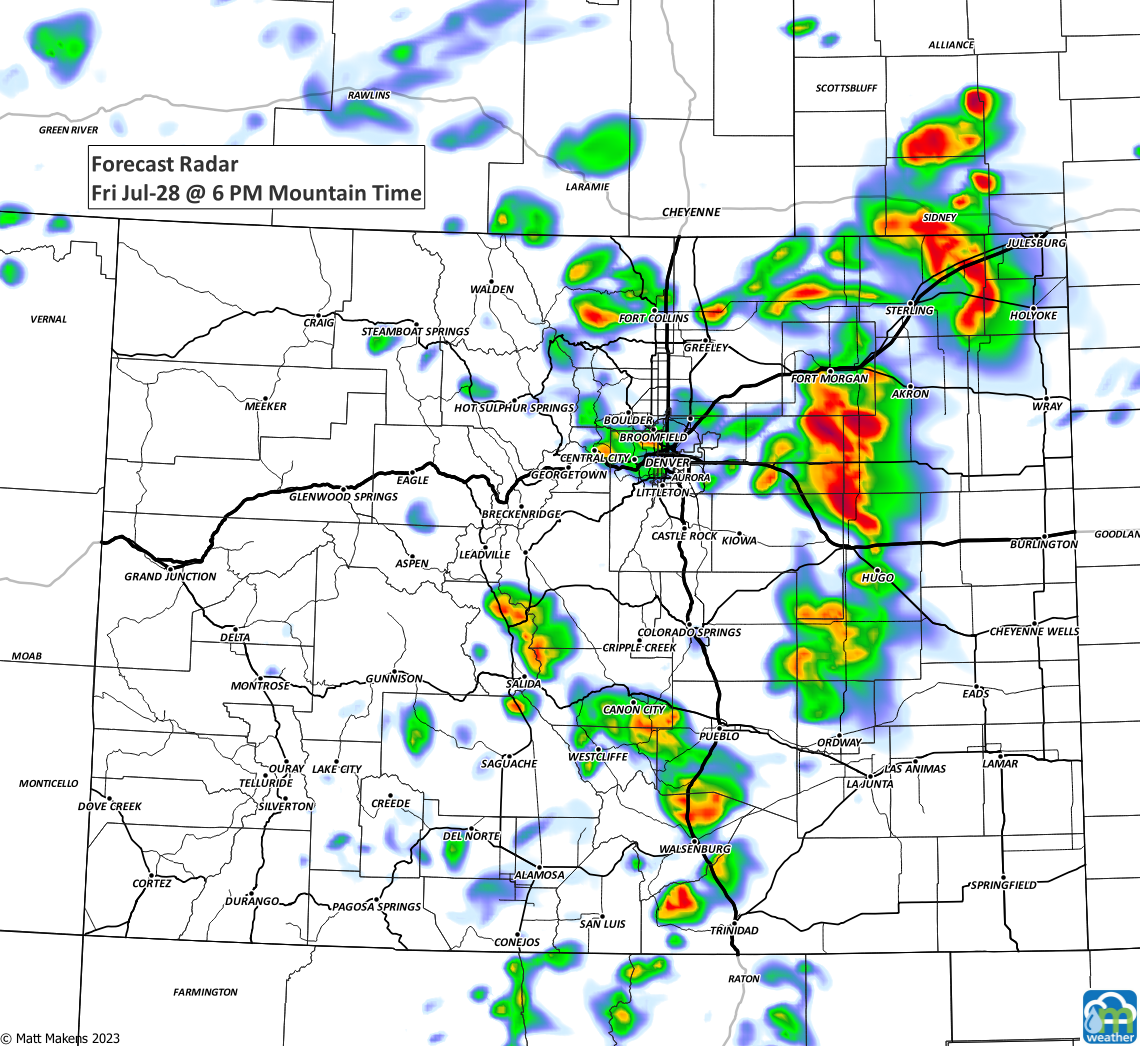
Strong and gusty outflow winds up to 60 mph are possible with the stronger storms along with brief moderate to heavy rain. The strongest storms are expected to be over the northern border areas with Wyoming and Nebraska. - NWS Boulder
As we look at the weekend, there's a slight increase to your chance of getting a storm. Although most will want to give us gusty wind and heavy rain, some during the weekend may grow larger hail and we could see some severe thunderstorm warnings dot the map, so make sure to stay weather aware as you work and play the next few days.
Wrap it together in one piece for the Denver area, an hourly timeline of temperatures and rain chances through Sunday.
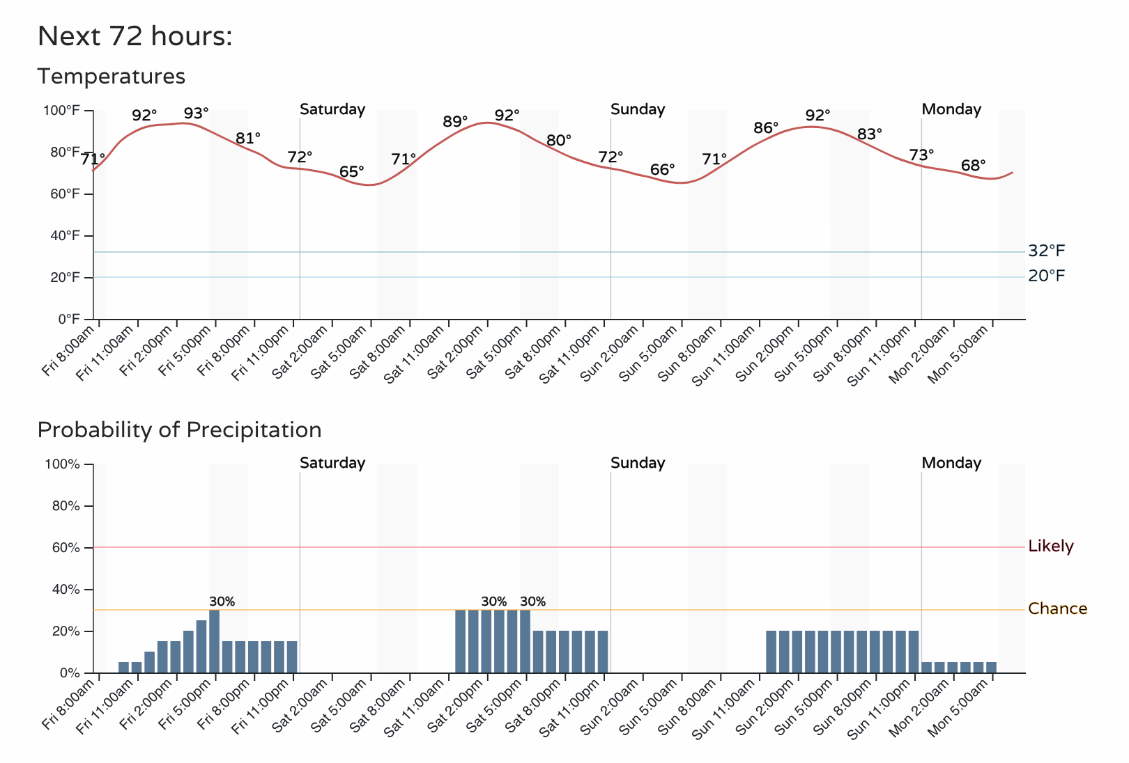
We may see the current ridge (placement of warm weather) weaken a touch next week which will mean some cooler temperatures. Let's not put the cart in front of the horse just yet though - we will have details on that in this week's SOTA which we publish Sundays.