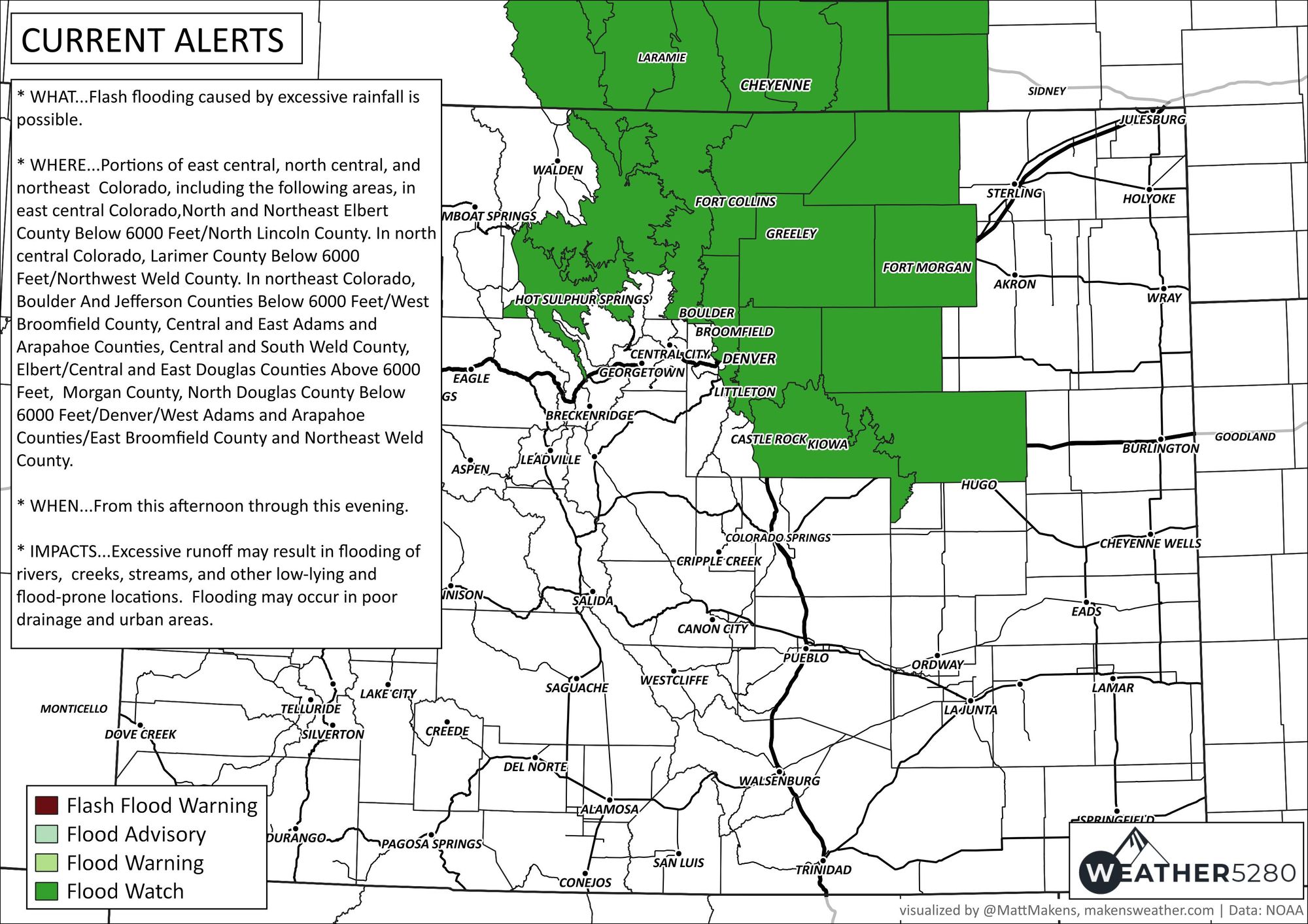
Denver Weather: Flood watch issued as heavy rain to target metro area

We have a heavy rainfall event approaching parts of the Northern Front Range from areas between Colorado Springs to Cheyenne, focused on Denver to Fort Collins.
Here's the flood watch guidance as issued by NWS Boulder:

* WHAT...Flash flooding caused by excessive rainfall is possible.
* WHERE...Portions of east central, north central, and northeast Colorado, including the following areas, in east central Colorado, North and Northeast Elbert County Below 6000 Feet/North Lincoln County. In north central Colorado, Larimer County Below 6000 Feet/Northwest Weld County. In northeast Colorado, Boulder And Jefferson Counties Below 6000 Feet/West Broomfield County, Central and East Adams and Arapahoe Counties, Central and South Weld County, Elbert/Central and East Douglas Counties Above 6000 Feet, Morgan County, North Douglas County Below 6000 Feet/Denver/West Adams and Arapahoe Counties/East Broomfield County and Northeast Weld County.
* WHEN...From this afternoon through this evening.
* IMPACTS...Excessive runoff may result in flooding of rivers, creeks, streams, and other low-lying and flood-prone locations. Flooding may occur in poor drainage and urban areas.
These thunderstorms will develop midday in the high country, then drift and grow into a complex of storms through the afternoon and evening. Rainfall rates may reach two inches per hour in some locations - hence the worry about flooding.
Here's a timeline of images for you.
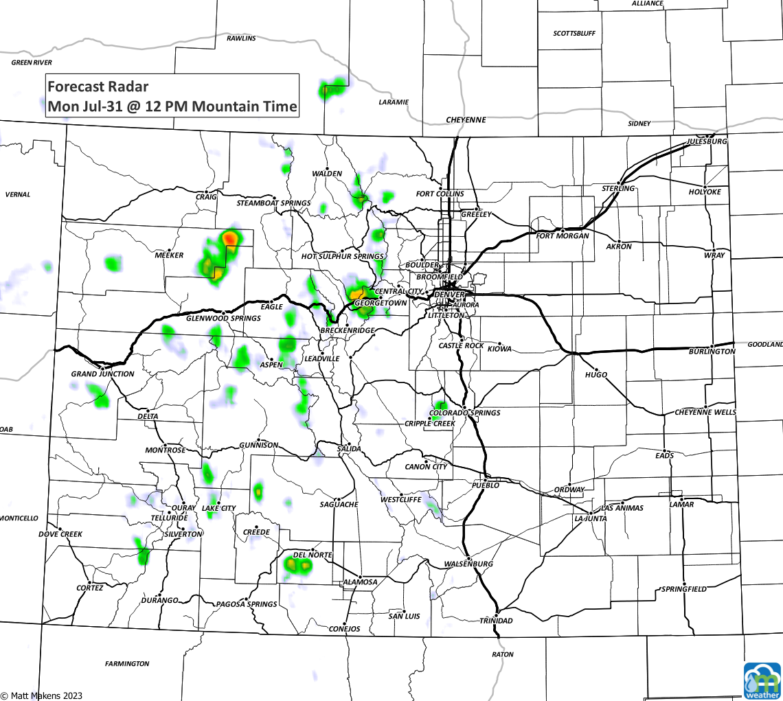
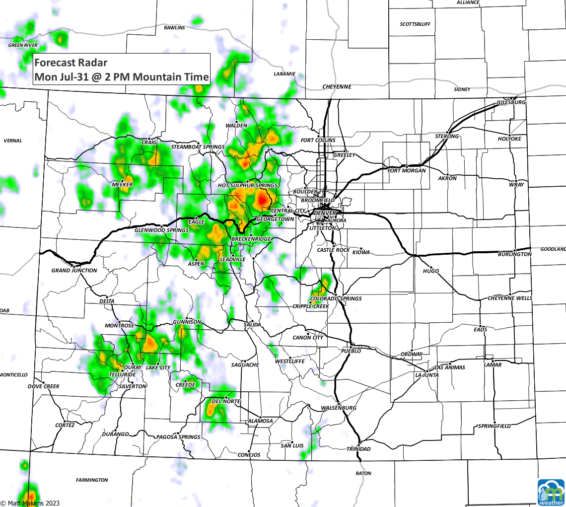
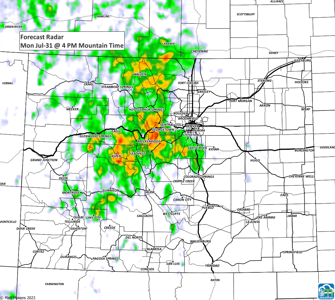
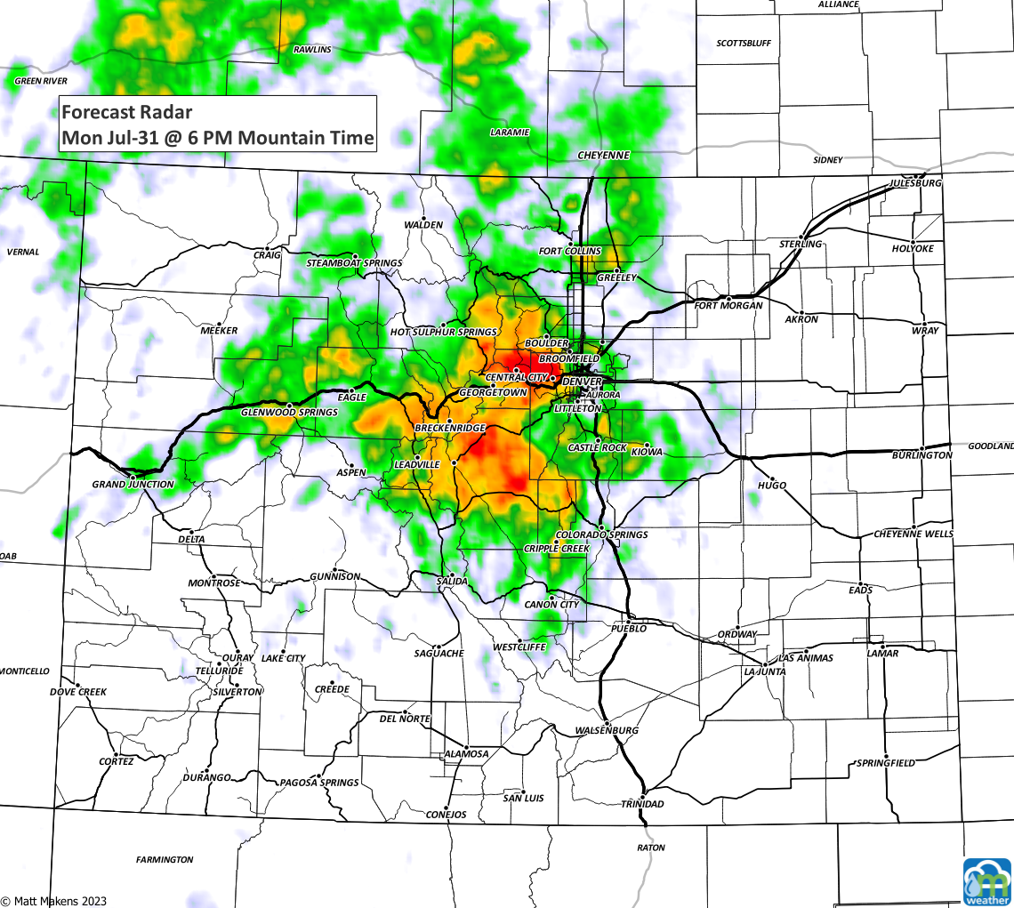
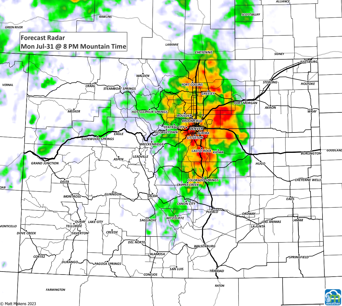
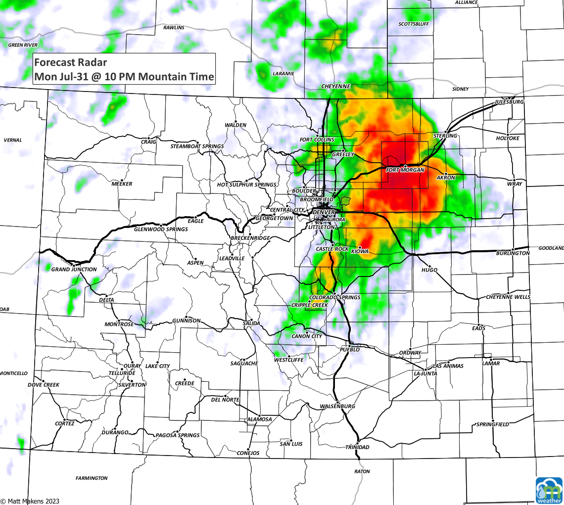
Along with heavy rainfall, some will have significant wind and others may see a bit of hail - however the wind and hail threat overall remains relatively low for today.
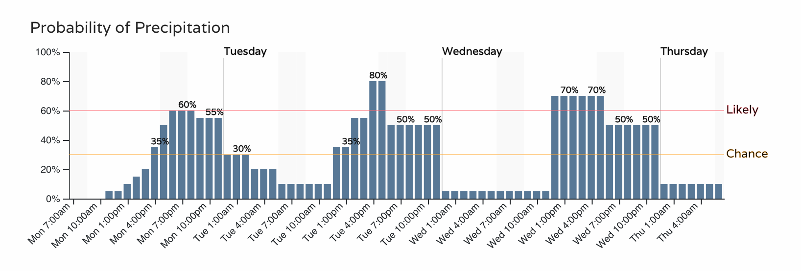
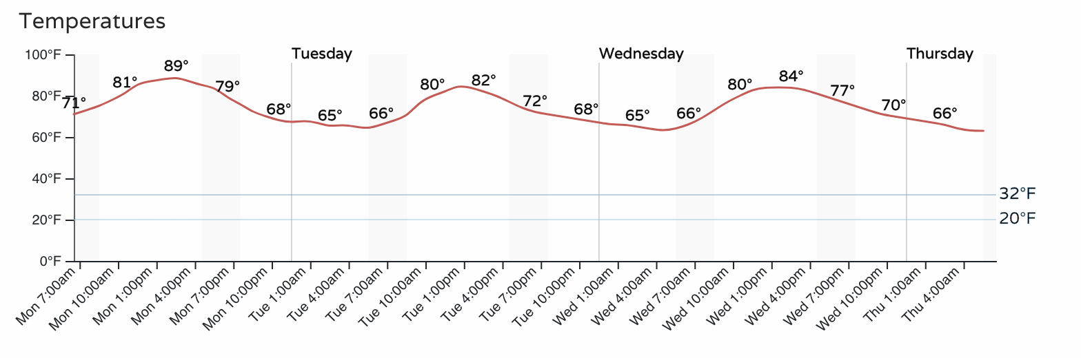
Additional storms will be possible Tuesday and Wednesday as part of this monsoonal "surge" we discussed in yesterday's broader look at the weather coming in this week.
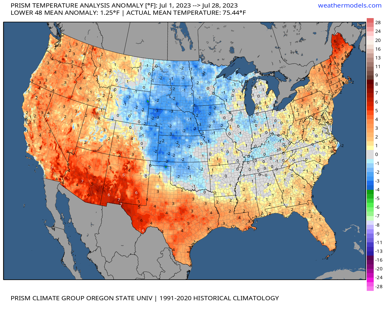
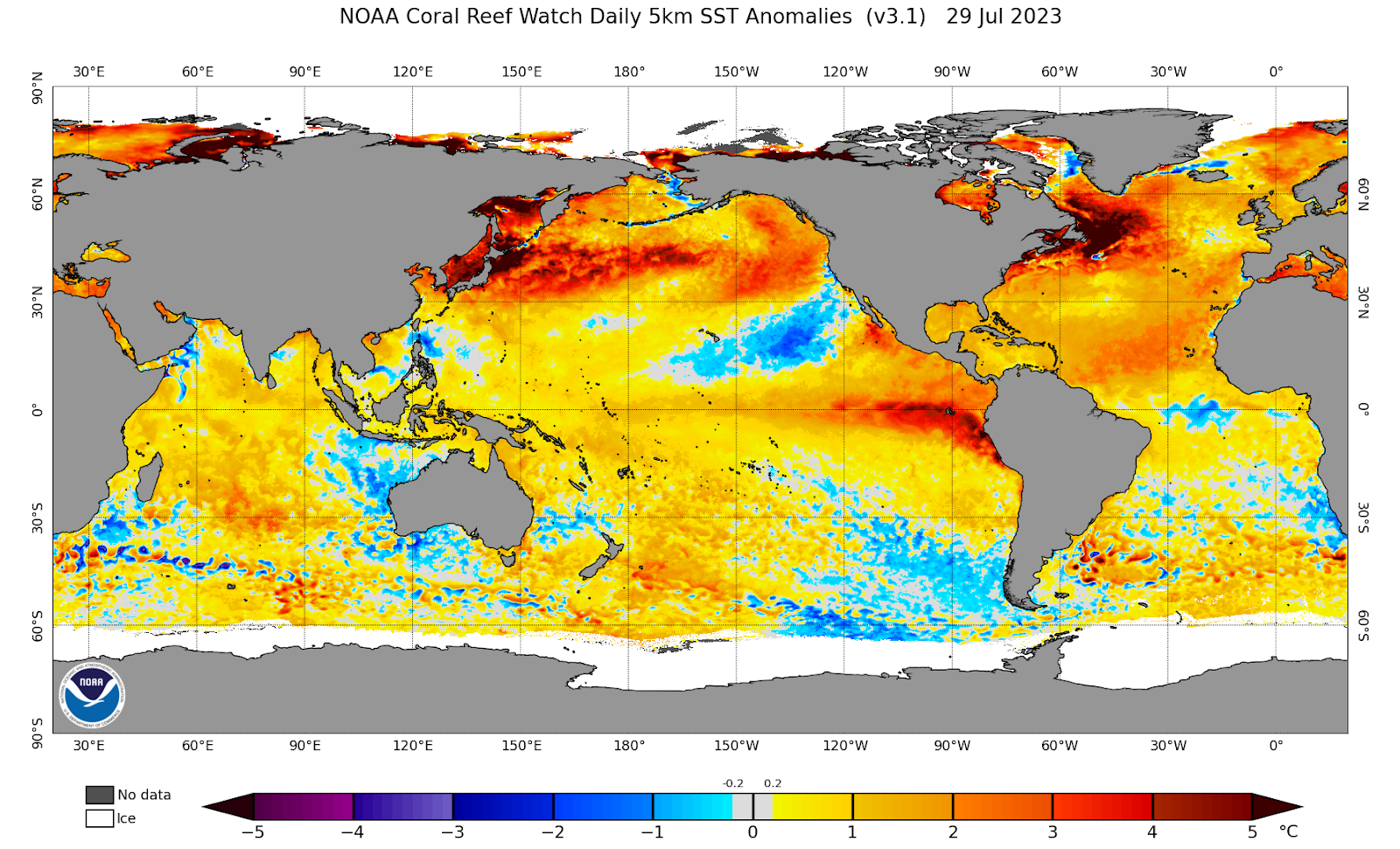
Is this part of El Niño? Well, the monsoon is partly controlled by the El Niño atmosphere, but this late and weak monsoon is more the result of something else as we discussed here with our members.
The timeline for additional storms and the temperatures through midweek are shown next:
Don't get rained out of your plans; If you'd like to be getting the "heads up, hey there is a forecast to be aware of" style emails from us, you can sign up for those for free by clicking here.