Denver Weather: Couple rounds of storms possible; severe weather pinpoints the plains

Additional thunderstorms with heavy rainfall possible again across the metro areas Wednesday, with the strongest storms carrying the largest hail over the plains. A weak impulse may generate another batch of storms overnight into Thursday morning.
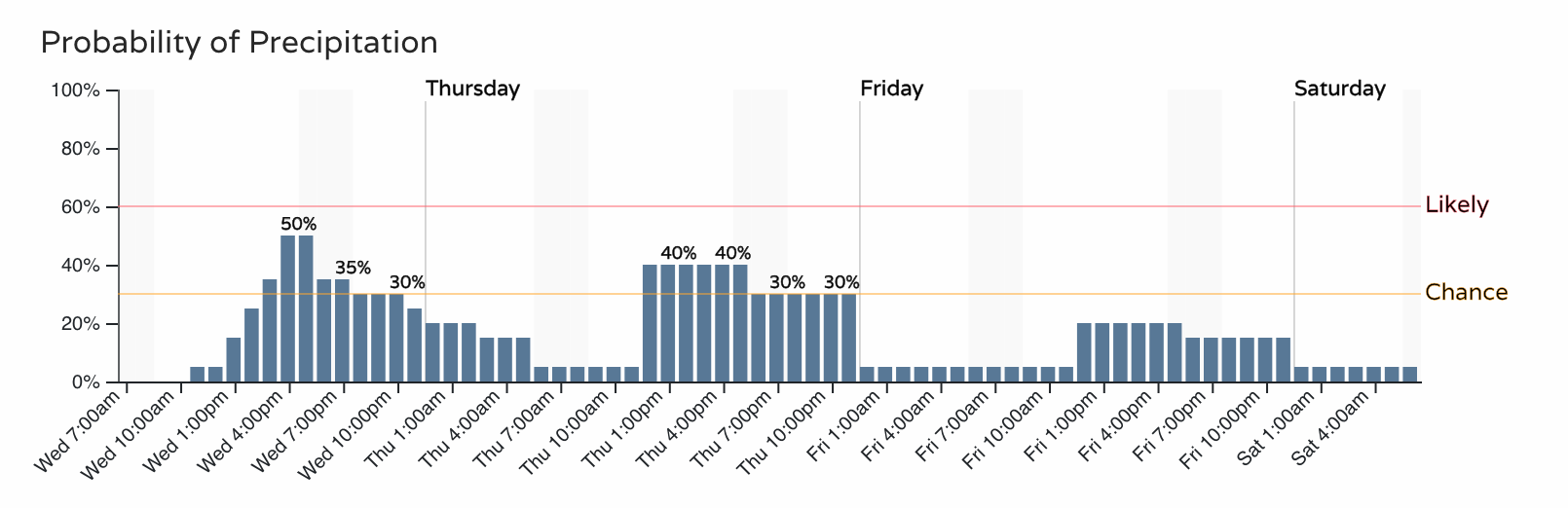
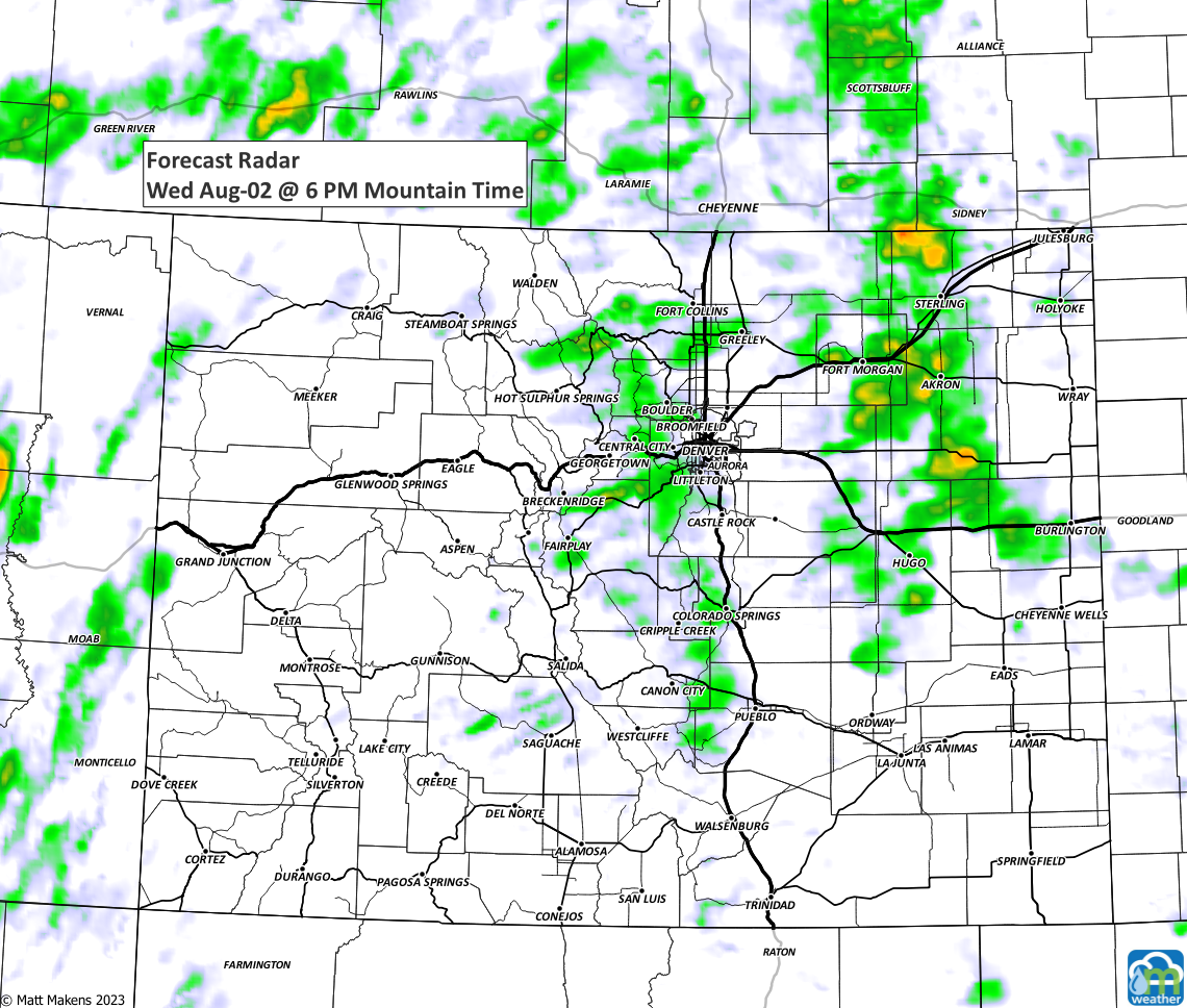
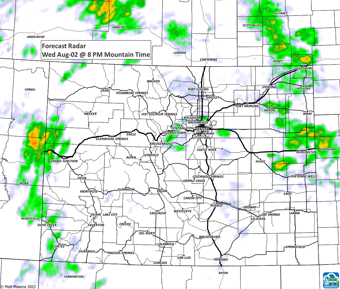
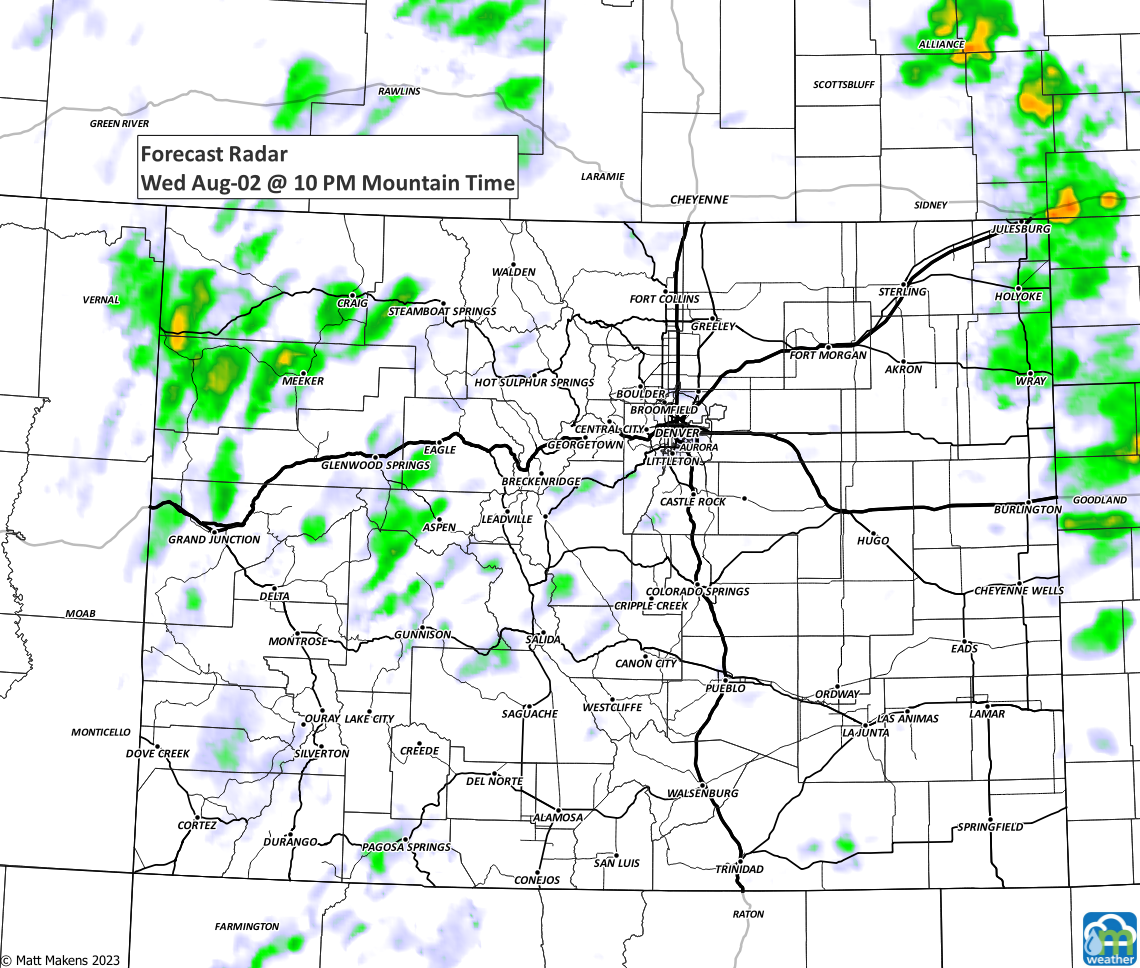
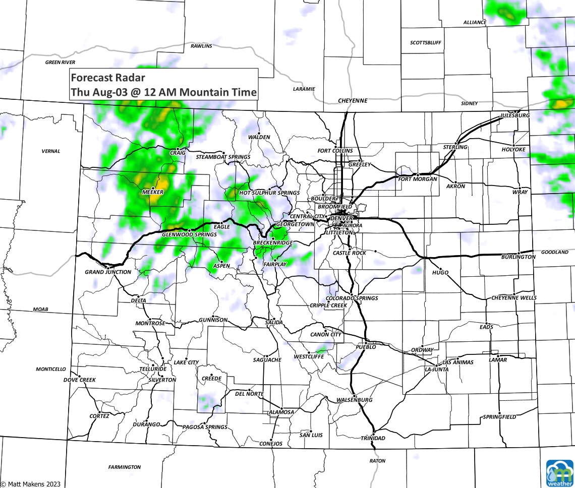
There is not a flood watch currently in effect for the Front Range, as there was the past two days, as the chances for storms carrying that much water decreases slightly. Still, a number of storms will be floating around. As a general setup, here's a timeline of the rain chances for the next three days.
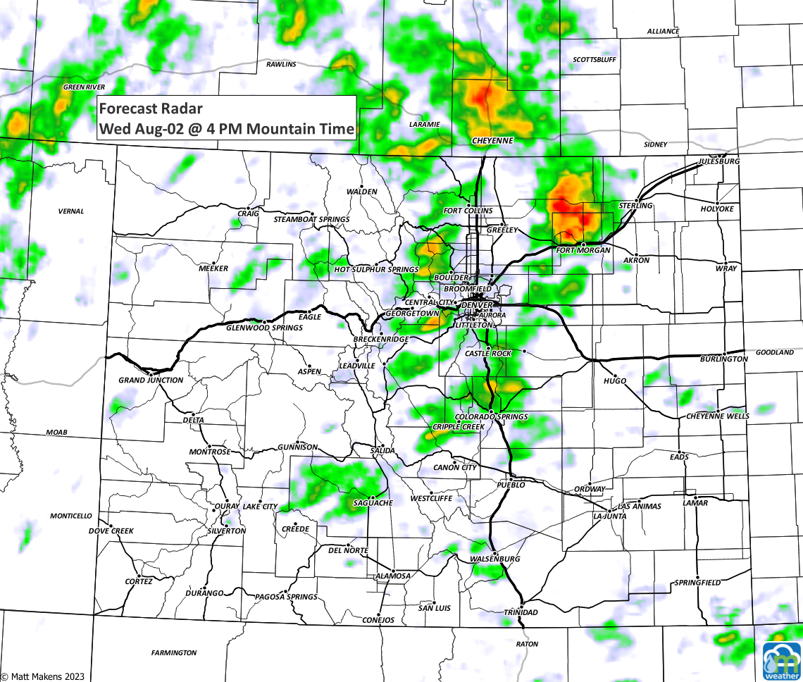
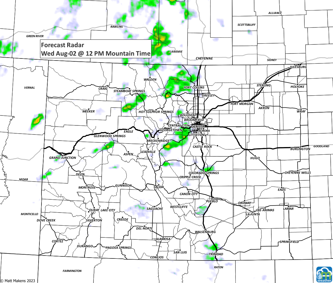
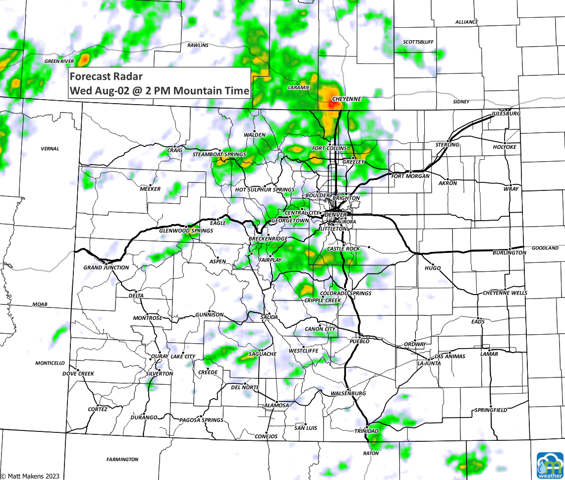
You'll see the storms developing on the mountains in the later morning through early afternoon before they roll toward I-25 and to the east. As they move onto the plains, larger hail - perhaps severe - will develop. Not to say hail isn't possible in the metro area, but to say the risk is higher east of the city.
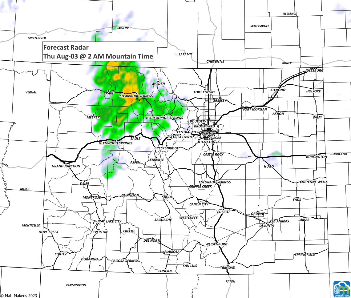
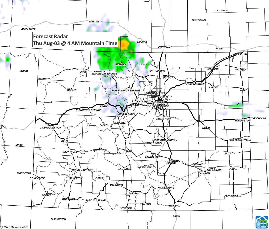
Here's a time series of images showing roughly the location and timing of storms, notice another batch is possible overnight. The highest chance for a night-time storm will be Western Colorado into the mountains but we could see a few develop on the metro area also as that energy move through.

The storm coverage has kept the temperatures a bit cooler, and we will stay cooler through the next few days.
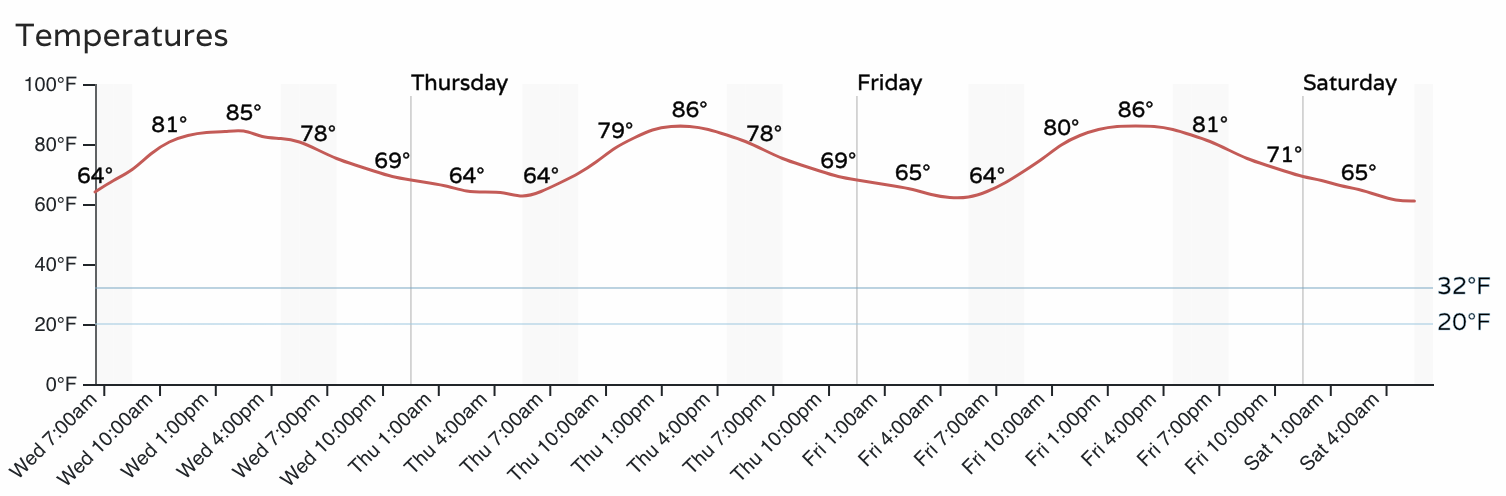
Beyond the temperatures you just saw, Sunday may be quite cool with highs only in the 70s! We will have more on that approaching change in a future post. If you'd like to be getting the "heads up, hey there is a forecast to be aware of" style emails from us, you can sign up for those for free by clicking here!
Keep us posted on the day's weather by reporting what you see to us in the comments field below. Have a good Wednesday!