Colorado weather: Big time cool down with areas of heavy rainfall in the forecast

A strong system will spread colder temperatures, more than 20-degrees colder, and heavy enough rainfall our cautionary flags are raised to the potential flooding that may be on the way.
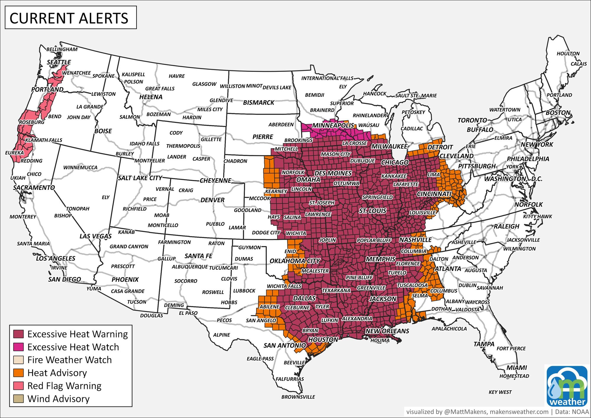
At the moment there are no alerts in place for the state, but that may change Friday as heavy rainfall takes aim on parts of the state. We do have alerts for heat for those to the east of the state, who will also cool off later this weekend.
Denver's cool off will be throughout the day Friday, but rain chances tend to hold off in the city until later in the day.
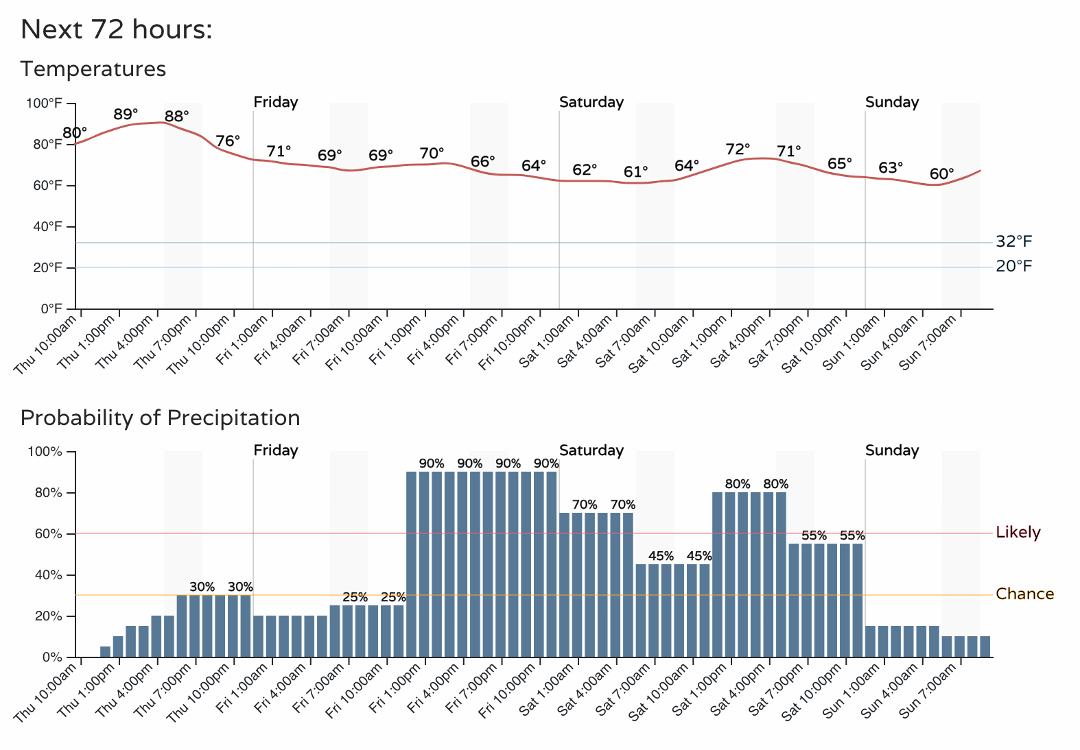
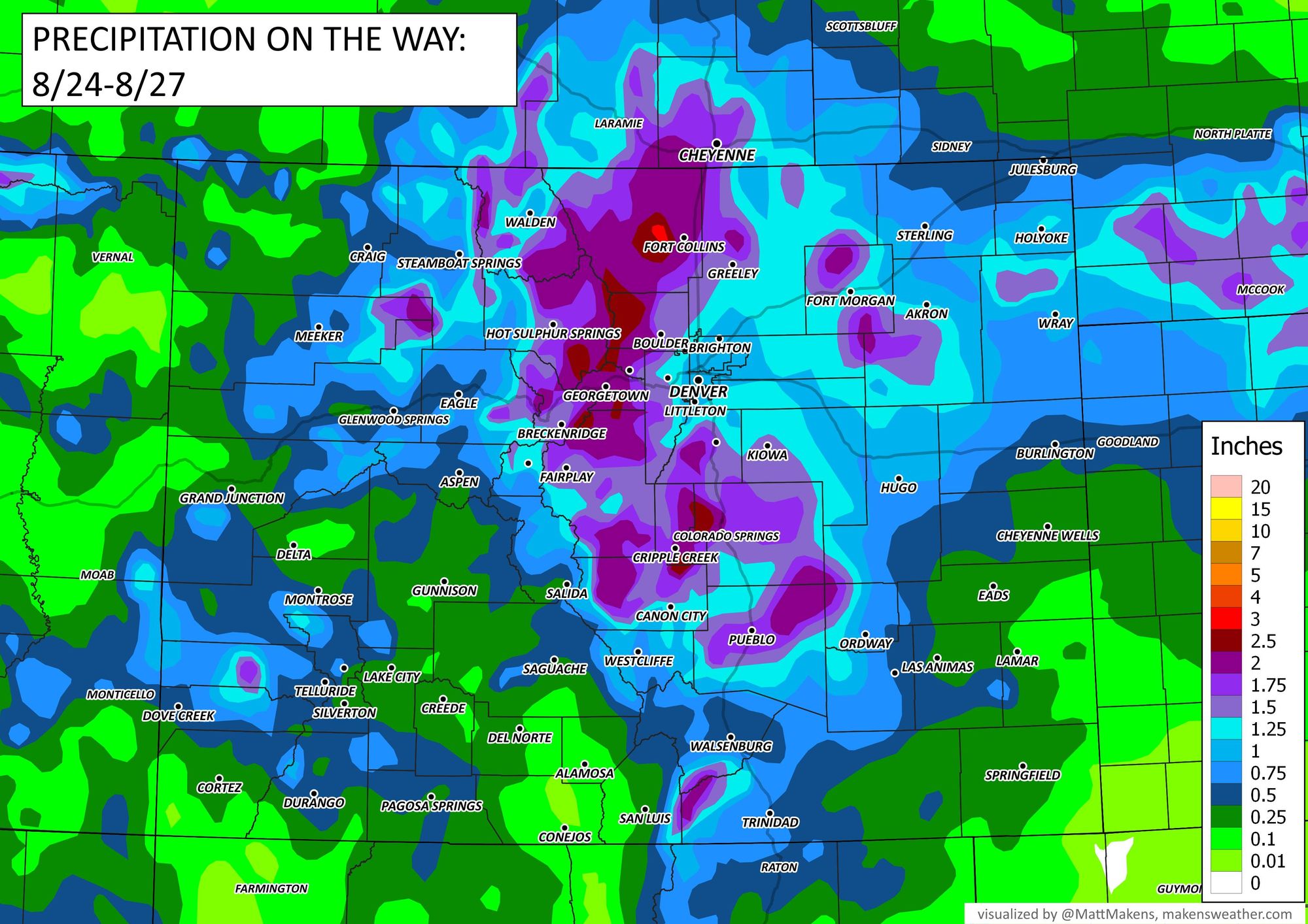
So, from the 90s Thursday to the 70s and 60s Friday through Saturday. Be ready for appreciable rainfall though, look at those rain chances above! Here are the estimated totals through the next three days:

There are some bullseyes of 2.5 to 3 inch totals along the urban corridor, foothills, and high country. Totals like that are concerning from a flooding perspective; and we could see some rainfall records set should this all pan out.
From a broader perspective, look at the chances of receiving at least 3 inches, these odds have shifted south a bit over the last couple of days.
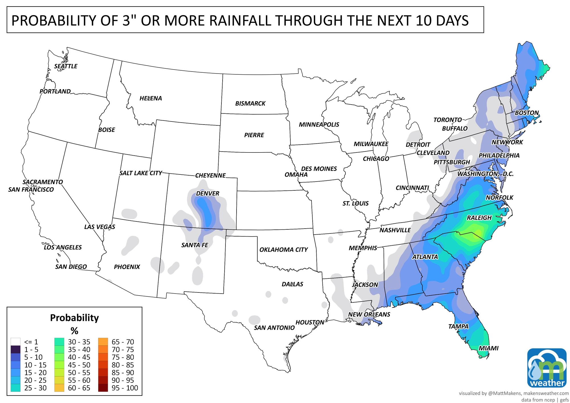
For those from Central to Southern Colorado, a 3-inch probability is problematic as we can't usually handle that much water well in those locations when that rain is expected over a short window of time; in this case during the course of about a day to day-and-a-half.
This rainfall event kicks off today for the state, particularly the high country, and then spreads toward the metro areas and plains Friday into Saturday.
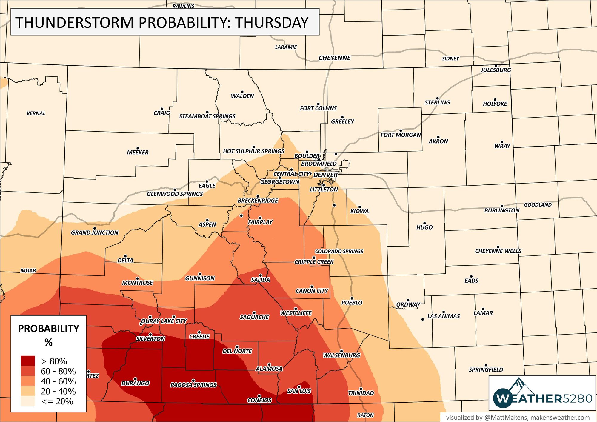
Today's chances for thunderstorms is shown here:
And, watch the animation as the storms from the southwest spread toward the Front Range.
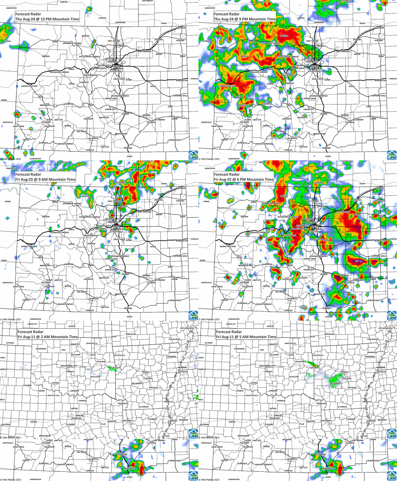
This could be quite a soggy Friday night football kind of night! Stay safe, stay weather aware, and of course stay one step ahead of the weather by subscribing to our email list today!
