Denver Weather: Cooler week ahead with scattered storms

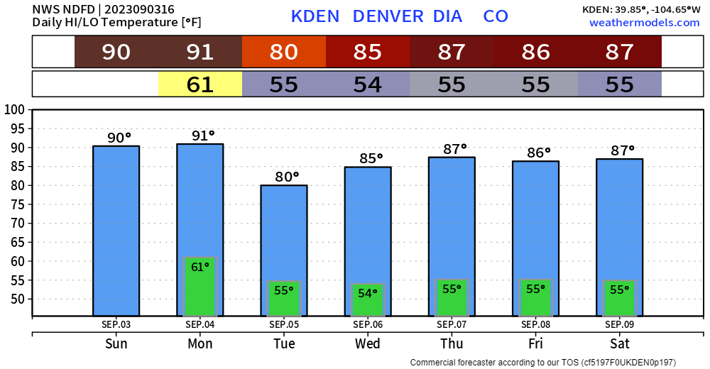
It's September 3rd, historically the earliest snowfall for Denver came today in 1961 with 4.2 inches but 2023 brings a mix of sun and clouds with highs into the 90s. Labor Day will also hit the 90s but a bit of a cooler stretch kicks off Tuesday...more on that in a moment.
https://www.instagram.com/p/Cwu8CWPs5Cc/
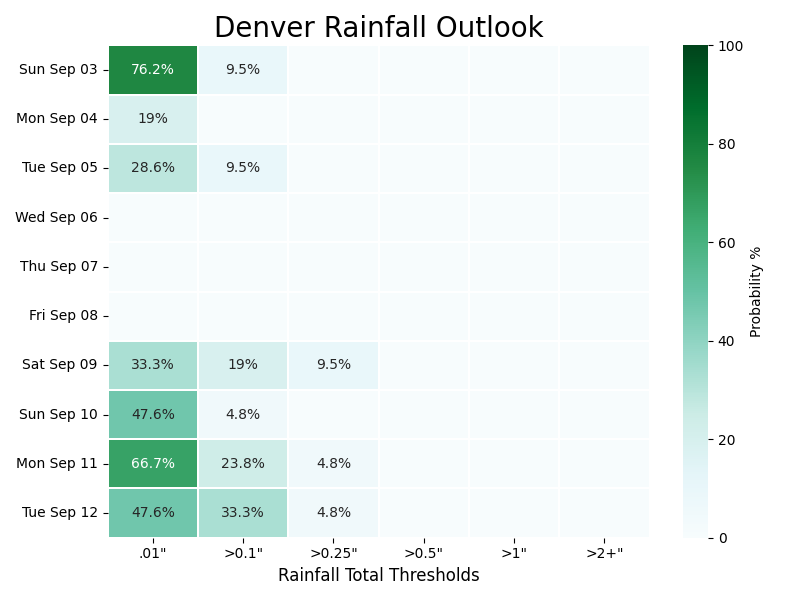
For today and tomorrow, increasing afternoon clouds offer a bit of shade and heat-relief. In the following hourly planner you'll see the rain chances beneath the temperature timeline for Denver.
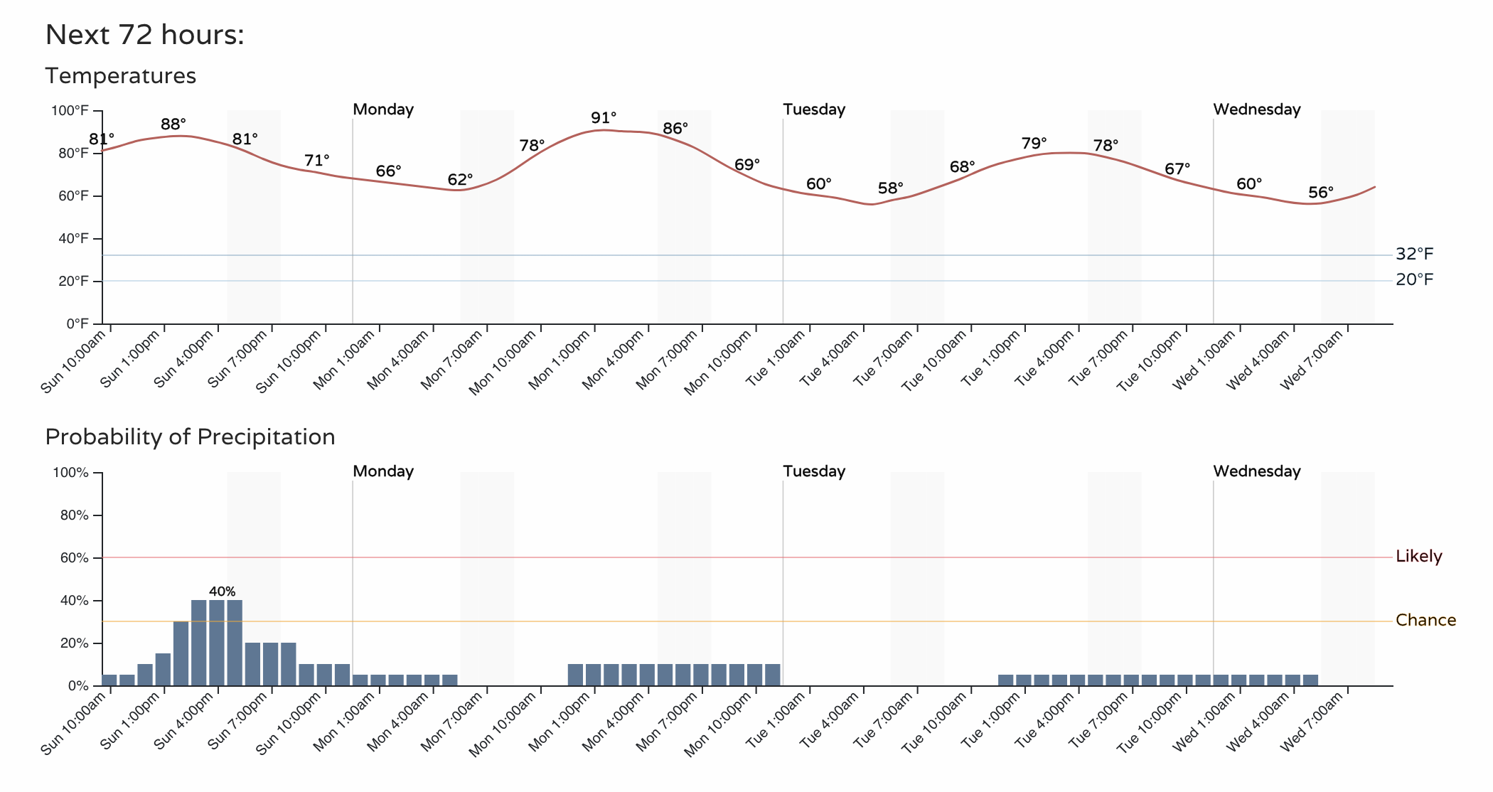
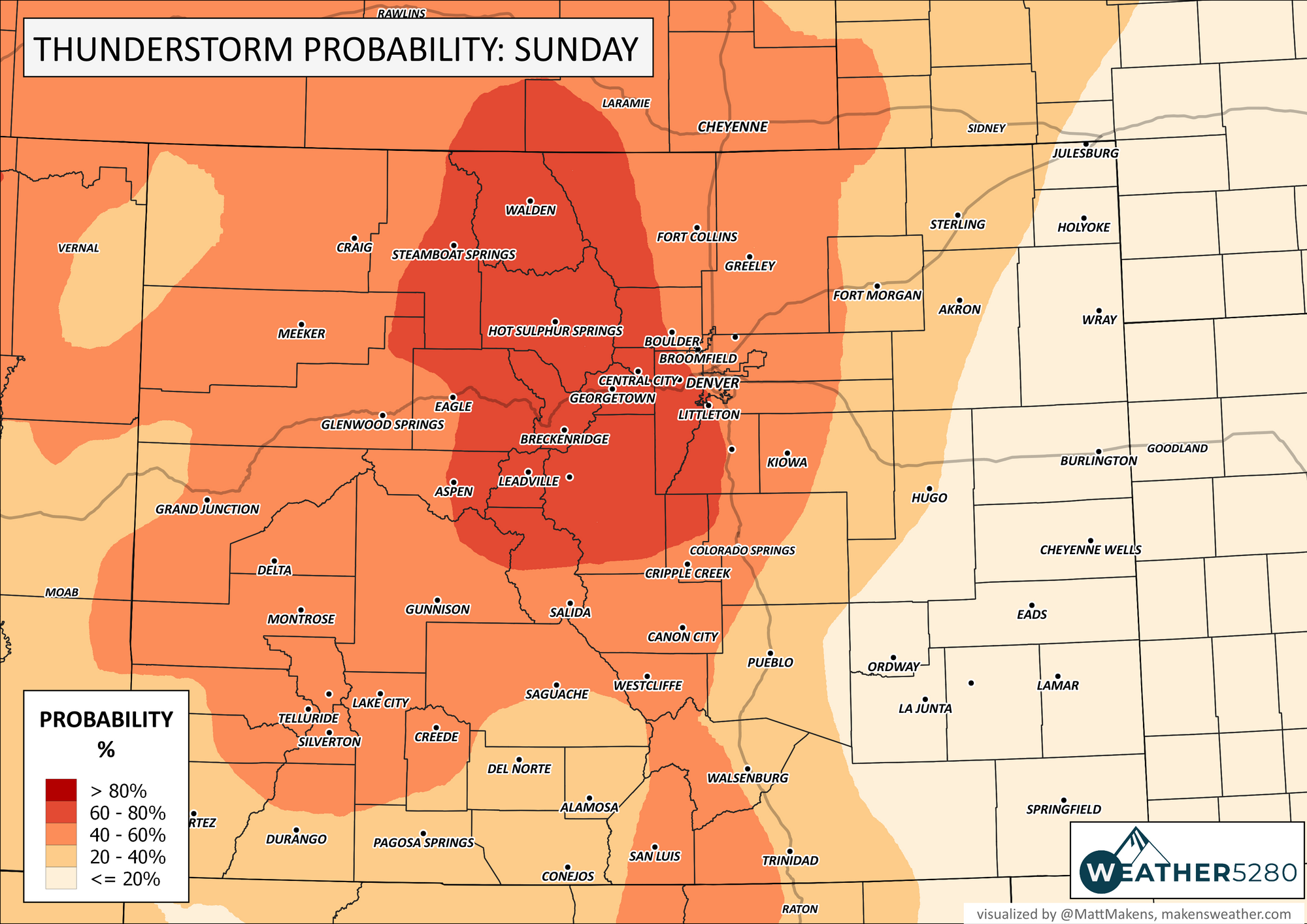
Clearly, not the best outlook for rain lovers, but today's outlook is higher than the next two days. So, let's expand on that.
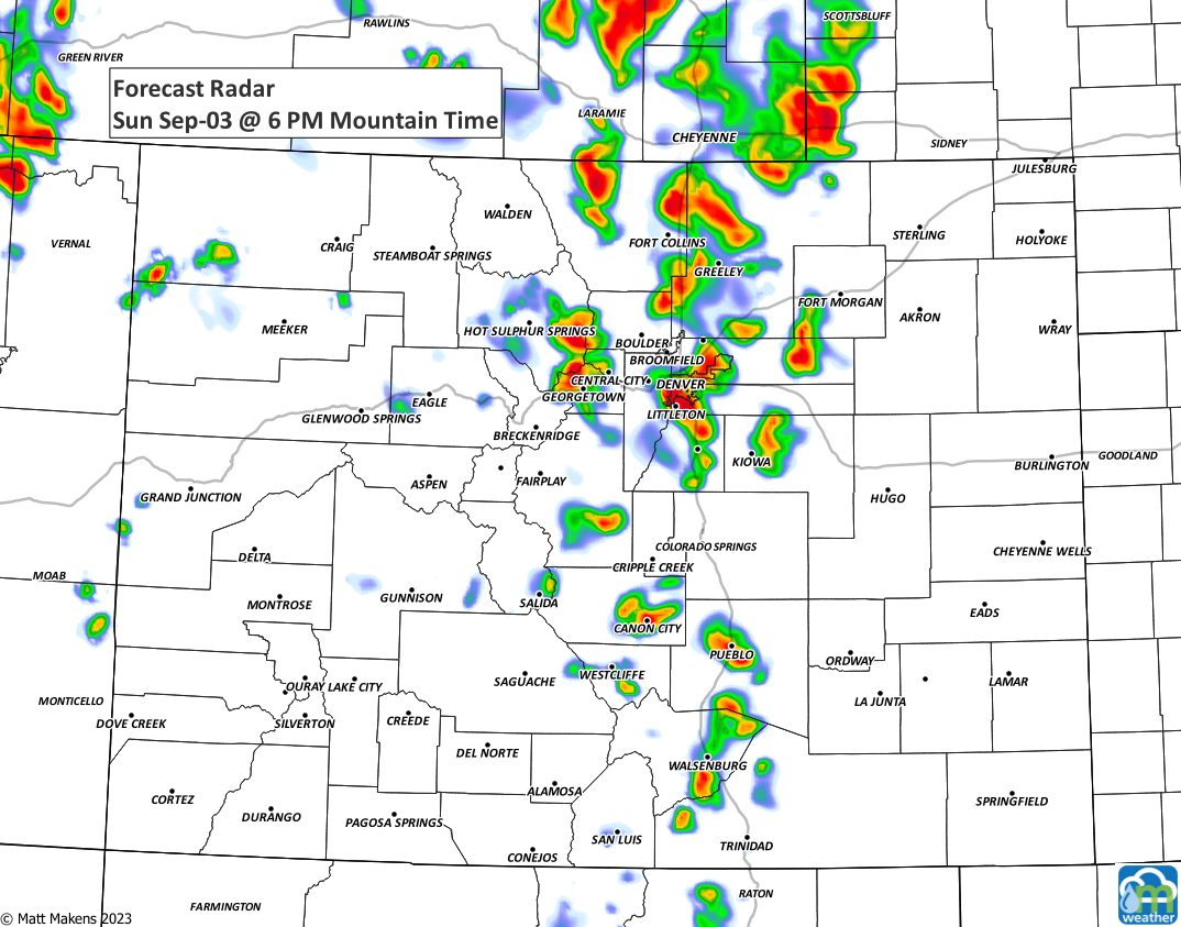
For today, scattered storms will develop in the high country and move toward the metro areas and plains. Overall, the threat of storms today is shown here:

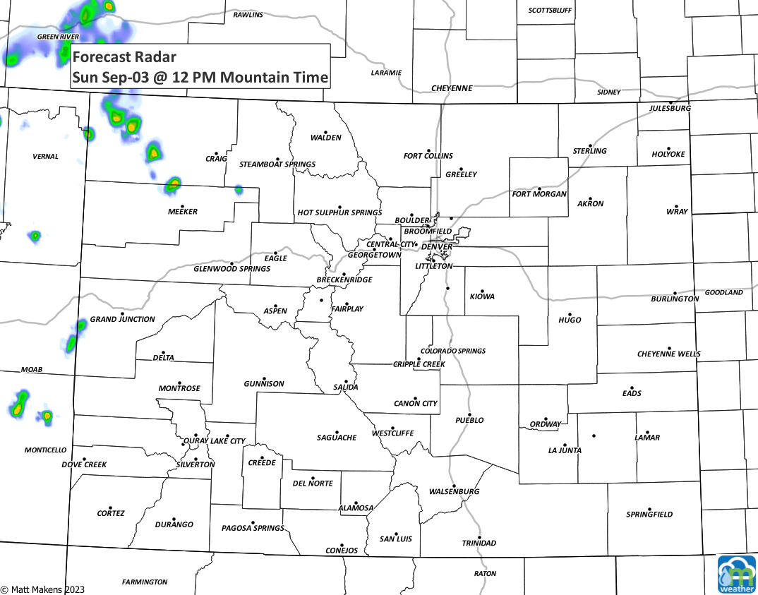
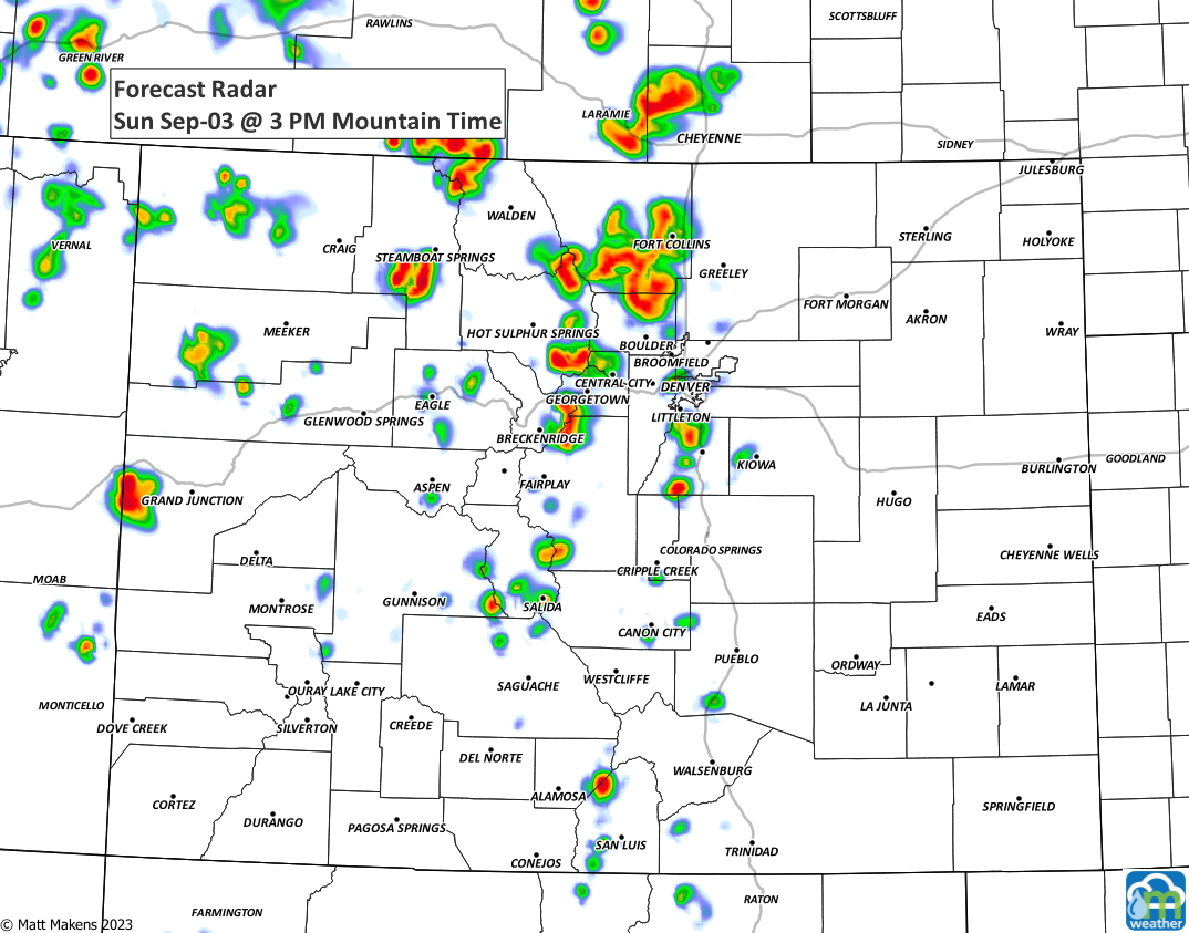
And, in a few segments, you can see where and when storms are possible.
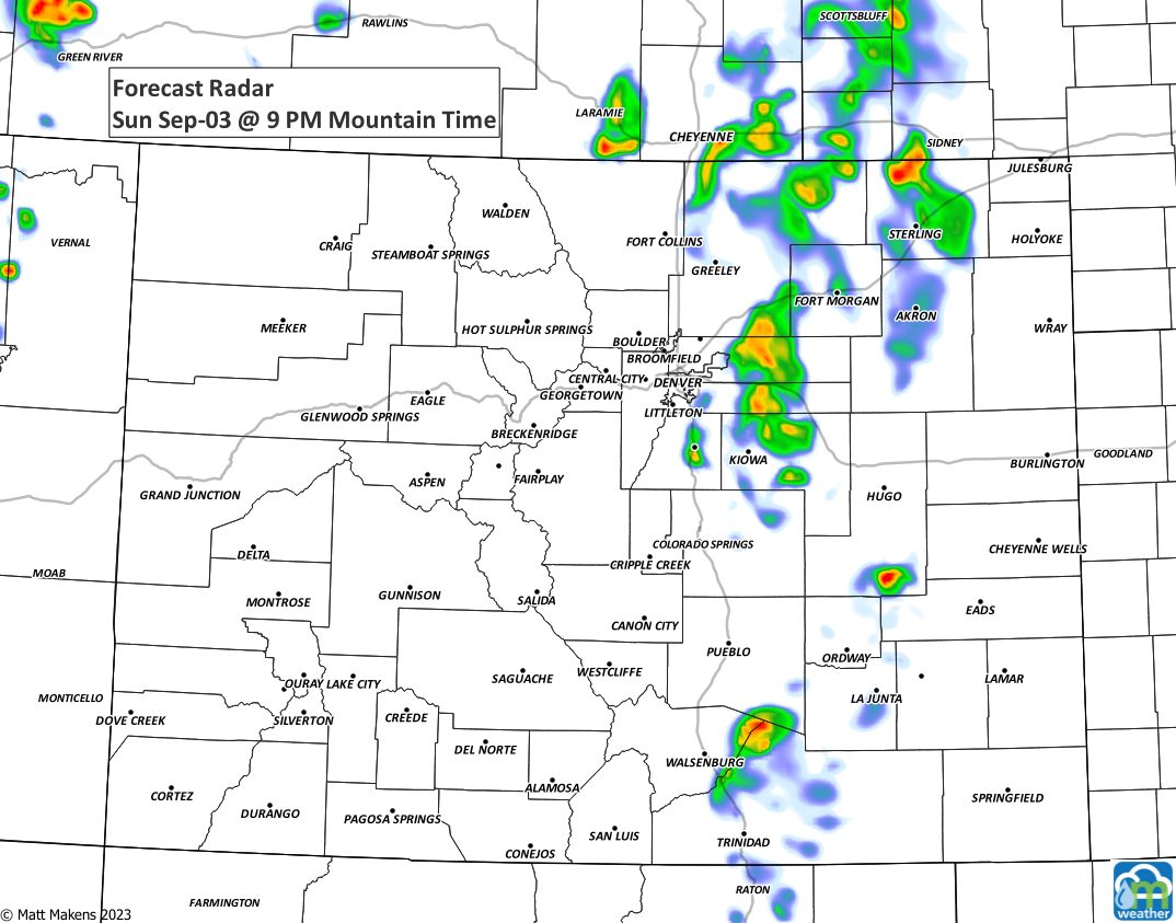
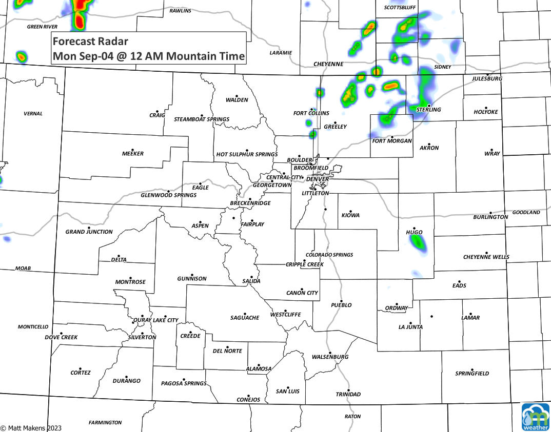
Then, for Labor Day let's see how the storms will perform.
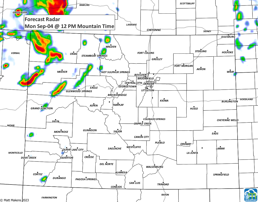
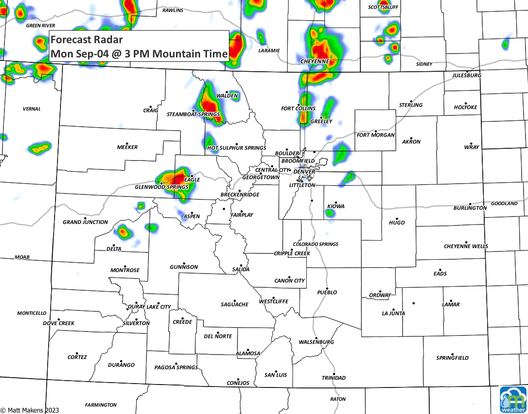
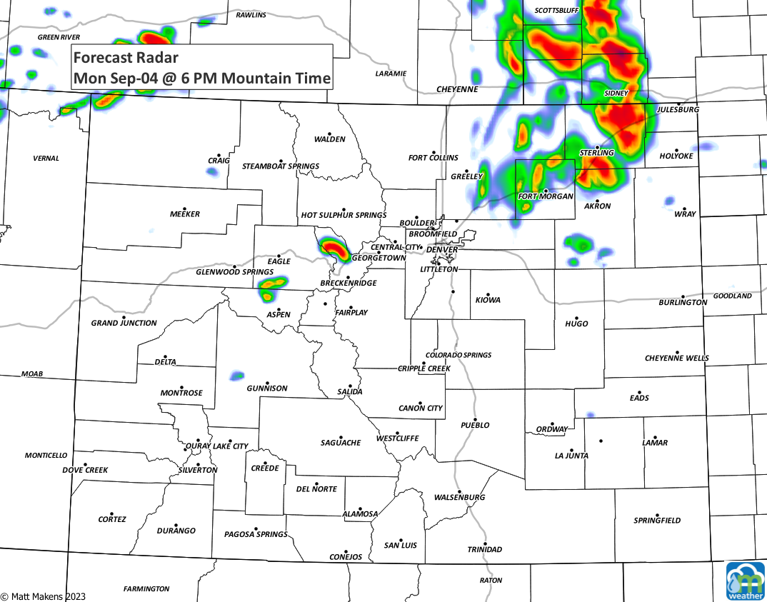
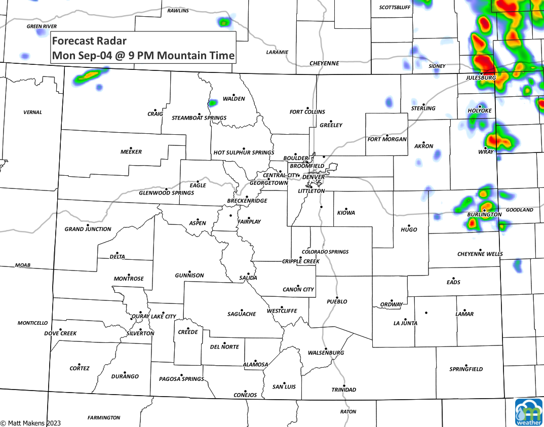
You'll see that tomorrow's storms favor more of NoCo, which is why the Denver timeline shown above has the highest chances for some rain for today.
As we look at the week ahead, not overly wet but additional rain chances and somewhat cooler for the shortened-work/school week.
We hope you have a good Labor Day, and week ahead. We won't challenge the earliest first snow record this year - clearly.