
A taste of fall is on the way for Colorado, Plains states

It's September, so of course this means there's plenty of buzz around the latest hurricane in the Atlantic. Lee could very well become a category 5 hurricane as it slowly tracks west before making an eventual turn north and northeast next week. While the southeast is likely to escape the wrath of Lee, states north will be on alert for any potential impacts next week. With any luck the storm will stay fully out-to-sea. As always, you can track the latest forecasts for the tropics here: https://www.weather5280.com/tropics/atlantic
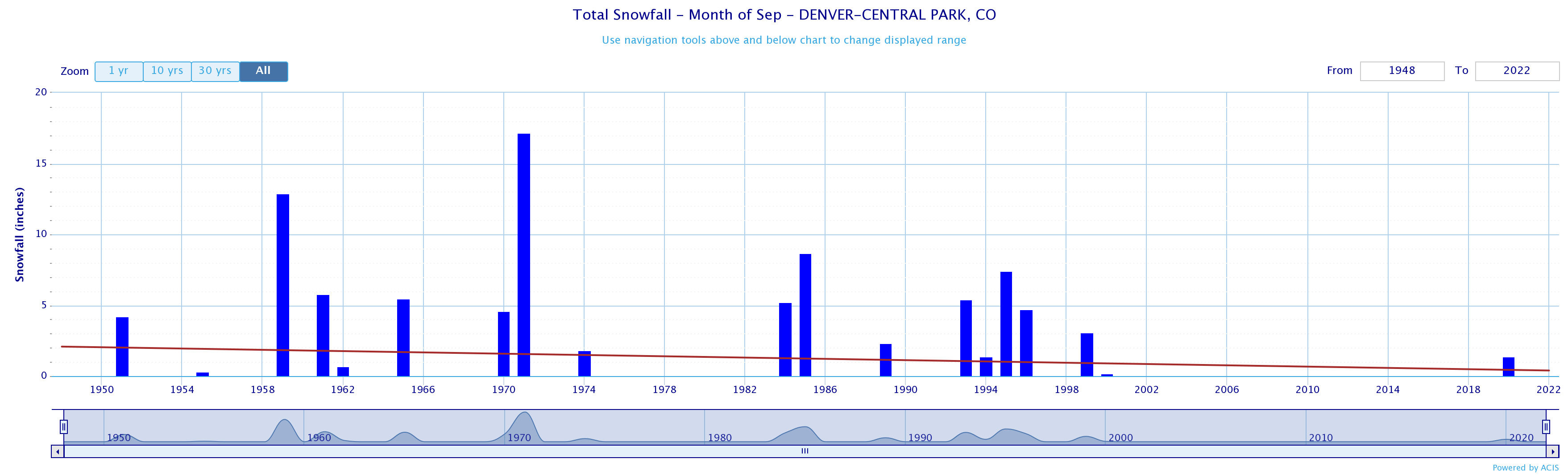
It being September also means we start to track the season's first meaningful cold fronts across the central U.S. While the date of Denver's earliest snow on record has come and gone, snow in Denver is always a possibility in September, if increasingly rare.
We aren't tracking snow at this time, at least not at lower elevations, but we are tracking a nice cool down for eastern Colorado later this weekend which will bring a blast of fall-like weather to the central and southern plains as well as some always appreciated precipitation.
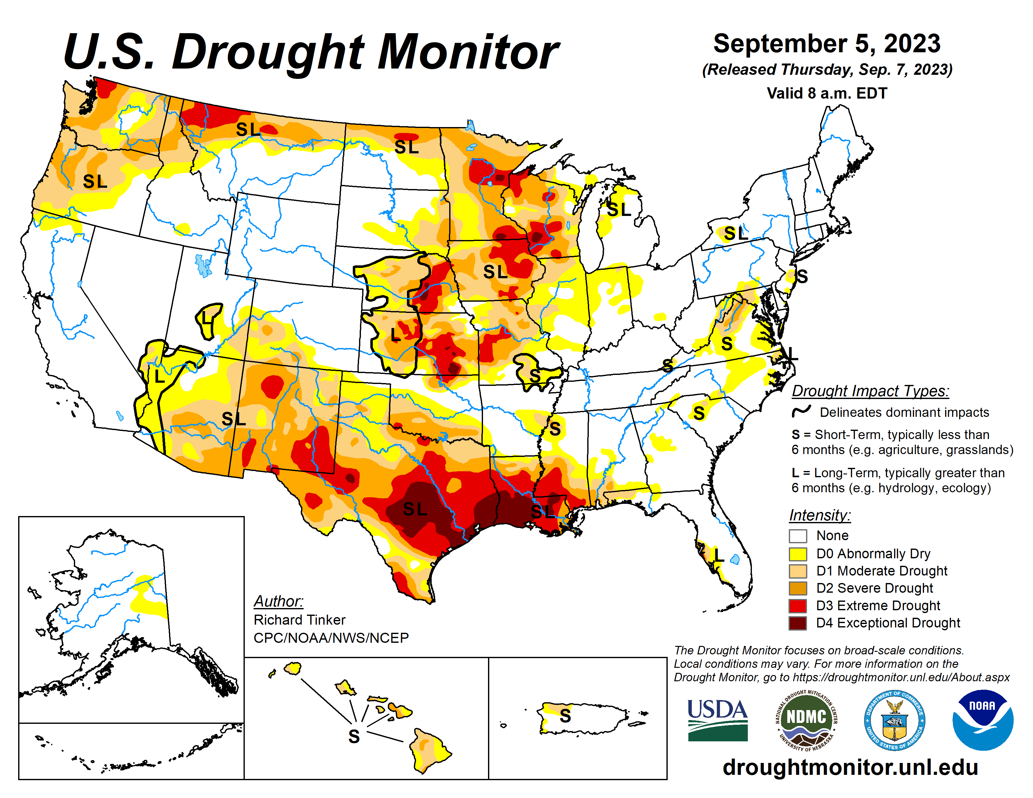
The latest Drought Monitor shows much of Colorado still doing okay in the drought department, but pretty widespread drought across the central and southern plains, particularly southeast Texas.
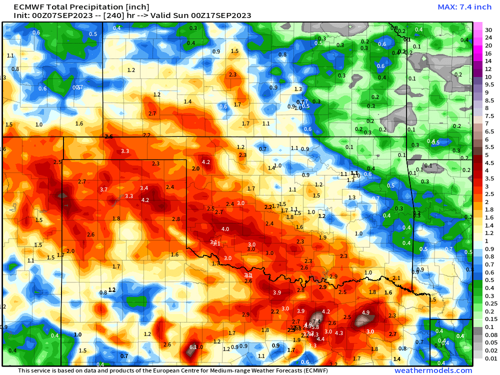
The upcoming rain may not work its way quite far enough south to help in some of these drought areas, but for the Front Range of the Rockies, adjacent plains, western Oklahoma, and northern Texas some appreciable moisture is on the way from late weekend into the middle part of next week. The map below shows (in green) the areas of the country expected to see above average precipitation through next Tuesday evening:
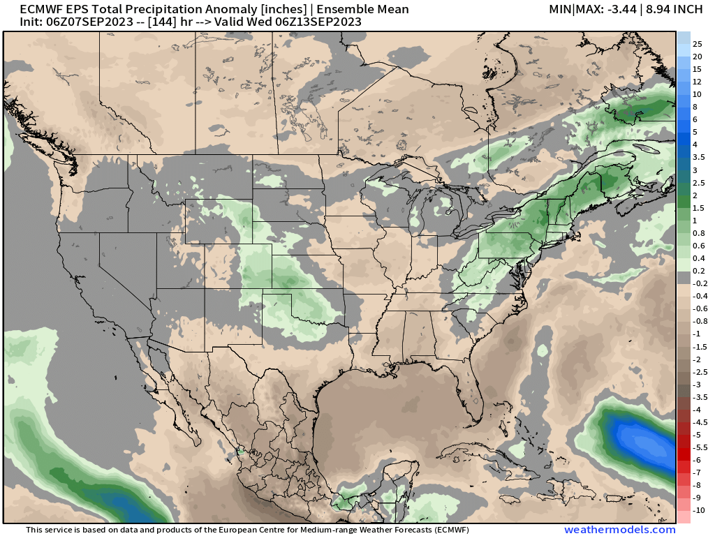
Through next Thursday we see some good precipitation across our area, particularly for the higher terrain of the Front Range and south across the Texas/Oklahoma panhandles. You can also see the rain from Lee as it makes its way north in the Atlantic next week:
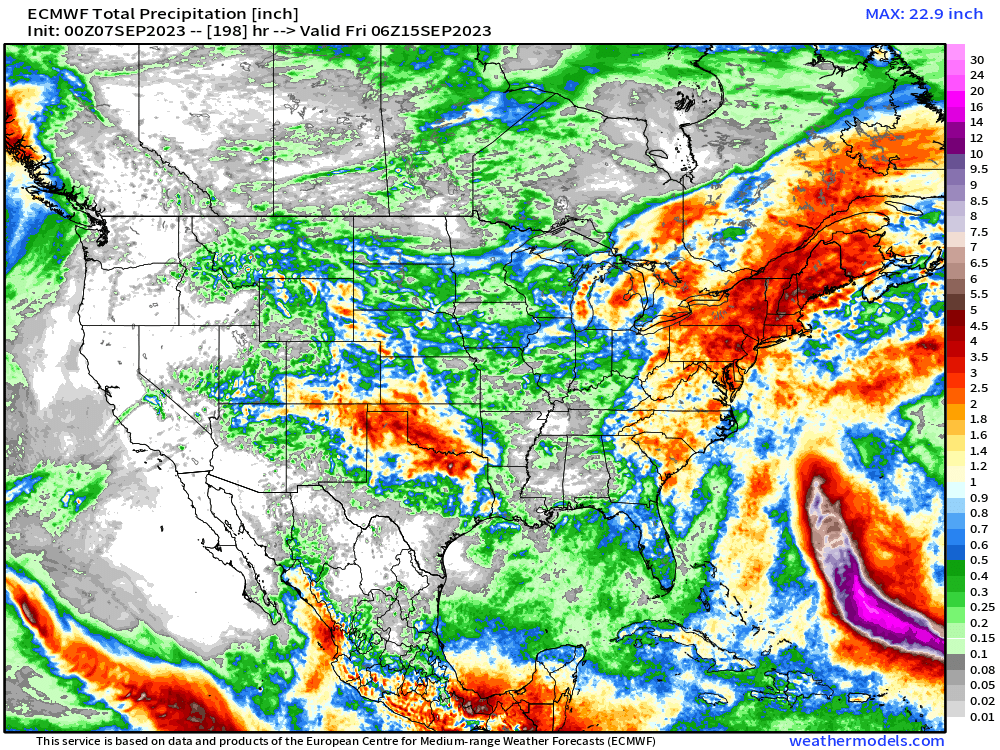
Zoomed in to northern Texas and Oklahoma, some 3 and 4" rainfall totals on the European model today through next week:
This is thanks to a deepening trough across the eastern U.S. and the passage of a rather strong shortwave and cold front Sunday and Monday through our region. As the ridge in place now gradually retrogrades, we should see the hot temperatures in place over the next couple of days replaced by much cooler air Sunday and into the middle of next week.
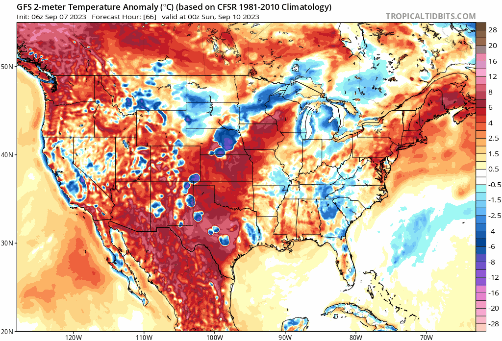
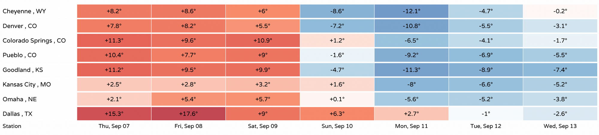
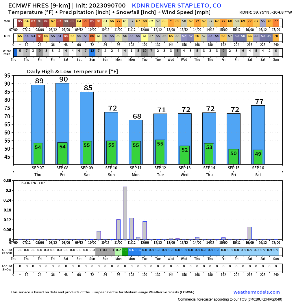
For Denver this means temperatures 10 to 15°F below average by Sunday and Monday, and below average temperatures across the board by early to mid next week:
The Euro shows highs in the upper 60s to low 70s for Denver starting Sunday and carrying through the week next week for Denver with even a shot at overnight lows in the 40s for the city!
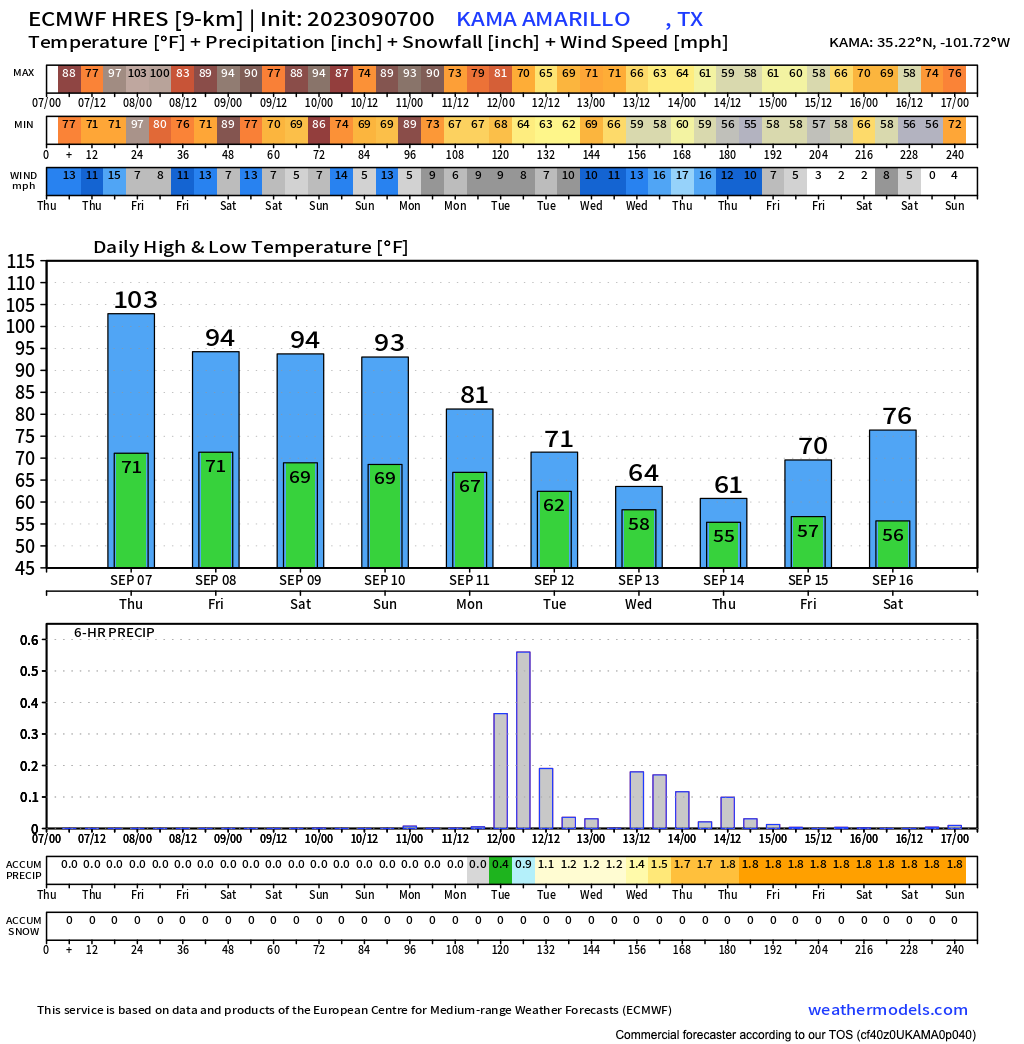
Similarly northern Texas where we see temperature tumble next week and a good chance of precipitation on the way for Amarillo:
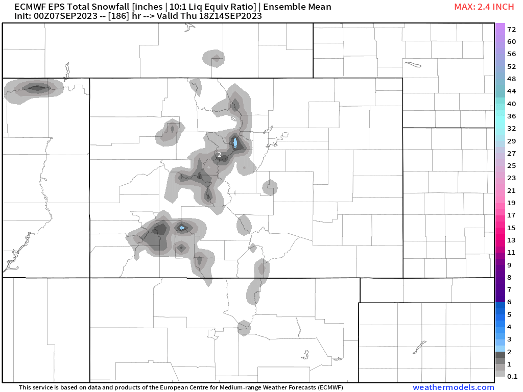
As for snow? Good bet some of the higher peaks will see their first dusting or light accumulation of the season later this weekend or early next week. The European ensemble mean has even a couple of inches in the forecast through Wednesday next week for the highest peaks west of Denver:
The season is-a-changing!