
Snow is on the way to Colorado this week: When, where, and how much?

As we covered for Weather5280 Insiders last week, changes are on the way for parts of the state for the middle and latter half of this week, which will include chilly temperatures, rain, and for some the first snow of the season.
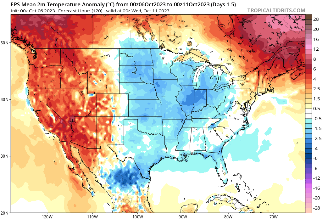
Uncertainty remains with exactly how things will unfold this week, namely around the exact track of the storm as it moves through Wednesday into Thursday, but also with regard to how much cold air we ultimately have to work with and when it'll arrive.
For the higher elevations of the northern and central mountains, we like the odds for accumulating snow this week. For Northeast Colorado quite a few questions remain unanswered.
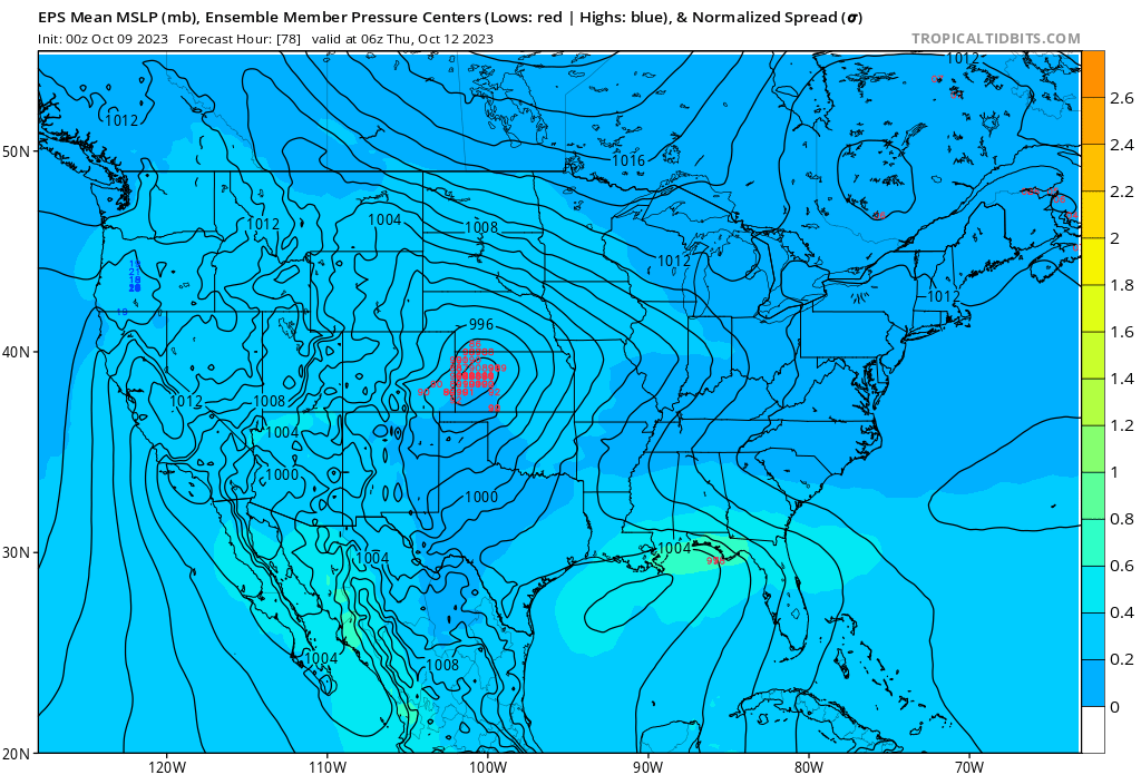
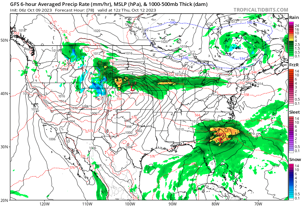
Models have largely coalesced around a northerly track for this week's system. Should that hold, the greatest impacts will be across Wyoming, Nebraska, and North Dakota vs across northern/northeastern Colorado. The last several runs from the European model show that the general idea is too far north for many of us to see the heavier rain and snow. Still, there's a good amount of uncertainty in the eventual track and speed of the storm – all images below are valid Thursday morning, with a good amount of wobbling on the placement of the upper level low.
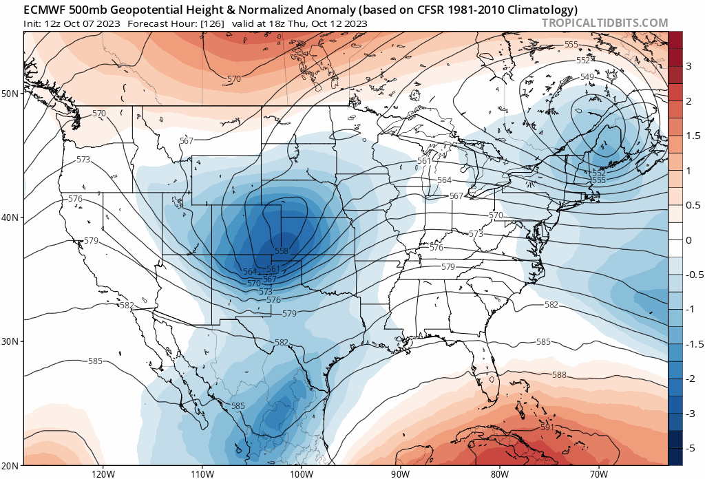
At the surface, we see the low setup across east-central Colorado Wednesday, ejecting east/northeast during the day Thursday. Again, the bias here is currently a bit far north for the Denver area, but supportive of some appreciable precipitation for northern Colorado communities, especially as you near the Colorado/Wyoming state line.
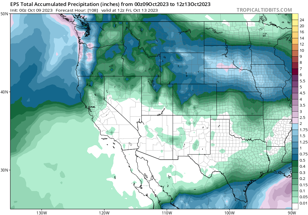
The ensemble mean shows the best odds for accumulating precipitation being for the northern and central mountains, then along the urban corridor generally from Denver north – splitting the I-70/I-76 corridors east of Denver. Easy enough to see that a wobble of 50 miles north or south greatly changes the calculus for the Denver metro area with regard to how much precipitation we are likely to see or not see.
Temperatures will be slow to cool, but will eventually get there. The best chance for rain to change to snow across the lower elevations of Northeast Colorado looks to be Thursday afternoon and evening, assuming we still have moisture to work with.
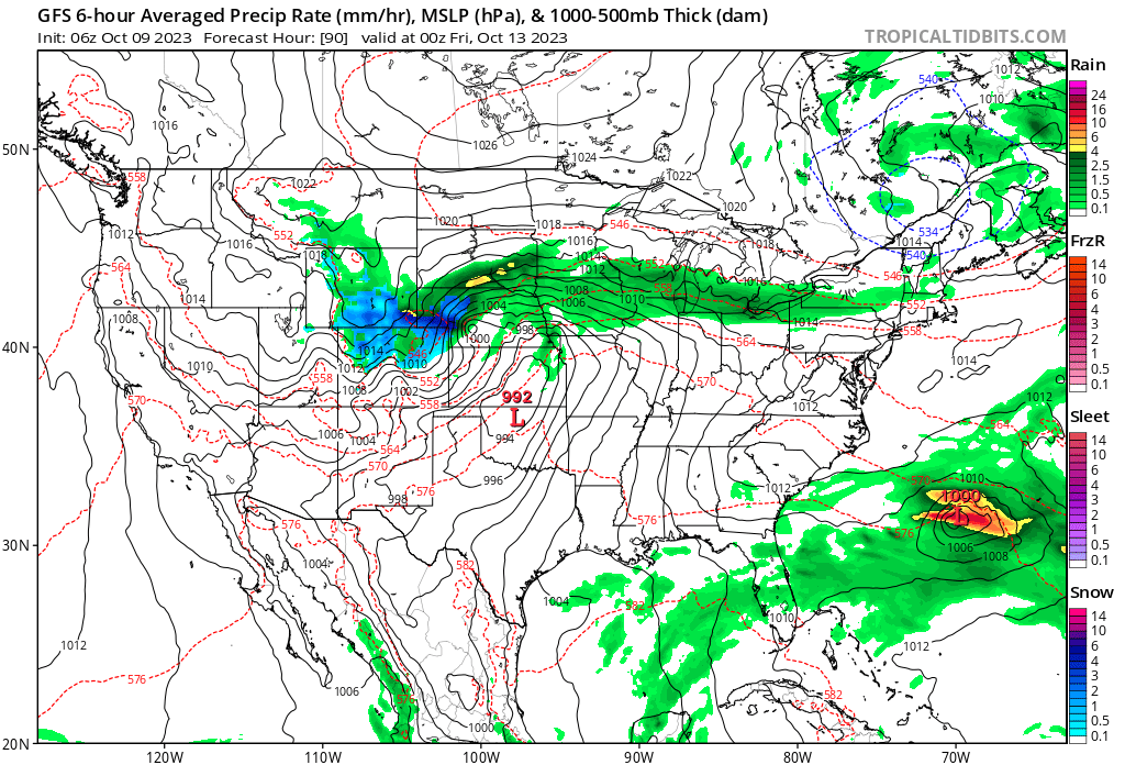
The latest GFS thinks there's at least a chance for some of us across NECO Thursday afternoon evening. It has snow coverage increasing across the high country Wednesday night, with a few scattered showers and storms across the plains, again heaviest stuff will be north:
By Thursday evening we see this model forecasting heavy snow along the I-8o corridor north of the state line, but also some rain changing to snow across parts of the Colorado plains, and particularly across the higher terrain west and south of Denver and again to the east/northeast. We shall see.
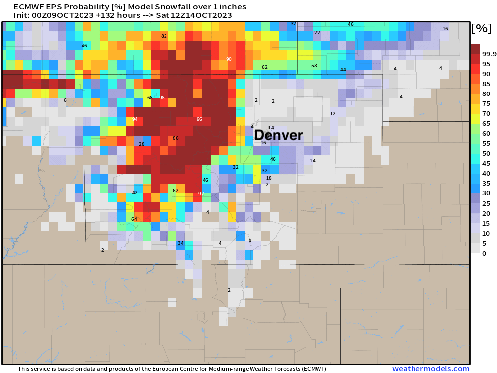
What are the odds Denver picks up its first measurable snow of the season this week? As of this morning, not overwhelmingly great but hey... there's a chance! For the Palmer Divide, Front Range foothills, and Cheyenne Ridge we see better odds on the table, and of course much of the high country should see some accumulating snow this week. Here are latest probabilities for 1" of snow or more through Friday night:
Think the odds end up a bit higher for Thursday in Denver? Make sure you enter our contest today to get your guess in, the chance to enter ends tomorrow!
Planning forecast
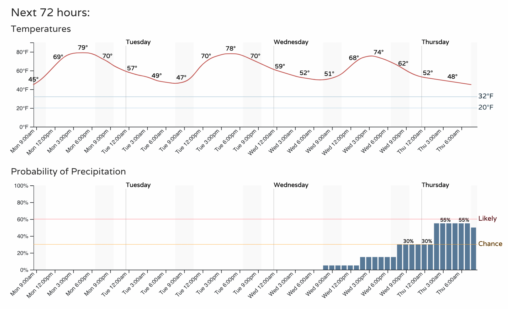
Highs will be in the 70s over the next several days along the Front Range urban corridor, but will drop into the 50s for the latter half of the week with guidance showing a low at or below freezing by Saturday morning for Denver:
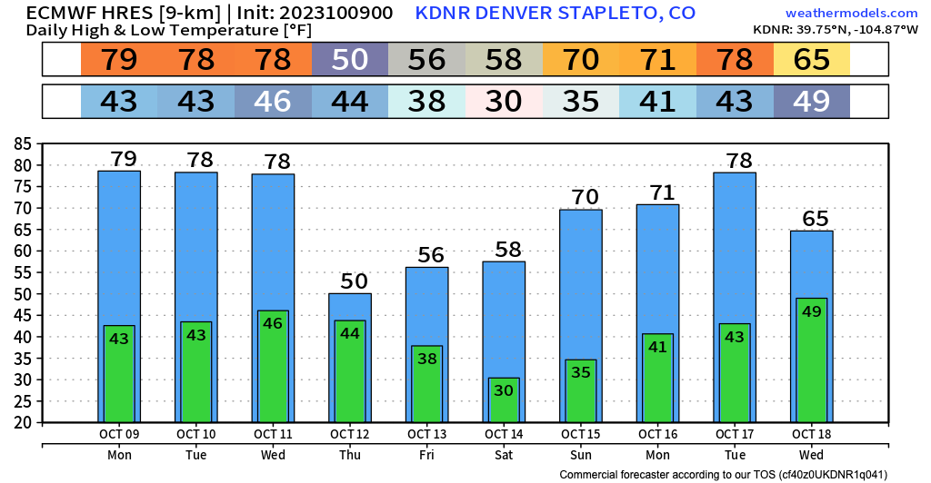
For the Front Range today and tomorrow will be dry and beautiful. Changes start to arrive Wednesday afternoon with some showers around and a hint of those changes on the way... with the best chance of precipitation (mainly in the form of rain at least initially) picking up late Thursday night into Thursday morning.
With the snow season heating up, don't get left out in the cold this winter! Stay one step ahead of the changing weather by subscribing to our email list today!