Colorado mountain snow returns, colder weather for the Front Range

Our slow start to the snowy-season continues statewide across Colorado. We're going to attempt to help out the slope this weekend as several waves of energy move across the state. Many of the ski resorts could see up to a foot or more of snow by Sunday night.
This will be a stark difference from much of what the state has see the past few days. many locations seeing above averages temps and lots of sun. On Wednesday Denver made it to 57 degrees at the airport, while locations over the southeast plains were in the mid-to-upper 60s.
Multi-day storm system into the weekend
Below is a map of upper-level height-anomalies – in laymen's terms, blue/green colder and unsettled, in orange and red, warm and generally drier. The loop of this GIF starts today, on Thursday, and finishes out on Monday.
As you can see, plenty of blues and greens pushing across Colorado. However, none of those systems can get consolidated enough to pull in moisture to the front range and eastern Colorado. They're basically just slamming up against the continental divide to provide the mountains with some decent snowfall. For the front range, chillier weather, and gusty winds by Saturday and Sunday will be the main story.
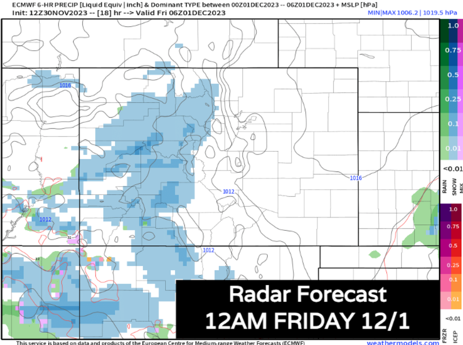
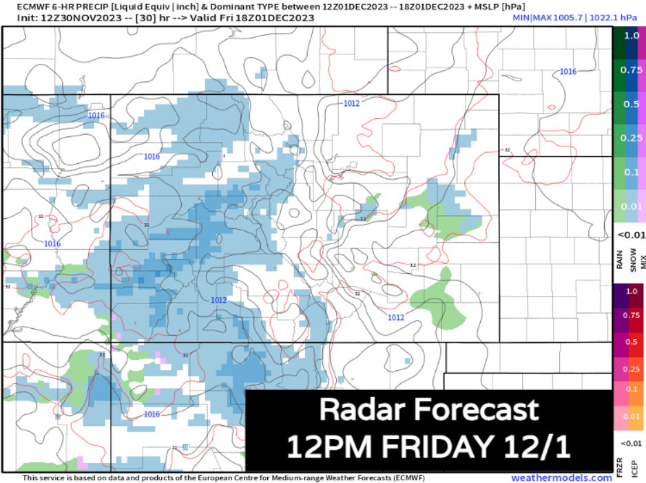
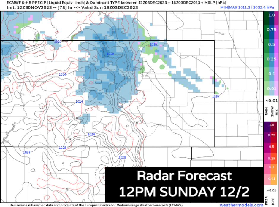
Let's time things out with the ECMWF model.
We start to see flakes fly in the high country after sunset on Thursday. Snow will continue off and on for most of the night into Friday morning. We're expecting most of the day on Friday to feature snow in the higher terrain. Expect slow, but probably not impossible travel. Keep that in mind if you're heading up for a weekend of skiing. Most of this first round of snow impacts the I-70 mountains, and southern mountain ranges.
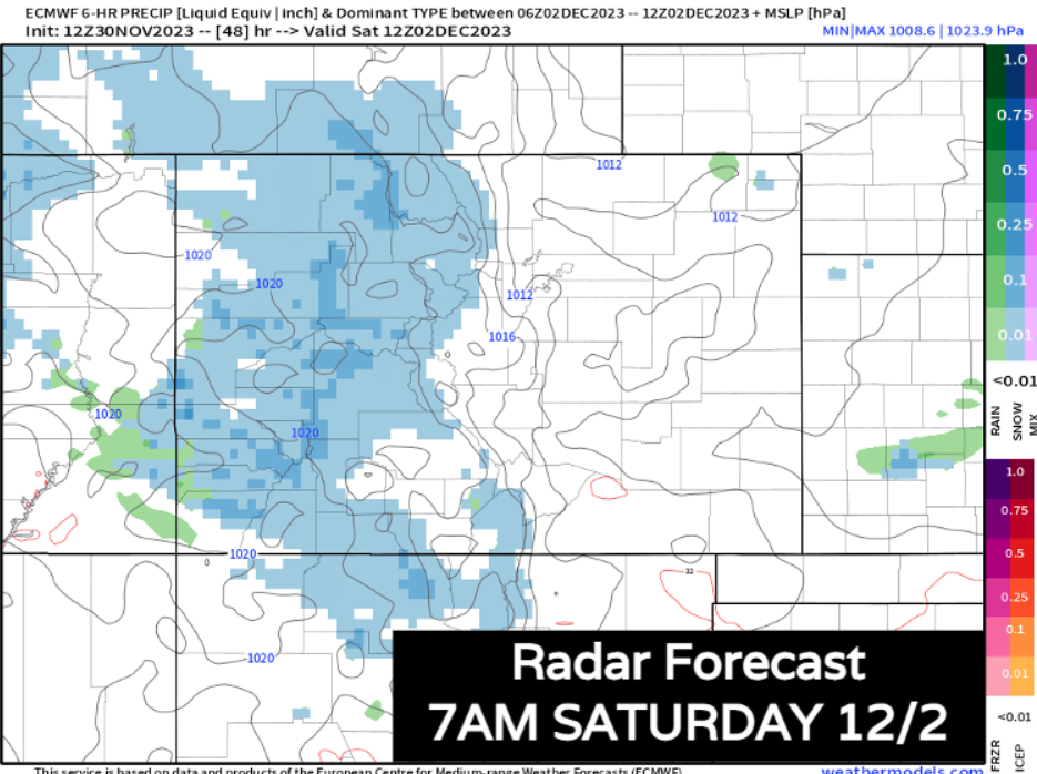
Snow will likely continue Friday night and into Saturday morning, with coverage expanding to the northern mountains including Steamboat Springs.
By Saturday afternoon, this first wave starts to exit. On its way out, it might bring a few snow showers along or east of I-25... but any significant snow stays in this hills through this weekend. Saturday evening, the snow slows down for the mountains a bit.
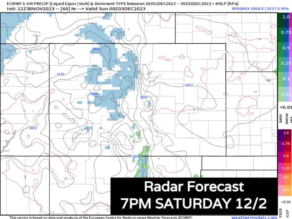
Another wave of energy passes into the northern mountains into Sunday morning, with some heavy snow expected from Aspen to Steamboat. This could feature some pretty tough travel – another thing to keep in mind if you'll be heading home at this time.
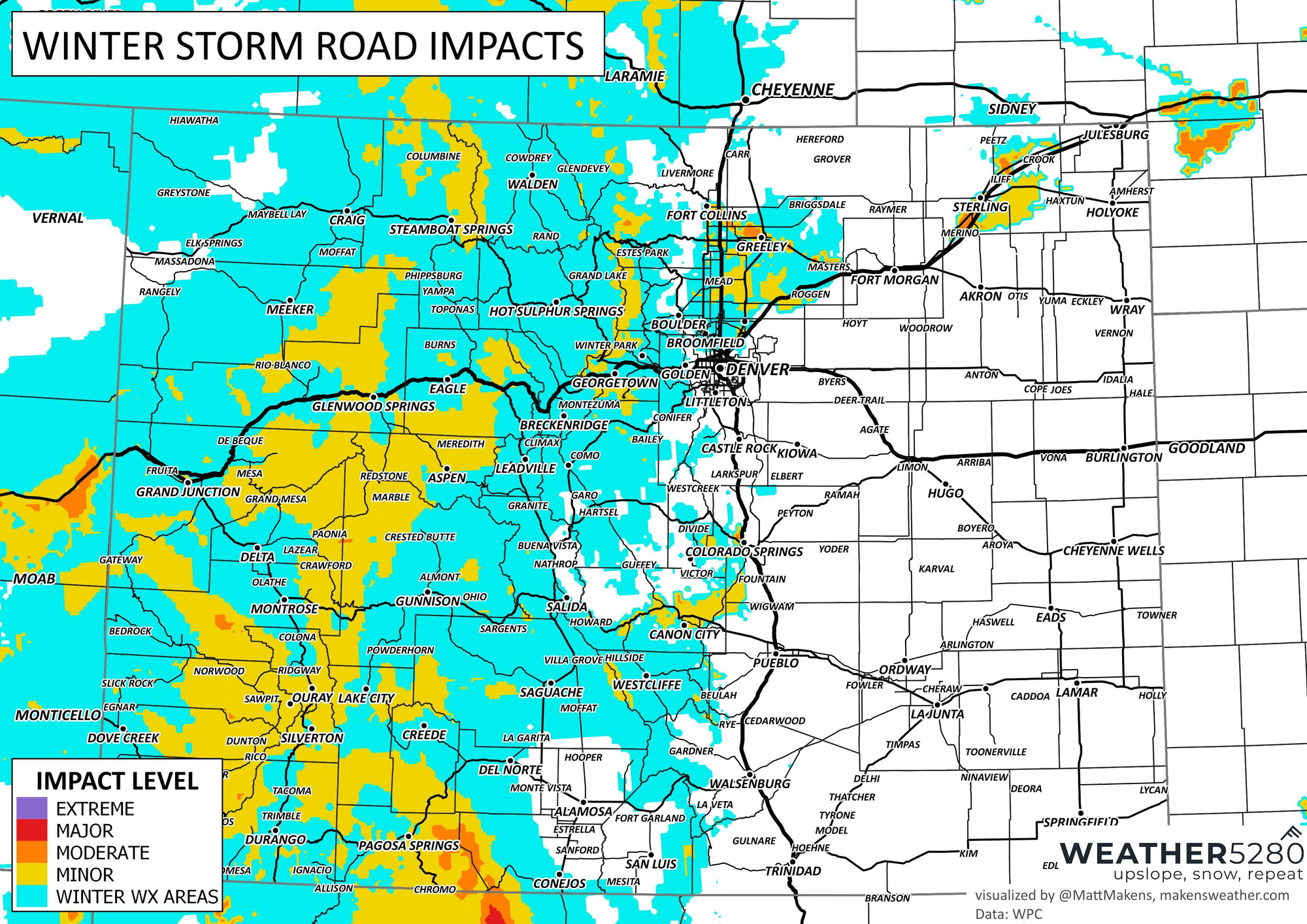
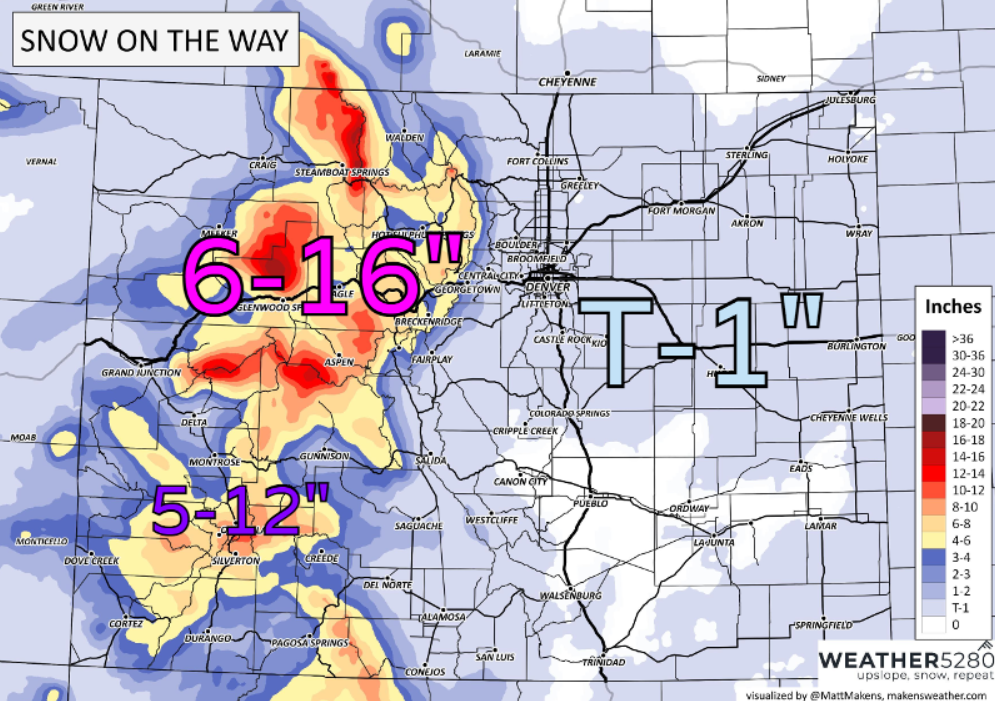
How much snow?
Overall, from early Friday through Sunday night, a good hit of snow is set to impact the continental divide.
Mountain locations along and north of I-70 do the best with this system, 6-16" of snow expected.
Over the southwest mountains/San Juans, not bad either with 5-12" possible.
Further east, there will be a few snow showers here or there... but nothing more than a dusting and maybe and inch or so in spots is expected.
Unfortunately this won't be a snow "drought" buster for the state, but should bring the numbers up just a bit... but we'll need another couple systems like this to really get things back on track.
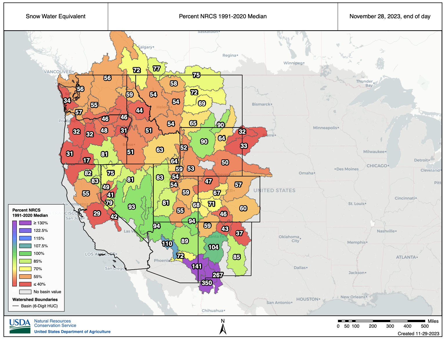
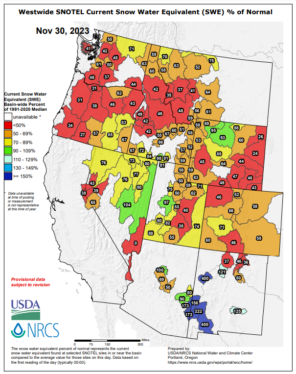
SNOTEL data over the western U.S. continues to be pretty abysmal for most... expect for Arizona and New Mexico which are cooking good. A hallmark of the enhanced subtropical jet during El Nino.
Looking ahead
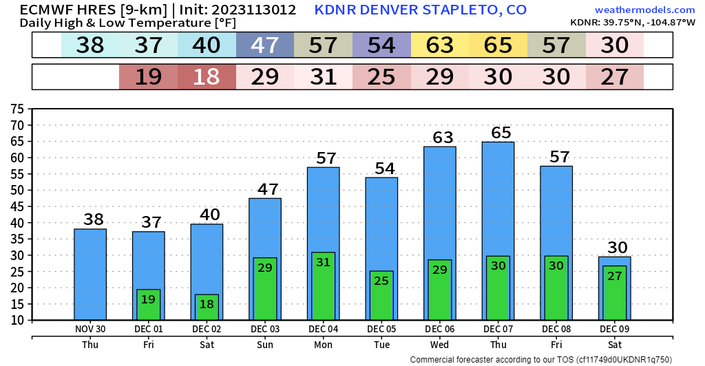
After the cooldown and mountain snow this weekend, we'll see another strong ridge of high pressure build into place next week. Dry & mild stretch is looking likely during this time period.
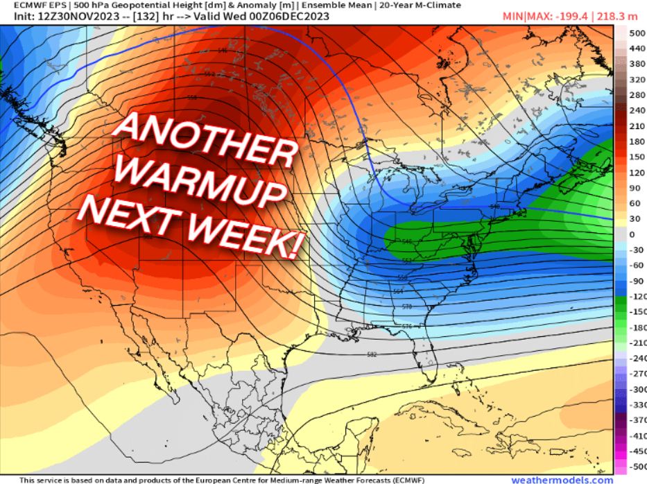
Big-time temperature seesaw coming to Colorado... 30s to close out this week, 60s and probably a few 70s over the plains look possible by Wednesday and Thursday.
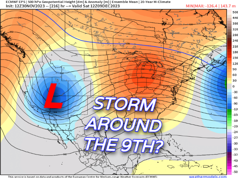
As we discussed yesterday, after that there's a decent signal for another storm system by the end of next week (Dec 9-10)... for now, it's in "fairy dust" range – but a strong ensemble signal like the one below is at least enough to talk about for now.
We'll probably push out another update on this upcoming storm in the next day or so, as well as keeping out eye on the possible system late next week – stay ahead of those forecast changes by subscribing to our email list today!