Colorado weather: Light mix with slick spots Tuesday morning, Wednesday storm approaching

After mild days Sunday and Monday, we're heading into a cloudier and colder pattern through midweek. It's all kicking off with some moisture streaming into the region Monday night and Tuesday morning.
Short range models are indicating a some drizzle and snow showers along the northern foothills and front range through Tuesday morning and into the early afternoon.
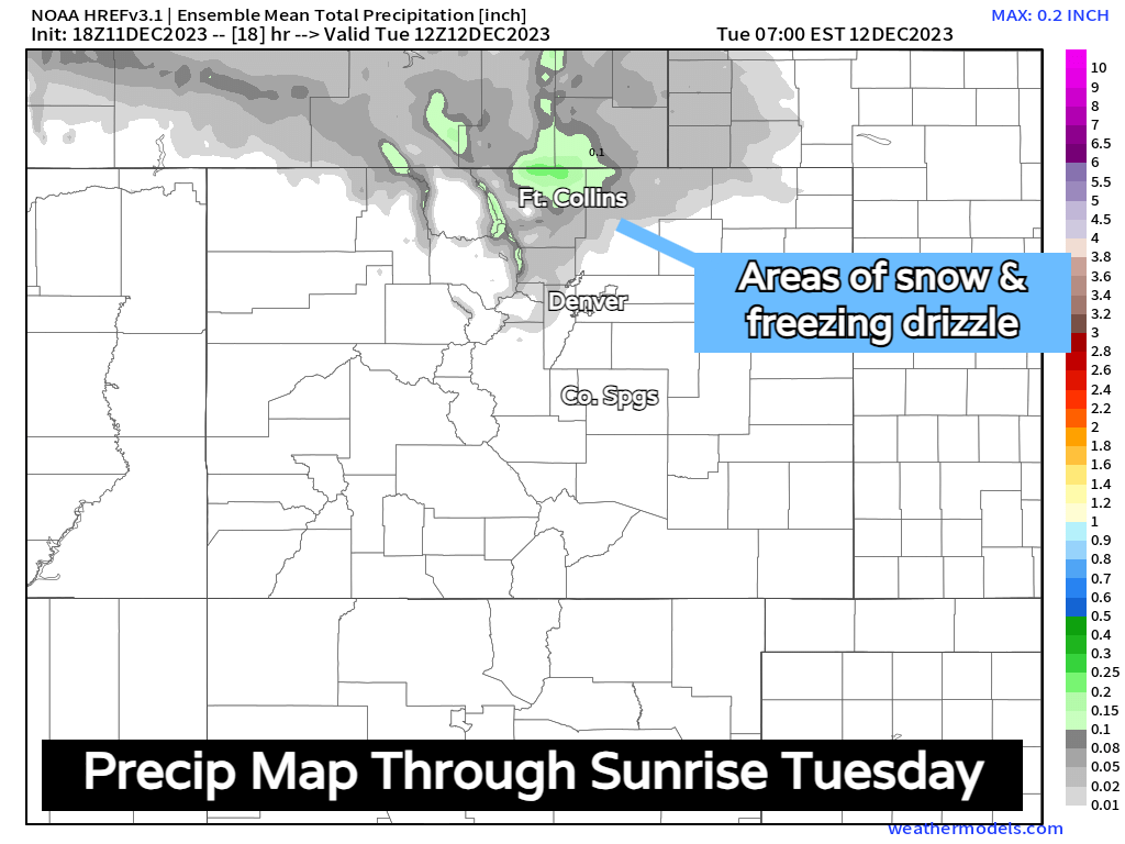
The signal for moisture is highest for Larimer and Weld counties, but we'll likely see some moisture drawn into the Denver Metro area by morning too. Slick spots on bridges and overpasses will be possible, but not likely widespread. Keep this in mind more if you have to drive north towards Wyoming though.
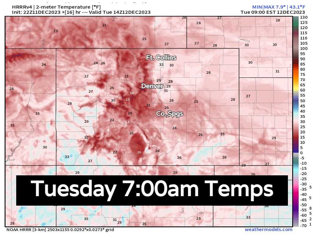
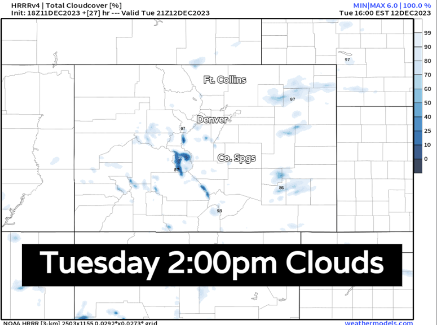
The rest of Tuesday is looking pretty gloomy. Lots of mid and high level cloud cover (on the image below, blue would be blue skies...white is the cloud coverage). Temps will be chilly all along the Front Range with highs in the 30s and 40s.
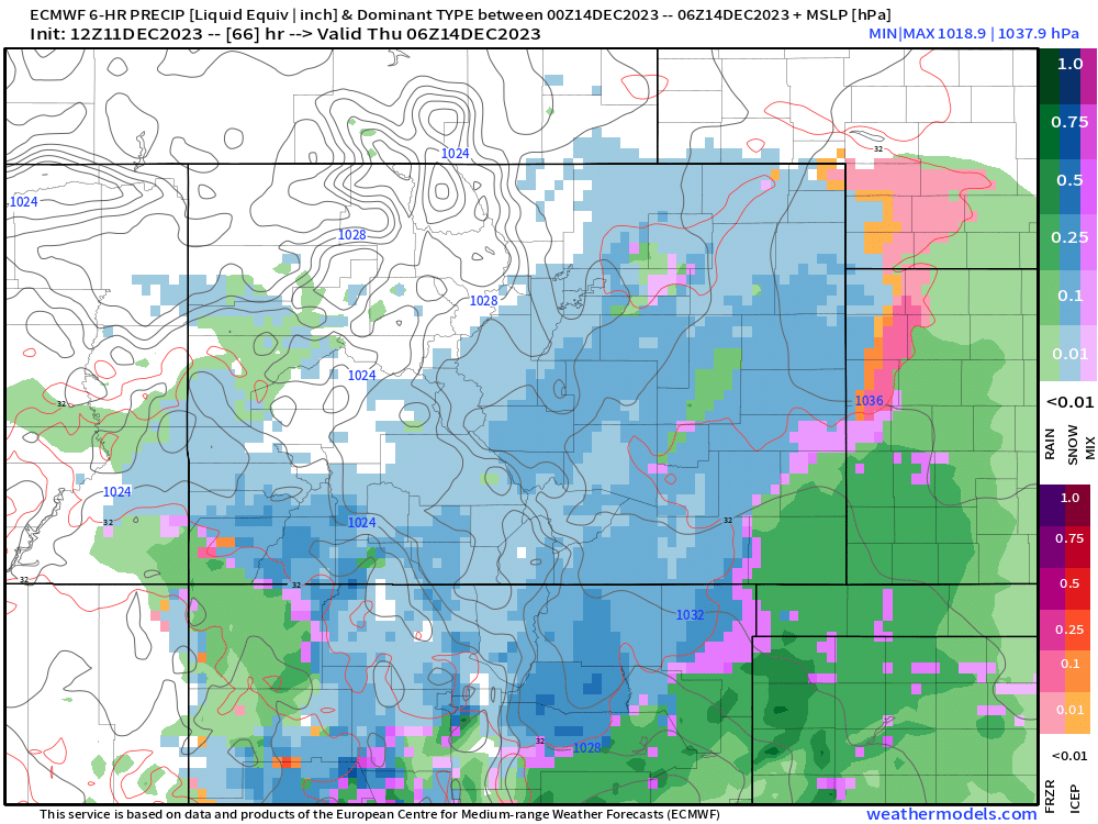
Another storm Wednesday?
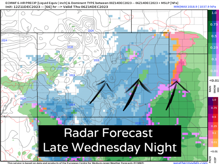
We're going to be sitting under a slow-moving storm system that will draw in tons of Pacific and Gulf of Mexico moisture Wednesday and Thursday. It's going to provide a lot of cloud cover and keep temperatures chilly through midweek. For areas south of I-70, we'll eventually see some rain and snow into the mix.
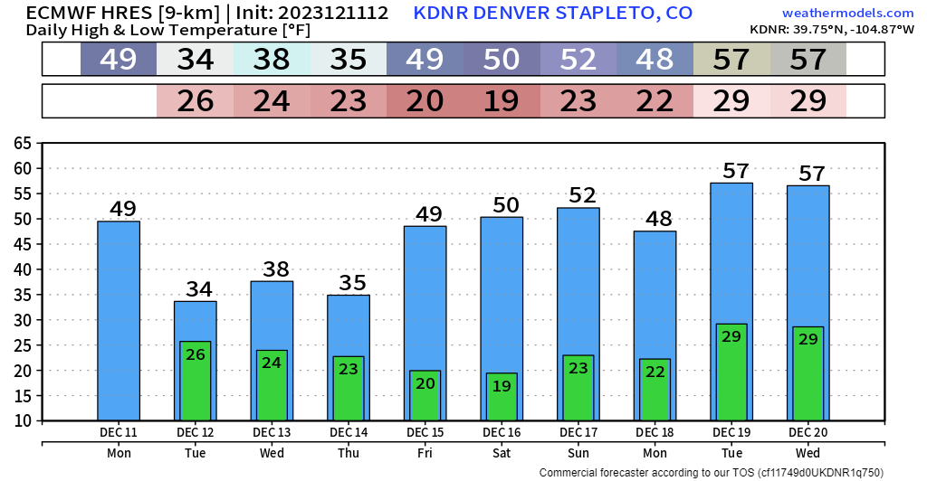
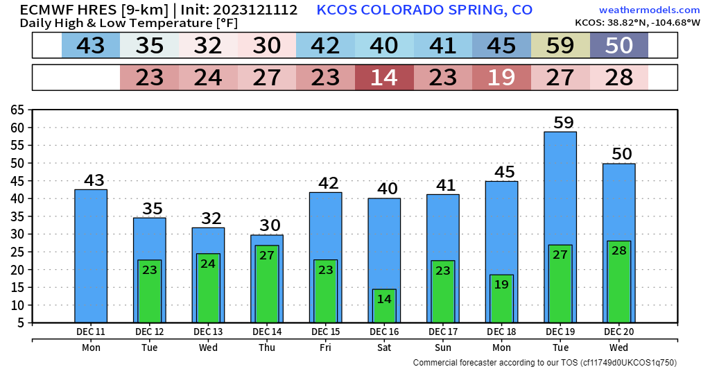
With the enhanced subtropical jet, some good moisture is expected over the southern plains of Colorado – this area has seen some drought creep back in a bit, so this is welcome! For Denver and north, this likely isn't a huge system, but at the very least, some mixed rain and snow showers are possible Wednesday night into early Thursday morning.
For areas like Colorado Springs and Pueblo, this storm has been creeping farther and farther north – the potential for accumulating and disruptive snow is possible Wednesday night and Thursday morning. We'll provide updates in the days ahead.
If you haven't done so already, subscribe to our email list, you'll get notified about our latest posts on Wednesday's system as we continue to track it through midweek! And for insiders, check out our latest Weather5280 Insider where we take a closer look at how the rest of the month is expected to turn out.