Colorado weather: Wind, fire, and snow through Tuesday

After a very active start to February, we've really toned things down. We are now starting to see the atmosphere charge up again ahead of our next storm system set to move through Monday and Tuesday. Ahead of it, wind and fire danger concerns take us through the rest of the weekend, and on the back half, mountain snow developing Monday night, leading to a chance at some front range snow by Tuesday morning.
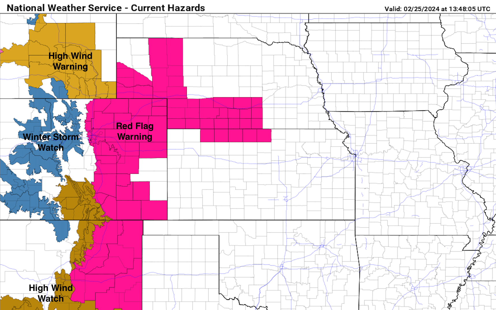
Above is the current NWS hazard map as of Sunday morning. Widespread high winds and fire danger across eastern Colorado today as you can see by the extent of the Red Flag Warning.
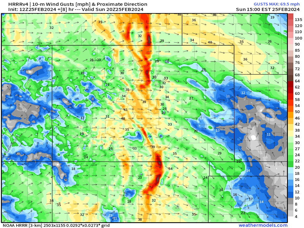
Below are a look at wind gusts and direction by this afternoon. Keep in mind that winds will likely start to pick up as early as 9 or 10 am, and be strongest from lunch to dinner.
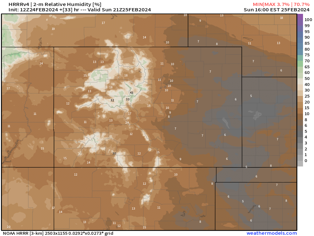
Corresponding relative humidity values paint the picture well too. Single digit and low teens RH with 25-40 mph gusts is a perfect recipe to fire danger.
Unfortunately, that doesn't look to be the worst of it... The storm approaches Monday and that's when winds really look to start cranking. Below is the HRRR projection for winds by Monday afternoon – an exceptionally windy day across the state appears on tap:
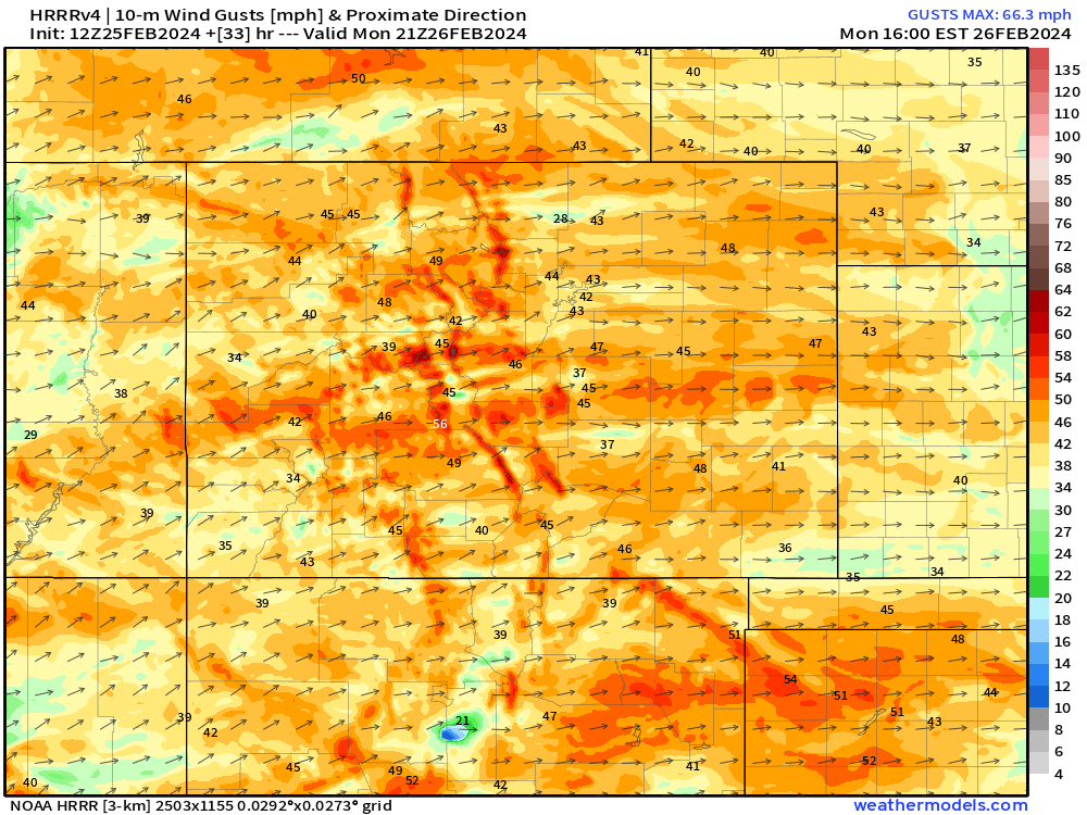
Gusts on the order of 40-50 mph look to be pretty widespread. Relative humidity will likely be back into the single digits too.
The Douglas County Sheriff's Office has issued a pre-evacuation notice for Perry Park Road south of Tomah Road due to GRASS FIRE. You should be alert and ready to leave this area at any time. If you are concerned about your safety or believe you are in danger, do not wait for an… pic.twitter.com/uyU7sqdUb2
— DC Sheriff (@dcsheriff) February 23, 2024
There's quite a bit of dry brush out there right now, and like we saw on Friday with the fire near Perry Park, any spark, even with light winds, is going to be very effective at starting wildland fire. Thankfully with quick response and relatively light winds, crews were able to stamp that thing out pretty fast.
Don't be hesitant to call out smoke the next few days, especially Monday as fire behavior could be very rapid – and as always, please practice fire safety!
More wind and dry conditions are expected on Tuesday, with the highest fire danger potential south of Palmer Divide. Cold frontal passage early Tuesday morning should give the northern front range a bit of relief from that. As that front moves through, we're looking at some snow potential.
Snow looks to pick up in the Mountains late Monday morning, with travel become very difficult into Monday evening and night. Snow showers look to fire over Larimer county around sunrise Tuesday and quickly spread south through the rest of the day. With snow falling during the day for most along I-25, road impacts may be muted a bit, but it's definitely possible we see slick conditions develop as the sun goes down Tuesday evening.
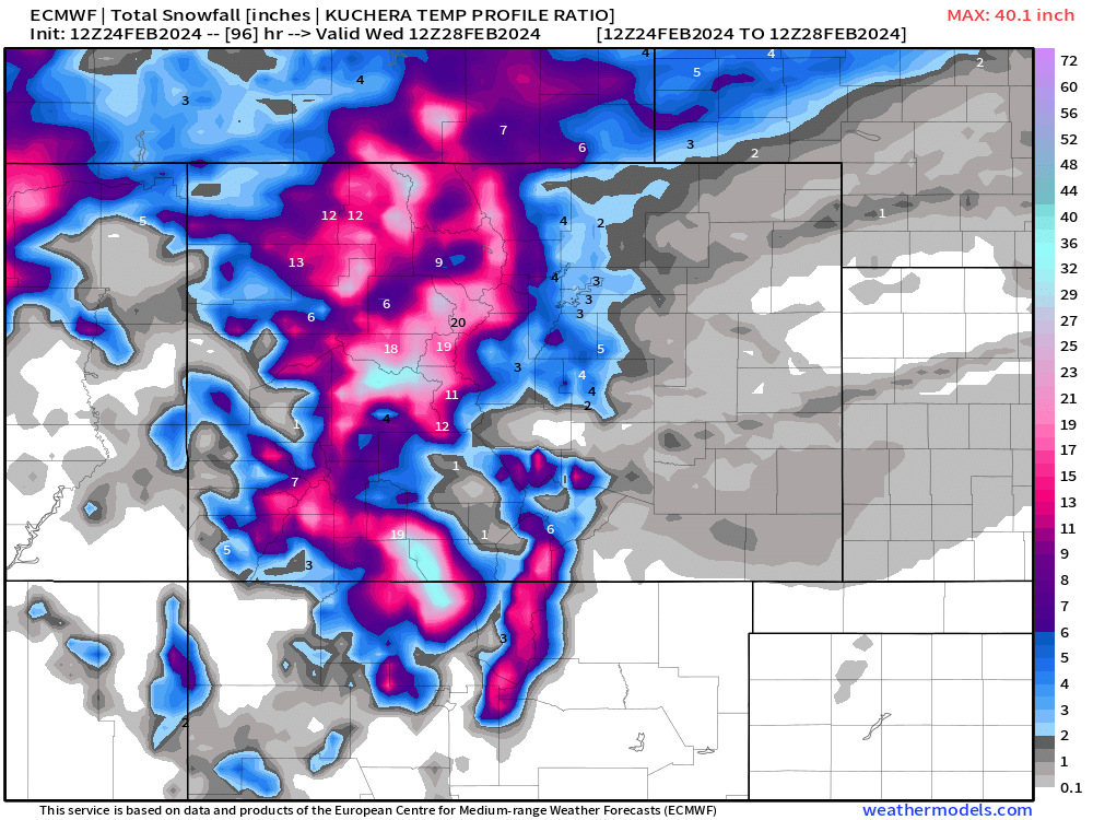
A rough start on snowfall totals would put the I-25 corridor from Fort Collins to Colorado Springs under the gun for 1-4". Perhaps a few spots on the Palmer squeezing out 2-6". Many mountain locations are under the gun for a healthy 1-2 feet of snow. There's still quite a lot of uncertainty for snow totals east of the mountains at this point, so you'll want to keep up to date.
Get those updates straight to your e-mail inbox by subscribing today 😁