Denver Weather: Wrapping up the weekend with rain and snow to kick off the week

As we settle down after a busy weekend, know that Monday will be impacted by the weather. Those returning to the metro areas from the mountains will have snow to drive through Monday and that will turn into chances of rain and snow as they move from the foothills into the city. Let's kick off this blog's images with an hourly planner for Denver's temperatures and chances for precipitation.
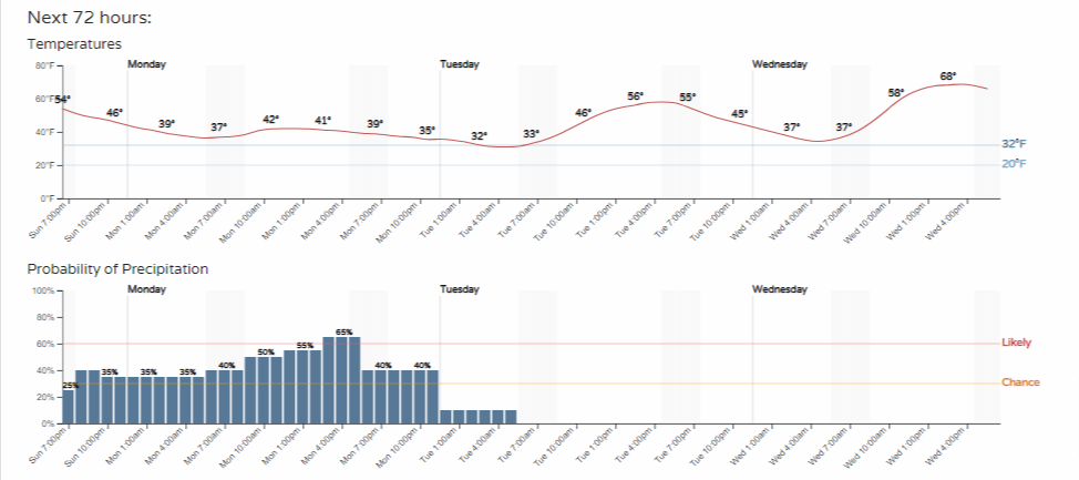
First, notice that temperatures hardly budge on Monday, staying mostly in the lower 40s. Tuesday into Wednesday, we see a rapid warming trend hit as chances for showers drop.
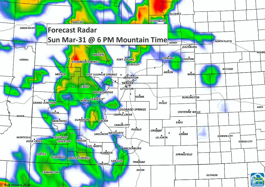
Turning to that moisture timeline, notice a chance of showers now through early Tuesday morning; the peak is later Monday, but the odds are far from widespread guaranteed moisture—meaning, we have scattered showers around, but not all of us will catch the water. Here's an animation showing estimated shower locations:
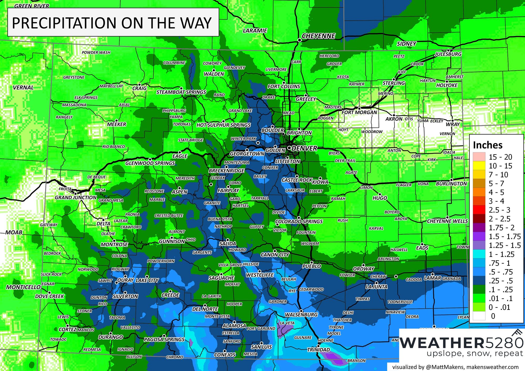
In terms of total potential water, we have the following precipitation estimates. (Generally less than 0.10" north and east of Denver, 0.1 to 0.25" around Denver and Colorado Springs, and more than 0.25" into the foothills, with the wettest of all being the southern mountains.)
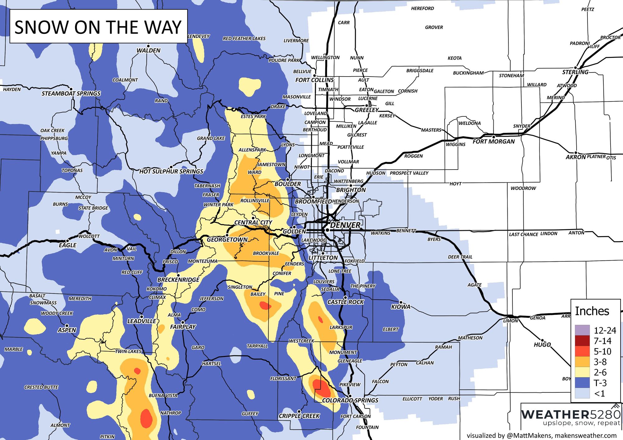
Now, how much snowfall is from that water? Those estimates are statewide, and then they are zoomed into the Northern Front Range.
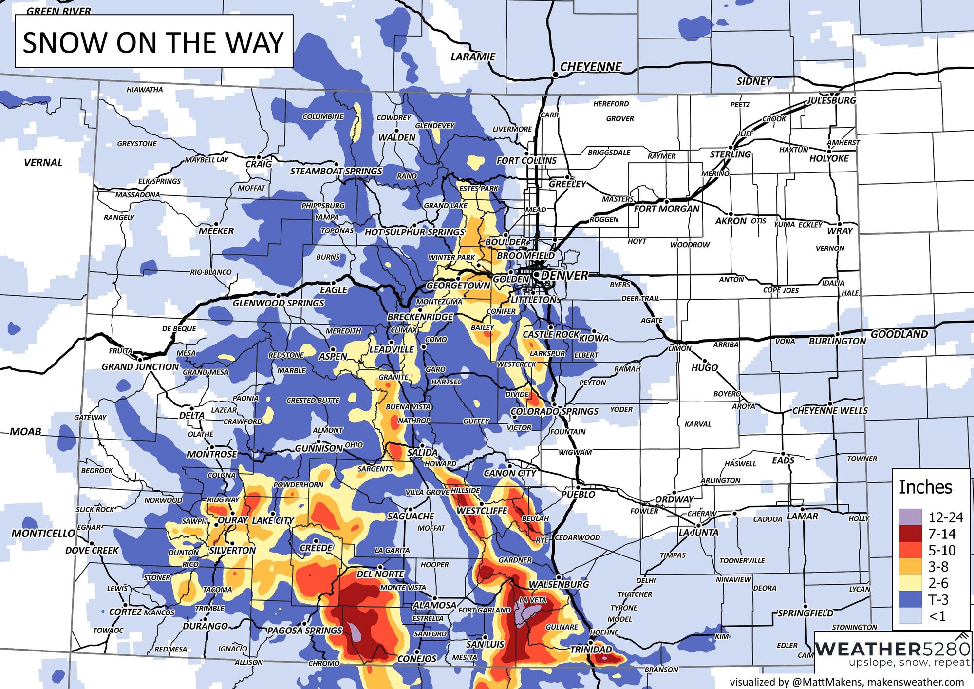

In theory, if you get a snow shower, you are more likely to be in the foothills, but the city itself may see some snowfall of a low amount. Move into Douglas, Western Elbert, or Northern El Paso Counties, and you could see a couple to a few inches. There will be areas of three to eight or isolated higher totals from the foothills to the mountains.
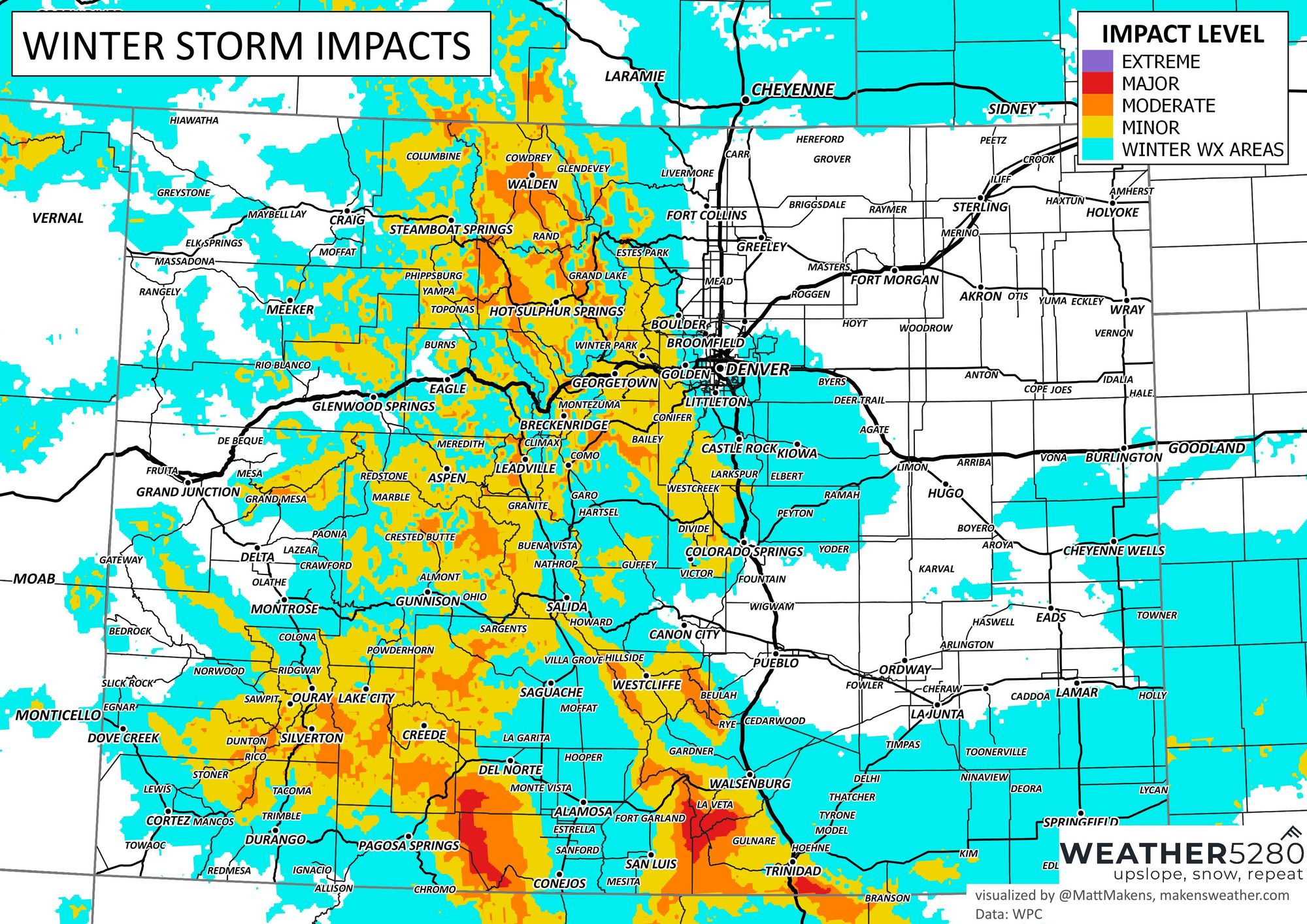
What impact will this have on our roads? There is a moderate impact on travel times and speeds in the mountains - although there is some major impact on the southern mountains. For the metro areas, wet roads mostly with some that could become slushy and icy for drivers coming down from elevations into the city. Most of us fall into a lower impact category, though.
If something looks goofy on Monday, we will get you an update on the storm as it passes through; we don't want you stuck without knowing - as always, subscribe to weather5280 to stay ahead of the storm!