Colorado weather: Warm and windy to end the week, turning unsettled for the weekend

We are tracking the next storm system that will bring rain, snow, and wind to the state by the weekend, but ahead of that... warm temperatures (and yes, high fire danger)!
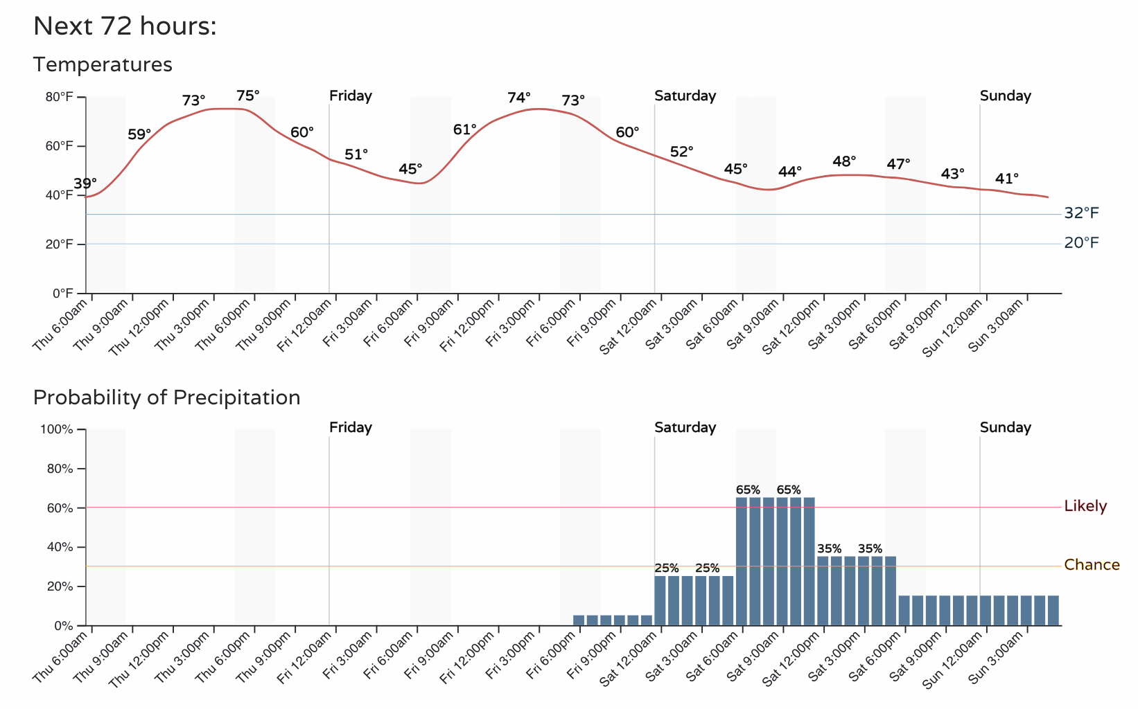
Denver finally hit the 70°F on Wednesday (71°F officially) marking the latest first 70°F day in over 40 years for the city. We should have little issue making it back above 70°F today and tomorrow before changes arrive Friday night into Saturday.
Here is the latest hourly planner for the Denver area:
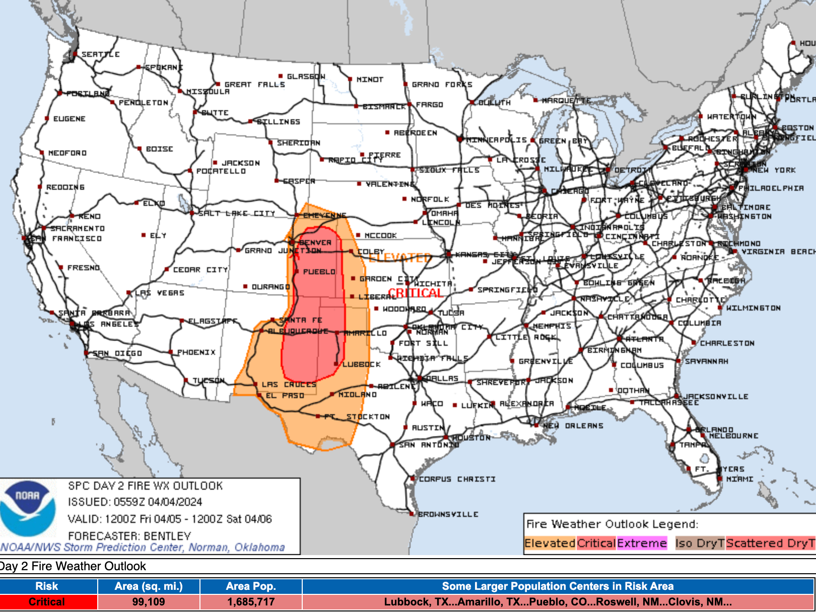
While temperatures will be quite pleasant over the next two days, the wind and low humidities will mean an uptick in fire danger across eastern Colorado as well, particularly on Friday. In fact, much of the eastern half of the state is under a Red Flag Warning for Friday.
Here is the latest Fire Weather outlook for Friday, showing elevated to critical fire danger across the eastern half of the state.
Weekend outlook
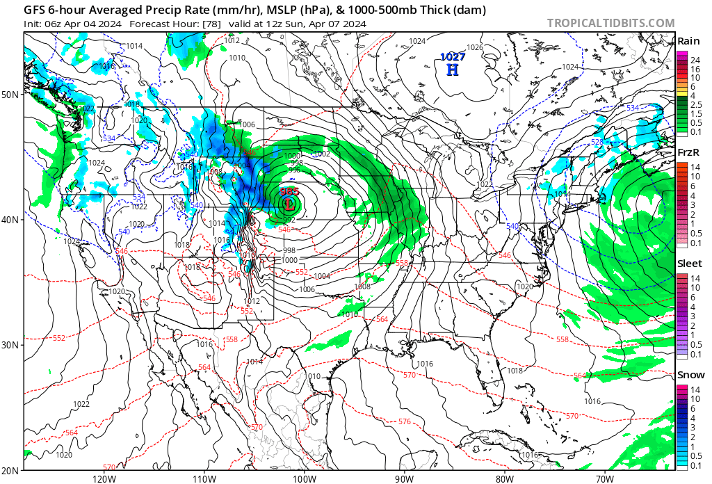
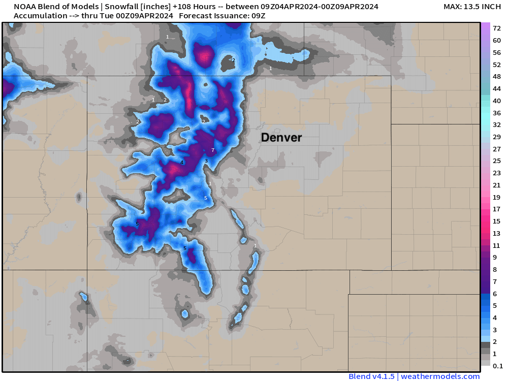
The approaching storm system for the weekend that will be responsible for some of that wind on Friday will bring some good mountain snow to the state, but is expected to track a bit too far north for the Front Range to really capitalize on moisture from this event. Still, look for some rain and snow showers to try and peel of the hills at times on Saturday, with a generally cooler and damper forecast on the way for the weekend.
The blend of models shows some nice precipitation for parts of the high country, but east of the hills most of the meaningful moisture ends up north of the state line with this system. Still, some moisture progged for northeast Colorado, so be prepared for that.
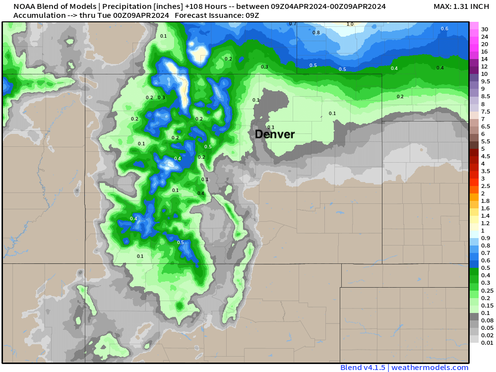
As for snow... be prepared for winter driving conditions if you head to the hills this weekend. Some resorts could pick up upwards of 8" of fresh, late-season snow!
Odds for snow at lower elevations are low, but some models show a burst of snow for the Palmer Divide Saturday morning, and then a bit of a quick-shot for rain to change to snow across the northeast plains at times on Saturday as well. We'll see.
For now, plan on enjoying those WARM April temperatures on the way today and tomorrow, and remember – be smart with ignitables, we don't want to see any wildfires!
We'll keep an eye on the weekend, and see if anything changes with regard to track and who sees how much rain and snow.