Incoming system will be exceptionally windy; High Wind Warning issued for Northeast Colorado Sat and Sun

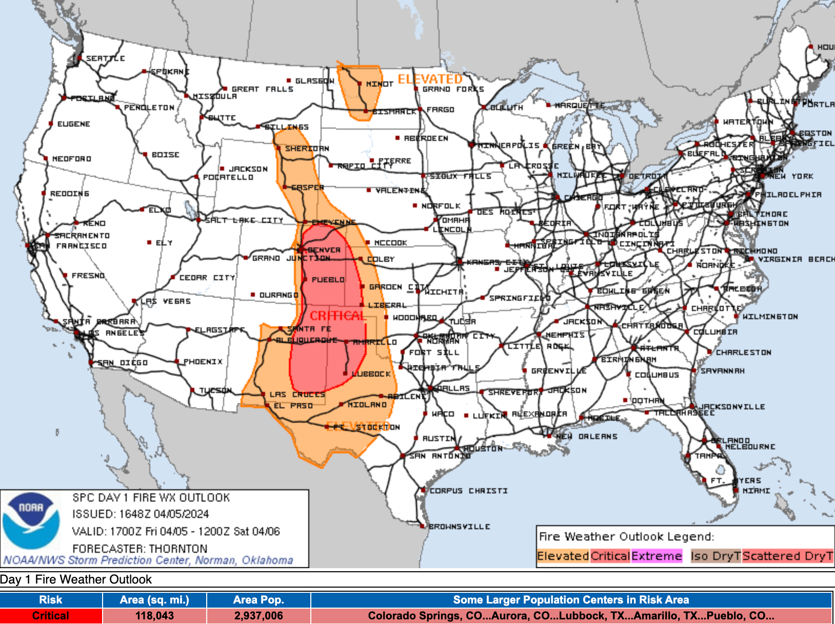
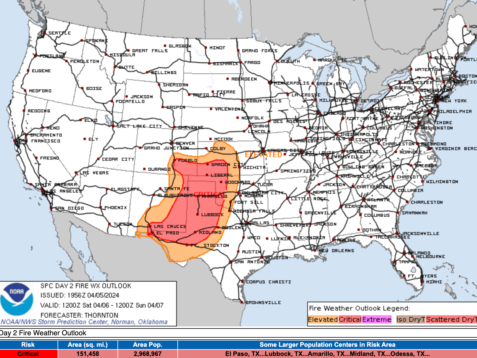
The fire danger remains high across all of eastern Colorado this afternoon as gusty winds, warm temperatures, and low humidity levels remain primed into this evening. Here's a look at current fire risk across the CONUS:
And multiple fires across the region, including the Vision Hills Fire northeast of Pueblo which as forced some evacuations this afternoon.
UPDATE: As 1:50 pm
— PuebloCounty Sheriff (@PuebloCountySO) April 5, 2024
Approximately 25 homes have been asked to evacuate due to the Vision Hills Fire. Residents half mile north of 1945 Overton Road are asked to evacuate. A reception center is being set up at 1650 Cooper Place.
The incoming system, and passage of a cold front will help the overall fire threat across northern Colorado on Saturday... but in some respects the help we get from the cooler temperatures and precipitation(?) will be offset by extremely strong winds along the Front Range this weekend.
Here is the Fire Weather outlook for Saturday, but don't sleep on the potential along the urban corridor and immediate foothills as the wind picks up Saturday into Sunday.
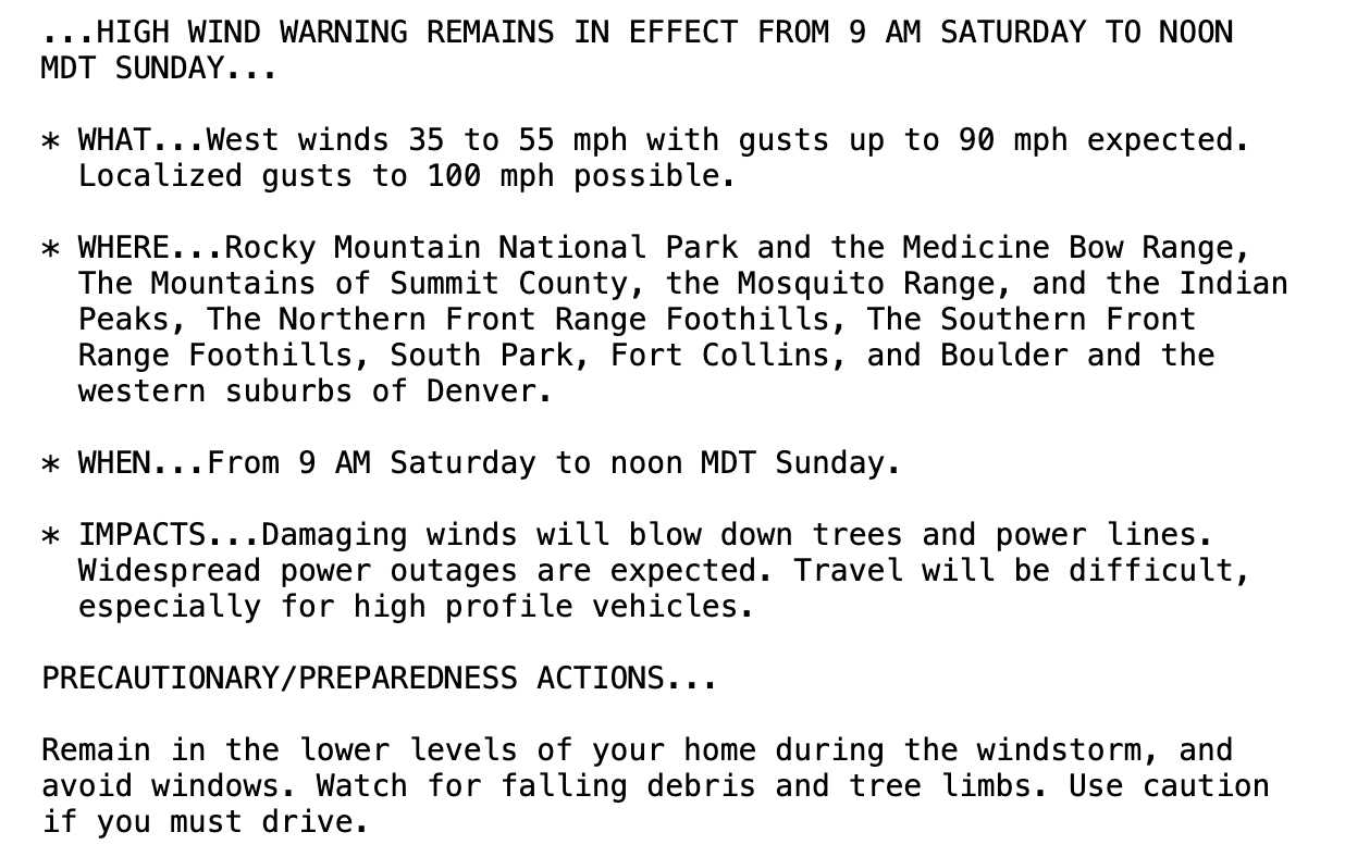
High Wind Warning
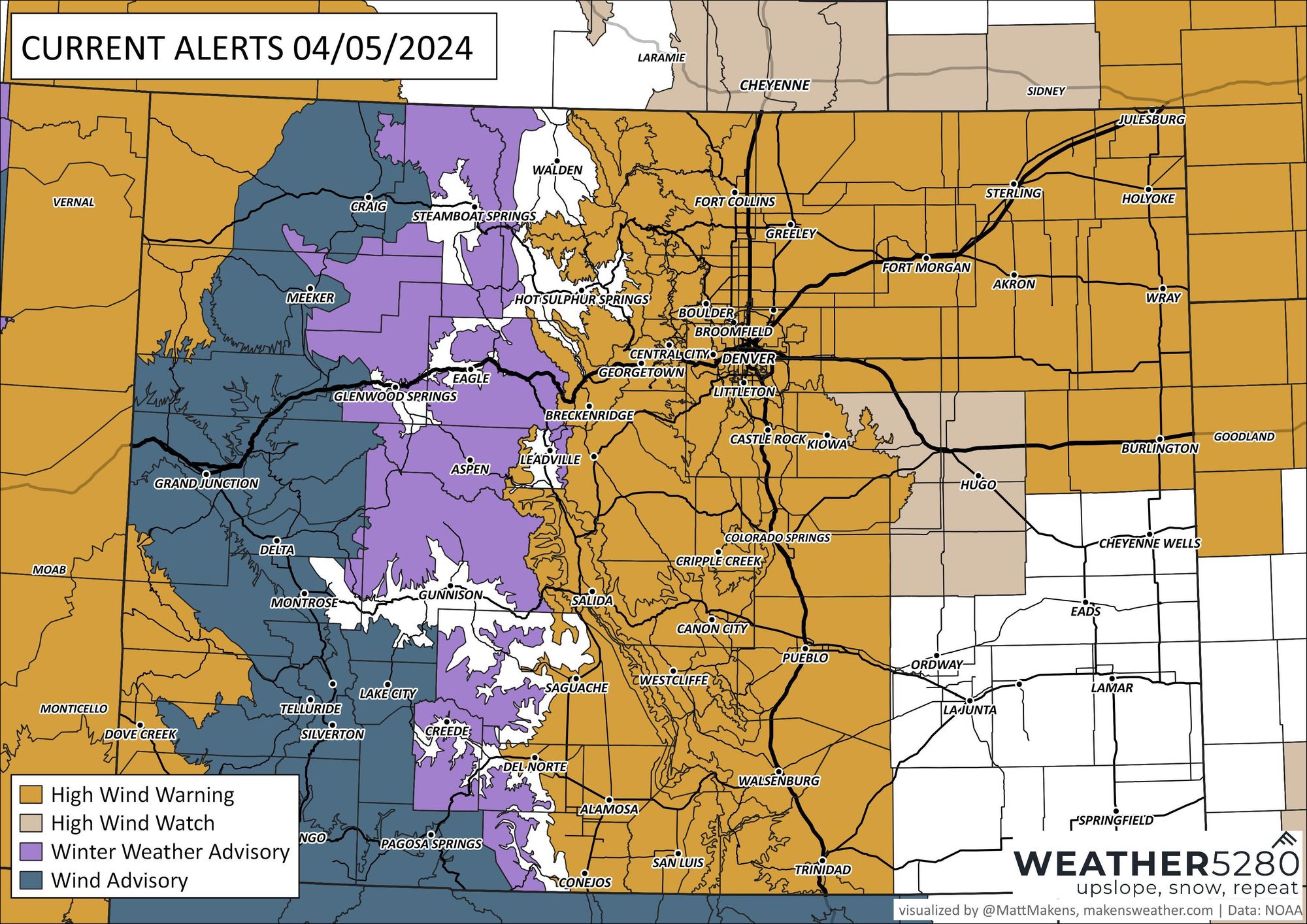
A High Wind Warning goes into effect Saturday morning for the foothills, and noon for the urban corridor. It'll continue through Sunday morning. Here's a look at the extent of the Warnings, with many of these areas also under a Red Flag Warning at the same time.

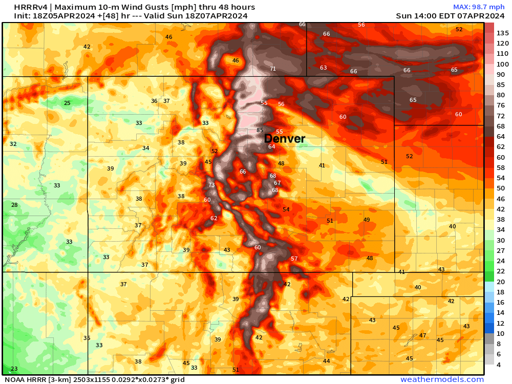
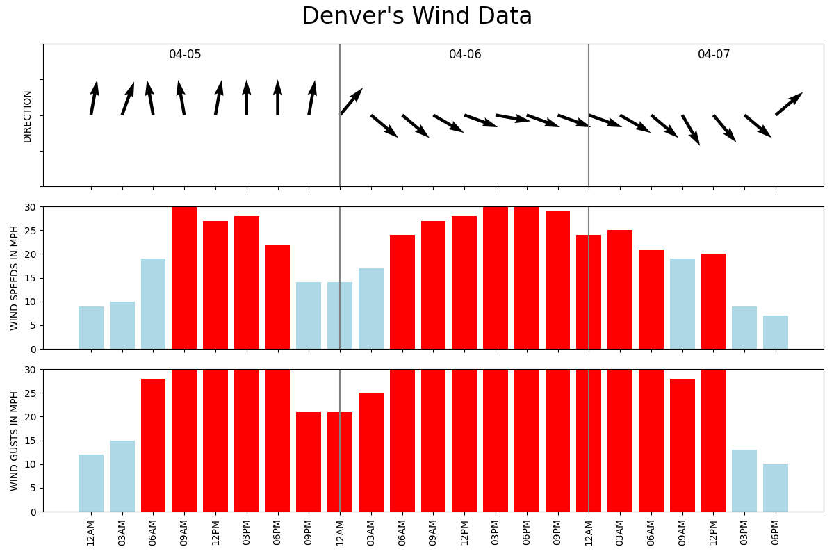
The strongest winds are expected in the hills northeast of Denver. Here are the max wind gusts forecast by the HRRR through Sunday morning. It's going to be WINDY for the northern Front Range foothills, with some pretty good wind across the northeast plains as well:
For the Boulder area, winds from 35 to 55 mph with gusts to 90 mph or above are forecast with this event. Here's the warning messaging from the National Weather Service:
Here's the planner for winds in the Denver area... Windy tonight, Saturday, and into Sunday midday before things begin to calm. The worst of the winds look to come tomorrow afternoon and evening.
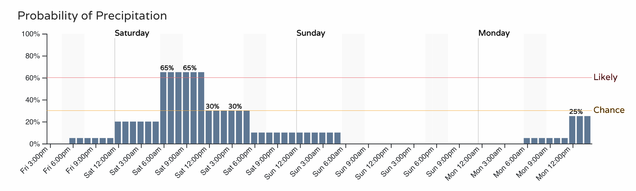
There will be some precipitation around too... we'll see if it's enough to make a meaningful impact on the expected fire danger, perhaps not.
For Denver, the best chance of showers moves through Saturday morning into the afternoon, before mostly just the wind takes over. Temperatures are forecast to be in the 40s at the time, so at lower elevations if we manage anything – it'll mainly be in the form of rain, or rain mixed with snow.
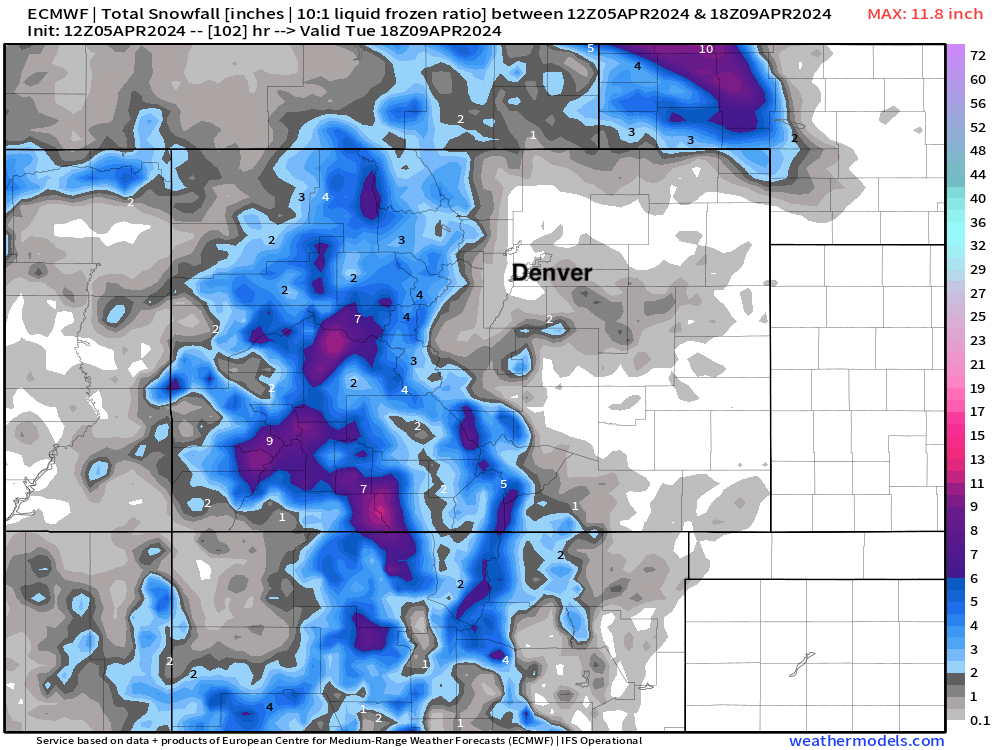
Looking at the latest model guidance, things don't look a lot different than our last outlook as to who sees snow and who doesn't. Some hints at a quick dusting to 1" across the Palmer and parts of the Plains Saturday... but maybe not likely, and if so – short lived.
Here is the European snowfall forecast through the weekend:
And the latest HRRR:
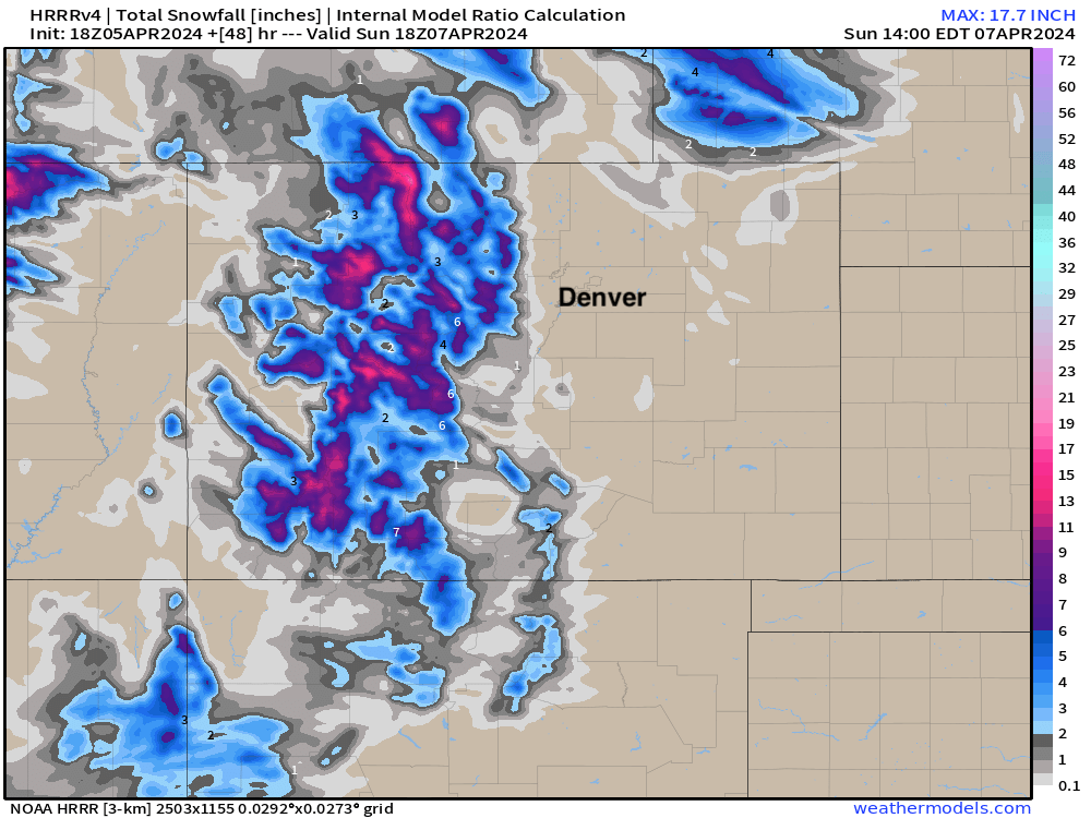
Some appreciable snow for the high country at least!
So, buckle up for the wind! And please, NO BURNING! And, let us know if you manage a bit of rain and snow on Saturday as well. We can hope.