Another windy storm with some front range moisture chances

As of noon Monday, a slow-moving upper level low pressure was situated over central Utah. On the front side, we're beginning to see some surface low pressure develop as well. This storm is bringing a lot of wind with it this afternoon, along with some widespread fire danger. As the system pivots east tonight into Tuesday, there will be a quick shot at moisture. As of now, short and mid-range data seems to have a bit of disagreement as to how much moisture we'll be able to squeeze out... let's dig into the details.
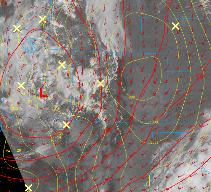
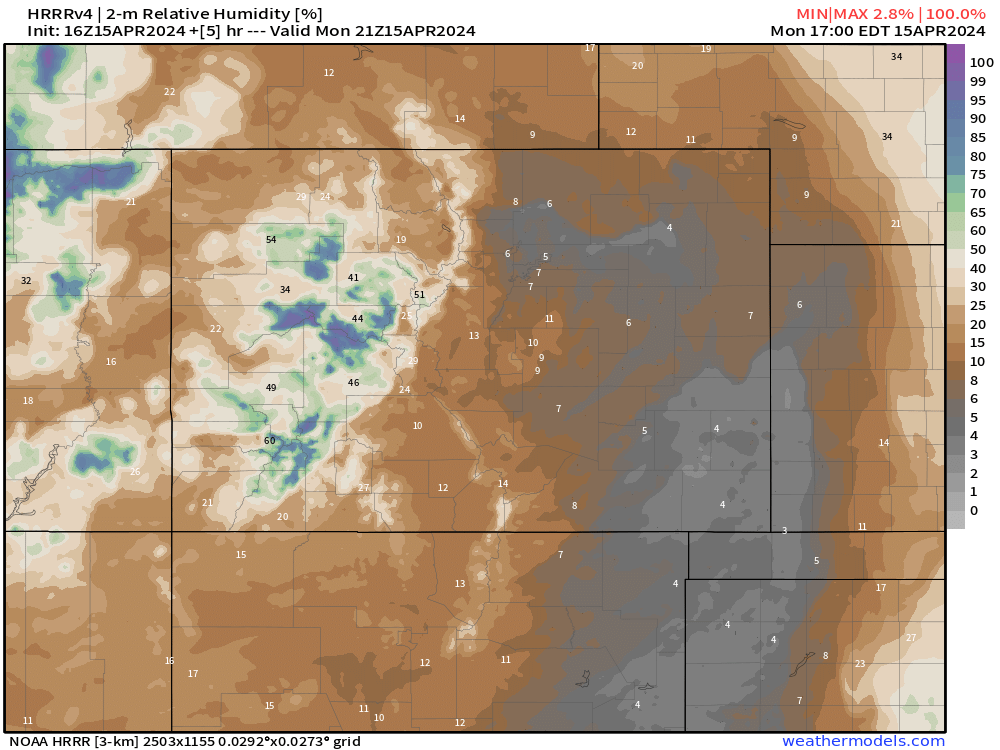
Starting off, wind gusts Monday will have to be top of mind with many folks, especially in southern Colorado seeing humidity values well below 10%. Areas around metro Denver have slightly less wind, but fire danger is certainly still elevated.
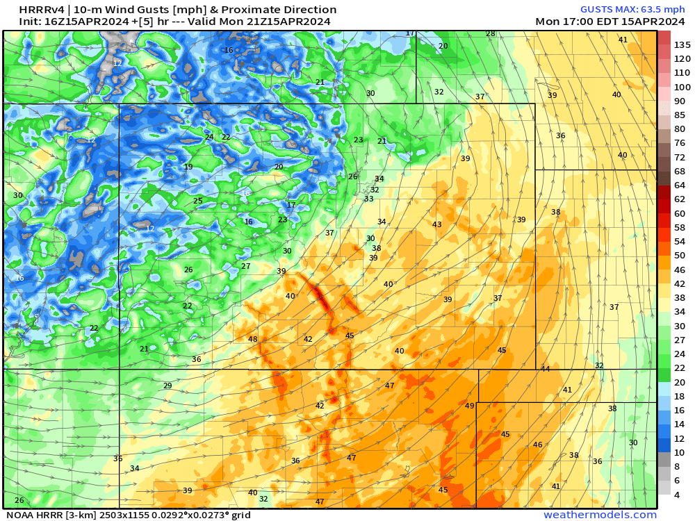
When will it get windy? Check out this animated forecast of expected wind gusts from now through Tuesday evening.
— NWS Boulder (@NWSBoulder) April 15, 2024
Winds peak in/near foothills tonight, and eastern plains Tuesday. #COwx pic.twitter.com/ihWYX57fFR
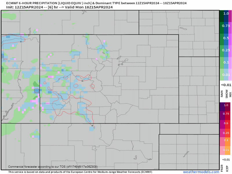
This storm will bring snow to the north central mountains starting around sunset this evening and exiting by Tuesday afternoon. Mountain travel along I-70 will likely be a bit tough tonight. Rain showers will develop along and east of I-25 overnight too. As mentioned earlier, it's a bit tough to pin down exactly how much that pivoting band of moisture will bring down low.
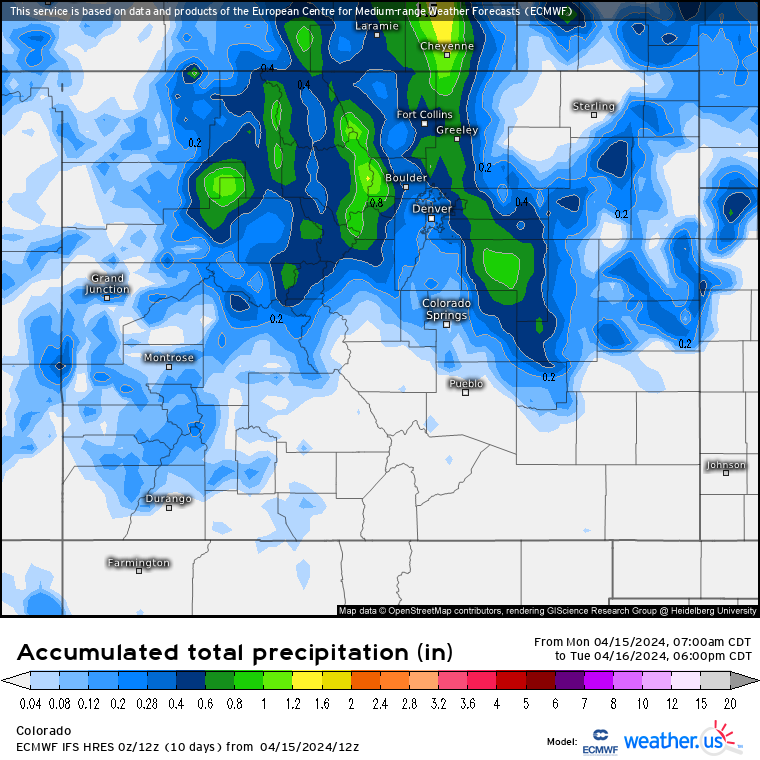
If we take a look at precip data from the EURO, it's fairly bullish with the deformation zone, bringing a stripe of 0.5"+ of mostly rain from the Palmer Divide, to DIA up through Cheyenne.
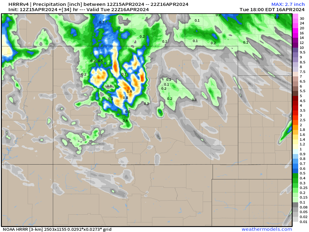
The HRRR is far less aggressive with this approach, but still brings plenty of moisture to the mountains in the form of snowfall.
Overall the approach from the EURO and HRRR, compared to what happens, likely falls somewhere in the middle. Hopefully we can squeeze out some front range moisture that's meaningful for some. Most of that would fall after midnight Monday, into very early Tuesday morning.
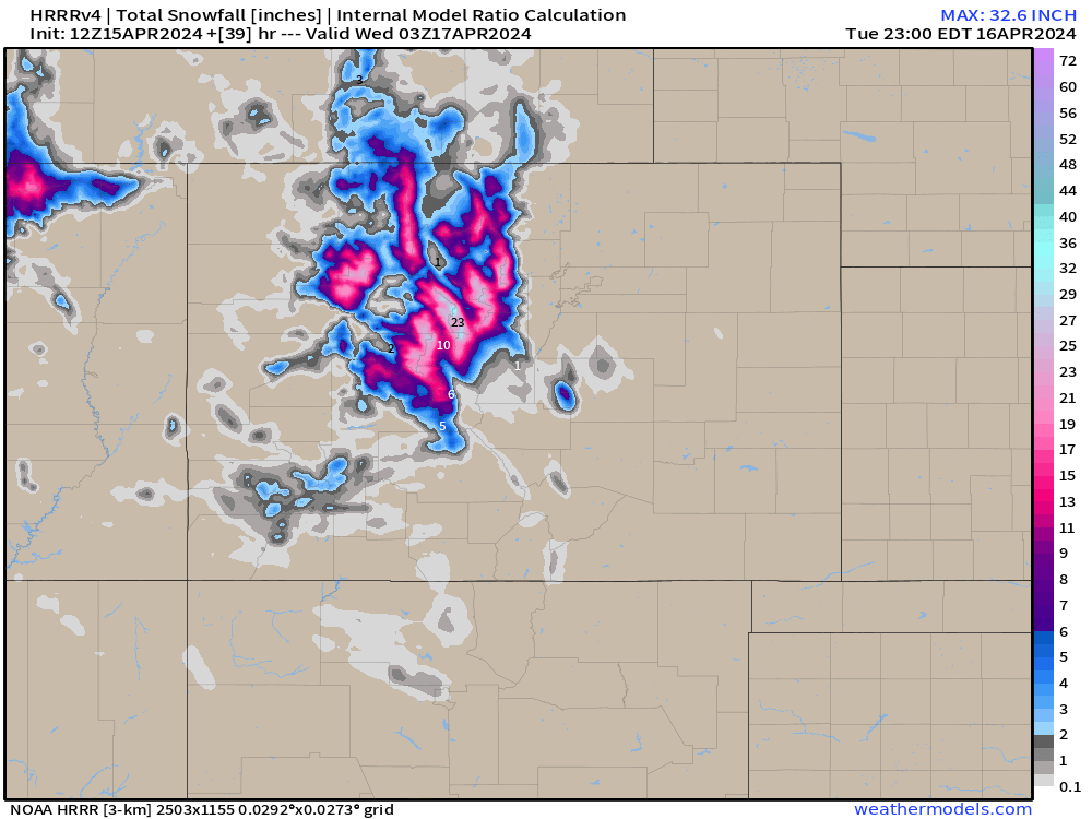
Snowfall in the mountains should be fairly robust. Areas above 10kft likely run 12-24". Between 9-10kft, 8-16" will be possible. Snow mostly wraps up by Tuesday evening.
Beyond this system, feels like it's anyone's guess as to what might play out... Plenty of up and down swings possible, moisture here and there.
Precip anomaly maps indicate north-central and northeast Colorado hanging out to at least some moisture chances. Those would have there best chance this upcoming weekend.
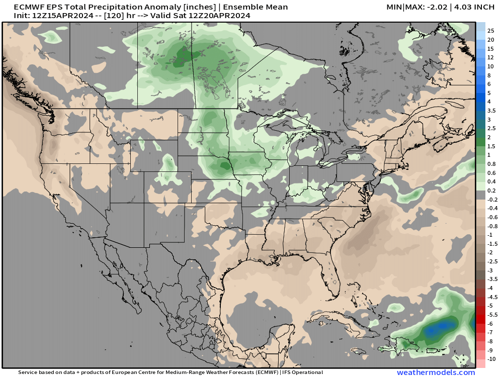
Perhaps a bit of snow to go with that for Denver and the Palmer Divide... but for now, the pattern has been so variably volatile, it's hard to pin something down. For now, let's get through this early week system.
We know it's pretty boring and slow right now, heck, our slack message went blank for a whole 4 days! Haven't had a stretch like that in a while! Hopefully you were out enjoy that beautiful weekend 😎
Either way, stick with us and as always, we're usually only a week or two out from Spring weather turning up in Colorado... sometimes it's just a waiting game.