Colorado weather: heavy rain (with some snow) this weekend

In our last post, we teased a possible storm system for this upcoming weekend. The potential for heavy precipitation (mainly rain with some snow) looks like it's still on the table.
Let's get right into this thing. To start, we will be mild Wednesday, Thursday and for part of Friday. A stout ridge, leading to dry and warm weather, will hang out overhead during this time.
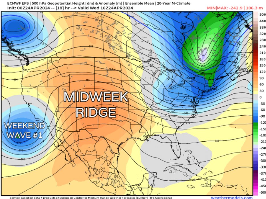
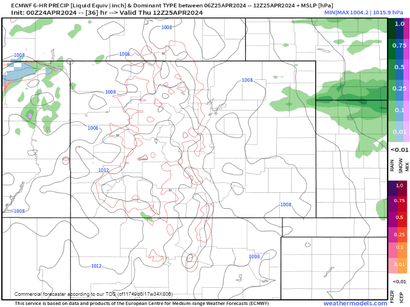
You can already start to see the pattern evolving out west as early as Wednesday, too. A potent low pressure off the SW coast of California will eventually spin our way by Friday. Right now, rain potential looks like it could start as early as late Thursday night into early Friday morning, especially along the I-76 corridor into NE Colorado.
Following the morning rain, showers and storms could develop along the I-25 corridor Friday afternoon and evening, with some snow possible in the higher terrain.
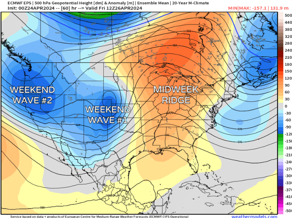
After wave #1 swings through on Friday, wave #2 arrives quickly on its heels. This second system looks a bit slower, therefore giving us a higher threshold for precip. If we can get some significant upslope to develop, this is the point where we'd really expect precipitation totals to pile up.
If you have plans for Friday evening, make sure they include rain gear. For Saturday, it's definitely possible we see the axe on the outdoor activities for the kiddos; in fact, it may rain from sun up to sun down at this point.
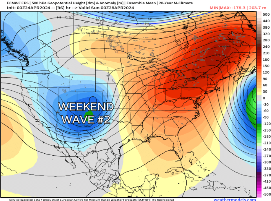
Most model guidance seems to get the bulk of this out of here by Sunday midday/afternoon, but Sunday morning plans could still have a chance of rain showers for many along I-25.
There's also some indication of a third little ripple that tries to pulse through Sunday night into Monday morning. For now, let's iron out the details on these first two systems, and we'll keep a close eye on wave #3's potential.
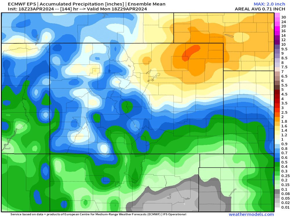
Regarding rain totals, the EURO ensembles (an average of many solutions instead of just one) show a large part of NE Colorado favored 1-2" of liquid water. Most of that would be rain below 8,000 feet, but that rain/snow line could definitely lower in elevation at this range.
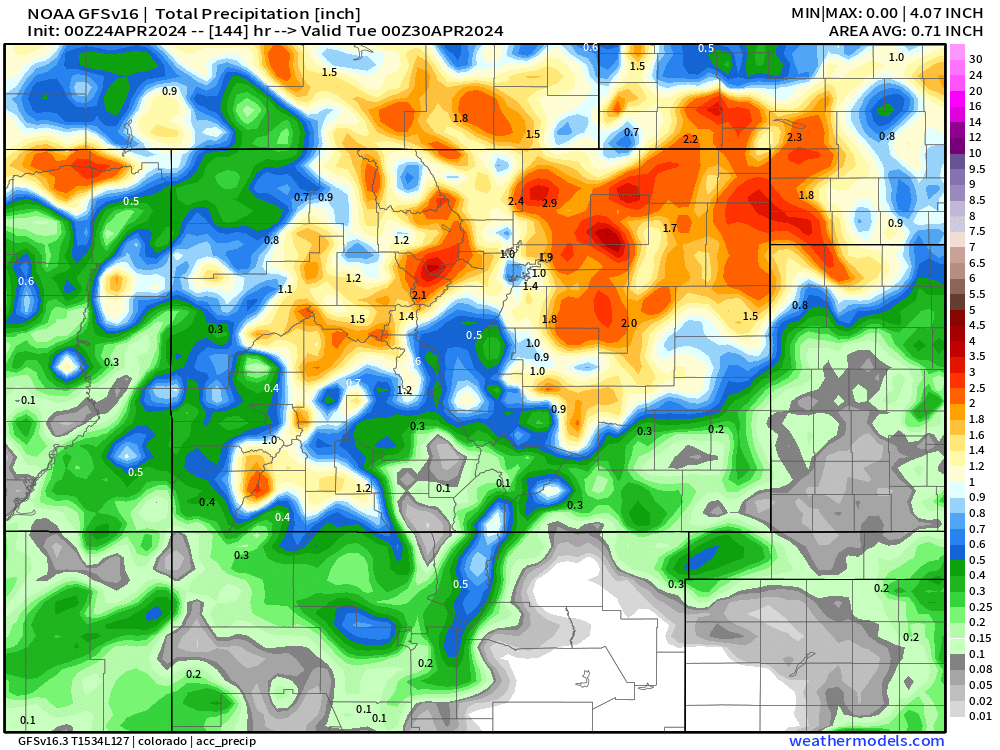
Even deterministic (single solution models), like the GFS, show a similar precip pattern, with NE Colorado favored for heavy moisture potential.
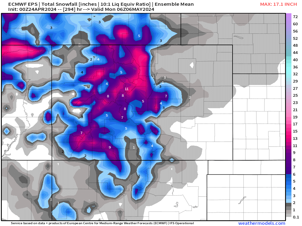
As for snow? The European ensemble model shows a pretty healthy dose of snow for the high country to end the month (woo!) with hints of mixed precipitation at lower elevations. The Palmer Divide and Southeast Denver suburbs may have the best shot at some accumulation depending on the second wave's timing/speed/intensity, but plenty of uncertainty remains here. Let's see how things look as we get closer to the weekend.
Do you need to switch around plans?
*For Friday, probably not.
*For Saturday, it's starting to look likely.
*For Sunday, maybe in the morning, but it looks drier by the afternoon.
Will this forecast change? It certainly could! But with all the modeling seeming to hone on a pretty slow-moving system with lots of moisture to work with, this certainly seems to be one that could bring us plenty of impacts and slowdowns.
We'll continue to fine-tune and massage this forecast throughout the week, so stick with us for the latest updates!