Wednesday AM update: April downpours bring May showers?

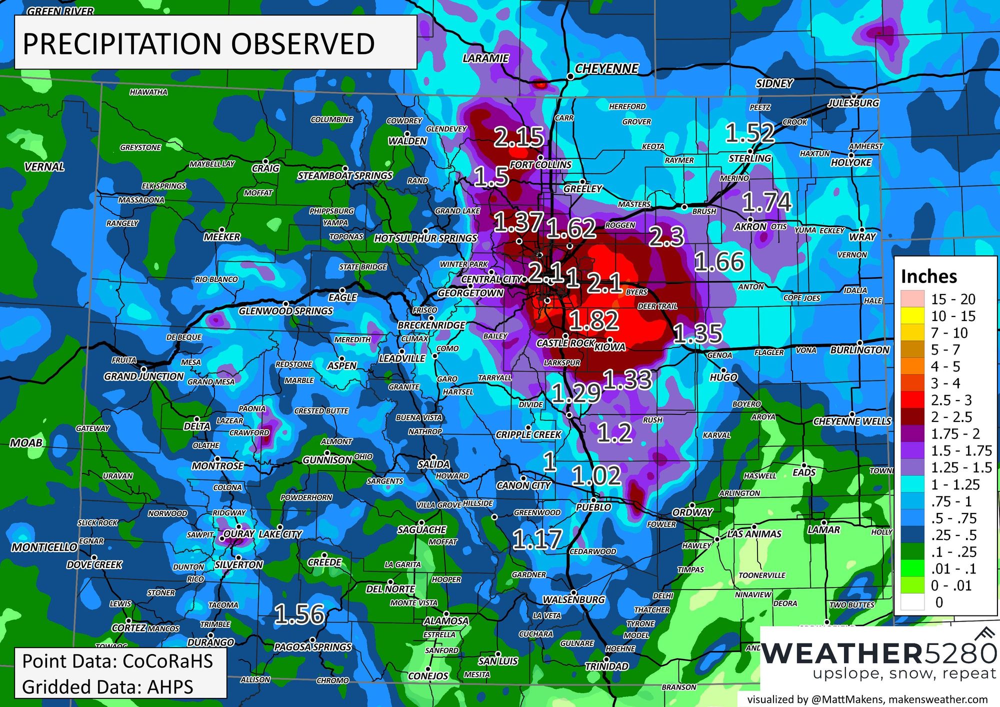
And oh what an April it was for northeast Colorado thanks in large part to last week's super-soaker delivered plentiful moisture to the region. Precipitation totals from 1 to 2"+ from Fort Collins south to Pueblo, with much of the state seeing at least SOME precipitation from that storm aside from the southeast plains.
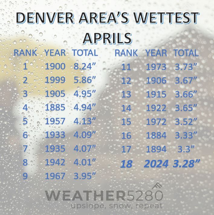
Denver recorded 3.28" of precipitation in April, more than 1.5" above average for the month. This will place April 2024 in the 18th spot for wettest Aprils on record. The wettest April on record was 1900, when 8.24" of precipitation was recorded in Denver.
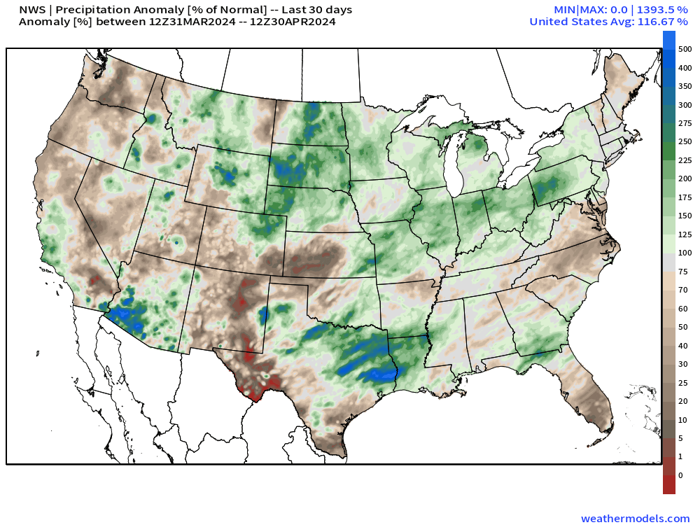
Looking across the CONUS, we see that drier than average conditions really tookover southern Colorado and the Panhandles in April after a relatively wet start to the year. Northeast Colorado certain lucked out, with some good moisture across the northern high plains in April.
As we kick off May, look for the unsettled weather to continue though no super-soaking storms are in the immediate outlook.
The European ensemble shows near average precipitation for the urban corridor through the first two weeks of the month, and with all the moisture to the east expect the active severe weather we saw over the last week or two of April to continue as we kick off the new month.

If we look at the 10 day planner from the Euro for the Denver area we see temperatures in the 60s and 70s through the weekend, with perhaps some cooler air in the forecast next week. Nothing crazy cold, but nothing crazy hot either.
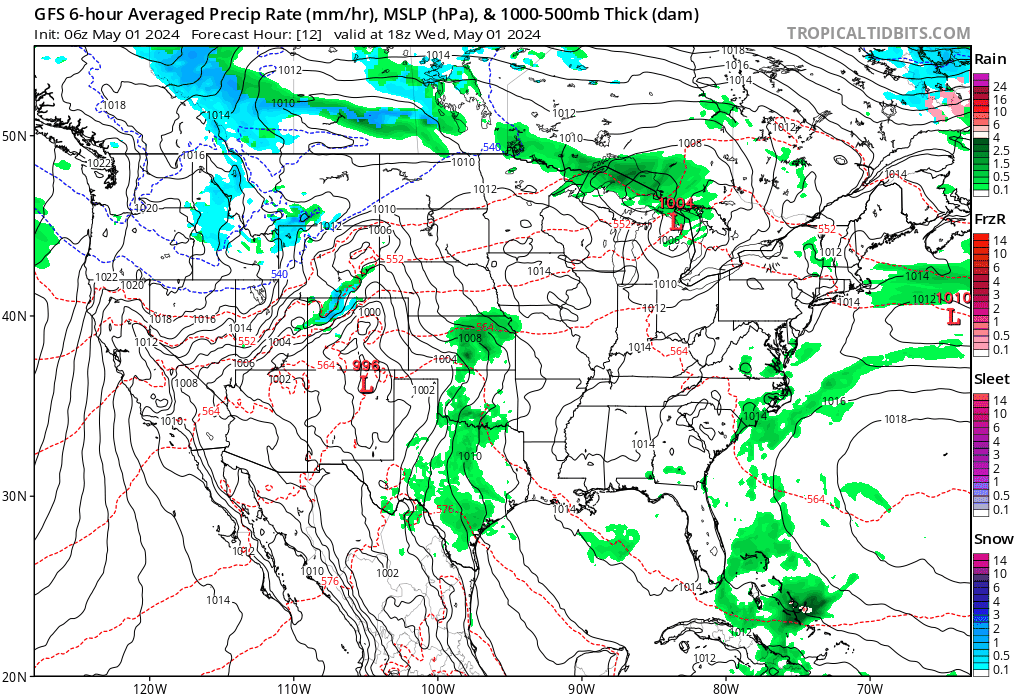
If you look across the bottom chart you'll see vertical bars across nearly every 6-hour period (yes, most quite small) but this is indicative of the nearly daily precipitation chances we'll see under this pattern, even if not huge most days.
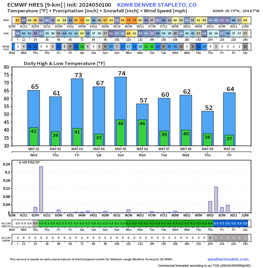
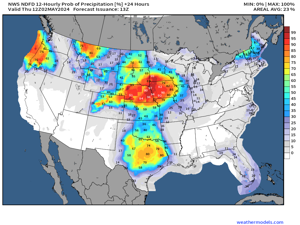
You'll note one of the better chances for precipitation above looks to come later today. We'll have about a 60% of showers for much of Northeast Colorado this evening and overnight as some energy passes through. The severe threat should be low for eastern Colorado, especially up along the hills, but a few strongs storms cannot be ruled out – in particular if your travels take you northeast of the city later today. Stay weather aware!
Here are the precipitation probabilities for the next 12 hours:
You can see this relatively active period nicely in the most recent GFS as well. Mostly quick-moving shortwaves with pockets of mountain snow and areas of rain for the plains, but perhaps a bit of a deeper trough moving through the Great Basin early next week which could bring a bit more chilly air to our area (reflected in the temperature outlook above).
We'll be keeping an eye on the severe threat as it is that time of year, and of course let you know if / when a more organized system is set to move our way.
Keep an eye to the sky, and your inbox for our updates!