
Denver Weather: Wind drops, along with temperatures which may hit freezing for us tonight

The wind has been decreasing Tuesday compared to the nasty stuff we had the past two days. As we continue to calm a bit today into tonight, temperatures will cool down to near freezing and below, a threat to you if you've already charged your irrigation systems and have early-season plants.
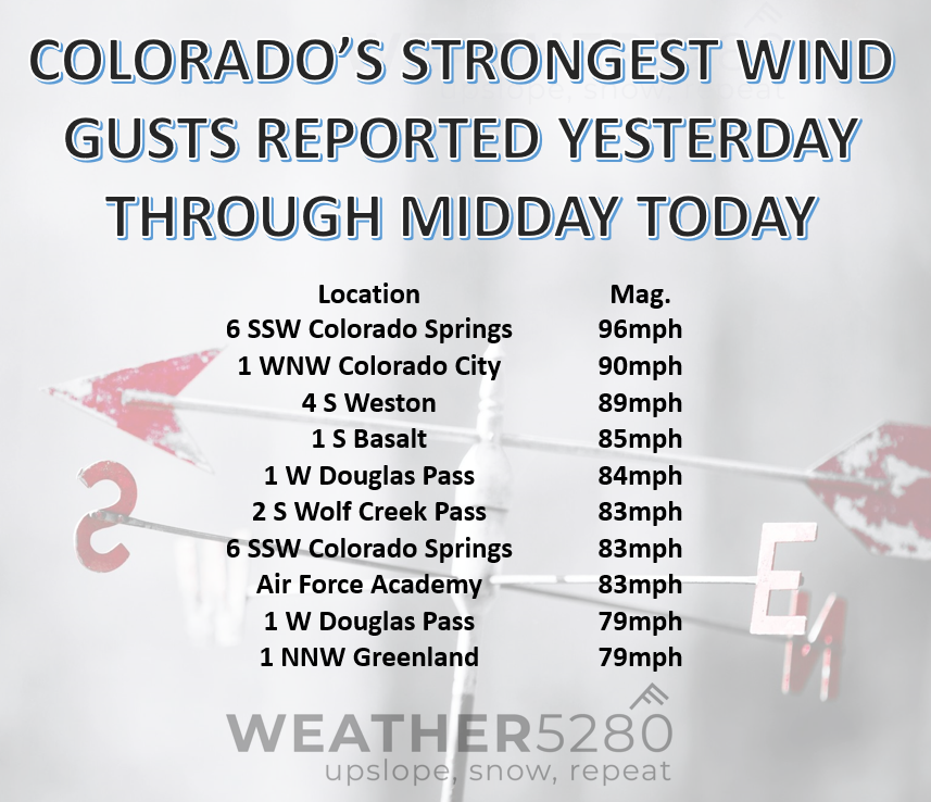
Got wind? As mentioned, the wind gusts are starting to calm a bit. This is not to say we are done with it, but that the wind will be more tolerable today for a lot of the area. A recap on the strongest winds and historical perspective on a "not windy April" was posted yesterday:
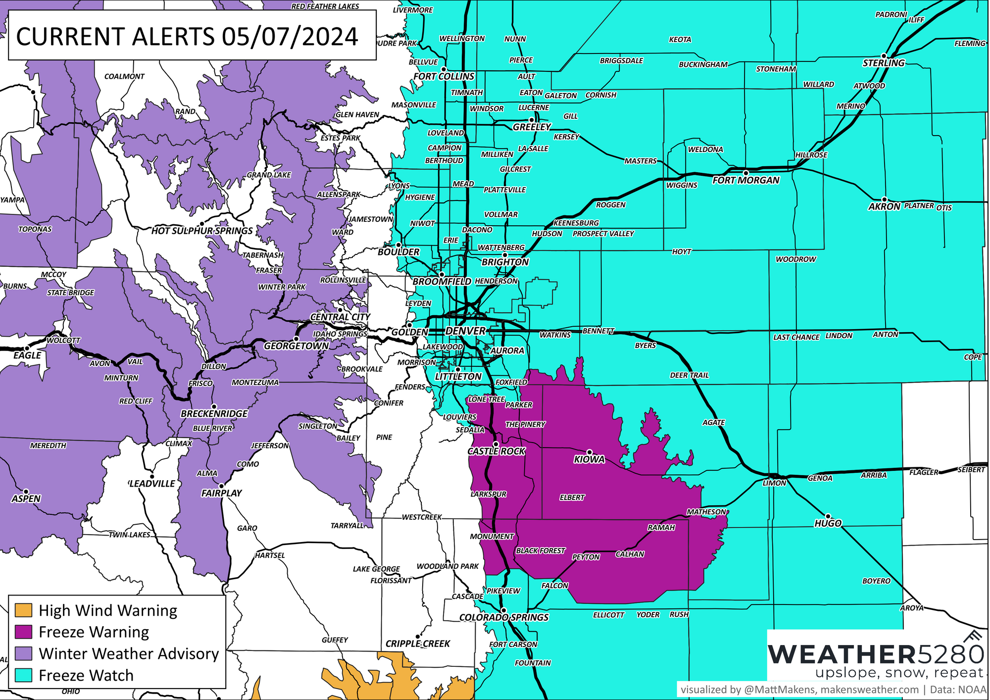
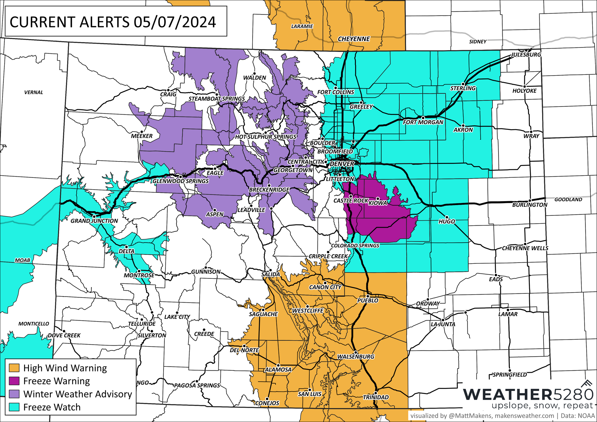
Today's threats are where? The strongest wind gusts, still dangerous, will be for Wyoming and across South-Central Colorado. The wind warnings are indicated on the following alert map. As the wind gives us a break, the Front Range, Denver, and Colorado Springs have a different threat coming - we are all expecting a cold night. This is particularly true for the Palmer Divide which may have a hard freeze overnight. I'll cover the winter advisory for the mountains down in the snow section.
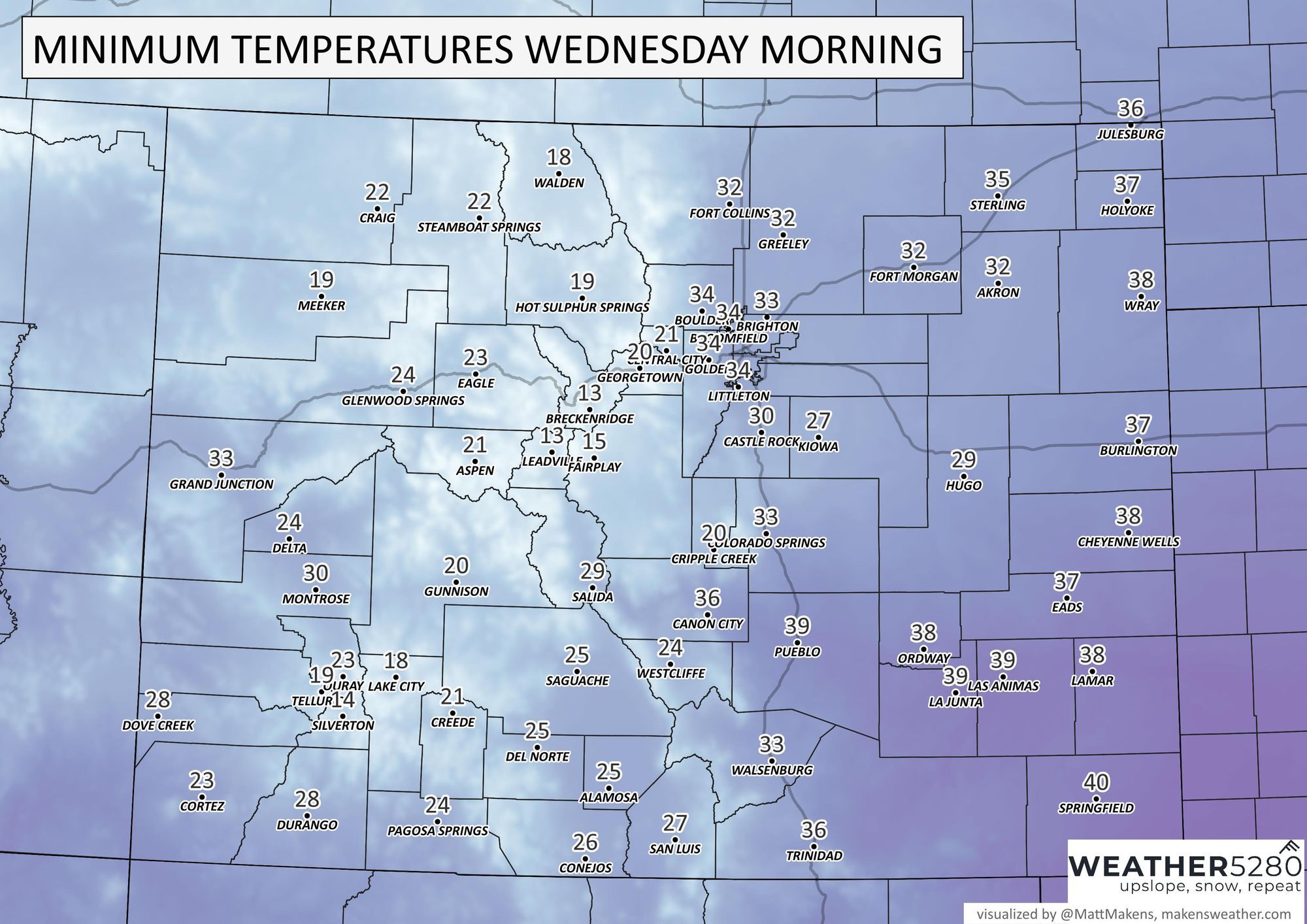
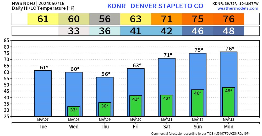
Here's a look at some of the low temperatures for tonight, no - not records. Denver's record low for this is 27° from 1885:
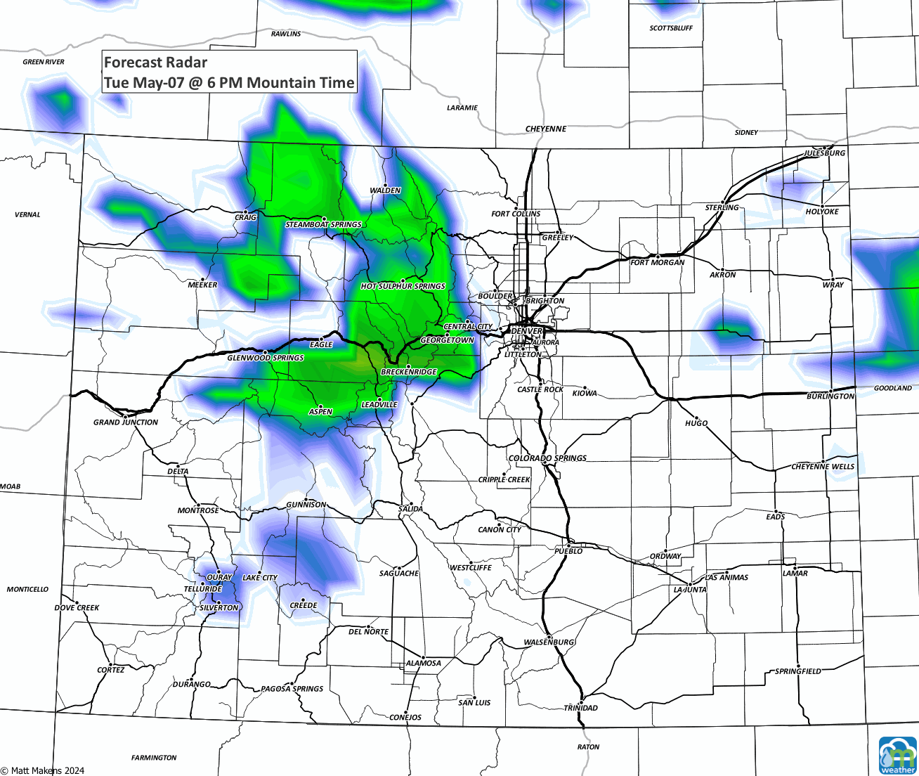
Where's the wet stuff? Whenever we get so windy, we dry out a ton as a result - some water would be nice. There is the slightest of chances for some rainfall/thunderstorms tonight but overall a dry day for most of the metro area. The moisture is in the high country for now.
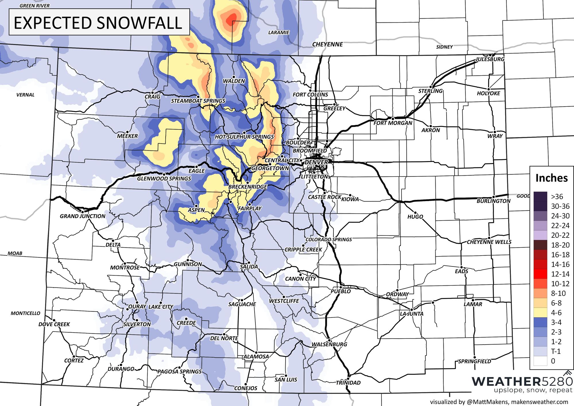
Winter driving conditions continue for the mountains today with some snow, heavy at times, and cold temperatures to further add to poor road conditions. These is true for those areas where we have a winter weather advisory:
If we broaden our timeline and look beyond today and tonight, we do see an increase in our rain chances. Another bit of energy will drift through late Wednesday through Thursday into Friday. As this ripple comes over Colorado we will have a better chance of spreading precipitation over the mountains and even catching moisture along I-25 and over northeastern Colorado (not a guarantee, but a pretty good shot at it). Here, I'll show you:
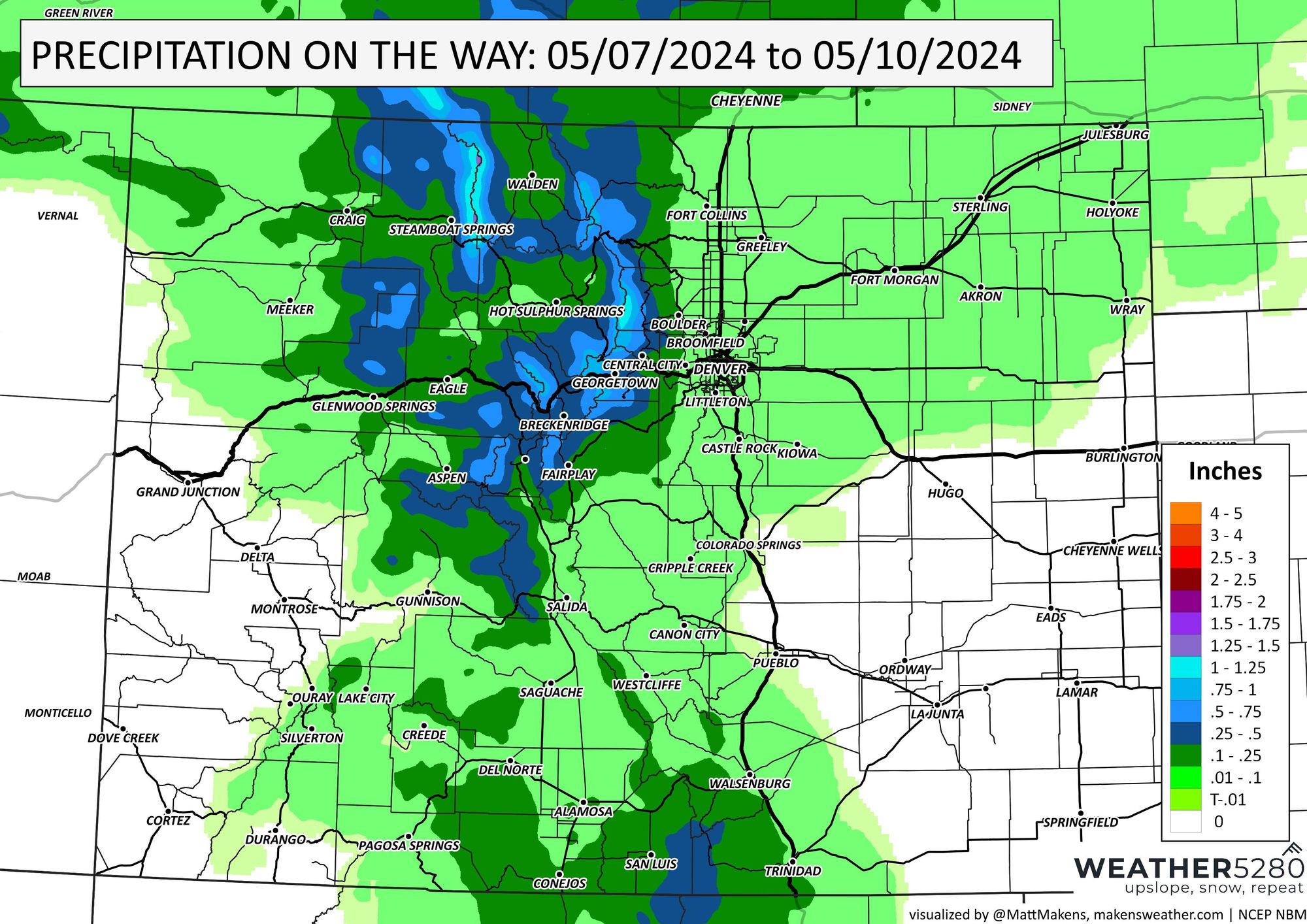
Looking at the next three days, we see we have at least a little bit of water to come (Denver and the Front Range less than a 1/10th of an inch by and large:
For the high country, that is more snow.
Groovy baby, when do we get the 70s back? Well, I won't call this work week warm, although it isn't bad; we are mostly in the 50s and 60s through Friday. Starting this weekend, however, we start to dial up the temps and get back to the 70s.
Sign up for our emails now so you won't miss out on these updates as we send them - they are as free as the chips and salsa at any local tex/mex restaurant.