
Denver Weather: Winter weather advisory nearby as snow drops to 6,000ft

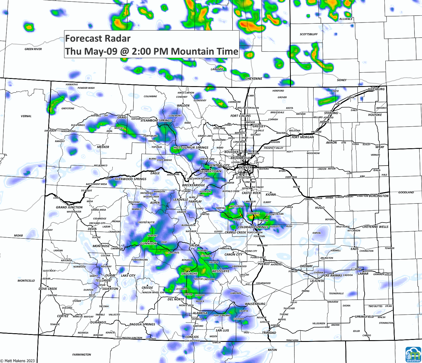
There's an unsettled weather pattern continuing today, and this will be the case right through the weekend with daily chances for rain and thunderstorms - oh, and snow for some too.
Those with the snow chances are the western and southern fringes of the Denver metro area, and in the ranges just west of Colorado Springs. Enough snow (6-12") may fall to create some issues in the highlighted alert regions shown in the following two maps.


This snow is mostly confined to elevations from 6,000 feet and higher, and will continue to be heaviest through the next 24 hours.
Let's watch this animation to get a sense of the timing of rain and snow.
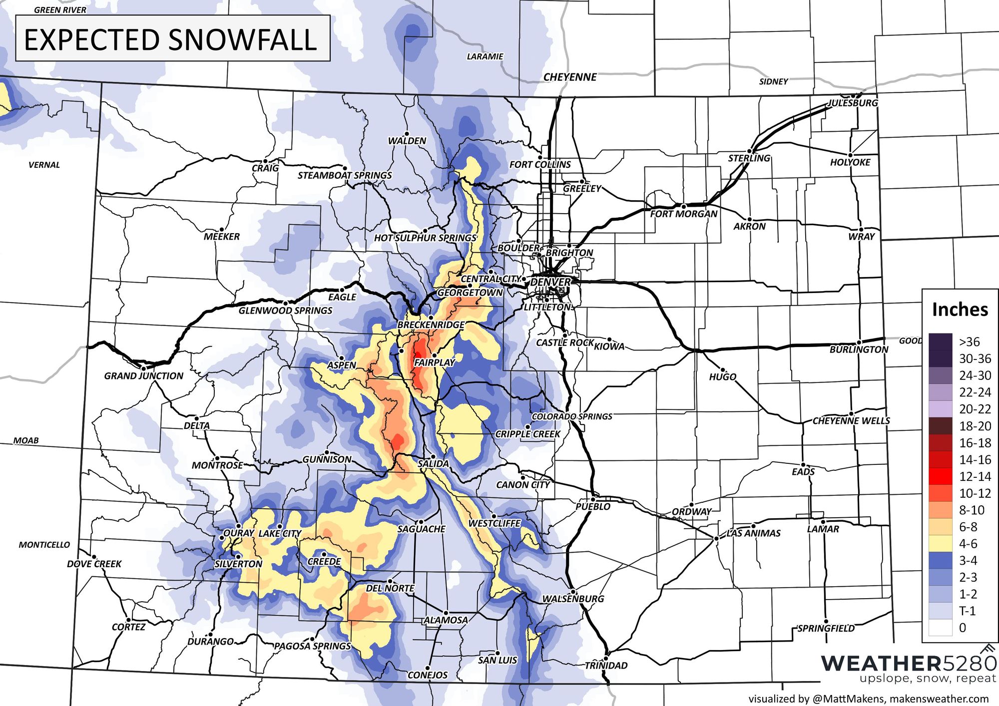
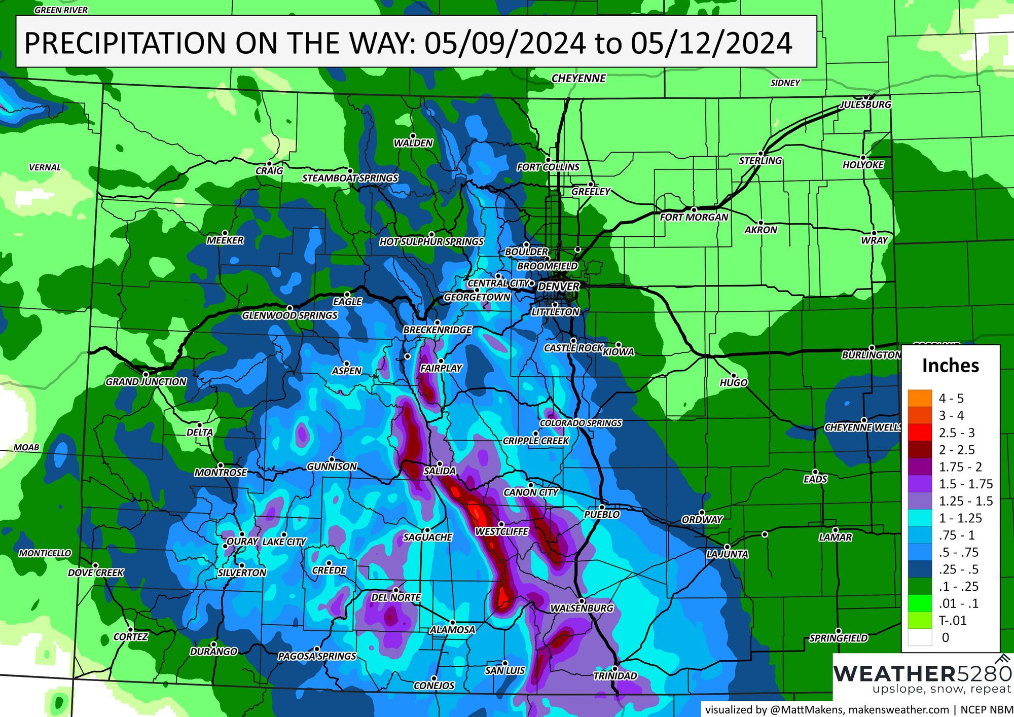
In the end, how much may fall? Start with snow, the mountains may approach a foot of new snowfall in the next few days. Isolated totals may be higher in spots. The totals shown below for snow and rain are the next three days worth.
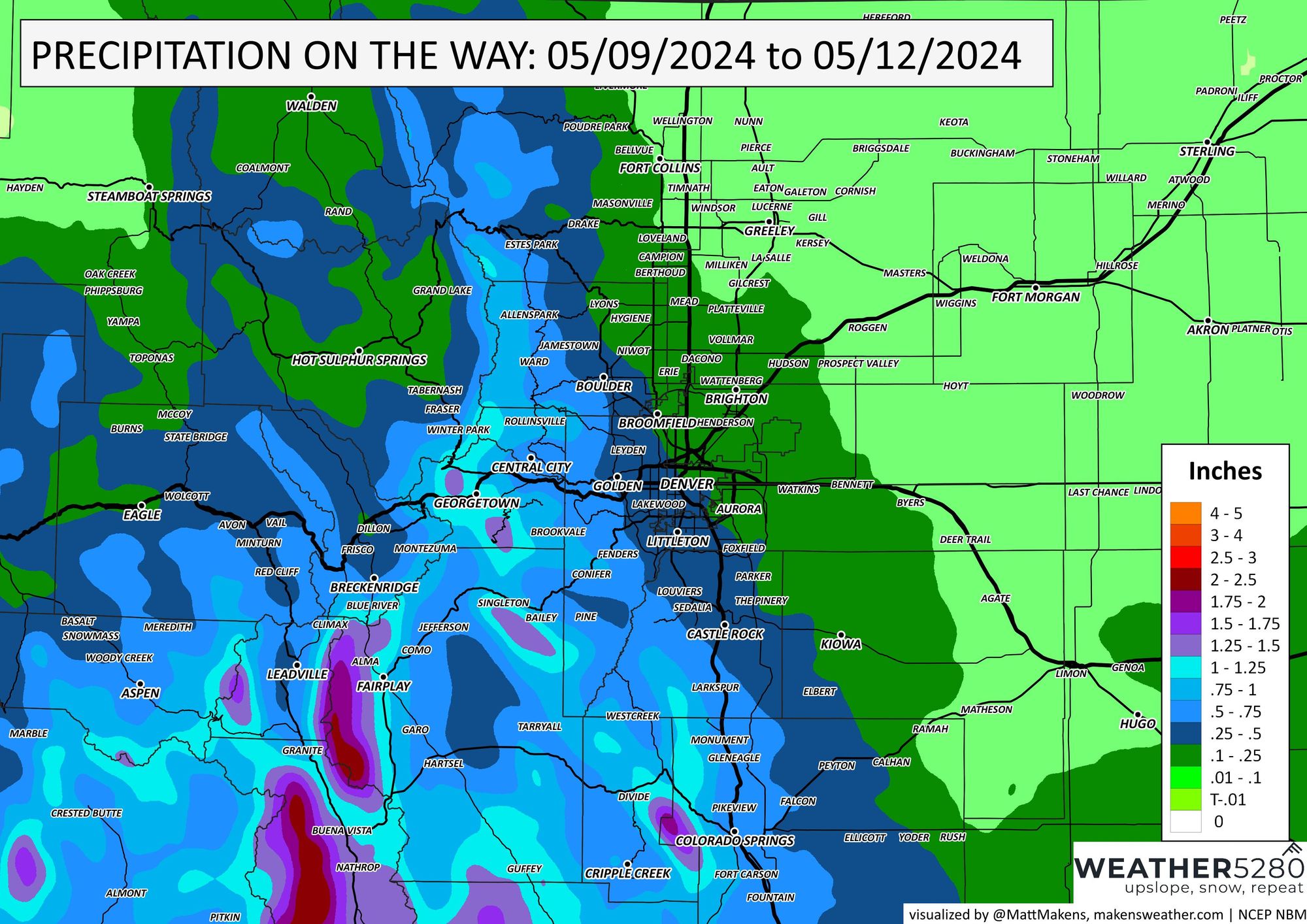
Now, onto rain and this will include the cities now. Overall, a LOT of water for the southern mountains and Southern Front Range, well over an inch in cases. For the Denver area and Northern Front Range, we'll zoom the map in.
Taking a closer look here, we have the potential for a half-inch of total water to the west and south of Denver into Colorado Springs. To the north and east of Denver we have lower totals, perhaps 1/10th to 1/4" on the way in the next three days.
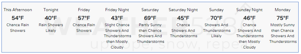
If you are trying to plan something for the weekend, you are probably asking what temperatures may be like. Here's a daily sense of how things will play out for Denver - unsettled:
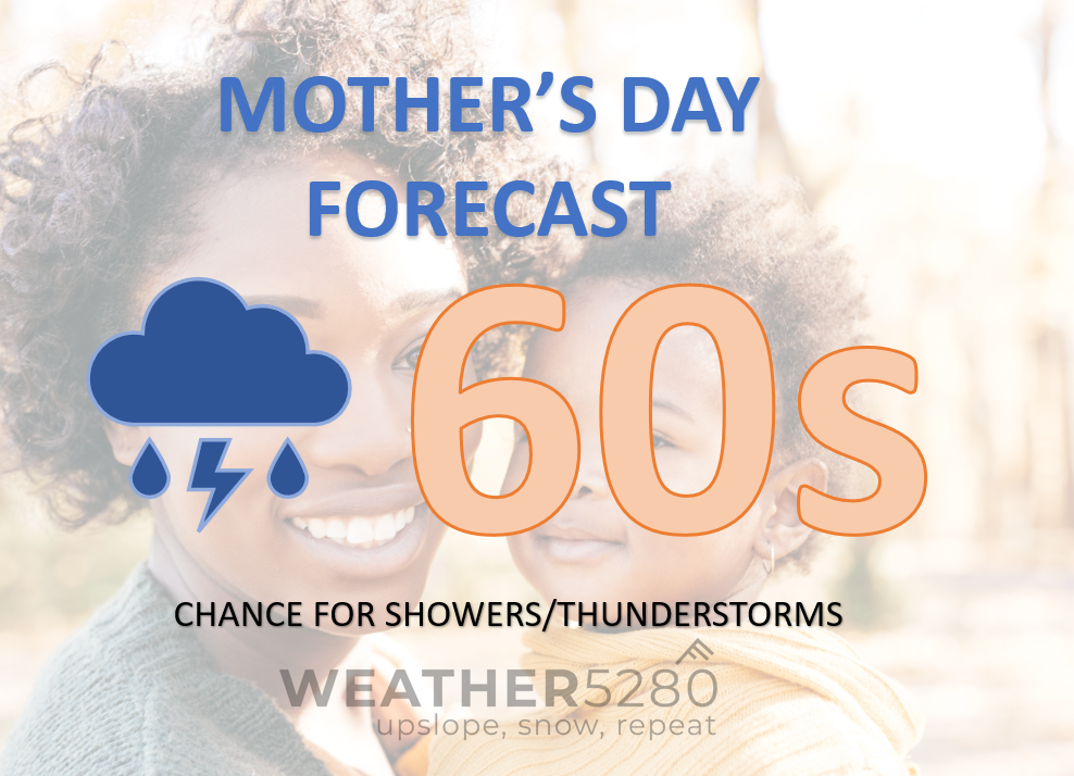
With Mother's Day on the horizon, here's a more specific planner for that. Happy Mother's Day!
As we wrap up this post, I think you can understand why I said we are stuck in an unsettled pattern. You can prevent feeling unsettled if you'd sign up for our forecast updates :-), they are the most calming things to arrive into your inbox. Sign up here.