Mid-May update: Showers persist in forecast, but overall drier pattern ahead; Latest on La Niña

We continue the cool down of SST anomalies across the ENSO region of the Pacific, with El Niño quickly fading and La Niña on the way by late summer if not before.
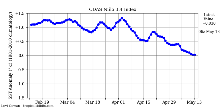
El Niño has weakened a lot over the last several weeks, with some indicators suggesting we are already at a neutral or near-neutral ENSO state. The ENSO 3.4 region which was 1+ degrees C above average all winter has neutralized quite a bit since April 1st, and is nearing that zero line:
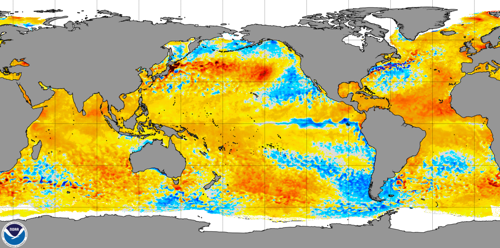
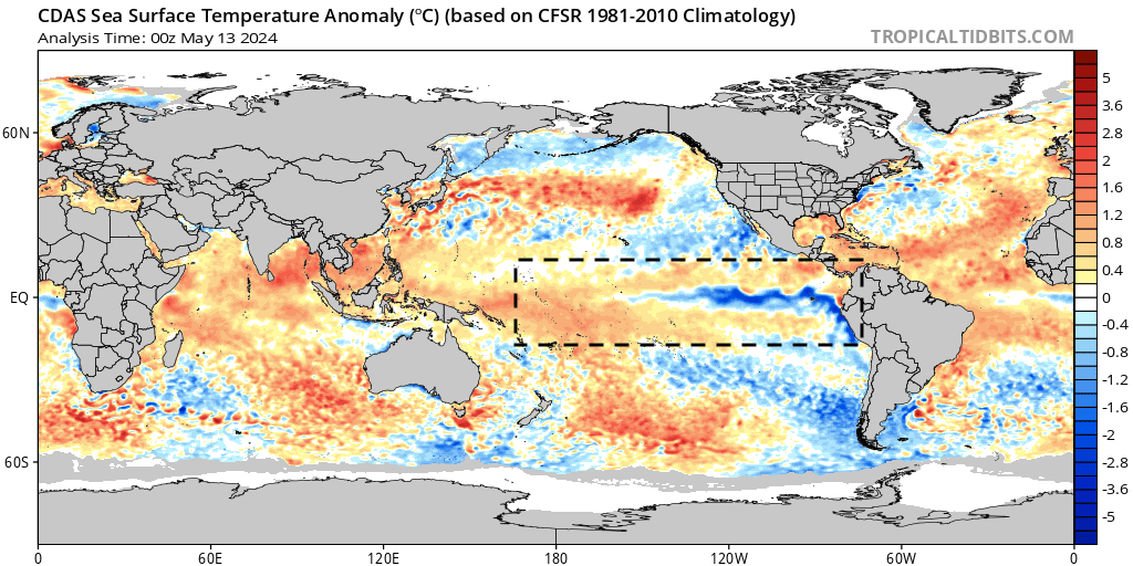
You can see the cooler than average SSTs really starting to present across the equatorial Pacific, a shift that should continue to over the coming months, moving us from El Niño conditions over the last winter, to neutral, and eventually an anticipated La Niña event for the second half of the year.
This transition will of course be impactful to not just our weather locally, but just about everywhere!
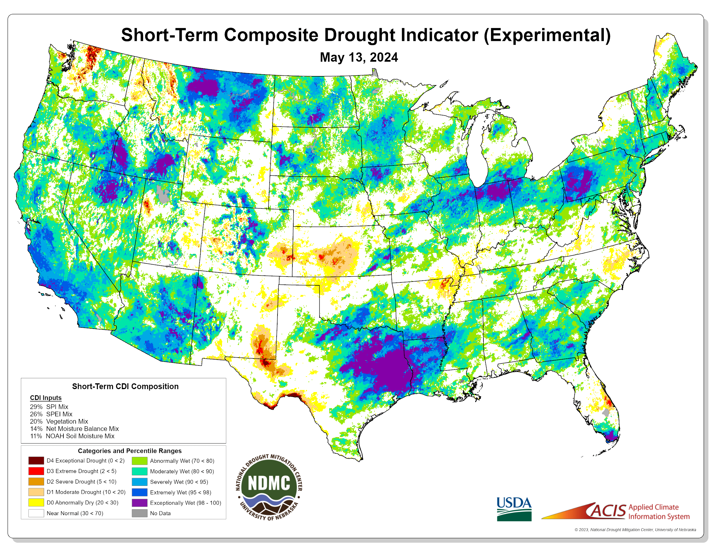
In the short term we expect a relatively active weather pattern to hold on, and thanks to a strong start to the year for precipitation across the region no current drought concerns. However, as we head into the summer months that is likely to change, especially if La Niña gets cranking and contributes to a lack-luster monsoon season across the Four Corners region.
In other words, in the coming months we expect drier-than-average conditions to appear south/southwest first, but eventually extend north and northeast – including northeast Colorado at drought risk despite such a wet start to the year.
While this weekend's moisture helped a bit across the south-central parts of the state, we are seeing seeing the warning signs across southeast Colorado and eastern New Mexico:
And, despite there being more showers and storms in the forecast over the coming week across much of Colorado, all indications are we are gradually in a drying phase. Here is a look at the potential moisture on the way through this week and weekend.
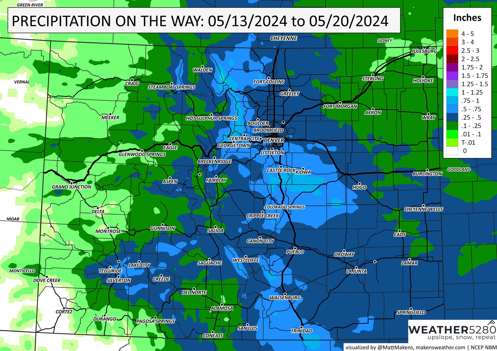
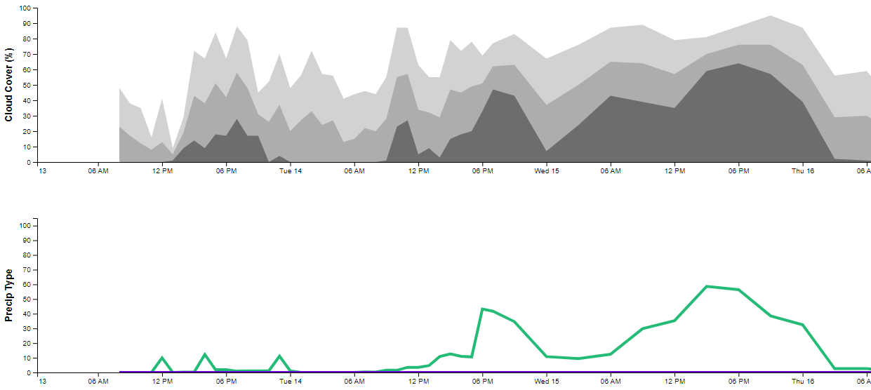
We have some folks that will get quite a bit of water, potentially, from several thunderstorm chances. Here's a look at the precipitation chances with cloud cover through Thursday morning, and you'll see Tuesday and Wednesday offer some rain/storm potential.
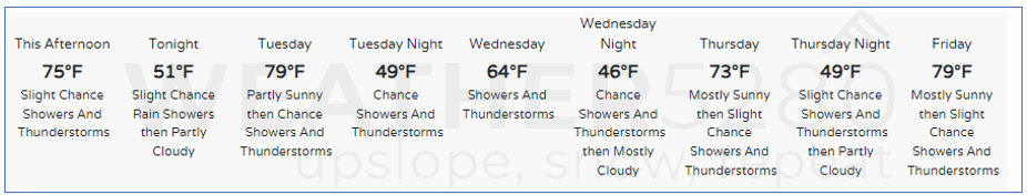
In all, here is a quick look at this week's forecast:
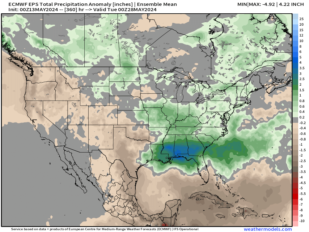
Let's look farther: The two week precipitation anomaly map from the European shows this, with much of the western CONUS and southern plains drying out, including most of Colorado forecast to end the period with average to below average precipitation.
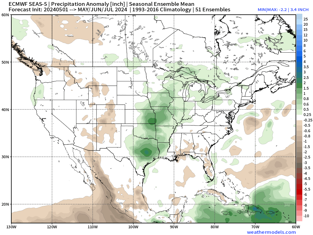
The three month composite would indicate that at least the early monsoon season won't be much to write home about either. Near-average precipitation forecast for Eastern Colorado, but across the higher terrain of Colorado and into New Mexico and Arizona below average precipitation is forecast over the next 2.5 months:
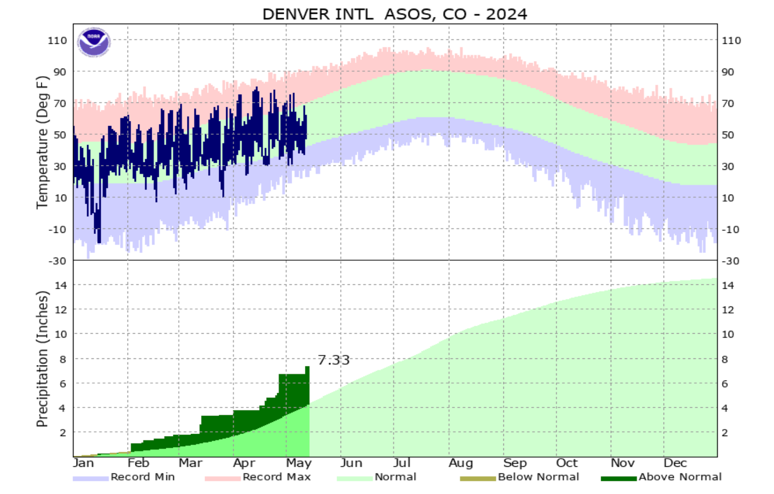
So, while we're okay for now, it sure seems like the writing is on the wall for our precipitation surplus pattern to gradually fade as we head into the summer months. Thankfully many locations are running well above average for precipitation to start the year – including DIA which has picked up 7.33" of precipitation through mid-May here, about half our annual precipitation, and of course well above average for the date.
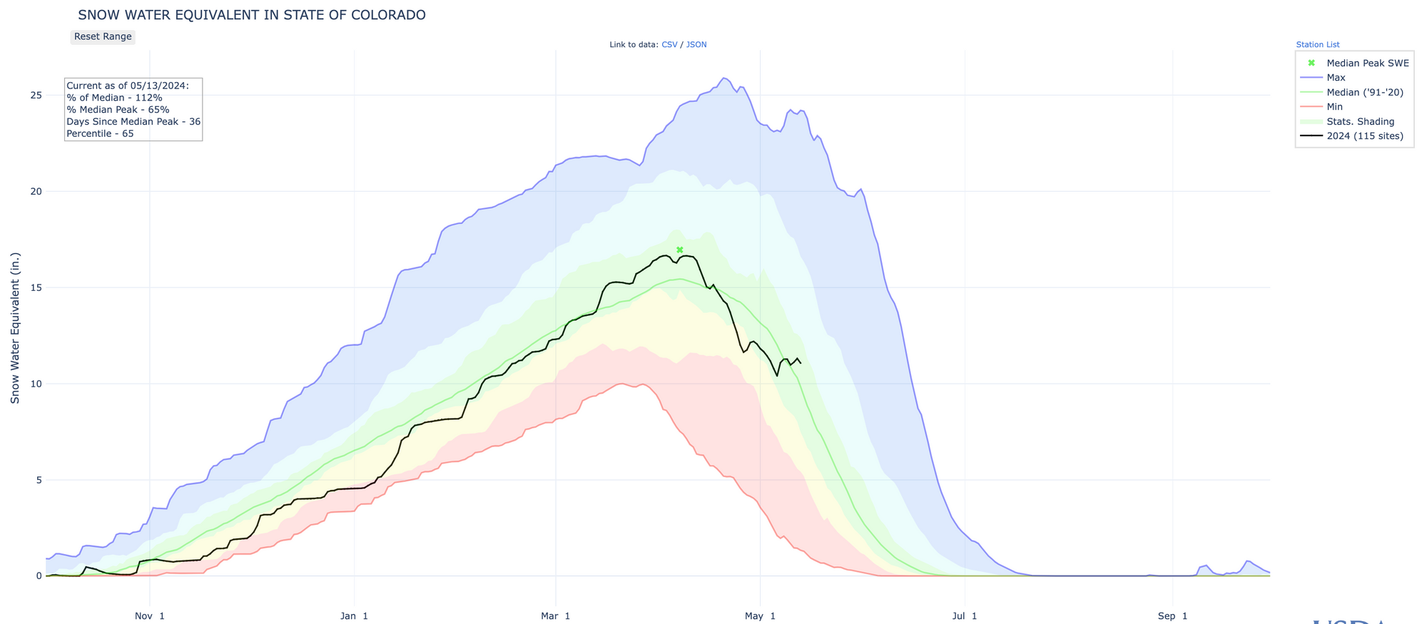
And, thanks to some late-season snow in the high country, snowpack for Colorado has jumped back above average for the date! How about that?!
In short, things are all good today, but let's keep an eye on that budding La Niña. As we head closer to the summer months, we'll begin more closely tracking its impact on the monsoon - our late summer moisture source.
We will have more on this week's storminess in our next post. Until then, have a great Monday.