
Denver Weather: Storms firing up and you could be in for a wet afternoon and evening

It's Tuesday afternoon and the radar is starting to see some thunderstorms, with many more expected during the coming hours. Let's take a look at what you can expect today and Wednesday in terms of these rain chances.
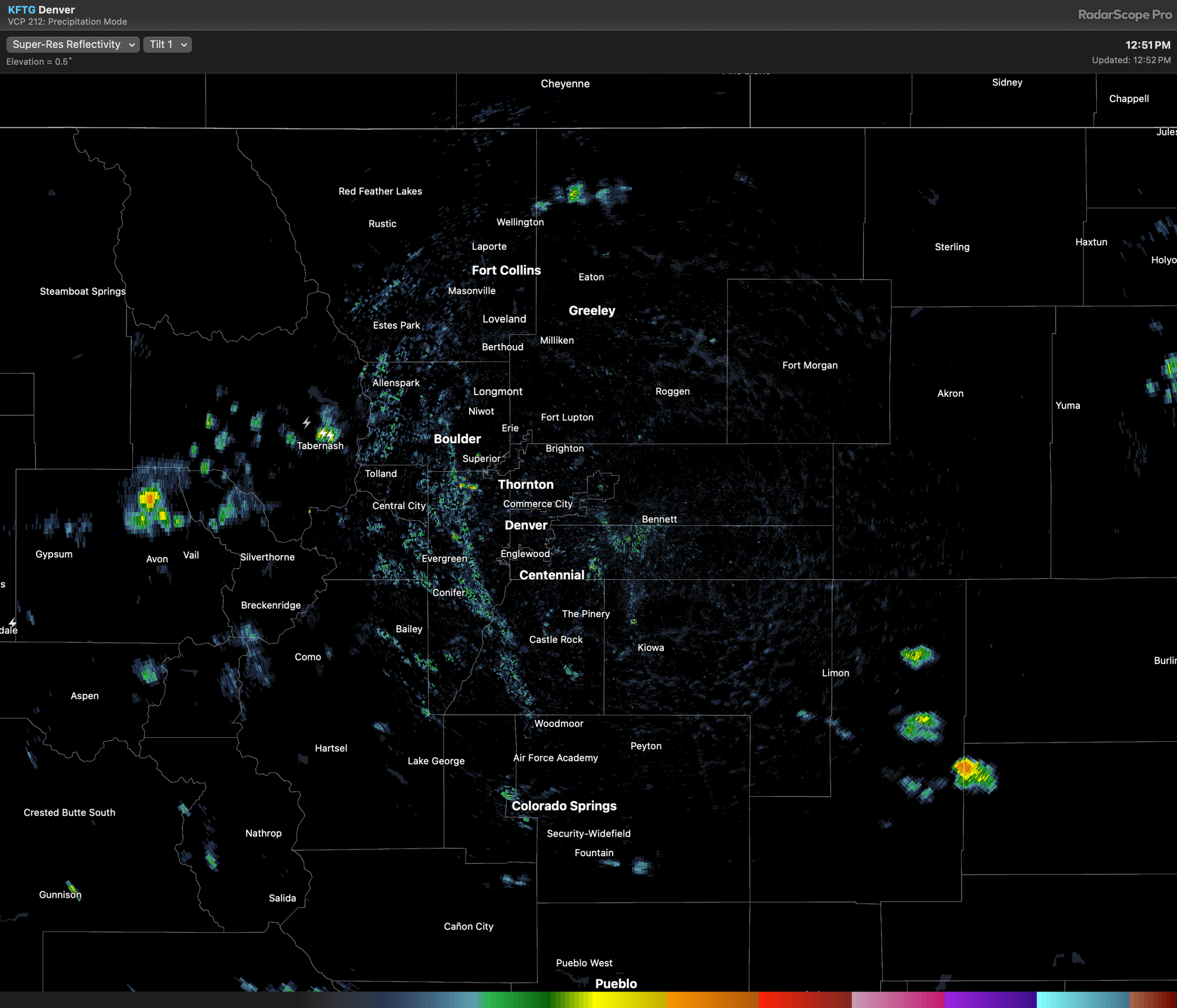
Radar as of 12:52:
Let's go forward - an animation to show you the approximate time and location for active weather.
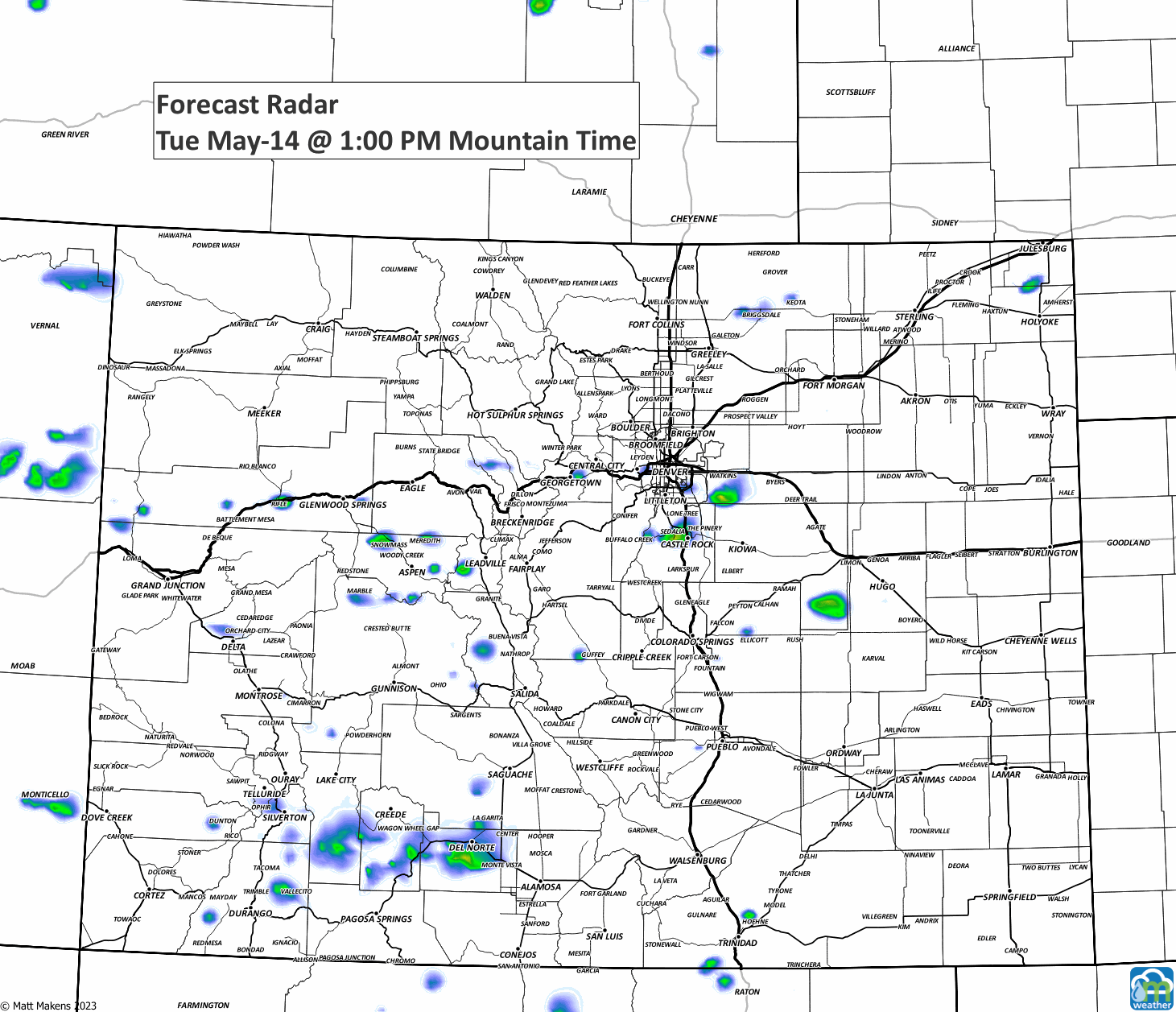
Generally, we see an increase in storm activity Tuesday afternoon and another round Wednesday afternoon, with isolated storms overnight and in the morning. The odds of getting wet are highest Wednesday for metro locations.
Technically we can get a severe storm (winds stronger than 58mph and hail quarter size, 1-inch, and larger) during the next couple days, but the odds are fairly marginal to get storms that strong.
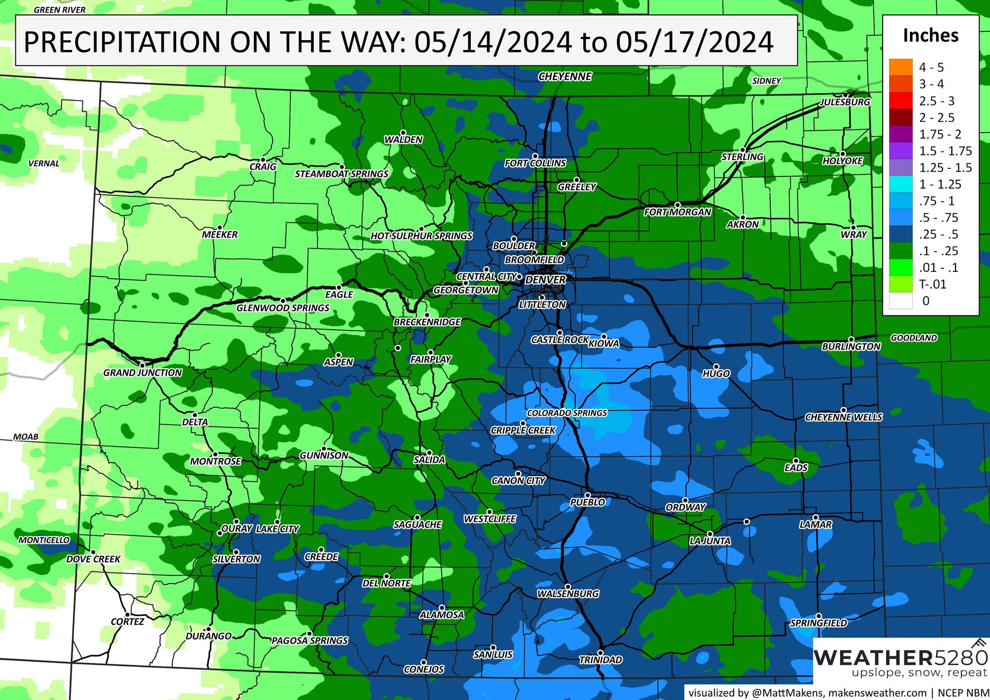
Here's how much rain may fall during the next couple days. For Fort Collins to Denver, pockets of 0.25 to 0.5" but from Denver to the Springs and across Southern Colorado there may be twice that much. Areas near the Springs may hit 1".
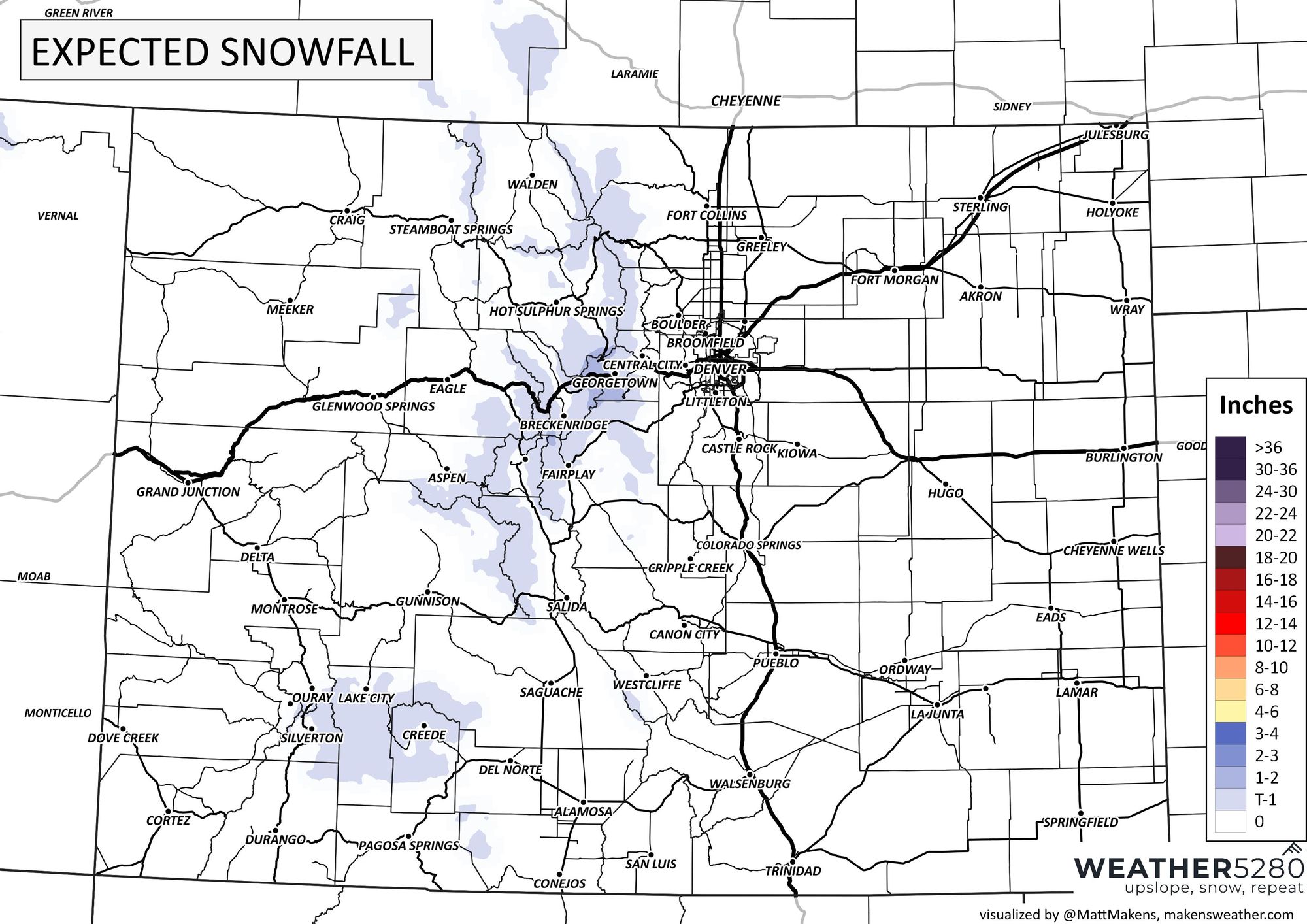
For snow lovers, there isn't much to hope for.
As these storms move through, and increase in number Wednesday, temperatures will be taking a hit. Rather than the 70s of Tuesday, we will be in the 60s for Wednesday, then back to 70s and 80s. Here's a quick look at the daily forecast:
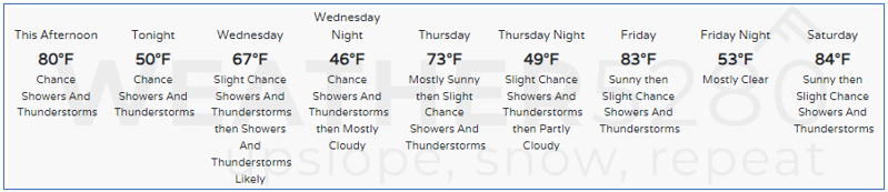
Well, well, well. That is a lot of "thunderstorm" appearances on that forecast... guess we are hitting spring with daily chances to get rain, hail, and thunder through the weekend.
Enjoy.