
Colorado Weather: Severe weather including risk of tornadoes for parts of the state

Severe weather will increase across the state again today. Let's look at the outlook area first for a general look at where the threat of damage is highest.
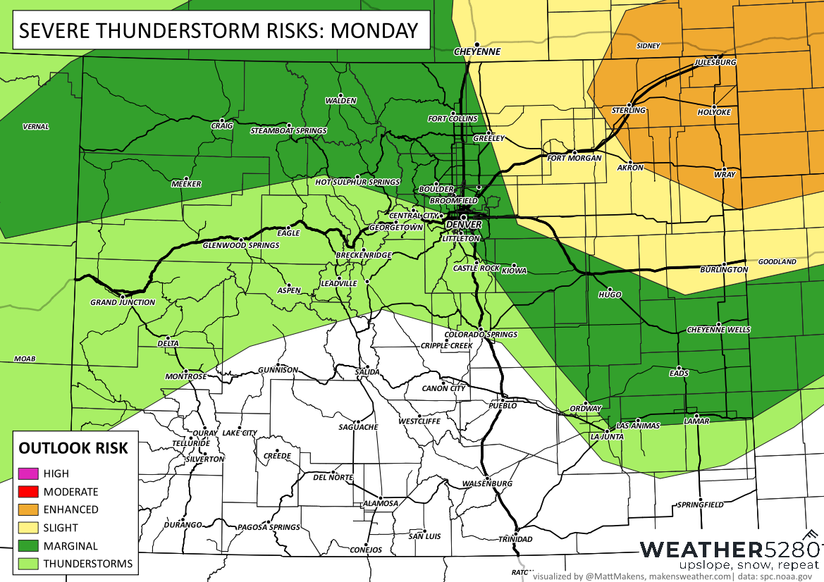
Although much of the state can have a thunderstorm today, note the increased risk of severity east of DIA, from Greeley, Cheyenne, and Strasburg toward the plains and into Nebraska and Kansas.
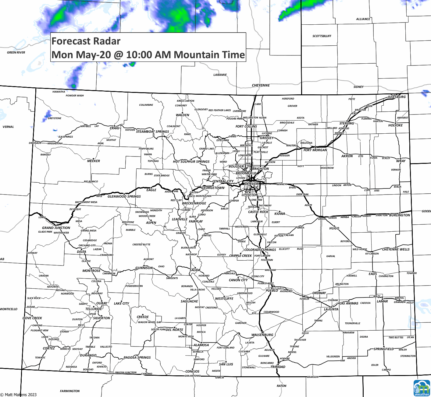
Let's move onto a timeline. This animation walks us all through the day into early Tuesday morning.
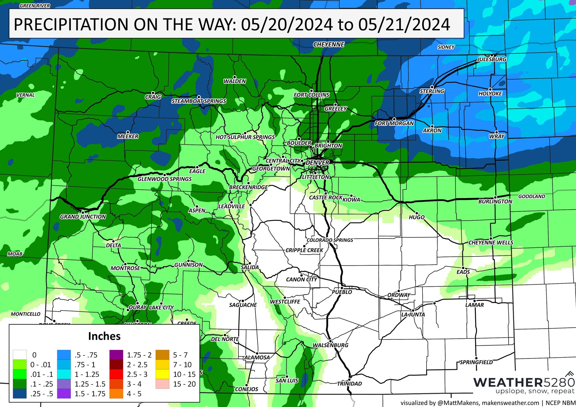
Be careful out there, the storms will pack a punch. At least there's some water if you are looking for it. Here is a precipitation estimate for what may fall through Tuesday morning.
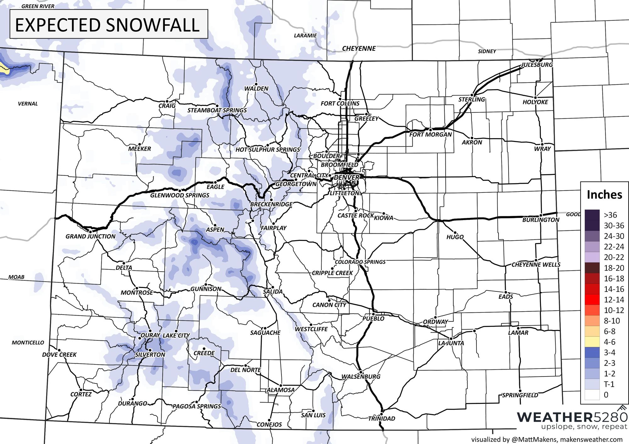
And, in case you are wondering about snow, yes there is a bit of that to fall in the high country as this energy swings across the state.
These maps are just all for Monday into Tuesday morning. There will be higher chances for moisture in the Denver area Tuesday with a lower likelihood of severe weather. Here's a planner showing hourly temperatures and precipitation chances.
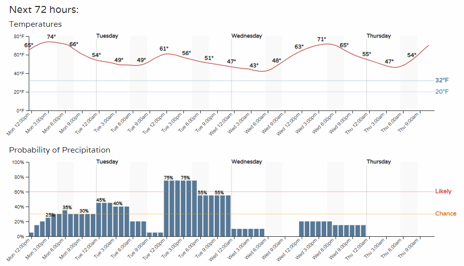
Tuesday may turn out to be the wetter day, and also the cooler one. In any case, we are into severe weather season and it's always good to keep tabs daily. We will help you with that with our forecast emails (click here to be added to our list).