
Colorado weather: Thursday's chances for damaging thunderstorms

Although isolated, some of us have been hit with thunderstorms for the past two days, and today brings additional chances for storms. There is a chance of damaging thunderstorms today, albeit that chance is highest east of I-25. The primary threats today will be wind and hail.
Let's begin with a general outlook.
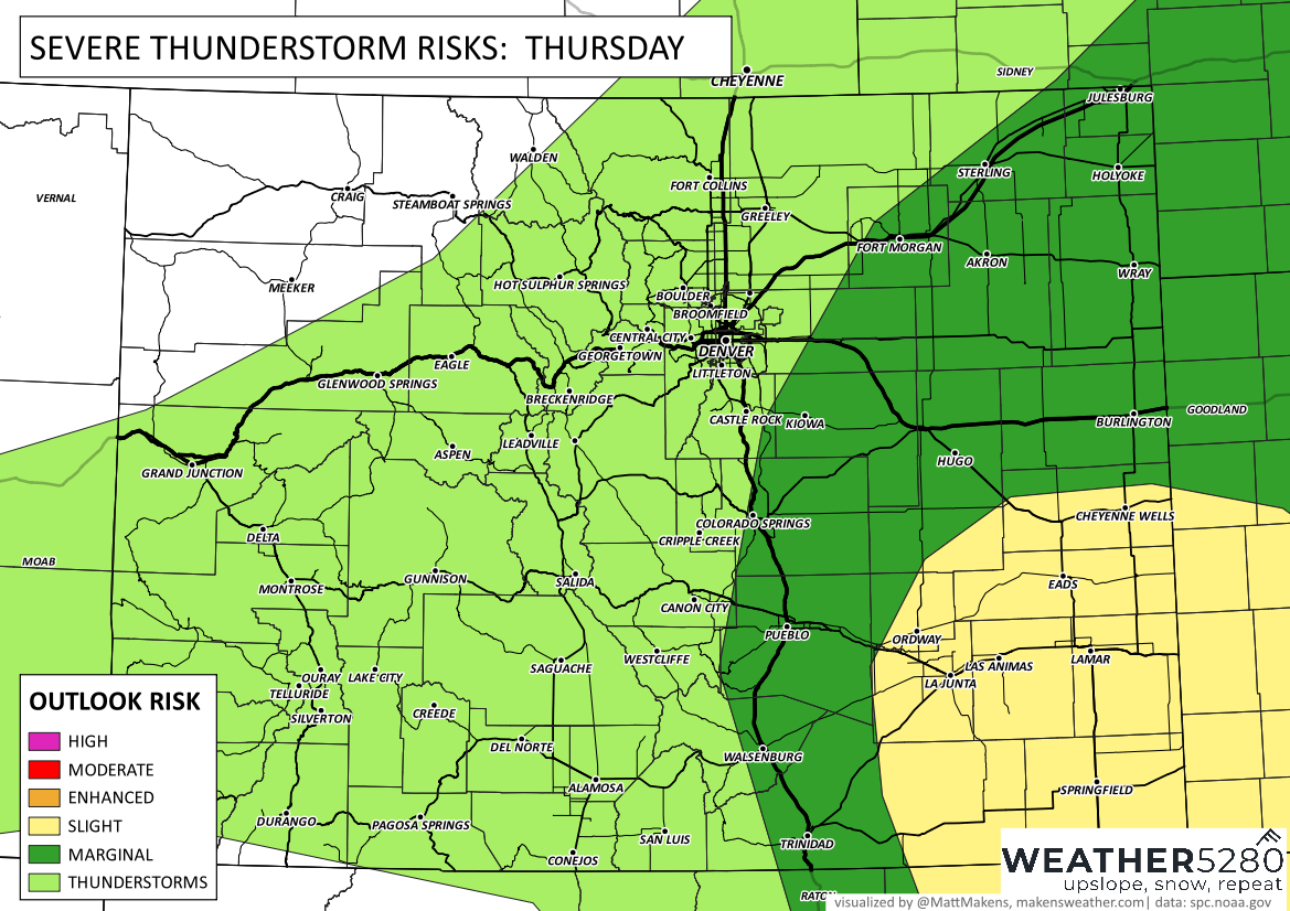
The most probable areas for problematic weather will be the southeastern corner, by Lamar and La Junta, but that's not so say someone near Denver gets a bad one, too.
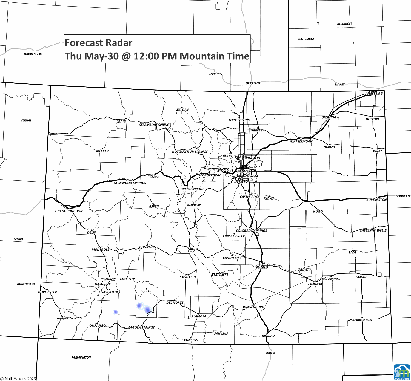
Here's a timeline of the storms, keep an eye on the overnight for Northern Colorado.
Beyond today we have additional chances for storms, about a one in three chance, Friday. The daily chances are shown on the following hourly planner, along with temperatures across the top.
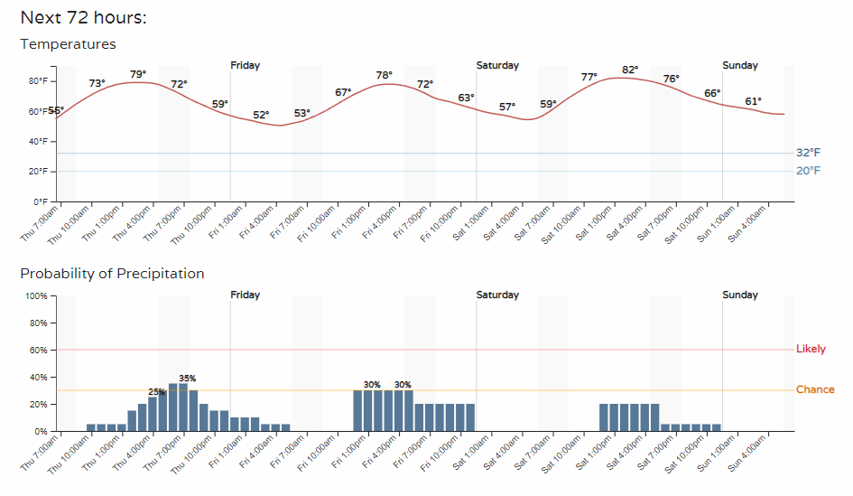
Note a couple of things. See how the hourly planner stretches chances out into the early morning hours on Friday? Return to the animation above, and you'll see a couple of storms in the early morning near the metro areas, too. So, it's not just an afternoon and early evening chance that you'll see a storm.
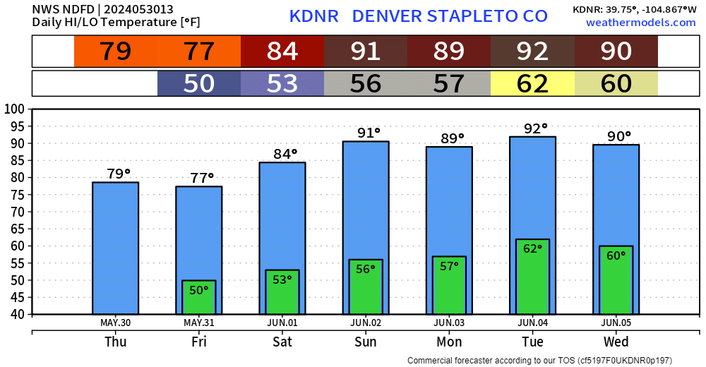
There is a bit of a pattern shift ahead. A drier and warmer phase will hit by Sunday when we will see the hottest weather of the year so far—the first 90°s since September 30th! Here's a look at the week's highs and lows for Denver.
We will have more on the hotter weather in our next update. Have a great Thursday.