Hot on Friday; An increased chance of storms and cooler on the way for the weekend to Colorado

An uptick in precipitation chances across the region area expected as we head into the weekend. This is true just about statewide, but in particular for the Front Range foothills and adjacent plains – with only an isolated storm chance today (and quite warm) but better chances for storms as we head into Friday and the weekend.
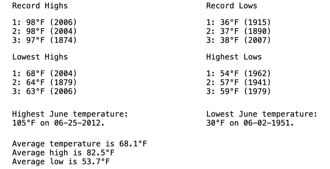
With the increased rain chances, we'll cool temperatures a bit too for the weekend. Until then, it'll be anything but cool, including some very hot temperatures across the region on Friday. The current forecast for Denver calls for a high of 95°F on Friday – not a record for the date, but pushing it! Here are the records for June 7th in Denver:
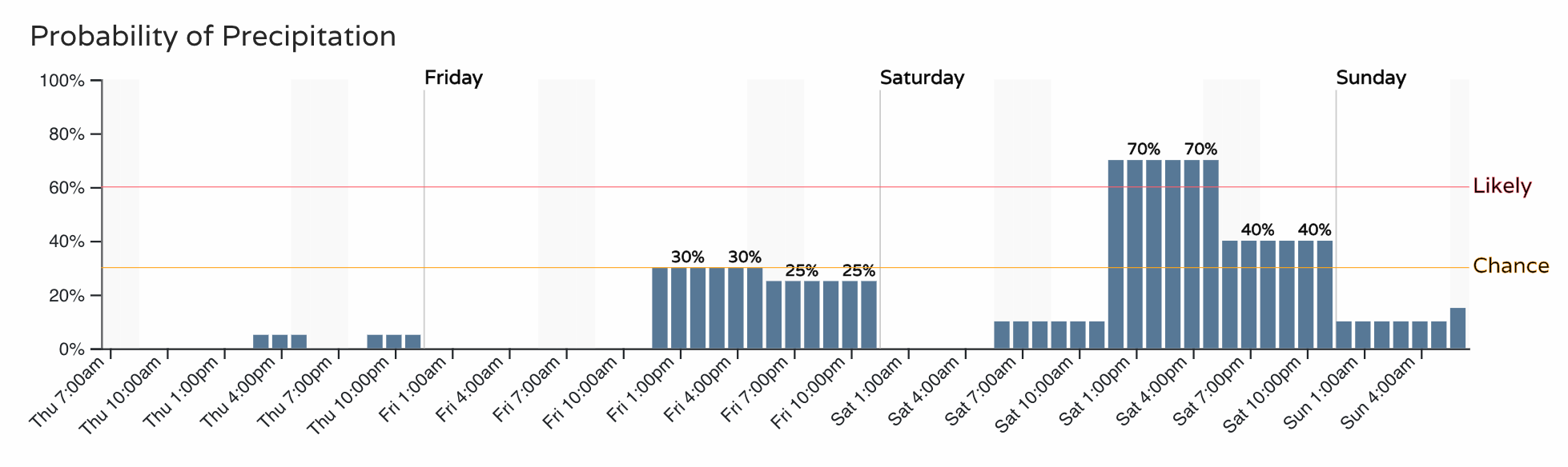
The rain chances will bring quick relief to the heat. For the Denver metro area that's about a 30% chance of storms Friday, and 70% on Saturday:
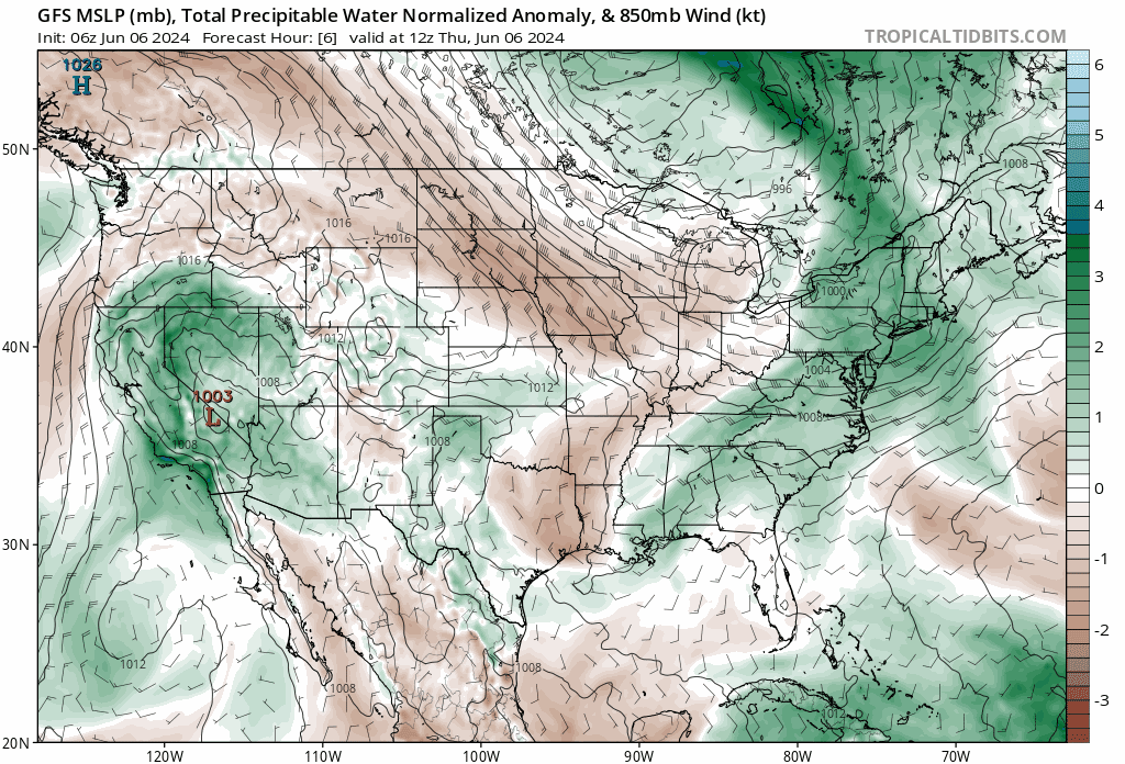
The incoming system has at times looked quite soggy, but recent guidance has cooled on this idea a bit, for the northern Front Range in particular.
Still, never say never! We'll have a good bit of moisture to work with for those storms that do develop along the Front Range with some impressive PWAT values across the state for the weekend. You can see this surge of moisture for the state with the deeper greens and blues over Colorado this weekend and into early next week – indicative of plentiful moisture to work with.
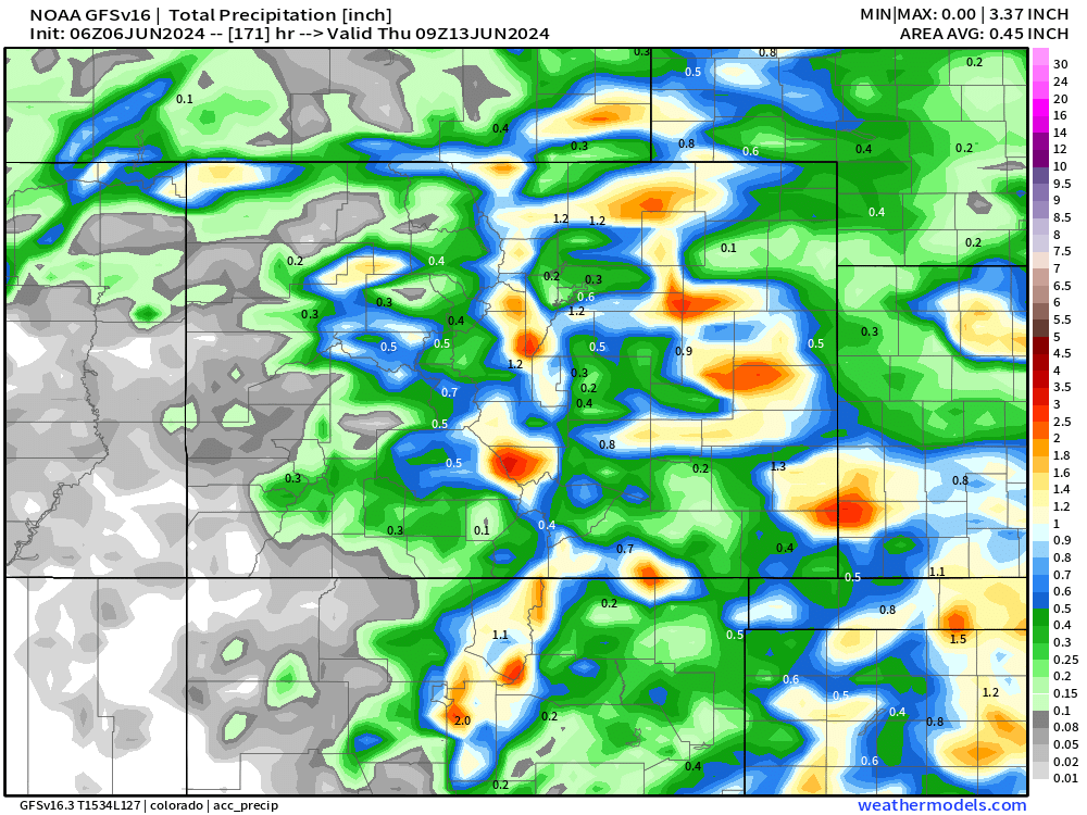
It's the warm season, and the convective nature of the storms this weekend means not everyone gets rain, even if the chance of rain is quite good! If we look at the modeled guidance for precipitation from the GFS and Euro operational models, we see that under the heavier storms will produce upwards of 1.5" of precipitation through the weekend, while the have-nots will see much lesser totals.
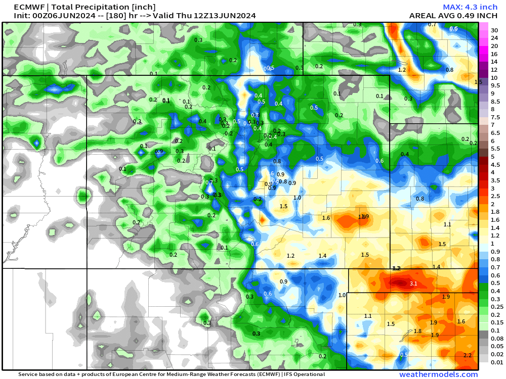
The Euro is similar, those shows a bit more widespread precipitation across the Southeast Plains, something we'll need to watch for:
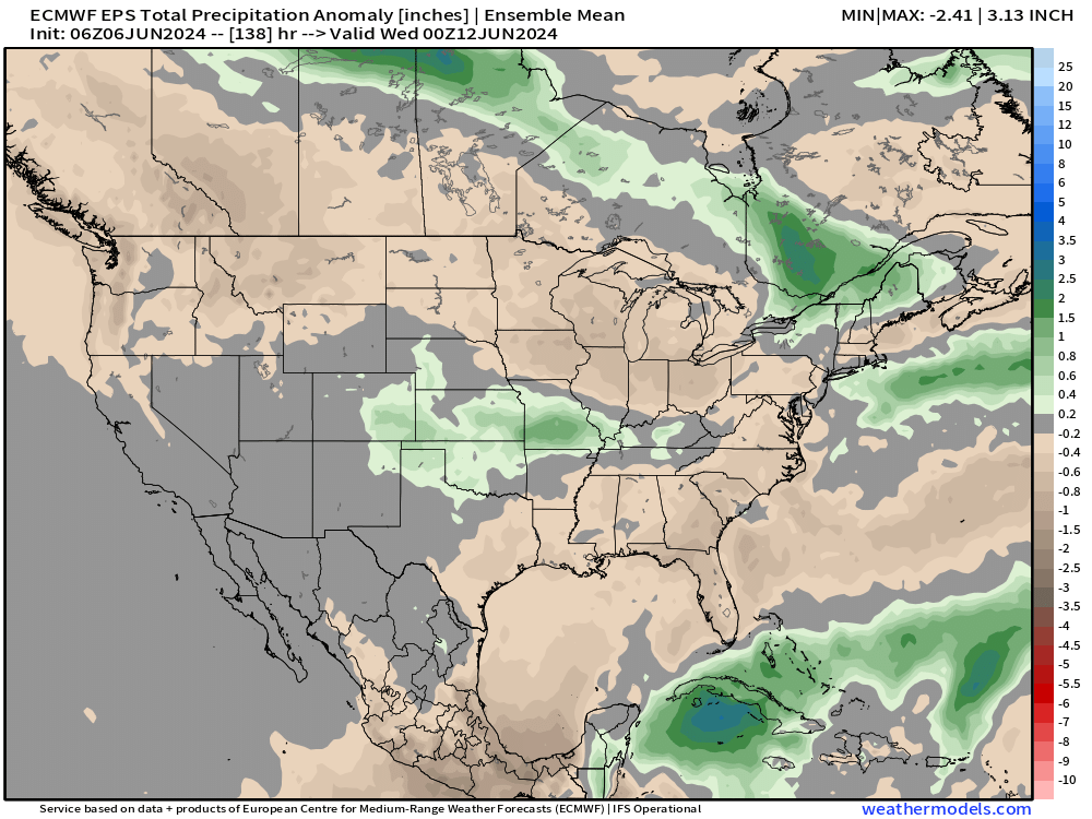
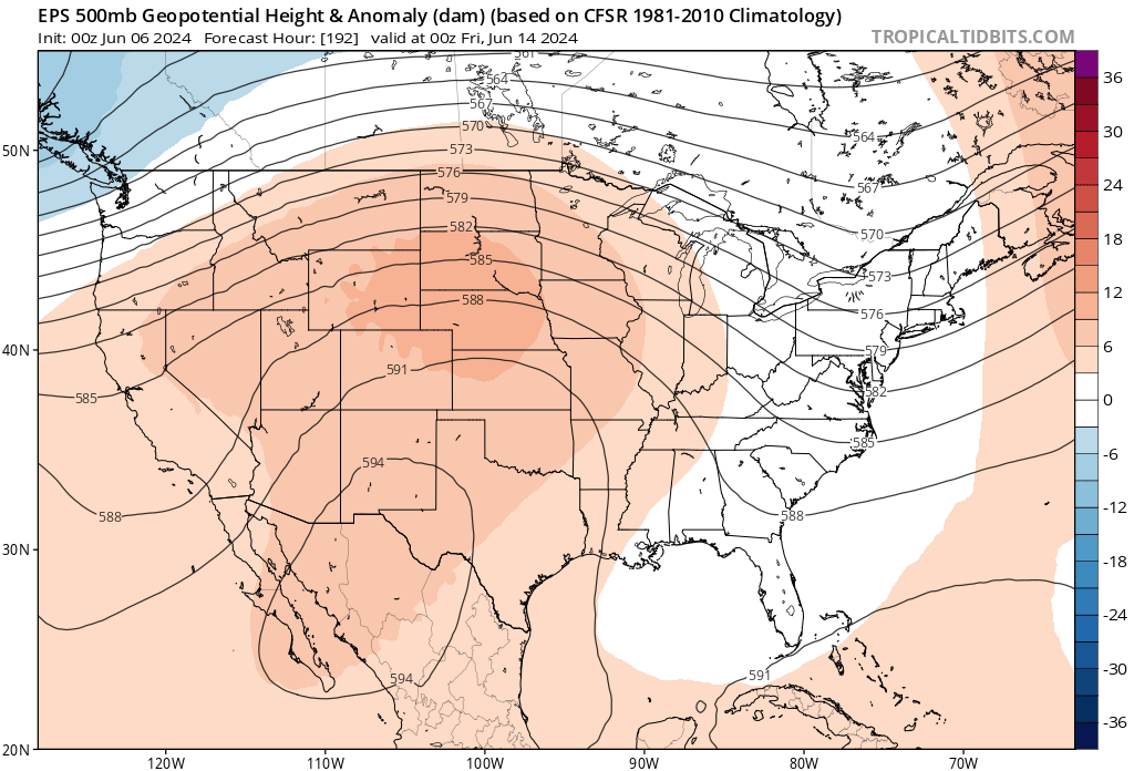
It shows in the ensemble anomalies as well, with a healthy look for much of eastern Colorado (favoring areas south of I-76) and into the panhandles.
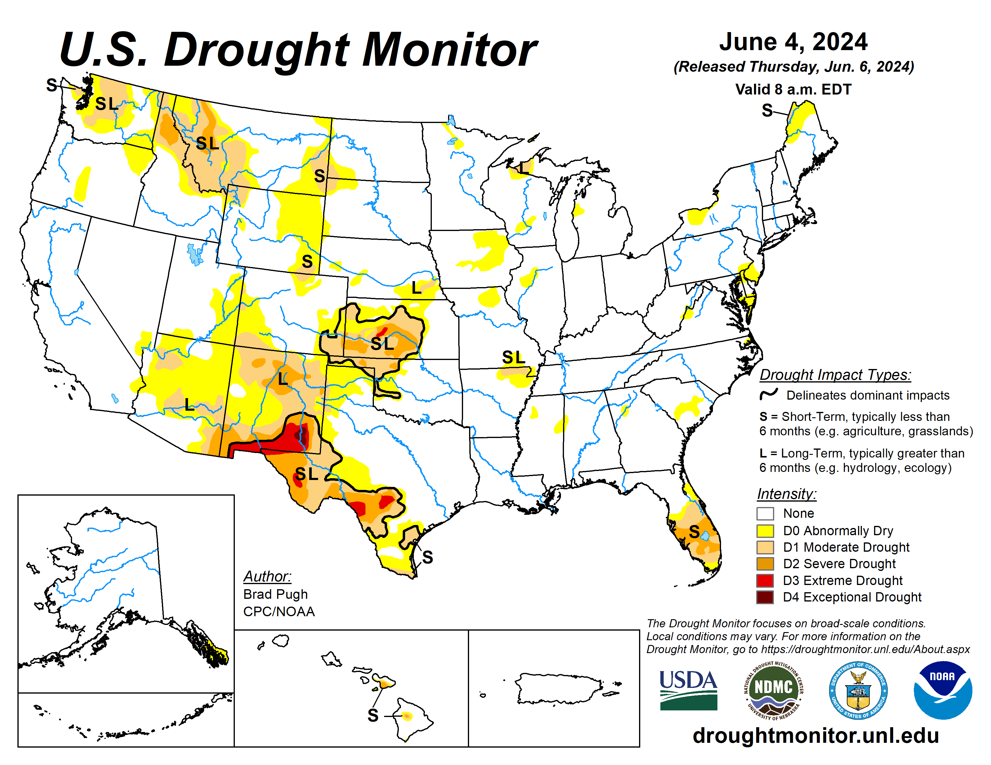
ANY time we can get moisture to the southeast plains of Colorado is welcome indeed. This is particularly true as we transition to La Niña and a likely more drought-prone long range outlook for the region.
In fact, not much drought across the CONUS as we head into spring, but some areas struggling with those moisture deficits can hope to pick up some water this weekend and into next week across southeast Colorado and Kansas. Let's hope!
Let's hope for some water this weekend as there's a pretty healthy signal for drier and hotter weather to follow this shot at water, with guidance showing a stout ridge – and hotter temperatures – trying to build in overhead later next week.
A quick peek at temp charts show summer in FULL swing around here after the brief cool down this weekend and early week.
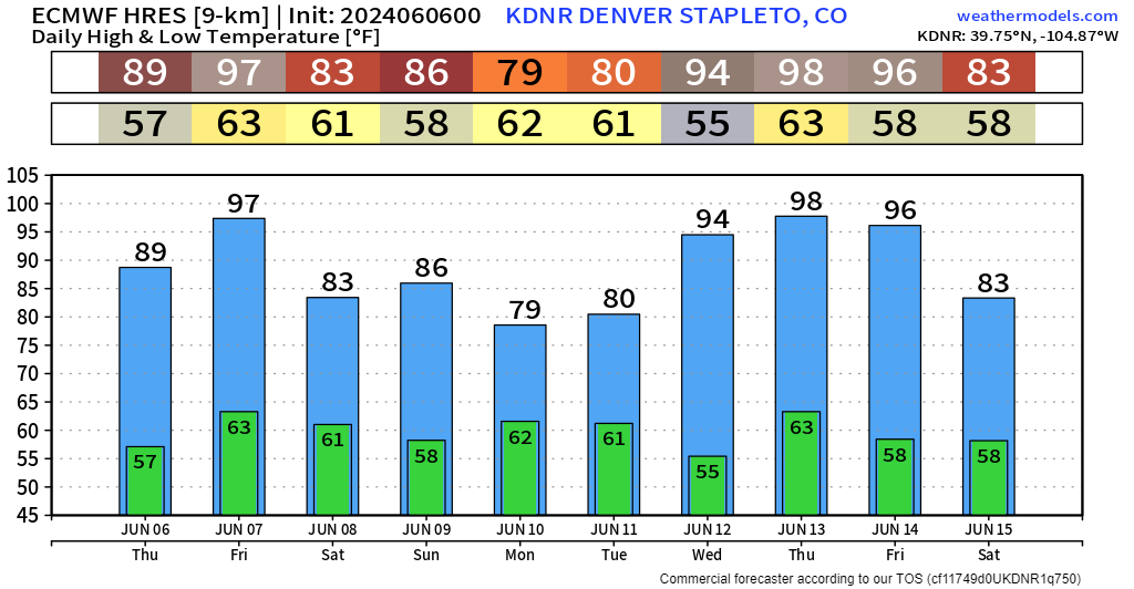

If we don't bust high on Friday and hit 100, we likely won't break a record for earliest. That record was set back in 2013 and tied again in 2022.
Next Thursday could be very warm with temps hovering close to 100.