Denver Weather: Severe thunderstorm watch issued, covers metro areas and plains

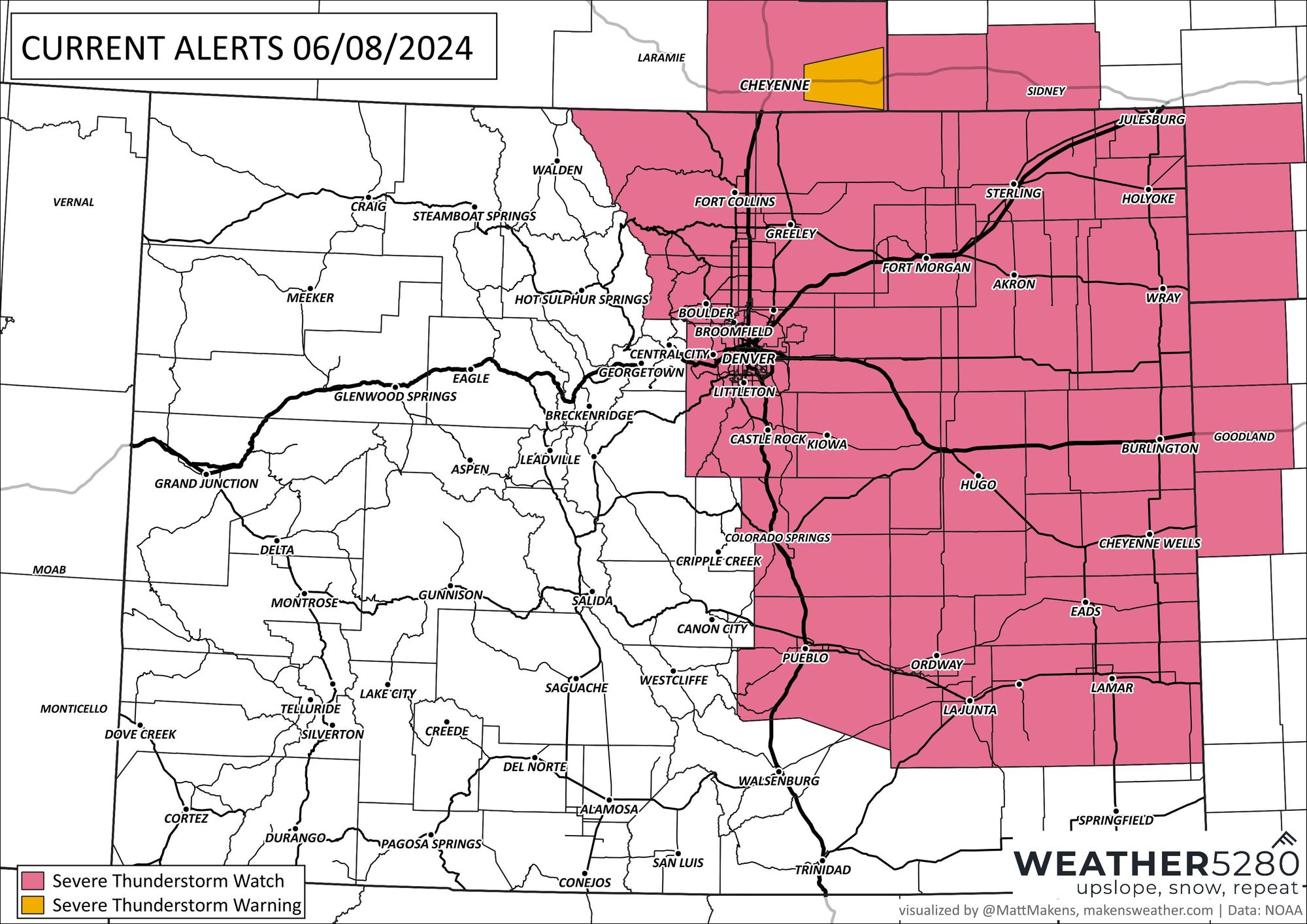
A severe thunderstorm watch has been issued for the Denver area, Front Range, and plains through Saturday evening. For Denver, the most likely time for severe weather happens in the next couple of hours, through 7pm for the Eastern Plains. Here is a map of the counties under the alert:

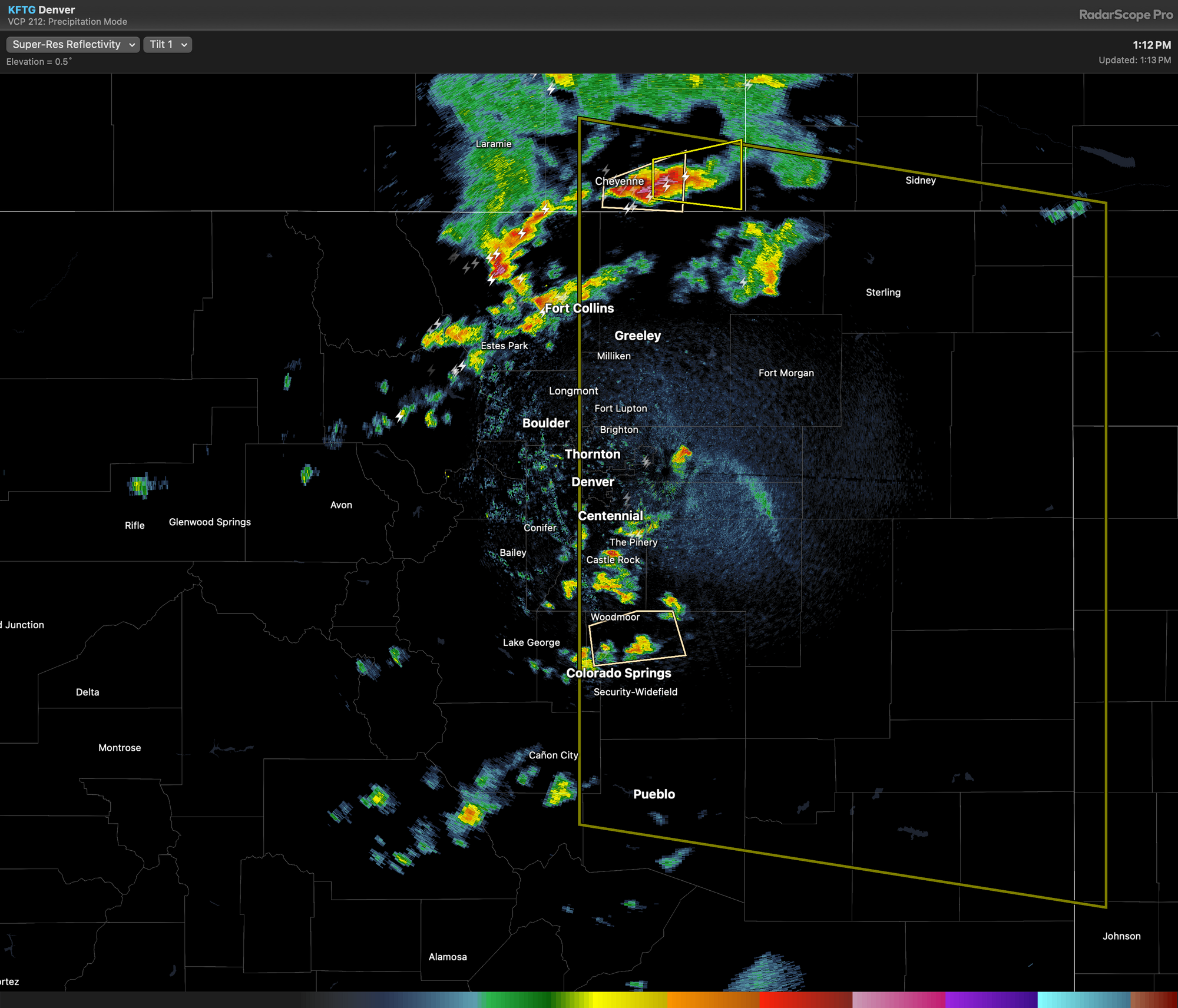
This comes as thunderstorms began developing on the Front Range, perhaps you already have had a storm over your area. Here's the radar picture from lunchtime Saturday.
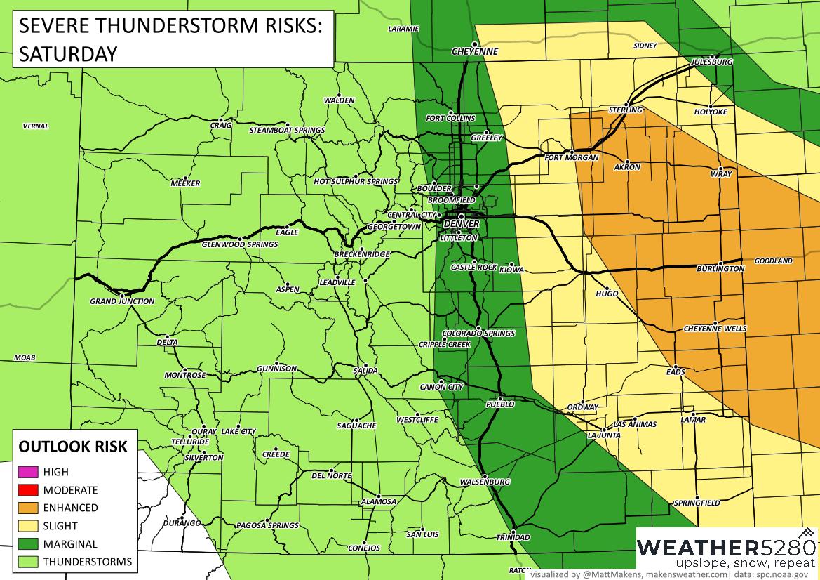
Going into today we knew conditions could lead to severe weather, the outlook areas covered eastern counties, where the threat is highest (the enhanced risk - orange areas here) from the Colorado Plains to Kansas:
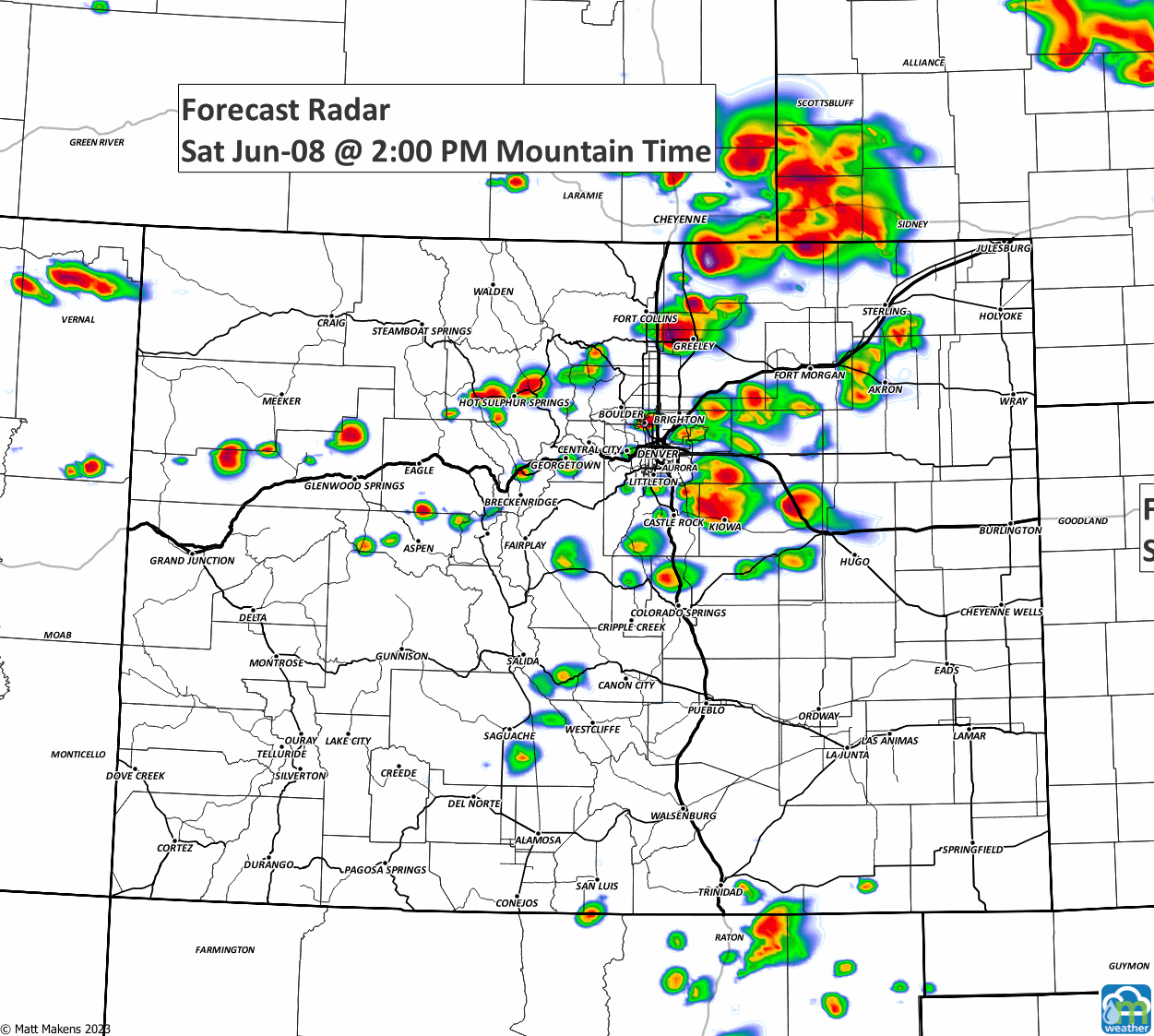
So, the highest threats from these storms will be wind and hail. Do your thing as you see a storm approaching... cover plants, get the car into the garage, etc. So, when is the most likely time for you to catch a storm? Here's an animation to show you the activity through tonight.
Did you notice how storms are possible into the overnight? Although the watch expires at 7pm, we have an isolated threat of storminess while we sleep - so, let's keep the car in the garage tonight just to be safe.