
Denver Weather: Guide to Monday's storms, when, where, and how bad are they going to be

Saturday was a significantly busy day of tracking severe thunderstorms over the Plains, Sunday was a bit quieter but the South Metro including Castle Rock got whacked around dinner time with flooding and hail. So, what's the 'skinny' on today's storms? Here's the where, when, and how bad...
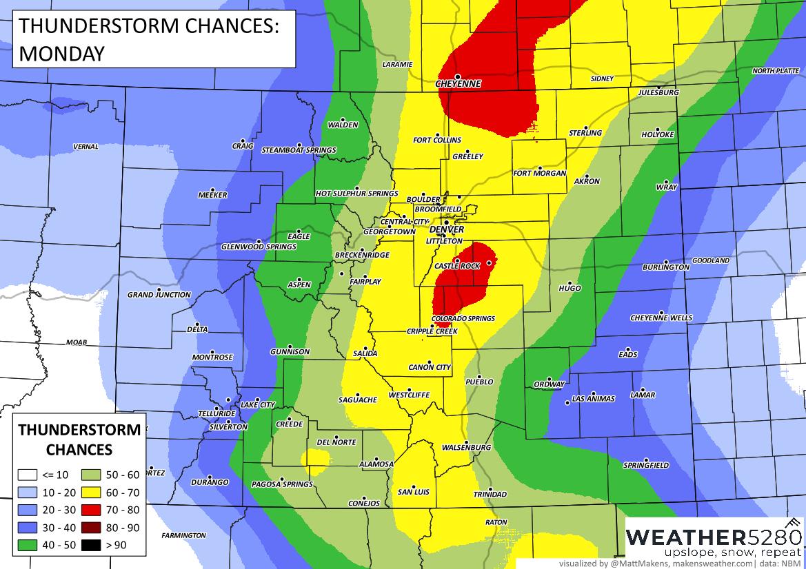
Where? This map will show the areas with highest probability of getting a storm today:
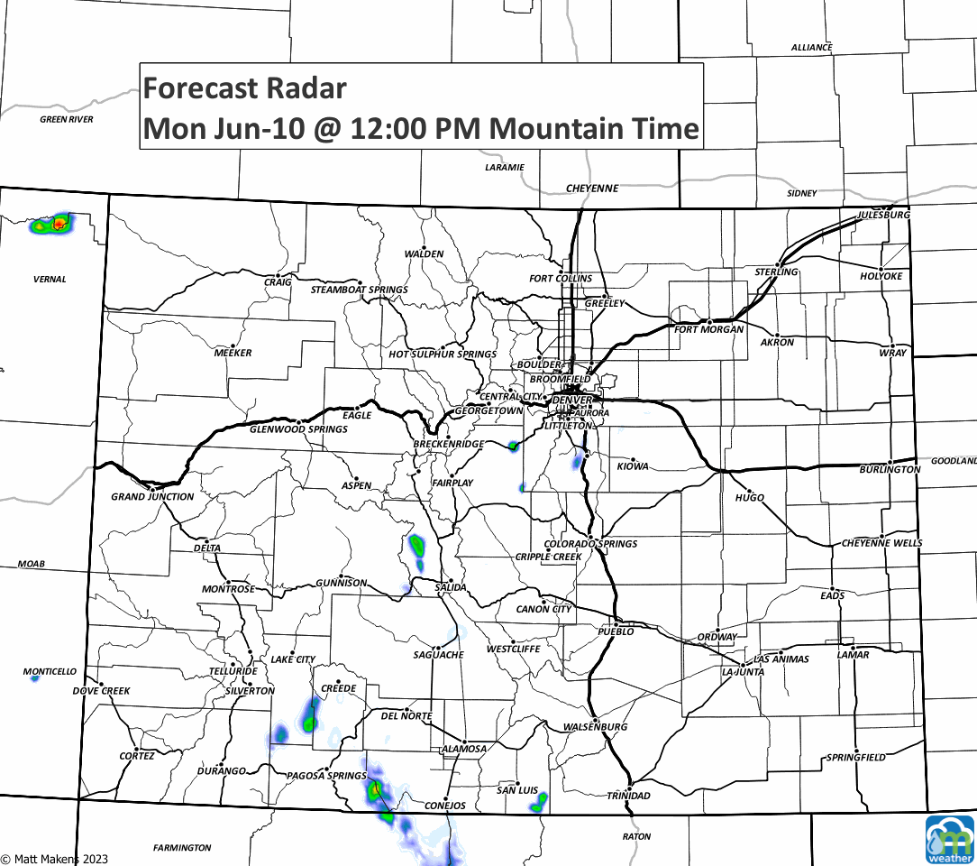
When? This animation walks us through the next 18 hours to show approximate locations and times of the storms.
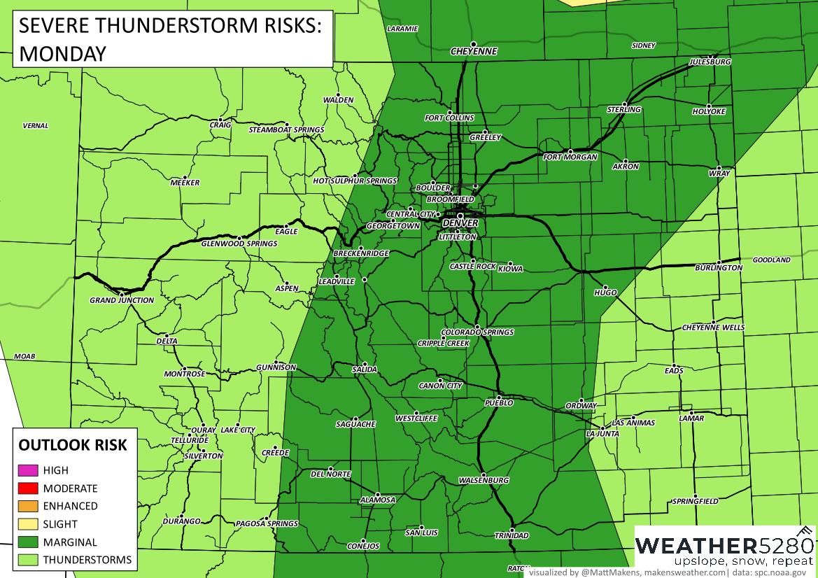
How bad? Well, like yesterday the overall threat of damaging wind/hail and isolated tornadoes is relatively low. However that risk, it's Colorado and we can see damaging hail with isolated flooding from these daily thunderstorms. So, even if the overall threat is low, my truck is in the garage and my garden covers are at the ready.
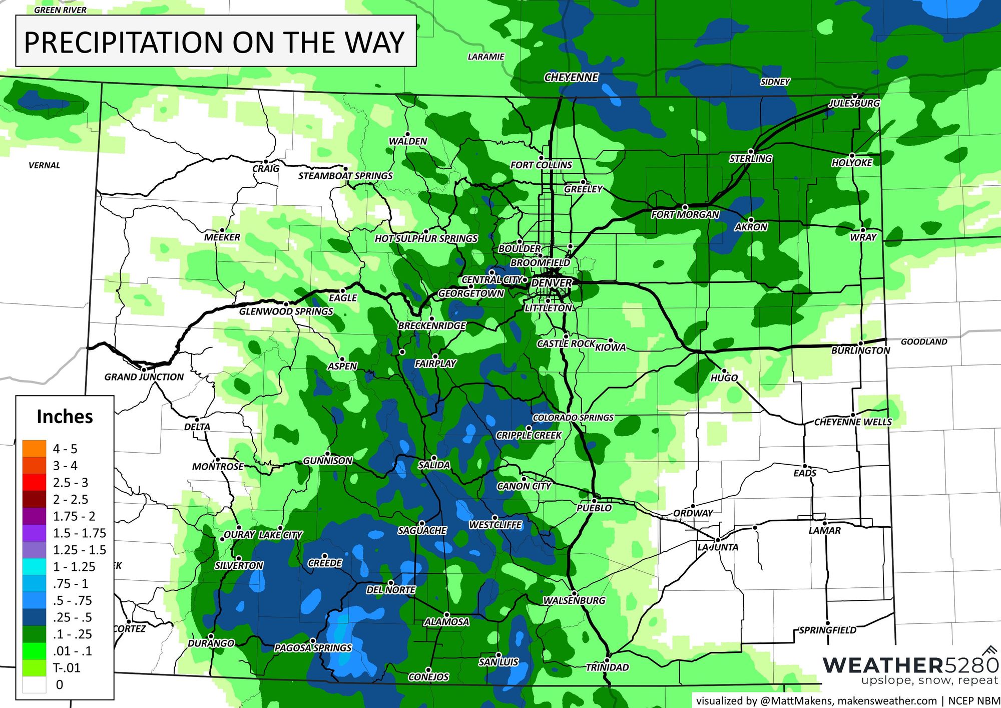
How much? Here's a general estimate to total rainfall today. Those that get a storm, have a strong chance of 0.25 to 0.5 inches.
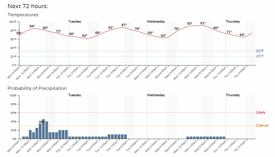
Is there more of this on the way? The chances for storms decreases beyond today. It isn't a zero percent chance of storms, but - overall - they become much less likely for the next few days.
We love catching your storm reports, especially hail sizes. Let us know what happens in your neck of the woods in the comment section below. Have a good Monday.